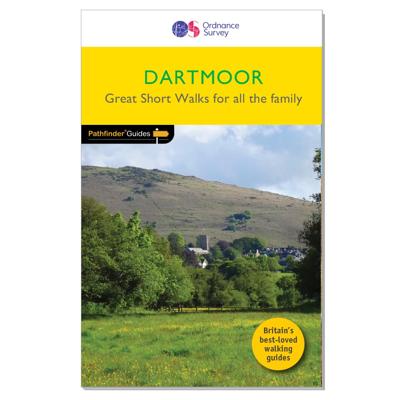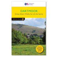
Wandelgids 008 Pathfinder Short Walks Dartmoor | Ordnance Survey

0
Wandelgids van een deel van Engeland. Deze gids bevat 20 wandelingen, geschikt voor de hele familie. De bijbehorende kaarten zijn uitstekend: men heeft de topografische kaarten van Ordnance Survey gebruikt waarop de route is ingetekend. Daarnaast praktische informatie over de wandeling en wat beschrijvingen van het gebied. Short Walks Dartmoor cov...

Verkopers met dit product

Verkoper
Bezorging
Prijs
DeZwerver.nl logo
DeZwerver.nl
2,95
11,50

Anderen bekeken ook

Wandelgids 008 Pathfinder Short Walks Dartmoor | Ordnance Survey
Wandelgids van een deel van Engeland. Deze gids bevat 20 wandelingen, geschikt voor de hele familie. De bijbehorende kaarten zijn uitstekend: men heeft de topografische kaarten van Ordnance Survey gebruikt waarop de route is ingetekend. Daarnaast praktische informatie over de wandeling en wat beschrijvingen van het gebied. Short Walks Dartmoor covering parts of Okehampton, Chagford and Lustleigh. Guidebook with 20 circular walks in an illustrated and easier-to-use layout, suitable for whole family. This selection offers interest and regional variety in Dartmoor, providing the best short walks in the area. Covering walks through the whole of Dartmoor, both popular and little know scenic routes including High Willhays, Haytor Teign gorge and Castle Drogo.   20 circular walks up to 5 miles Clear, large scale Ordnance Survey route maps GPS reference for all Dartmoor waypoints Where to park, good pubs and places of interest en route All routes have been fully researched and written b…
11,50
Wandelgids 026 Pathfinder Guides Dartmoor | Ordnance Survey
Wandelgids van een deel van Engeland. Deze gids bevat 28 dagwandelingen, variërend van korte tochten tot pittige dagtochten. De bijbehorende kaarten zijn uitstekend: men heeft de topografische kaarten van Ordnance Survey gebruikt waarop de route is ingetekend. Daarnaast praktische informatie over de wandeling en wat beschrijvingen van het gebied. Each of the Jarrold Pathfinder titles features 28 circular routes, all tried and tested by seasoned walkers. The routes range from extended strolls to exhilarating hikes, so there is something for everyone. They also contain: -Ordnance Survey mapping; -background details of each area; -details of refreshment stops and parking; -walking safety advice; and -information about walkers and the law
18,50
Wandelgids 001 Pathfinder Guides South Devon & Dartmoor | Ordnance Survey
Wandelgids van een deel van Engeland. Deze gids bevat 28 dagwandelingen, variërend van korte tochten tot pittige dagtochten. De bijbehorende kaarten zijn uitstekend: men heeft de topografische kaarten van Ordnance Survey gebruikt waarop de route is ingetekend. Daarnaast praktische informatie over de wandeling en wat beschrijvingen van het gebied. Each of the Pathfinder titles features 28 circular routes, all tried and tested by seasoned walkers. The routes range from extended strolls to exhilarating hikes, so there is something for everyone. They also contain: -Ordnance Survey mapping; -background details of each area; -details of refreshment stops and parking; -walking safety advice; and -information about walkers and the law
18,50
Wandelgids 031 Pathfinder Short Walks Brecon Beacons | Ordnance Survey
Wandelgids van een deel van Wales. Deze gids bevat 20 wandelingen, geschikt voor de hele familie. De bijbehorende kaarten zijn uitstekend: men heeft de topografische kaarten van Ordnance Survey gebruikt waarop de route is ingetekend. Daarnaast praktische informatie over de wandeling en wat beschrijvingen van het gebied. et outside and get active with all the family in the gorgeous Brecon Beacons with these 20 hand-picked and lovingly illustrated short walks. Everybody can enjoy country walking amidst mountains, lakes and forests and there are even accessible routes up the Sugar Loaf, around the Usk Reservoir and to the top of Pen y Fan.   Featured Brecon Beacons Short Walks include:   - Cross the Usk Bridge and see castle ruins on the riverside walk at Castle Meadows - Discover a legendary lake at Llyn y Fan Fach - Climb grassy mountain paths to the rocky summit of the iconic Sugar Loaf - Enjoy great views from an Iron Age Fort at Mynnyd Illtud - See the dazzling Ystradfellte waterfal…
11,50
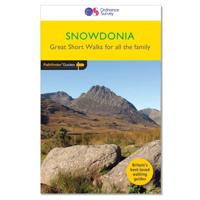
Wandelgids 014 Pathfinder Short Walks Snowdonia | Ordnance Survey
Wandelgids van een deel van Wales. Deze gids bevat 20 wandelingen, geschikt voor de hele familie. De bijbehorende kaarten zijn uitstekend: men heeft de topografische kaarten van Ordnance Survey gebruikt waarop de route is ingetekend. Daarnaast praktische informatie over de wandeling en wat beschrijvingen van het gebied. The Snowdonia short walks guidebook is ideal for all the family. Containing 20 splendid short walks ranging from 2 to 6 miles, this guide is perfect for newcomers to country walking and those that prefer gentler rambling. The mountains of Snowdonia are magnificent featuring row-upon-row of jagged peaks and ridges; However, there is more to Snowdonia than its mountains. The region offers the walker plenty of easy low-level walks through delightful valleys ranging from narrow and steep-sided to green and open.   The walks in this guide take in some of Snowdonia’s most famous features – castles, lakes, legends, forests, valleys and waterfalls. The only walk featured that …
11,50
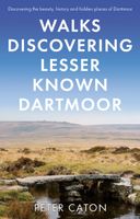
Wandelgids Walks Discovering Lesser Known Dartmoor | Matador
A guide describing routes of 1½ to 10 miles, enabling walkers to discover the beauty, history and hidden places of Dartmoor, the wildest, most remote and arguably the most beautiful area in Southern England.   The walks will take you to antiquities dating from the Bronze Age and even earlier, to hidden waterfalls and gorges, abandoned remote dwellings, fascinating industrial archaeology, majestic tors and wonderful viewpoints.   For those who don’t know Dartmoor they provide routes for interesting walks of varying length and difficulty. Whilst some of the points of interest will be familiar to those who know the moor well, the walks will take you to places that very few people visit, passing little known artefacts with something new for almost everyone.   Produced in full colour with routes clearly marked on OS maps, the book includes comprehensive background information on the moor and the history, stories and legends of the many places visited on each walk.   An author of walking an…
18,50
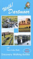
Wandelgids Walk! Dartmoor | Discovery Walking Guides
Engelstalige wandelgids voor Dartmoor, met uitgebreide beschrijvingen van wandelroutes, routekaartjes, praktische informatie zoals bussen en accommodatie. Kate and Alan Hobbs have reviewed and refreshed their Walk! Dartmoor classic guide book for its new 2016 edition. 40 fully detailed walking routes with OS maps and gps waypoints for you to enjoy adventuring on Dartmoor. Walk! Dartmoor with Kate and Alan Hobbs covers walks of varying length across Dartmoor - from the dramatic high moors, gentle riversides, idyllic country lanes, unspoilt villages, to sites of ancient archaeology and former industries, and all with spectacular views.   This user friendly illustrated guide has a summary of walking routes and is rated by time, effort, distance and hills, as well as the availability of refreshments en route and the vertigo risk.Each walk is described in full and there are timings listed in the book to help with navigation and progress. Walk! Dartmoor contains a 1:40,000 scale Ordnance Su…
19,95
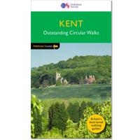
Wandelgids 008 Pathfinder Guides Kent | Ordnance Survey
Wandelgids van een deel van Engeland. Deze gids bevat 28 dagwandelingen, variërend van korte tochten tot pittige dagtochten. De bijbehorende kaarten zijn uitstekend: men heeft de topografische kaarten van Ordnance Survey gebruikt waarop de route is ingetekend. Daarnaast praktische informatie over de wandeling en wat beschrijvingen van het gebied. Walkers in Kent enjoy a number of long-distance footpaths, including the North Downs Way, Wealdway, Pilgrims' Way and Greensand Way, and sections of them are incorporated into several walks in this guide. Routes starting at Tenterden and Penshurst wind through a typical Kentish landscape, characterised by orchards, medieval churches and oast houses.   Deal and Sandwich, featured on another walk, were once centres for smugglers, while walks along the cliffs of Dover and Folkestone evoke historic maritime events. In contrast, Romney Marsh and the Swale have a wild and lonely beauty which evoke a more contemplative mood.   28 circular, graded wa…
18,50
Wandelgids 15 Short Walks Dartmoor - North - | Cicerone
Would you like to explore the best of Okehampton and Chagford? This guidebook covers 15 of Dartmoor's best short walks including Chagford, Belstone, Hound Tor and Bowerman's Nose, High Willhays and Yes Tor, and Meldon Reservoir.   Why choose this guidebook?   Walks under three hours, plus one challenge route Easy to follow with clear route descriptions Facilities, parking and highlights for every route No specialist gear needed, walk all year round Ordnance Survey mapping Cicerone’s Short Walks guidebooks contain everything you need to get outdoors and discover the best of an area. The routes are perfect if you’re new to walking or looking for something you can enjoy with the whole family. Let the adventures begin!
13,95
Wandelgids 044 Pathfinder Guides Essex | Ordnance Survey
Pathfinder Guide to Essex offers excellent lowland walking in the south-east of England. The routes are all circular exploring the finer countryside of the county, in a series of parkland, farmland, woodland and coastal and estuarine walks, visiting its places of historic interest, attractive towns and charming villages. Given the pleasant and undramatic nature of the terrain, routes only really vary in length in terms of difficulty and there is a general progression through the book from shortest to longest. Beginning with a short walk linking Laindon Common with Great and Little Burstead, encountering the infant River Crouch, the book progresses to a near 10-mile excursion across Bradwell Marsh, with its wide open horizons, and a visit to the isolated and tiny Saxon chapel of St Peter-on-the-Wall. Sea air can also be taken on walks from Walton-on-the-Naze, a circuit of the eastern end of Mersea Island, along St Osyth Creek, at Maldon, from Burnham-on-Crouch, and overlooking Benfleet…
18,50

Klanten-reviews van Wandelgids 008 Pathfinder Short Walks Dartmoor | Ordnance Survey

Er zijn nog geen beoordelingen voor dit productBen jij de eerste die een review plaatst?

Meer over Wandelgids 008 Pathfinder Short Walks Dartmoor | Ordnance Survey

Productomschrijving

Wandelgids van een deel van Engeland. Deze gids bevat 20 wandelingen, geschikt voor de hele familie. De bijbehorende kaarten zijn uitstekend: men heeft de topografische kaarten van Ordnance Survey gebruikt waarop de route is ingetekend. Daarnaast praktische informatie over de wandeling en wat beschrijvingen van het gebied.

Short Walks Dartmoor covering parts of Okehampton, Chagford and Lustleigh. Guidebook with 20 circular walks in an illustrated and easier-to-use layout, suitable for whole family.

This selection offers interest and regional variety in Dartmoor, providing the best short walks in the area. Covering walks through the whole of Dartmoor, both popular and little know scenic routes including High Willhays, Haytor Teign gorge and Castle Drogo.  
  • 20 circular walks up to 5 miles
  • Clear, large scale Ordnance Survey route maps
  • GPS reference for all Dartmoor waypoints
  • Where to park, good pubs and places of interest en route
  • All routes have been fully researched and written by expert outdoor writers 
  • Beautiful photography of scenes from the walks
  Ideal for families, or for those who prefer shorter distances, Short Walks guides contain 20 walks graded by distance, duration and difficulty. Each route includes points of interest as well as fun observation questions for children.


Productinformatie

    Verken gerelateerde categorieën

    Webshop.nl maakt gebruik van cookies. Ga je verder op onze website, ga dan akkoord met het plaatsen van cookies en de verwerking van deze data door ons en vermelde partners.