webshop.nl
Categorieën
  Sluiten

Meer Ordnance Survey
Meer Ordnance Survey in Auto-onderdelen

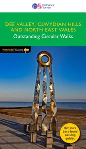
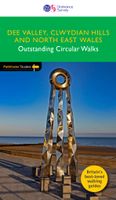
Wandelgids 79 Pathfinder Guides Dee Valley, Clwydian Hills and North E

Fraaie, goed verzorgde wandelgidsjes met 28 wandelingen van max. een dag, (beginnend bij korte, eindigend bij langere wandelingen). Weergegeven op duidelijke topografische kaartjes (1:25.000). Bevat verder wetenswaardigheden en praktische informatie voor onderweg. Enjoy 145 miles of lush green walks in north-east Wales with 28 superb country walks,...
18,50

Webshops met dit product

Webshop
Bezorging
Prijs

Anderen bekeken ook

Wandelgids 79 Pathfinder Guides Dee Valley, Clwydian Hills and North E
Fraaie, goed verzorgde wandelgidsjes met 28 wandelingen van max. een dag, (beginnend bij korte, eindigend bij langere wandelingen). Weergegeven op duidelijke topografische kaartjes (1:25.000). Bevat verder wetenswaardigheden en praktische informatie voor onderweg. Enjoy 145 miles of lush green walks in north-east Wales with 28 superb country walks, graded by length and difficulty. Choose from 14 routes in the Cylwdian Range and Dee Valley Area of Outstanding Natural Beauty, three on the North Wales coast between Great Orme and Point of Ayr and 11 in Denbighshire and Flintshire to the east of the River Conwy – or do them all!   Featured Dee Valley, Clwydian Hills and North-East Wales walks include:   - Follow the Wales Coast Path along the coastal sand dunes to Point of Ayr and Prestatyn - Circle Great Orme for impressive views of Llandudno, the coast and the mountains of Snowdonia - Stroll along the Llandudno Canal to the magnificent Pontcysyllte Aqueduct, a World Heritage Site - Rambl…
18,50
Wandelgids 83 Pathfinder Guides North Coast 500 and Northern Highlands
Enhance your North Coast 500 tour with the only walking guidebook featuring routes based on or accessible from Scotland’s ultimate road trip. Discover Britain’s remotest sandy beaches, Scotland’s most northerly munro, some of the oldest rocks on Earth and more with 28 breathtaking walks accessed from the North Coast 500 as well as 32 unmissable stop-off-and-stroll recommendations.   Featured North Coast 500 and Northern Highlands walks include:   - Circle Loch Coulin where Beinn Eighe and Liathach are reflected in the still waters - Wander the astounding landscape of Knockan Crag, where some of the oldest rocks on Earth can be seen - Climb Ben Hope, Scotland’s most northerly munro, towering above the Flow Country - See the waterfalls and rocks walls of the Big Burn as you ascend Ben Bhraggie for views over the Dornoch Firth - Explore the landscape and history of the Applecross peninsula with sublime views of Raasay - Take a moorland and clifftop route to the vast golden sands of Sandwo…
18,50
Wandelgids 78 Pathfinder Guides Anglesey, Lleyn and Snowdonia | Ordnan
Fraaie, goed verzorgde wandelgidsjes met 28 wandelingen van max. een dag, (beginnend bij korte, eindigend bij langere wandelingen). Weergegeven op duidelijke topografische kaartjes (1:25.000). Bevat verder wetenswaardigheden en praktische informatie voor onderweg. Experience breathtaking north Wales with 28 unforgettable walks through Anglesey, the Lleyn Peninsula and the Snowdonia National Park. Find stunning views of the Welsh coast, the ‘holy isle’ of Ynys Mon and sublime Snowdonia with a range of walks graded by length and difficulty, from relaxed rambles to challenging climbs.   Featured Anglesey, Lleyn and Snowdonia walks include:   - Enjoy views of Snowdon from the shores of Llyn Padarn, dotted with remnants of the Llanberis slate quarries and a medieval castle - Climb to Holyhead Mountain, Anglesey’s highest point, through the South Stacks Cliff Nature Reserve - See the glorious Lleyn Heritage Coast from the headland of Trywn-y-Tâl, circling back to the pleasant village of Tref…
18,50
Reisgids Snowdonia & North Wales | Rough Guides
Een kleinere versie in zakformaat van de grotere versies van de Rough Guides. Als altijd weer vol met goede informatie over cultuur en praktische zaken. Voorrin een kaart van de regio. This compact, pocket-sized Snowdonia & North Wales travel guidebook is ideal for travellers on weekend trips or shorter breaks in the UK. It includes ready-made walking and driving itineraries that allow you to organise your visit to Snowdonia & North Wales without losing time planning.   The Snowdonia & North Wales guide book covers: The North Coast and Carneddau Mountains, A Tour of Anglesey, Beddgelert and Porthmadog, Snowdon from Caernarfon, The Lleyn Peninsula, Tremadog Bay to the Mawddach Estuary, Wrexham to Bala - and Back, Dolgellau to Cadair Idris and the Aran Mountains, Cadair Idris to Machynlleth.   Inside this Snowdonia & North Wales travel book you will find:   - 9 ready-made walks and tours - easy-to-follow walking and driving tour itineraries featuring the best places to visit, as …
14,95
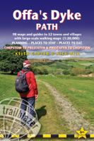
Wandelgids Offa's Dyke Path | Trailblazer Guides
Goede wandelgids van de Offa's Dyke Path. Met veel details zijn alle etappes beschreven. Tevens informatie over overnachtingen en openbaar vervoer.   All the information you need to walk Offa's Dyke Path in this two-way edition, with routes re-walked in both directions - from Chepstow to Prestatyn and from Prestatyn to Chepstow and reformatted for use by walkers hiking south to north and north to south. The Offa's Dyke Path is a magnificent National Trail that runs from the North Wales coast to the Severn Estuary following the line of Offa's Dyke, an impressive 8th century earthwork along the English/Welsh border. The ever-changing landscape - the Wye Valley, the Black Mountains, the Shropshire Hills and the Clwydian Hills - is steeped in history and legend providing 177 miles of fascinating walking.   This sixth edition has been re-walked and fully updated and includes:98 walking maps - 1:20,000 (3 and 1/8 inches to 1 mile) - the largest-scale maps availableUnique mapping features…
21,95
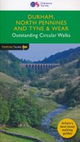
Wandelgids 39 Pathfinder Guides Durham, north Pennines and Tyne and We
Wandelgids van een deel van Engeland, Schotland of Wales. Deze gids bevat 28 dagwandelingen, variërend van korte tochten tot pittige dagtochten. De bijbehorende kaarten zijn uitstekend: men heeft de topografische kaarten van Ordnance Survey gebruikt waarop de route is ingetekend. Daarnaast praktische informatie over de wandeling en wat beschrijvingen van het gebied. This Pathfinder walking guide covers both the Cumbrian and Durham sides of the North Pennines, a designated Area of Outstanding Beauty, and also extends eastwards to Durham to the North Sea Coast. The area contains some of the finest moorland in the country, walks across Bowes Moor and Holwick as well as low-level walks beside rivers, through woodlands and forests, by the coast, and former railway tracks.   There are 28 circular walks, graded by difficulty and created by seasoned walkers. Each route includes and extract of the OS Explorer map, route notes, photos and key features to look for on the way. There is a route to …
18,50

Klanten-reviews van Wandelgids 79 Pathfinder Guides Dee Valley, Clwydian Hills and North E

Er zijn nog geen beoordelingen voor dit productBen jij de eerste die een review plaatst?

Meer over Wandelgids 79 Pathfinder Guides Dee Valley, Clwydian Hills and North E

Productomschrijving

Fraaie, goed verzorgde wandelgidsjes met 28 wandelingen van max. een dag, (beginnend bij korte, eindigend bij langere wandelingen). Weergegeven op duidelijke topografische kaartjes (1:25.000). Bevat verder wetenswaardigheden en praktische informatie voor onderweg. Enjoy 145 miles of lush green walks in north-east Wales with 28 superb country walks, graded by length and difficulty. Choose from 14 routes in the Cylwdian Range and Dee Valley Area of Outstanding Natural Beauty, three on the North Wales coast between Great Orme and Point of Ayr and 11 in Denbighshire and Flintshire to the east of the River Conwy – or do them all!   Featured Dee Valley, Clwydian Hills and North-East Wales walks include:   - Follow the Wales Coast Path along the coastal sand dunes to Point of Ayr and Prestatyn - Circle Great Orme for impressive views of Llandudno, the coast and the mountains of Snowdonia - Stroll along the Llandudno Canal to the magnificent Pontcysyllte Aqueduct, a World Heritage Site - Ramble the Prestatyn hillsides in the north of the Clwydian mountain range for views of Prestatyn, Rhyl and along the coast to Llandudno - Take Offa’s Dyke Path from Llandegla to the viewpoint of Moel y Wan and tranquil lanes filled with wildflowers - See the Penycloddau and Moel Arthur Iron Age hillforts on an undulating hike through the Clwydians from Llangwyfan - Climb to the summit of Castell Dinas Bran from Llangollen for views of the green Denbighshire countryside   OS Pathfinder Guides: Outstanding Circular Walks   - The definitive pocket book guide to Great Britain’s great outdoors - 28 mostly circular walks in one guidebook, ranging from 3-12½ miles - Walks are graded by length and difficulty ensuring a range of routes suitable for walkers of varying experience and mobility - Includes OS Explorer 1:25 000 scale map extracts for every route (4cm to 1km or 2½ inches to one mile) - Discover GPS waypoints, parking information and detailed route descriptions for foolproof navigation - Enhances your walk with information on rare wildlife, natural habitats and points of historical interest

Productspecificaties

Artikelnummer(s)
Brand
Ordnance Survey

Verken gerelateerde categorieën

Webshop.nl maakt gebruik van cookies. Ga je verder op onze website, ga dan akkoord met het plaatsen van cookies en de verwerking van deze data door ons en vermelde partners.