webshop.nl

Meer Ordnance Survey
Meer Ordnance Survey in Wandeltochten

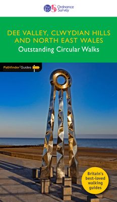
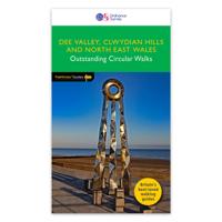
Wandelgids 79 Pathfinder Guides Dee Valley, Clwydian Hills and North E

0
Fraaie, goed verzorgde wandelgidsjes met 28 wandelingen van max. een dag, (beginnend bij korte, eindigend bij langere wandelingen). Weergegeven op duidelijke topografische kaartjes (1:25.000). Bevat verder wetenswaardigheden en praktische informatie voor onderweg. Enjoy 145 miles of lush green walks in north-east Wales with 28 superb country walks,...

Verkopers met dit product

Webshop
Bezorging
Prijs
DeZwerver.nl logo
DeZwerver.nl
niet bekend
18,50

Klanten-reviews van Wandelgids 79 Pathfinder Guides Dee Valley, Clwydian Hills and North E

Er zijn nog geen beoordelingen voor dit productBen jij de eerste die een review plaatst?

Meer over Wandelgids 79 Pathfinder Guides Dee Valley, Clwydian Hills and North E

Productomschrijving

Fraaie, goed verzorgde wandelgidsjes met 28 wandelingen van max. een dag, (beginnend bij korte, eindigend bij langere wandelingen). Weergegeven op duidelijke topografische kaartjes (1:25.000). Bevat verder wetenswaardigheden en praktische informatie voor onderweg. Enjoy 145 miles of lush green walks in north-east Wales with 28 superb country walks, graded by length and difficulty. Choose from 14 routes in the Cylwdian Range and Dee Valley Area of Outstanding Natural Beauty, three on the North Wales coast between Great Orme and Point of Ayr and 11 in Denbighshire and Flintshire to the east of the River Conwy – or do them all!   Featured Dee Valley, Clwydian Hills and North-East Wales walks include:   - Follow the Wales Coast Path along the coastal sand dunes to Point of Ayr and Prestatyn - Circle Great Orme for impressive views of Llandudno, the coast and the mountains of Snowdonia - Stroll along the Llandudno Canal to the magnificent Pontcysyllte Aqueduct, a World Heritage Site - Ramble the Prestatyn hillsides in the north of the Clwydian mountain range for views of Prestatyn, Rhyl and along the coast to Llandudno - Take Offa’s Dyke Path from Llandegla to the viewpoint of Moel y Wan and tranquil lanes filled with wildflowers - See the Penycloddau and Moel Arthur Iron Age hillforts on an undulating hike through the Clwydians from Llangwyfan - Climb to the summit of Castell Dinas Bran from Llangollen for views of the green Denbighshire countryside   OS Pathfinder Guides: Outstanding Circular Walks   - The definitive pocket book guide to Great Britain’s great outdoors - 28 mostly circular walks in one guidebook, ranging from 3-12½ miles - Walks are graded by length and difficulty ensuring a range of routes suitable for walkers of varying experience and mobility - Includes OS Explorer 1:25 000 scale map extracts for every route (4cm to 1km or 2½ inches to one mile) - Discover GPS waypoints, parking information and detailed route descriptions for foolproof navigation - Enhances your walk with information on rare wildlife, natural habitats and points of historical interest

Productspecificaties

Artikelnummer(s)
Brand
Ordnance Survey

Verken gerelateerde categorieën

Webshop.nl maakt gebruik van cookies. Ga je verder op onze website, ga dan akkoord met het plaatsen van cookies en de verwerking van deze data door ons en vermelde partners.