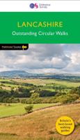
Wandelgids 053 Pathfinder Guides Lancashire | Ordnance Survey

0
Wandelgids van een deel van Engeland, Schotland of Wales. Deze gids bevat 28 dagwandelingen, variërend van korte tochten tot pittige dagtochten. De bijbehorende kaarten zijn uitstekend: men heeft de topografische kaarten van Ordnance Survey gebruikt waarop de route is ingetekend. Daarnaast praktische informatie over de wandeling en wat beschrijvin...

Verkopers met dit product

Verkoper
Bezorging
Prijs
DeZwerver.nl logo
DeZwerver.nl
2,95
18,50

Anderen bekeken ook

Wandelgids 044 Pathfinder Guides Essex | Ordnance Survey
Pathfinder Guide to Essex offers excellent lowland walking in the south-east of England. The routes are all circular exploring the finer countryside of the county, in a series of parkland, farmland, woodland and coastal and estuarine walks, visiting its places of historic interest, attractive towns and charming villages. Given the pleasant and undramatic nature of the terrain, routes only really vary in length in terms of difficulty and there is a general progression through the book from shortest to longest. Beginning with a short walk linking Laindon Common with Great and Little Burstead, encountering the infant River Crouch, the book progresses to a near 10-mile excursion across Bradwell Marsh, with its wide open horizons, and a visit to the isolated and tiny Saxon chapel of St Peter-on-the-Wall. Sea air can also be taken on walks from Walton-on-the-Naze, a circuit of the eastern end of Mersea Island, along St Osyth Creek, at Maldon, from Burnham-on-Crouch, and overlooking Benfleet…
18,50
Wandelgids 005 Pathfinder Guides Cornwall | Ordnance Survey
Wandelgids van een deel van Engeland. Deze gids bevat 28 dagwandelingen, variërend van korte tochten tot pittige dagtochten. De bijbehorende kaarten zijn uitstekend: men heeft de topografische kaarten van Ordnance Survey gebruikt waarop de route is ingetekend. Daarnaast praktische informatie over de wandeling en wat beschrijvingen van het gebied. Each of the Jarrold Pathfinder titles features 28 circular routes, all tried and tested by seasoned walkers. The routes range from extended strolls to exhilarating hikes, so there is something for everyone. They also contain: -Ordnance Survey mapping; -background details of each area; -details of refreshment stops and parking; -walking safety advice; and -information about walkers and the law Cornwall's coastal path gives access to many of Britain's finest marine landscapes, and a great many of the walks in this guide utilise sections of the path, which is maintained to a high standard. Two walks, starting at Polkerris and Little Petherick re…
18,50
Wandelgids 078 Pathfinder Guides Anglesey, Lleyn and Snowdonia | Ordnance Survey
Fraaie, goed verzorgde wandelgidsjes met 28 wandelingen van max. een dag, (beginnend bij korte, eindigend bij langere wandelingen). Weergegeven op duidelijke topografische kaartjes (1:25.000). Bevat verder wetenswaardigheden en praktische informatie voor onderweg. Experience breathtaking north Wales with 28 unforgettable walks through Anglesey, the Lleyn Peninsula and the Snowdonia National Park. Find stunning views of the Welsh coast, the ‘holy isle’ of Ynys Mon and sublime Snowdonia with a range of walks graded by length and difficulty, from relaxed rambles to challenging climbs.   Featured Anglesey, Lleyn and Snowdonia walks include:   - Enjoy views of Snowdon from the shores of Llyn Padarn, dotted with remnants of the Llanberis slate quarries and a medieval castle - Climb to Holyhead Mountain, Anglesey’s highest point, through the South Stacks Cliff Nature Reserve - See the glorious Lleyn Heritage Coast from the headland of Trywn-y-Tâl, circling back to the pleasant village of Tre…
18,50
Wandelgids 048 Pathfinder Guides Suffolk | Ordnance Survey
Fraaie, goed verzorgde wandelgidsjes met 28 wandelingen van max. een dag, (beginnend bij korte, eindigend bij langere wandelingen). Weergegeven op duidelijke topografische kaartjes (1:25.000). Bevat verder wetenswaardigheden en praktische informatie voor onderweg. Suffolk's riverside meadows of the Stour valley remain as beautiful today as when Constable painted them two centuries ago. Similarly, the county's lonely expanses of estuarine marsh, which are a feature of the coast, have a quality that appeal to writers as well as artists. A walk through Flatford and East Bergholt passes one of Constable's most famous viewpoints, and Flatford Mill itself. There is a choice of coastal walks, including routes through Southwold, Shingle Street, Dingle Marshes, Thorpeness and the Shotley peninsula. With 28 walks through the Suffolk countryside, if you’re a walker who really wants to make the most of the Suffolk countryside, make sure you don’t set off on your walk without a copy of Pathfinder …
18,50
Wandelgids 045 Pathfinder Guides Norfolk | Ordnance Survey
200 miles of inland and coastal walking visiting windpumps and watermills . . .   Walk 28 beautiful trails across Norfolk with the OS Pathfinder Guidebooks, graded by length and ranging from 3 ¾ to 11 miles.   The routes range from extended strolls to longer hikes, offering something for all levels! Explore the area including the stunning coastal scenery in the north of the country, such as the unique inland waterways of the Broads to the east and the remote beauty of the vast fenlands to the west.   Walking routes include some historic highlights: Castle rising and Oxburgh Hall, as well as ancient routes such as Boudicca's and the Peddars way. You can also discover stunning seascapes at Overstand and Wells-next-the-Sea.   Each walk includes a detailed description, an OS map, GPS waypoints and notes ofkey featuresand things to see.   Publication Date: 2019   Walks in this book:   Horsey Binham Priory Oxborough and Gooderstone Hales Green from Loddon Marham Fen and the Nar Valley …
18,50
Wandelgids 054 Pathfinder Guides Hertfordshire and Bedfordshire | Ordnance Survey
Wandelgids van een deel van Engeland, Schotland of Wales. Deze gids bevat 28 dagwandelingen, variërend van korte tochten tot pittige dagtochten. De bijbehorende kaarten zijn uitstekend: men heeft de topografische kaarten van Ordnance Survey gebruikt waarop de route is ingetekend. Daarnaast praktische informatie over de wandeling en wat beschrijvingen van het gebied. Both counties tend to be underrated by walkers, often overlooked in favour of the delights of the Thames Valley or the hillier Chilterns country of Buckinghamshire. But they do possess much fine walking country, with a diversity of terrain, gentle hilly regions, lots of pleasant woodland, attractive riverside landscapes and an impressive collection of pretty villages.   There are a large number of country parks, especially in Bedfordshire, which make excellent starting points for walks in the surrounding countryside, linked by the public footpath network. Both Hertfordshire and Bedfordshire have an extensive network of wel…
18,50
Wandelgids 079 Pathfinder Guides Dee Valley, Clwydian Hills and North East Wales | Ordnance Survey
Fraaie, goed verzorgde wandelgidsjes met 28 wandelingen van max. een dag, (beginnend bij korte, eindigend bij langere wandelingen). Weergegeven op duidelijke topografische kaartjes (1:25.000). Bevat verder wetenswaardigheden en praktische informatie voor onderweg. Enjoy 145 miles of lush green walks in north-east Wales with 28 superb country walks, graded by length and difficulty. Choose from 14 routes in the Cylwdian Range and Dee Valley Area of Outstanding Natural Beauty, three on the North Wales coast between Great Orme and Point of Ayr and 11 in Denbighshire and Flintshire to the east of the River Conwy – or do them all!   Featured Dee Valley, Clwydian Hills and North-East Wales walks include:   - Follow the Wales Coast Path along the coastal sand dunes to Point of Ayr and Prestatyn - Circle Great Orme for impressive views of Llandudno, the coast and the mountains of Snowdonia - Stroll along the Llandudno Canal to the magnificent Pontcysyllte Aqueduct, a World Heritage Site - Ramb…
18,50
Wandelgids 082 Pathfinder Guides Orkney and Shetland | Ordnance Survey
Wandelgids van een deel van Engeland. Deze gids bevat 28 dagwandelingen, variërend van korte tochten tot pittige dagtochten. De bijbehorende kaarten zijn uitstekend: men heeft de topografische kaarten van Ordnance Survey gebruikt waarop de route is ingetekend. Daarnaast praktische informatie over de wandeling en wat beschrijvingen van het gebied. 28 outstanding walks – 23 circular and five there-and-back routes visiting eleven islands across both archipelagos. The size and nature of the islands lend themselves best to short and half-day walks where unhurried and free-range walking is encouraged and the endless distractions of scenery, seabirds, wildflowers and sea watching are best appreciated and enjoyed at a relaxed pace.   In Orkney, the first walk is a short stroll around Hoxa Head with its extensive views across Scapa Flow and subsequent routes go on to explore more widely over Mainland Orkney and take in the islands of Hoy, Rousay and South Ronaldsay, concluding with a ramble al…
18,50
Wandelgids 027 Pathfinder Guides Perthshire, Angus & Fife | Ordnance Survey
Wandelgids van een deel van Engeland, Schotland of Wales. Deze gids bevat 28 dagwandelingen, variërend van korte tochten tot pittige dagtochten. De bijbehorende kaarten zijn uitstekend: men heeft de topografische kaarten van Ordnance Survey gebruikt waarop de route is ingetekend. Daarnaast praktische informatie over de wandeling en wat beschrijvingen van het gebied. Each of the Jarrold Pathfinder titles features 28 circular routes, all tried and tested by seasoned walkers. The routes range from extended strolls to exhilarating hikes, so there is something for everyone. They also contain: -Ordnance Survey mapping; -background details of each area; -details of refreshment stops and parking; -walking safety advice; and -information about walkers and the law Approaching the eastern part of central Scotland, where the Grampians dominate the horizon, it appears at first glance to be mountain country. In fact much of the area is low-lying, with flat woodland and agricultural land bordered by…
18,50
Wandelgids 008 Pathfinder Guides Kent | Ordnance Survey
Wandelgids van een deel van Engeland. Deze gids bevat 28 dagwandelingen, variërend van korte tochten tot pittige dagtochten. De bijbehorende kaarten zijn uitstekend: men heeft de topografische kaarten van Ordnance Survey gebruikt waarop de route is ingetekend. Daarnaast praktische informatie over de wandeling en wat beschrijvingen van het gebied. Walkers in Kent enjoy a number of long-distance footpaths, including the North Downs Way, Wealdway, Pilgrims' Way and Greensand Way, and sections of them are incorporated into several walks in this guide. Routes starting at Tenterden and Penshurst wind through a typical Kentish landscape, characterised by orchards, medieval churches and oast houses.   Deal and Sandwich, featured on another walk, were once centres for smugglers, while walks along the cliffs of Dover and Folkestone evoke historic maritime events. In contrast, Romney Marsh and the Swale have a wild and lonely beauty which evoke a more contemplative mood.   28 circular, graded wa…
18,50

Klanten-reviews van Wandelgids 053 Pathfinder Guides Lancashire | Ordnance Survey

Er zijn nog geen beoordelingen voor dit productBen jij de eerste die een review plaatst?

Meer over Wandelgids 053 Pathfinder Guides Lancashire | Ordnance Survey

Productomschrijving

Wandelgids van een deel van Engeland, Schotland of Wales. Deze gids bevat 28 dagwandelingen, variërend van korte tochten tot pittige dagtochten. De bijbehorende kaarten zijn uitstekend: men heeft de topografische kaarten van Ordnance Survey gebruikt waarop de route is ingetekend. Daarnaast praktische informatie over de wandeling en wat beschrijvingen van het gebied.

With its fen-like lowlands, its coastal scenery, the high fells of Bowland and the lush river valleys of the Ribble and Lune, Lancashire is a county of surprising diversity from its great Industrial heritage towns to its attractive, rural villages and its numerous historic monuments. There can be no better way of exploring Lancashire than by foot; it has a number of satisfying long-distance paths - both inland and coastal - and, as this book shows, opportunity for a great number of circular walks in highly distinctive surroundings, including the Lune Valley, Formby Point and Forest of Bowland.

Productinformatie

    Verken gerelateerde categorieën

    Webshop.nl maakt gebruik van cookies. Ga je verder op onze website, ga dan akkoord met het plaatsen van cookies en de verwerking van deze data door ons en vermelde partners.