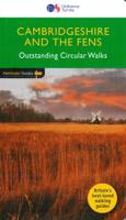
Wandelgids 051 Pathfinder Guides Cambridgeshire & the Fens | Ordnance Survey

0
Explore 28 beautiful walks across Cambridgeshire and the Fens with the OS Pathfinder Guidebooks, graded by length and ranging from 3 to 11 miles.   It is the flattest place in the country - but there is still a lot of landscape to discover. The Fens cover a large section of Cambridgeshire, with low-lying wetlands, tranquil riverside scenery, charm...

Verkopers met dit product

Verkoper
Bezorging
Prijs
DeZwerver.nl logo
DeZwerver.nl
2,95
18,50

Anderen bekeken ook

Reisgids Slow Travel Cambridgeshire and the Fens | Bradt Travel Guides
Een bijzondere serie van Bradt guides, waarin een gedeelte van Engeland uitgebreid beschreven wordt. Met veel aandacht voor kleine details die je niet al gauw elders zult vinden. Naast de beschrijvende informatie vind je ook een schat aan praktische informatie als accommodatie-adressen of leuke pubs. Een aanrader! This new book adds Cambridgeshire and the Fens to Bradt's award-winning Slow Travel series - the biggest series of UK regional travel guides, now over 20 titles strong. No other title offers the range and depth of information on this varied, beautiful and surprisingly undiscovered region. Cambridge itself attracts visitors, students, professionals and academics from around the world, but beyond the University City lie towns and villages, wide open spaces, gentle waterways and wonderful cycling and walking country that comparatively few take time to discover. Engaging and unexpected, this is an informative guide that captures both the stand-out highlights and lesser-known att…
22,50
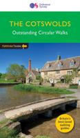
Wandelgids 006 Pathfinder Guides Cotswolds | Ordnance Survey
180 miles of wonderful walking in idyllic, limestone countryside . . .   Take a journey on 28 beautiful walks across the Cotswolds with the OS Pathfinder Guidebooks, graded by length and ranging from 3 to 10 miles.   All walks in this book include written directions, an extract of the OS map for the area and some background on the history and natural environment you see. Most of the walks avoid busy roads and are designed to help you make the most of a holiday or day trips. There are notes on parking, pubs, and things to see en route.   The routes range from extended strolls to longer hikes, something for all levels! Each walk includes a detailed description, an OS map, GPS waypoints and notes of key features and things to see.   This is one of a series of books with great walking routes covering the most popular and scenic areas of Britain. Printed with weather-resistant covers featuring durable rounded corners, they are the perfect companion for country walking throughout Britain.  …
18,50
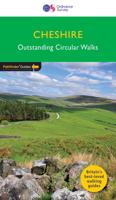
Wandelgids 042 Pathfinder Guides Cheshire | Ordnance Survey
175 miles of delightfully pastoral country walking from Thurstaston Common on the Wirral to Tegg's Nose on the north-western fringes of the Peak District National Park . . .   Uncover 28 beautiful walks around Cheshire with the OS Pathfinder Guidebooks, graded by length and ranging from 3 ½ to 10 ½ miles.   The routes range from extended strolls to longer hikes, something for all levels! Each walk includes a detailed description, an OS map, GPS waypoints, and notes of key features and things to see.   This is one of a series of books with great walking routes covering the most popular and scenic areas of Britain. Printed with weather-resistant covers featuring durable rounded corners, they are the perfect companion for country walking throughout Britain.   Publication Date: 2019   Walks in this book:   Wirswall Hill and Big Mere Bollington and Nab Head Little Budworth Country Park Styal and the Bollin Valley Dane Valley Chester and the River Dee Boothsdale Astbury mere and Vil…
18,50
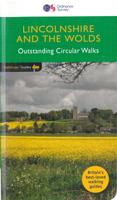
Wandelgids 050 Pathfinder Guides Pathfinder Lincolnshire & the Wolds | Ordnance Survey
Discover 28 beautiful walks across Lincolnshire & the Wolds with the OS Pathfinder Guidebooks, graded by length and ranging from 3 to 11 miles.   Explore the second largest county in England, Lincolnshire. The county is largely unspoilt and offers a great opportunity for new and unique walking experiences. Routes in this book include Thornton Abbey, Sway Valley, Horncastle, the Vale of Belvoir, and Frampton Marsh.   Each walk includes a detailed description, an OS map, GPS waypoints and notes of key features and things to see.   This is one of a seriess of books with great walking routes covering the most popular and scenic areas of Britain. Printed with weather-resistant covers featuring durable rounded corners, they are the perfect companion for country walking throughout Britain.
18,50
Wandelgids 071 Pathfinder Guides The High Fells of Lakeland | Ordnance Survey
Are you planning a holiday to the Lake District? Do you enjoy a hill-walking challenge with impressive mountain-top views? Inside Pathfinder (R) Guide to the High Fells of Lakeland are 20 majestic and challenging fell walks amid the glorious scenery of the Lake District mountains with clear and easy-to-follow route directions compiled from the author's 40 years' experience of Lakeland walking. For adventurous ramblers and walkers wanting a hill-walking challenge, this brand new Pathfinder (R) walking guide features 20 demanding day-walks in the mountains of the Lake District, from Scafell Pike (highest mountain in the Lake District), to Helvellyn, Skiddaw, Great End and Bowfell - all over 900m (nearly 3000 feet) high. Giving a detailed guide to 20 inspiring expeditions on the high fells of Lakeland, Pathfinder (R) Guide to the High Fells of Lakeland explores some of the best fell walking country in the Lake District. With views over to Buttermere, Derwentwater and Grasmere, the Lakela…
18,50
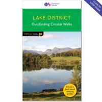
Wandelgids 060 Pathfinder Guides Lake District | Ordnance Survey
Wandelgids van het Lake District, dit prachtige deel van Engeland. Deze gids bevat 28 dagwandelingen, variërend van korte tochten tot pittige dagtochten. De bijbehorende kaarten zijn uitstekend: men heeft de topografische kaarten van Ordnance Survey gebruikt waarop de route is ingetekend. Daarnaast praktische informatie over de wandeling en wat beschrijvingen van het gebied. Are you planning a visit to the Lake District? Do you enjoy a walk in the country or a leisurely afternoon stroll? Britain's best loved walking guides brings you a brand new Pathfinder Guide to More Lake District Walks containing 28 fabulous walks exploring the wide range of landscapes offered by the UK's most popular walking region. Offering something for walkers of all abilities, Pathfinder Guide to Lake District Walks contains: * 28 easy to follow walks ranging in length from 2-15 miles - all clearly graded * Large-scale Ordnance Survey route maps for each walk * GPS waypoints for easy navigation * Colour photo…
18,50
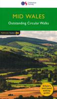
Wandelgids 041 Pathfinder Guides Mid Wales | Ordnance Survey
Wandelgids van midden Wales. Deze gids bevat 28 dagwandelingen, variërend van korte tochten tot pittige dagtochten. De bijbehorende kaarten zijn uitstekend: men heeft de topografische kaarten van Ordnance Survey gebruikt waarop de route is ingetekend. Daarnaast praktische informatie over de wandeling en wat beschrijvingen van het gebied. Explore Mid Wales over 28 walks with this walking guidebook from the Pathfinder series. Each walk is listed by distance and difficulty, and range from a family-friendly 4km (2.5 miles) to a challenging 20km (12 miles)   Often ignored in favour of the more popular Snowdonia and Brecon Beacons National Parks to the north and south, mid Wales still offers some stunning views and beautiful walks. Both coastal routes and upland walks are featured, and include Catti's Cave, Devil's Bridge and the Mynach Valley, The Claerwen Valley and the source of the river Severn   Each of the 28 circular walks has been created by experienced walkers, and includes a route…
18,50
Wandelgids 069 Pathfinder Guides South West England's Coast | Ordnance Survey
Immerse yourself in 28 beautiful walks along the South West Coast of England with the OS Pathfinder Guidebooks, graded by length and ranging from 3 to 9 miles.   The routes range from extended strolls to longer hikes, something for all levels! Each walk includes a detailed description, an OS map, GPS waypoints and notes of key features and things to see.   Routes include Lulworth Cove, Old Harry rocks, Chesil beach, Lizard Point, and Sidmouth.   This is one of a series of books with great walking routes covering the most popular and scenic areas of Britain. Printed with weather-resistant covers featuring durable rounded corners, they are the perfect companion for country walking throughout Britain.
18,50
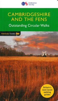
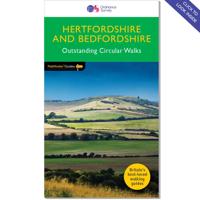
Wandelgids 054 Pathfinder Guides Hertfordshire and Bedfordshire | Ordnance Survey
Wandelgids van een deel van Engeland, Schotland of Wales. Deze gids bevat 28 dagwandelingen, variërend van korte tochten tot pittige dagtochten. De bijbehorende kaarten zijn uitstekend: men heeft de topografische kaarten van Ordnance Survey gebruikt waarop de route is ingetekend. Daarnaast praktische informatie over de wandeling en wat beschrijvingen van het gebied. Both counties tend to be underrated by walkers, often overlooked in favour of the delights of the Thames Valley or the hillier Chilterns country of Buckinghamshire. But they do possess much fine walking country, with a diversity of terrain, gentle hilly regions, lots of pleasant woodland, attractive riverside landscapes and an impressive collection of pretty villages.   There are a large number of country parks, especially in Bedfordshire, which make excellent starting points for walks in the surrounding countryside, linked by the public footpath network. Both Hertfordshire and Bedfordshire have an extensive network of wel…
18,50
Wandelgids 049 Pathfinder Guides Vale of York and the Yorkshire Wolds | Ordnance Survey
Wandelgids van een deel van Engeland. Deze gids bevat 28 dagwandelingen, variërend van korte tochten tot pittige dagtochten. De bijbehorende kaarten zijn uitstekend: men heeft de topografische kaarten van Ordnance Survey gebruikt waarop de route is ingetekend. Daarnaast praktische informatie over de wandeling en wat beschrijvingen van het gebied. With 28 circular, graded walks all tried and tested by seasoned walkers, this guidebook for the Vale of York and the Yorkshire Wolds will help you to make the most of a holiday or day out. Routes range from 4km (2.5 miles) up to 15.3km (9.5 miles), so there is a route to suit all abilities and available time.   While most visitors to the area go to Yorkshire's two national parks, the flat plains of the Vale of York and the rolling uplands the Wolds are a great alternative, and still provide a huge diversity of scenery and walking opportunities. Highlights of the 28 walks shown include the coast at Flamborough Head, the deserted medieval vi…
18,50

Klanten-reviews van Wandelgids 051 Pathfinder Guides Cambridgeshire & the Fens | Ordnance Survey

Er zijn nog geen beoordelingen voor dit productBen jij de eerste die een review plaatst?

Meer over Wandelgids 051 Pathfinder Guides Cambridgeshire & the Fens | Ordnance Survey

Productomschrijving

Explore 28 beautiful walks across Cambridgeshire and the Fens with the OS Pathfinder Guidebooks, graded by length and ranging from 3 to 11 miles.   It is the flattest place in the country - but there is still a lot of landscape to discover. The Fens cover a large section of Cambridgeshire, with low-lying wetlands, tranquil riverside scenery, charming towns, villages, and country houses. The area is rich in heritage, wildlife and history just waiting to be discovered.   Each walk includes a detailed description, an OS map, GPS waypoints and notes of key features and things to see.   This is one of a series of books with great walking routes covering the most popular and scenic areas of Britain. Printed with weather-resistant covers featuring durable rounded corners, they are the perfect companion for country walking throughout Britain.

Productinformatie

    Verken gerelateerde categorieën

    Webshop.nl maakt gebruik van cookies. Ga je verder op onze website, ga dan akkoord met het plaatsen van cookies en de verwerking van deze data door ons en vermelde partners.