Productomschrijving
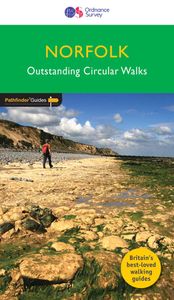
200 miles of inland and coastal walking visiting windpumps and watermills . . . Walk 28 beautiful trails across Norfolk with the OS Pathfinder Guidebooks, graded by length and ranging from 3 ¾ to 11 miles. The routes range from extended strolls to longer hikes, offering something for all levels! Explore the area including the stunning coastal scenery in the north of the country, such as the unique inland waterways of the Broads to the east and the remote beauty of the vast fenlands to the west. Walking routes include some historic highlights: Castle rising and Oxburgh Hall, as well as ancient routes such as Boudicca's and the Peddars way. You can also discover stunning seascapes at Overstand and Wells-next-the-Sea. Each walk includes a detailed description, an OS map, GPS waypoints and notes ofkey featuresand things to see. Publication Date: 2019 Walks in this book: Horsey Binham Priory Oxborough and Gooderstone Hales Green from Loddon Marham Fen and the Nar Valley Way Tyrrel's Wood and Shelton Felbrigg Park and Metton Langmere and the Devil's Punchbowl River Bure and Upton Marshes How Hill and Ludham The Buckenhams Hardley Cross Blickling and the River Bure Peddars Way Fring and Sedgeford Castle Acre and West Acre Boudca's Way Shotesham & Saxlingham Nethergate Thompson Common and the Pingos Westwick Woods and the Weaver's Way West Runton and Beacons Hill Wiveton Downs and Cley next the Sea The Burnhams Denver Sluice a three rivers walk Wells-next-the-Sea, Warham, and Wighton The Weaver's Way to The Berney Arms Reepham, Marriott's Way, and Salle Weeting Castle and Grime's Graves Castle Rising and Roydon Common Ringstead Downs and the Norfolk Coast

