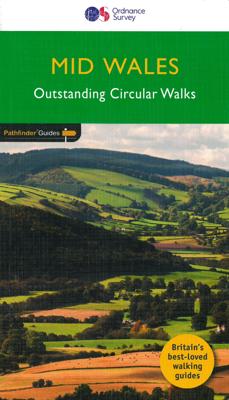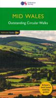
Wandelgids 041 Pathfinder Guides Mid Wales | Ordnance Survey

0
Wandelgids van midden Wales. Deze gids bevat 28 dagwandelingen, variërend van korte tochten tot pittige dagtochten. De bijbehorende kaarten zijn uitstekend: men heeft de topografische kaarten van Ordnance Survey gebruikt waarop de route is ingetekend. Daarnaast praktische informatie over de wandeling en wat beschrijvingen van het gebied. Explore M...

Verkopers met dit product

Verkoper
Bezorging
Prijs
DeZwerver.nl logo
DeZwerver.nl
2,95
18,50

Anderen bekeken ook

Wandelgids 054 Pathfinder Guides Hertfordshire and Bedfordshire | Ordnance Survey
Wandelgids van een deel van Engeland, Schotland of Wales. Deze gids bevat 28 dagwandelingen, variërend van korte tochten tot pittige dagtochten. De bijbehorende kaarten zijn uitstekend: men heeft de topografische kaarten van Ordnance Survey gebruikt waarop de route is ingetekend. Daarnaast praktische informatie over de wandeling en wat beschrijvingen van het gebied. Both counties tend to be underrated by walkers, often overlooked in favour of the delights of the Thames Valley or the hillier Chilterns country of Buckinghamshire. But they do possess much fine walking country, with a diversity of terrain, gentle hilly regions, lots of pleasant woodland, attractive riverside landscapes and an impressive collection of pretty villages.   There are a large number of country parks, especially in Bedfordshire, which make excellent starting points for walks in the surrounding countryside, linked by the public footpath network. Both Hertfordshire and Bedfordshire have an extensive network of wel…
18,50
Wandelgids 100 outstanding British Walks | Ordnance Survey
Beschrijving van de 100 mooiste Pathfinder wandelingen in Engeland, Wales en Schotland. Uitstekende beschrijving van de route met een zeer duidelijke topografische kaart waarop de route is ingetekend.  This magnificent compendium of outstanding British walks brings together the finest selection of Pathfinder Walks in Britain s officially designated places of scenic beauty and historic interest: National Parks, Areas of Outstanding Natural Beauty, National Scenic Areas, Heritage Coast, National Trails and UNESCO World Heritage Sites. There are 100 walking gems in this collection, recommended by a group of experienced authors and guides. The walks span a range of distances and degrees of challenge and are organised by region with coverage across England, Wales and Scotland. 100 Outstanding British Walks is lavishly illustrated with stunning landscape photography and informative introductions to each of the walks. It is designed to be enjoyed at home, while the OS Maps app provides the p…
27,95
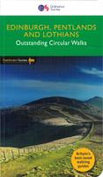
Wandelgids 047 Pathfinder Guides Edinburgh, Pentlands & the Lothians | Ordnance Survey
Wandelgids van een deel van Engeland, Schotland of Wales. Deze gids bevat 28 dagwandelingen, variërend van korte tochten tot pittige dagtochten. De bijbehorende kaarten zijn uitstekend: men heeft de topografische kaarten van Ordnance Survey gebruikt waarop de route is ingetekend. Daarnaast praktische informatie over de wandeling en wat beschrijvingen van het gebied. This new edition of Pathfinder: Edinburgh, Pentlands & Lothians has been fully revised to include seven new walking routes, including a classic walk to the summit of Arthur's Seat. The countryside around Edinburgh is ideal for walking with rolling hills and an impressive Scottish coastline. Pathfinder: Edinburgh, Pentlands & Lothians includes new walks in the Pentlands Hills, the Moorfoot and the Lammermuir Hills, perfect for all ages and abilities, and all within 20 miles of Edinburgh; Scotland's historic capital city. With 28 stunning walking routes, ranging from 3-10 miles, Pathfinder walks are the essential walking gui…
18,50
Wandelgids 85 Pathfinder Guides Outer Hebrides | Ordnance Survey
This new title to the Outer Hebrides represents a very welcome addition to our Pathfinder® Guide series: 28 outstanding walks – 23 circular and five there-and-back routes visiting ten islands. The size and nature of the islands lend themselves best to short and half-day walks where unhurried and free-range walking is encouraged and the endless distractions of scenery, wildlife, history and Gaelic cultural heritage are best appreciated and enjoyed at a relaxed pace.   Featured Outer Hebrides walks include:   This wonderful collection of island walks is divided into three chapters: Lewis and Harris Berneray, North Uist, Benbecula, South Uist and Eriskay Barra and Vatersay There is an illustrated introduction to each of these island groups and planning information on ferries from the mainland and inter-island connections. Walks are presented sequentially geographically, starting in Stornoway, heading up to the Butt of Lewis and then working southwards along the main touring route down th…
18,50
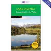
Wandelgids 060 Pathfinder Guides Lake District | Ordnance Survey
Wandelgids van het Lake District, dit prachtige deel van Engeland. Deze gids bevat 28 dagwandelingen, variërend van korte tochten tot pittige dagtochten. De bijbehorende kaarten zijn uitstekend: men heeft de topografische kaarten van Ordnance Survey gebruikt waarop de route is ingetekend. Daarnaast praktische informatie over de wandeling en wat beschrijvingen van het gebied. Are you planning a visit to the Lake District? Do you enjoy a walk in the country or a leisurely afternoon stroll? Britain's best loved walking guides brings you a brand new Pathfinder Guide to More Lake District Walks containing 28 fabulous walks exploring the wide range of landscapes offered by the UK's most popular walking region. Offering something for walkers of all abilities, Pathfinder Guide to Lake District Walks contains: * 28 easy to follow walks ranging in length from 2-15 miles - all clearly graded * Large-scale Ordnance Survey route maps for each walk * GPS waypoints for easy navigation * Colour photo…
18,50
Wandelgids 012 Pathfinder Guides New Forest, Hampshire and South Downs | Ordnance Survey
Wandelgids van een deel van Engeland, Schotland of Wales. Deze gids bevat 28 dagwandelingen, variërend van korte tochten tot pittige dagtochten. De bijbehorende kaarten zijn uitstekend: men heeft de topografische kaarten van Ordnance Survey gebruikt waarop de route is ingetekend. Daarnaast praktische informatie over de wandeling en wat beschrijvingen van het gebied. Pathfinder® Guide to New Forest, Hampshire and South Downs offers interest, regional variety and balance of routes in the New Forest and South Downs National Parks within Hampshire, and in the Itchen and Test valleys, and across the north of the county, providing the best walks in the area.   From an easy stroll across typical New Forest heathland at Bishop's Dyke to the much more energetic downland walking around Kingsclere and Watership Down, this volume contains something for everyone. This newly published OS edition contains a brand new walk on Beaulieu Heath and takes in Hawkhill Inclosure, contrasting two celebrated …
18,50
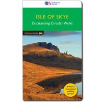
Wandelgids 003 Pathfinder Guides Isle of Skye | Ordnance Survey
Wandelgids van Isle of Skye. Deze gids bevat 28 dagwandelingen, variërend van korte tochten tot pittige dagtochten. De bijbehorende kaarten zijn uitstekend: men heeft de topografische kaarten van Ordnance Survey gebruikt waarop de route is ingetekend. Daarnaast praktische informatie over de wandeling en wat beschrijvingen van het gebied. Pathfinder® Guide to the Isle of Skye, featuring 28 outstanding walks designed for a range of abilities covering 150 miles of walking.   Features: •    28 guided walks for a range of abilities  •    Large detailed Ordnance Survey map extracts •    Key information such as parking and type of terrain  •    GPS waypoints for each route •    Weather-resistant book cover •    Durable rounded corners   Walks are clustered around: •    Portree Bay •    Culnacnoc •    Trumpan •    Kinloch Forest •    Ramasaig •    Glen Brittle •    Strath Suardal •    Sligachan •    Kilmarie   Pathfinder® Guides are Britain’s best-loved walking guides. W…
18,50
Wandelgids 083 Pathfinder Guides North Coast 500 and Northern Highlands | Ordnance Survey
Enhance your North Coast 500 tour with the only walking guidebook featuring routes based on or accessible from Scotland’s ultimate road trip. Discover Britain’s remotest sandy beaches, Scotland’s most northerly munro, some of the oldest rocks on Earth and more with 28 breathtaking walks accessed from the North Coast 500 as well as 32 unmissable stop-off-and-stroll recommendations.   Featured North Coast 500 and Northern Highlands walks include:   - Circle Loch Coulin where Beinn Eighe and Liathach are reflected in the still waters - Wander the astounding landscape of Knockan Crag, where some of the oldest rocks on Earth can be seen - Climb Ben Hope, Scotland’s most northerly munro, towering above the Flow Country - See the waterfalls and rocks walls of the Big Burn as you ascend Ben Bhraggie for views over the Dornoch Firth - Explore the landscape and history of the Applecross peninsula with sublime views of Raasay - Take a moorland and clifftop route to the vast golden sands of Sandw…
18,50
Wandelgids 088 Pathfinder Guides Scottish Borders | Ordnance Survey
Pathfinder® Guide to the Scottish Borders, featuring 28 outstanding walks designed for a range of abilities covering 170 miles of walking.   Features:   28 guided walks for a range of abilities Large detailed Ordnance Survey map extracts Key information such as parking and type of terrain GPS waypoints for each route Weather-resistant book cover Durable rounded corners     This new guide to Scottish Borders has 18 brand-new Pathfinder walks across the county. There are new short walks along the Tweed Valley between Peebles and Coldstream, and along the Teviot Valley from Hawick to Kelso. The stunningly scenic coastline has new walks at Eyemouth and Cockburnspath, while inland peaceful circuits explore the heritage at Duns, Greenlaw, Lauder and St Mary’s Loch.   The other much-loved walks in the book feature circuits along the coast at St Abb’s Head; in the Eildon and Leaderfoot National Scenic Area; in the remote Liddesdale countryside and along the Scotland/England border using both …
18,95
Wandelgids 049 Pathfinder Guides Vale of York and the Yorkshire Wolds | Ordnance Survey
Wandelgids van een deel van Engeland. Deze gids bevat 28 dagwandelingen, variërend van korte tochten tot pittige dagtochten. De bijbehorende kaarten zijn uitstekend: men heeft de topografische kaarten van Ordnance Survey gebruikt waarop de route is ingetekend. Daarnaast praktische informatie over de wandeling en wat beschrijvingen van het gebied. With 28 circular, graded walks all tried and tested by seasoned walkers, this guidebook for the Vale of York and the Yorkshire Wolds will help you to make the most of a holiday or day out. Routes range from 4km (2.5 miles) up to 15.3km (9.5 miles), so there is a route to suit all abilities and available time.   While most visitors to the area go to Yorkshire's two national parks, the flat plains of the Vale of York and the rolling uplands the Wolds are a great alternative, and still provide a huge diversity of scenery and walking opportunities. Highlights of the 28 walks shown include the coast at Flamborough Head, the deserted medieval vi…
18,50

Klanten-reviews van Wandelgids 041 Pathfinder Guides Mid Wales | Ordnance Survey

Er zijn nog geen beoordelingen voor dit productBen jij de eerste die een review plaatst?

Meer over Wandelgids 041 Pathfinder Guides Mid Wales | Ordnance Survey

Productomschrijving

Wandelgids van midden Wales. Deze gids bevat 28 dagwandelingen, variërend van korte tochten tot pittige dagtochten. De bijbehorende kaarten zijn uitstekend: men heeft de topografische kaarten van Ordnance Survey gebruikt waarop de route is ingetekend. Daarnaast praktische informatie over de wandeling en wat beschrijvingen van het gebied.

Explore Mid Wales over 28 walks with this walking guidebook from the Pathfinder series. Each walk is listed by distance and difficulty, and range from a family-friendly 4km (2.5 miles) to a challenging 20km (12 miles)   Often ignored in favour of the more popular Snowdonia and Brecon Beacons National Parks to the north and south, mid Wales still offers some stunning views and beautiful walks. Both coastal routes and upland walks are featured, and include Catti's Cave, Devil's Bridge and the Mynach Valley, The Claerwen Valley and the source of the river Severn   Each of the 28 circular walks has been created by experienced walkers, and includes a route description, extracts of the OS Explorer map for the route and key features and points of historical interest to look out for. Printed with weather-resistant covers featuring durable rounded corners, the Pathfinder Guides are Britain’s best-loved walking guides and are the perfect companion for country walking throughout Britain.

Productinformatie

    Verken gerelateerde categorieën

    Webshop.nl maakt gebruik van cookies. Ga je verder op onze website, ga dan akkoord met het plaatsen van cookies en de verwerking van deze data door ons en vermelde partners.