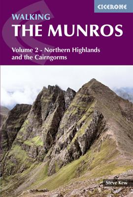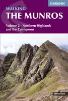
Wandelgids 2 Walking The Munros vol. 2 | Cicerone

0
Uitstekende wandelgids van het noorden van de Schotse Hooglanden en Cairngorms. Goed beschreven met veel praktische informatie om de route te kunnen lopen, inclusief redelijke kaarten. Volume two of Walking the Munros, this guidebook describes 70 challenging and inspiring routes up Scotland's iconic 3000ft+ mountains within the Northern Highlands...

Verkopers met dit product

Verkoper
Bezorging
Prijs
DeZwerver.nl logo
DeZwerver.nl
2,95
20,95

Anderen bekeken ook

Wandelgids 2 Walking The Munros vol. 2 | Cicerone
Uitstekende wandelgids van het noorden van de Schotse Hooglanden en Cairngorms. Goed beschreven met veel praktische informatie om de route te kunnen lopen, inclusief redelijke kaarten. Volume two of Walking the Munros, this guidebook describes 70 challenging and inspiring routes up Scotland's iconic 3000ft+ mountains within the Northern Highlands, the Cairngorms and the Isle of Skye. The routes, which range from 7 to 46km (with the option to reduce walking distance on some of the longer routes by cycling the approach), cover 143 Munro summits, offering half and full-day walk and scramble options.   Clear and concise route descriptions are accompanied by 1:100K mapping, together with invaluable practical information on access, parking, accommodation and more. Also included are two handy indexes of the Munros - listed alphabetically and by height - a perfect resource for peak-baggers.   This guide incorporates both popular and lesser-known routes, and celebrates the raw and rugged …
20,95
Wandelgids 1 Walking The Munros Vol 1 Southern, Central and Western Highlands - Schotland | Cicerone
Uitstekende wandelgids van het zuiden, midden en westen van de Schotse Hooglanden. Goed beschreven met veel praktische informatie om de route te kunnen lopen, inclusief redelijke kaarten. Guidebook to walking the Munros in southern, central and western Highlands. Describes 69 challenging routes across 139 of the iconic 3000ft+ mountains covering areas such as Glencoe, Bridge of Orchy and Mull. Includes routes up Ben More, Ben Alder, Ben Lomond and Ben Nevis, the highest mountain in the British Isles. Volume 1 of two guidebooks.   Seasons The guide is intended for summer hillwalkers (usually April/May to October in Scotland). In winter conditions the routes become more serious mountaineering expeditions requiring appropriate skills, equipment and experience.   Centres Arrochar, Crianlarich, Killin, Pitlochry, Tyndrum, Glencoe, Fort William, Spean Bridge, Dalwhinnie, Braemar, Glenshee   Difficulty Most of the Munros are straightforward walks but some involve ridge walking, sc…
20,95
Wandelgids 1 Walking the Corbetts: Volume 1 | Cicerone
Uitstekende wandelgids, goed beschreven met veel praktische informatie om de route te kunnen lopen, inclusief redelijke kaarten. This guide describes routes up all 112 Corbetts south of the Great Glen. The Corbetts offer challenging ascents and descents on steep slopes. The Corbetts (Scotland's 2500-2999ft mountains) are every bit as interesting as the Munros (3000ft and over), often clear when the Munros are in cloud, walkable on short winter days and free of the peak-bagging crowds of their taller neighbours.   Walking the Corbetts is divided into two volumes. This guide covers the Corbetts to the south of the Great Glen, which runs from Fort William to Inverness and includes the Southern Uplands, Southern Highlands, Cairngorms and also the islands of Arran and Jura. Choosing the best, rather than the quickest routes up each summit the author covers 112 Corbetts described in 95 routes, illustrated with custom 1:100,000 mapping.   South of Glasgow and Edinburgh are the moorland hills…
23,95
Wandelgids 2 Walking the Corbetts: Volume 2 | Cicerone
Uitstekende wandelgids, goed beschreven met veel praktische informatie om de route te kunnen lopen, inclusief redelijke kaarten. This guide describes routes up all 109 Corbetts north of the Great Glen. The Corbetts offer challenging ascents and descents on steep slopes. The Corbetts (Scotland's 2500-2999ft mountains) are every bit as interesting as the Munros (3000ft and over), often clear when the Munros are in cloud, walkable on short winter days, free of the peak-bagging crowds of their taller neighbours.   Walking the Corbetts is divided into two volumes. The guide covers the Corbetts to the north of the Great Glen, which runs from Fort William to Inverness and includes those in Knoydart, Applecross, Torridon and the isles of Skye, Mull, Rum and Harris. Choosing the best, rather than the quickest, routes up each summit the author covers 109 peaks in 90 routes, illustrated with custom 1:100,000 mapping.   South of the Great Glen it is the Munros which attract most attention, but al…
23,95
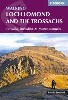
Wandelgids Walking Loch Lomond and The Trossachs | Cicerone
Uitstekende wandelgids, sommige meerdaags, voor dit uitdagende wandelgebied in Schotland. Guidebook to over 70 walking routes in the hills of Loch Lomond and the Trossachs National Park in Scotland's Southern Highlands. Including 21 Munros on less-popular routes, as well as plenty of Corbetts and Grahams. Hill summits of Ben Lomond, the Cobbler, Ben Lui and the Arrochar Alps have plenty of routes to explore. The routes in this guide range from 1 to 17 miles, and are clearly graded for distance and difficulty, as well as dividing between low-level, mid-level and mountain walks. From short, loch-side strolls suitable for all walkers, to long, challenging mountain routes with rocky scrambling, the Loch Lomond and Trossachs hills have plenty to offer.    The glens and mountains walks in this guide are divided into area: the Trossachs, Callander and Loch Lubnaig, Balquhidder and Lochearnhead, Crianlarich to Inveraran, Tyndrum, Ben Lomond, Loch Lomond West, Arrochar Alps and Glen Croe to Lo…
20,95
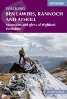
Wandelgids Walking Ben Lawers, Rannoch and Atholl | Cicerone
Wandelgids met 80 wandelingen van verschillende niveaus in het gebied van de Perthshire Highlands.  The south-eastern Grampians of the former county of Perthshire may be grassier and less rugged than other Scottish mountains, but they are just as big. The routes in this guide take you to the summits of these 'jolly green giants' - covering all of the region's Munros, often by unconventional routes, as well as several Corbetts and smaller hills - and also over the Atholl passes, along rivers and through the woods of Perthshire's 'Big Tree Country'. The 80 walks comprise a mixture of low-level, mid-level and mountain routes and are graded by both length and difficulty. Many are demanding, crossing remote, uneven, steep and/or pathless terrain, but also included are gentler walks on clear paths taking in local features of interest.   The route description is illustrated with clear mapping (a mixture of OS 1:50,000 and smaller-scale maps for the longer routes) and the route summary table …
19,95
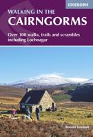
Wandelgids Walking in the Cairngorms | Cicerone
Uitstekende wandelgids, sommige meerdaags, voor dit uitdagende wandelgebied in Schotland. This guidebook contains over 100 routes for walking in the Scottish Cairngorms. It includes 18 Munro summits and smaller viewpoint hills. Walks range in length from 1 to 26 miles and are graded for difficulty.    For the adventurous there are the best of the area's rocky scrambles, and the classic through-routes including the Lairig Ghru. For those looking for a more gentle alternative, there are easy, sandy trails wandering among the tall pines and along the banks of the great rivers Spey, Nethy and Dee.    Britain's biggest mountain range is home to exceptional and varied scenery - from the ancient Caledonian forest to the granite plateau, the glacial glens and high corries where green lochans lie below great crags of the plateau rim.  Along with the main Cairngorm range between Speyside and Deeside, the guidebook covers Lochnagar. It includes practical information on snack stops, public …
20,95
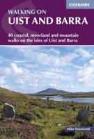
Wandelgids Walking on Uist and Barra - Schotland | Cicerone
This guide offers 40 varied and graded walking routes on the unique 100km cluster of islands that make up Uist and Barra. From short, flat beach walks beside crystal clear waters to long excursions across wild mountainous terrain, the routes visit all the major islands from Berneray to Vatersay but also those smaller and offshore such as Eriskay and Mingulay. Walking across these landscapes, especially the hill country, gives a sense of remoteness and peaceful solitude that cannot be found in the mainland's National Parks or on the Munros busy with peak baggers. Despite a relatively narrow area, Uist and Barra's diverse islands offer a contrasting walking terrain and many ancient historic sites such as chambered cairns and standing stones as well as lots of local wildlife. Upland areas are home to red deer and golden and white-tailed eagles, while along the coast grey seals are common and thousands of birds set up their breeding grounds in the machair. Daily flights between Glasgow an…
23,95
Wandelgids The Munros | SMC guide
Toonaangevend boek over alle Munros in Schotland, de bergen boven de 3000 feet. Er zijn talloze mensen die in hun leven alle Munros willen beklimmen; het is een hele cultus. This fully revised edition of the Scottish Mountaineering Club’s original and best-selling guidebook The Munros describes the best walking routes on Scotland’s 282 mountains above 3000ft.   Comprehensive descriptions in this definitive guide recommend ascent and descent routes for each of the Munros and their 226 subsidiary Tops, with maps of the peaks and principal surrounding hills to help you plan the most enjoyable journeys through Scotland’s wild landscape. The descriptions are brought to life throughout with vivid photography that illustrates the dramatic beauty of these much-loved mountains.   In addition to routes themselves the book contains Munros Tables, a complete list of the 508 Munros and subsidiary Tops, listed in height order. Whether you are an occasional walker looking for inspiration or a dedica…
37,95
Wandelgids Walking in Carmarthenshire | Cicerone
This guidebook presents 30 contrasting day walks exploring the mountains, valleys and coastline of Carmarthernshire in south-west Wales. Ranging from 2 to 10 miles in length and suitable for walkers of all abilities, the routes introduce the varied walking on offer in this county, including parts of the Brecon Beacons and the Cambrian Mountains.   Alongside detailed route descriptions and clear OS mapping, the book is packed with interesting information about the places and heritage encountered. Notes on landscape, geology and wildlife of the area are included, and for each walk there is useful practical information on transport and refreshments.   A county of contrasts with around 1850 miles of footpaths, Carmarthernshire is a walker's paradise. Highlights include the Black Mountains (Mynydd Du), the Teifi Valley, Camarthen Bay, the southwestern Coast, and 'Dylan Thomas Country' around Laugharne.   Activities Walking   Seasons The walks can be done at any time of year, but the drier …
19,50

Klanten-reviews van Wandelgids 2 Walking The Munros vol. 2 | Cicerone

Er zijn nog geen beoordelingen voor dit productBen jij de eerste die een review plaatst?

Meer over Wandelgids 2 Walking The Munros vol. 2 | Cicerone

Productomschrijving

Uitstekende wandelgids van het noorden van de Schotse Hooglanden en Cairngorms. Goed beschreven met veel praktische informatie om de route te kunnen lopen, inclusief redelijke kaarten.

Volume two of Walking the Munros, this guidebook describes 70 challenging and inspiring routes up Scotland's iconic 3000ft+ mountains within the Northern Highlands, the Cairngorms and the Isle of Skye. The routes, which range from 7 to 46km (with the option to reduce walking distance on some of the longer routes by cycling the approach), cover 143 Munro summits, offering half and full-day walk and scramble options.   Clear and concise route descriptions are accompanied by 1:100K mapping, together with invaluable practical information on access, parking, accommodation and more. Also included are two handy indexes of the Munros - listed alphabetically and by height - a perfect resource for peak-baggers.   This guide incorporates both popular and lesser-known routes, and celebrates the raw and rugged beauty of these majestic mountains.   Volume 1 details the other 139 Munros, covering the southern, central and western Highlands and Mull.

Productinformatie

    Verken gerelateerde categorieën

    Webshop.nl maakt gebruik van cookies. Ga je verder op onze website, ga dan akkoord met het plaatsen van cookies en de verwerking van deze data door ons en vermelde partners.