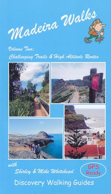
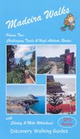
Wandelgids 2 Madeira Walks | Discovery Walking Guides

0
Engelstalige wandelgids Madeira, met uitgebreide beschrijvingen van wandelroutes, routekaartjes en praktische informatie zoals bussen en accommodatie. In dit tweede deel staan de wat uitdagendere routes. As a walker's paradise, Madeira has it all - majestic mountains, rugged coastline, ancient forests, a unique levada network and verdant flora; ea...

Verkopers met dit product

Verkoper
Bezorging
Prijs
DeZwerver.nl logo
DeZwerver.nl
niet bekend
19,95

Anderen bekeken ook

Wandelgids Walk! La Gomera | Discovery Walking Guides
La Gomera is the ultimate get-away-from-it-all island: easy-going, unspoilt, friendly, isolated from the hustle and bustle of modern living, and so laid back it’s virtually supine - even the volcanoes have been dormant for millions of years. The walks, however, are a bit more energetic. For the new 4th edition of Walk! La Gomera Charles Davis has teamed up with Jan Kostura. Jan brings his wide experience and passion for the Canaries, checking, re-walking and revising existing routes, and adding a couple of his own adventures, including a new Top Three Gomeran walk. Two routes have been dropped as having become too dangerous, but the good news is that many of the more harum-scarum walks have been improved through path clearing and the addition of railings to the vertiginous stretches. Other good news is that the devastating forest fires of 2012 have proved not nearly as damaging as we feared, leaving most of our itineraries unscathed. In short, there is every reason to take off and ex…
17,50
Wandelkaart Tour & Trail Madeira | Discovery Walking Guides
Goed gedetallieerde wandelkaart van Madeira, schaal 1:40.000, scheur en watervast papier. Wandelroutes staan ingetekend. Our large 1:40,000 scale, combined with splitting the island into East and West with a generous overlap, produces double sided map whose total size is 840mm by 600mm and folds to 235mm by 120mm. You get the most detailed map of Madeira that is produced including our 'Tour & Trail' level of detail ranging from major roads to secondary roads to minor roads to streets and camino rural narrow country roads, plus dirt roads and walking trails. Altitude background colouring is designed to clearly show the altitude range when travelling across the island by car or on foot. 100 metre and 50 metre contours are clearly shown on the map along with a large number of individual height points and all of the official 'Trig' points. Tour & Trail attention to detail is legendary as is our useful symbol range including miradors, picnic areas, petrol stations, bar/restaurants and park…
15,95
Wandelgids 1 Madeira Walks | Discovery Walking Guides
Engelstalige wandelgids Madeira, met uitgebreide beschrijvingen van wandelroutes, routekaartjes en praktische informatie zoals bussen en accommodatie.   Dit eerste deel heeft wandelingen voor zowel de beginnende als de geoefende wandelaar.   Madeira is a wonderful destination for walkers, offering a breathtaking diversity of landscapes; lushly verdant slopes, towering volcanic peaks, dramatic gorges and soaring cliffs surprise and amaze the newcomer. Add the levada network, primeval forests, subtropical flora and the superb landscaped gardens - little wonder that the island is fondly called "The floating garden of the Atlantic". Shirley Whitehead, Madeira's resident walking expert, has brought together over 40 'Leisure Walks' adventures suitable for a wide range of abilities and age groups.   Madeira Walks volume 1 offers a wealth of choice for every walker and explores the best areas the island has to offer. With Madeira Walks in your pocket, your visit to Madeira becomes an unforget…
18,50
Wandelgids Walking on Madeira | Cicerone
Zeer goede wandelgids van deze gerenommeerde Engelse uitgever. Met veel detail worden de wandelingen beschreven, voorzien van goede kaarten en ook nog praktische informatie. Veelal veel keuze uit het grote aantal dagtochten dat beschreven wordt. De afstand is tussen de 5 en 18 kilometer, al naar gelang wat je als wandelaar in gedachte hebt.    This guide describes a varied selection of 57 walks on the Portuguese island of Madeira, exploring the dramatic cliff coastline, scenic levadas (irrigation channels), dense laurisilva 'cloud' forests and high mountain peaks, plus three walks on neighbouring Porto Santo. There are routes to suit all abilities, from easy, level levada walks to steep and rugged mountain paths – some with exposed sections calling for a sure foot and good head for heights. Since the steep terrain of Madeira does not easily support circular walks, many of the routes are linear, however most can be accessed by public transport and there is the option to link routes to …
24,95
Wandelgids Walking on Arran | Cicerone
Uitstekende wandelgids voor dit uitdagende wandelgebied in Schotland. Dagtochten. The 45 walking routes in this Isle of Arran guidebook range from easy 3km (2 miles) nature trails to long arduous mountain routes with scrambles (up to 32km) providing thorough coverage of Arran, including the ascent of Goatfell and nearby Holy Isle. Most routes are 10km to 15km long but many give opportunities to create longer cross island walks. This guidebook presents a selection of 45 day walks on the popular and accessible Isle of Arran. The routes are between 2 miles (3km) and 20 miles (32km) in length, from easy waymarked forest trails to more arduous mountain walks, exposed ridge routes and scrambles. There are linear and circular walks to choose from, and opportunities to link routes together and create longer walks across the length and breadth of the island. With highlights including Goatfell, Beinn Tarsuinn, the Sannox Horseshoe, Glen Rosa and the Cock of Arran, there's something here to suit…
23,95
Wandelgids Walking and Trekking in Iceland - IJsland | Cicerone
Wandelgids met beschrijvingen, kaarten en praktische informatie zoals bussen, overnachten, etc. voor meerdaagse wandelroutes en dagwandeltochten op IJsland. A country of extraordinary beauty, Iceland’s incredible variety of volcanic and glacial landscapes makes it a unique destination for walking and trekking holidays. Its three national parks include the mighty Vatnajökull, largest national park in Europe.   The wide range of routes in this book introduce walkers and backpackers to this ‘Land of Ice and Fire’. There are 100 days of walking in this guidebook, stretching over 1722km, split between 49 day walks and 10 multi-stage treks. They climb mountains, cross glaciers, pass lakes and explore coastlines and geothermal areas, and range from easy nature trails to challenging treks. So, there is enough variation to satisfy all kinds of walkers. The routes are spread all around Iceland, grouped into twelve regions. Detailed information is given at the start of each route or trekking sta…
26,95
Wandelkaart Tour & Trail Lanzarote | Discovery Walking Guides
De Lanzarote Tour & Trail Super-Durable wandelkaart (4de editie) beslaat dit grote eiland op een schaal van 1: 40.000 wat resulteert in de meest gedetailleerde en sterkste kaart van Lanzarote die u kunt kopen.   For your best adventures, use the best map. Water-proof, split-proof, tear-proof, adventure-proof. Lanzarote Tour & Trail Super-Durable Map is simply the toughest, most accurate, easy to read, easy to use multipurpose map that you can get. A large 960mm by 694mm double sided map sheet covers Lanzarote and its neighbouring island La Graciosa at 1:40,000 scale. A generous overlap and an extra mini-map reduce the need of turning the map in use. Whether you plan to walk, or discover the island by car or the bus, this is the map for you. New for the 6th edition is a summary of Lanzarote bus system, with overview of bus lines and actual bus routes highlighted in the map. Also new is a summary and a mini-guide to main tourist attractions of Lanzarote, with tips for a successful…
18,95
Wandelkaart Tour & Trail Gran Canaria | Discovery Walking Guides
Goede, scheur- en watervaste, wandelkaart van Gran Canaria.   Gran Canaria Tour & Trail Super-Durable Map covers the whole island at 50,000 scale  in a double sided map sheet of North and South with a generous overlap common to both North and South map sheets.   For the best adventures, use the best map.  Gran Canaria is a large island of dramatic landscapes. Gran Canaria Tour & Trail Super-Durable Map (50k scale) is a large 960mm by 700mm double sided map sheet which folds to its 235mm by 120mm pocket size. A special concertina map fold makes the map easy to unfold and refold in use.  Super-Durable means water-proof and tear-proof, simply wipe clean with a damp cloth if your map gets dirty. This map has a "2 Year Guarantee" covering adventurous use.   Gran Canaria North is on one side with South on the reverse side, while a generous common overlap minimises your map turning.    Now in its 5th edition Gran Canaria Tour & Trail Super-Durable Map, 50k scale, is the result o…
15,95
Wandelkaart Tour & Trail Zakynthos | Discovery Walking Guides
Goede scheur- en watervaste wandelkaart van Zakynthos. For the best adventures, use the best map. Water-proof, split-proof, tear-proof, adventure-proof. Zakynthos (Zante) Tour & Trail Super-Durable Map is simply the toughest, most accurate, easy to read, easy to use map of the island you can buy at any price.   Super-Durable Maps come with a 2 year adventurous use `Wear and Tear' guarantee. A large 840mm by 694mm double sided map sheet has Zakynthos (Zante) at 1:35,000 scale with the North-West of the island on the cover side and the South-East on the reverse. There is a very generous overlap between the two sides so the only time you need to turn the map over is if you are driving from Cape Skinari (NW) to Cape Gerakas (SE) at the opposite end of the island.   Our special concertina map fold makes our map easy to use and easy to refold to its 235mm by 120mm pocket size. You can also download the digital Custom Map edition of our Zakynthos Tour & Trail Map for use with Garmin gps unit…
15,95
Wandelgids Mountain Walking in Mallorca | Cicerone
Goede wandelgids van een prachtig wandelgebied. De routes zijn goed beschreven met veel details, daarnaast de noodzakelijke praktische informatie en men maakt gebruik van goed leesbare, voldoende gedetailleerde kaarten. Met zorg uit gekozen wandelingen door één van Engelands meest gerenommeerde wandelaars!   This guidebook presents 50 half-day and day walks in Mallorca's Serra de Tramuntana, the striking limestone range that stretches along the northwestern flank of the island. Whilst the region promises breathtaking scenery and some fantastic walks, there is also some potentially challenging terrain, making guidance when choosing, planning and walking routes all the more valuable. As many involve steep ground, navigational challenge and hands-on scrambling, they are primarily geared towards those with some experience of mountain walking.    Comprehensive route description is illustrated with 1:25,000 Alpina mapping and each walk includes a statistics box to aid route selection. Usefu…
20,95

Klanten-reviews van Wandelgids 2 Madeira Walks | Discovery Walking Guides

Er zijn nog geen beoordelingen voor dit productBen jij de eerste die een review plaatst?

Meer over Wandelgids 2 Madeira Walks | Discovery Walking Guides

Productomschrijving

Engelstalige wandelgids Madeira, met uitgebreide beschrijvingen van wandelroutes, routekaartjes en praktische informatie zoals bussen en accommodatie.

In dit tweede deel staan de wat uitdagendere routes.

As a walker's paradise, Madeira has it all - majestic mountains, rugged coastline, ancient forests, a unique levada network and verdant flora; easy to see why so many walkers return year after year. In 2015 Madeira was voted the "World's Best Island Destination" by the World Travel Awards the final accolade from the previous two years when it was voted "Europe's Leading Island Destination". Quite an achievement, brought about largely by the substantial EU investment over the past decade in the improvement and development of the island's infrastructure and facilities.   One of the initiatives focused on improving and creating new walking trails which has resulted in Madeira now being regarded as one of Europe's top hiking destinations.To date, around thirty routes on Madeira have been designated Recommended Trails for Hikers and currently our guides are the only publications to include all these trails. We have also taken on board the many comments received from walkers over the last few years. Taking all the above into account, we've reorganized our books into a compendium of two editions; Madeira Walks: Volume One, Leisure Trails included the shorter and easier trails whilst Madeira Walks: Volume Two covers 40 more challenging and high altitude routes.   There's a good balance including coastal routes, forest trails, moorland and mountain pathways and levada walks although the terrain varies greatly. We've introduced a number of new routes whilst continuing to include our favourite 'off the beaten track' trails, so regardless of fitness, age or ability, there's something for everyone. Both books are arranged by geographic area, then by exertion rating under each heading.   All the trails have been surveyed and mapped using GPS satellite navigation. The authors and their co-walkers have walked all these routes and continue to revisit as many as possible, especially those we believe could be subject to change; this ensures accuracy and up to date information for hikers. Clear descriptions guide the walker both to the starting point and throughout the routes, with gradings, distances, timings and altitudes all symbolized.   Whilst distances vary considerably, many of the routes have steep ascents or descents and a few are subject to some extremely precipitous sections. Some information on flora and fauna is also included, while references to places of interest give readers a sense of the culture and history around these trails. Map sections were developed from the Madeira Tour & Trail Map, by far the most up to date and best-selling map on the island.   In addition to the walking trails, viewing platforms (miradouros) are found around the island providing strategic positions for taking in the most stunning views. Barbeque and picnic areas are also positioned in picturesque locations around the island.
Verken gerelateerde categorieën

Webshop.nl maakt gebruik van cookies. Ga je verder op onze website, ga dan akkoord met het plaatsen van cookies en de verwerking van deze data door ons en vermelde partners.