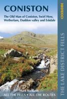
Wandelgids 15 Short Walks Coniston and Langdale | Cicerone

0
15 of the best short walks in the southwestern Lake District around Coniston and Langdale. Handpicked by Cicerone's expert author, and with no complicated navigation or challenging terrain, these walks can be enjoyed by everyone.   Easy-to-read Ordnance Survey maps, clear route descriptions and lots of images Includes Coniston Old Man, Tarn Hows, ...

Verkopers met dit product

Verkoper
Bezorging
Prijs
DeZwerver.nl logo
DeZwerver.nl
2,95
13,95

Anderen bekeken ook

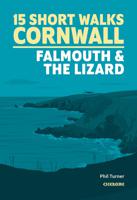
Wandelgids 15 Short Walks Short Walks in Cornwall | Cicerone
15 of the best short walks in Cornwall around Falmouth and the Lizard. Handpicked by Cicerone's expert author, and with no complicated navigation or challenging terrain, these walks can be enjoyed by everyone.   Easy-to-read Ordnance Survey maps, clear route descriptions and lots of images Includes St Agnes Beacon and Wheal Coates, Truro, Gwennap Pit, St Mawes, Mylor, Frenchman's Creek, Loe Pool, Cadgwith and Lizard Point Most walks are under 3 hours in duration All routes are accessible by public transport Information on local beauty spots and refreshment stops GPX files available for download
13,95
Nieuw
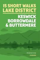
Wandelgids 15 Short Walks Keswick, Borrowdale and Buttermere | Cicerone
15 of the best short walks in the northern Lake District around Keswick, Borrowdale and Buttermere. Handpicked by Cicerone's expert author, and with no complicated navigation or challenging terrain, these walks can be enjoyed by everyone.   Easy-to-read Ordnance Survey maps, clear route descriptions and lots of images Includes Buttermere, Derwentwater, Cat Bells, Castlerigg Stone Circle, Rannerdale Knotts, Castle Crag, Ashness Bridge and Skiddaw Most walks are under 3 hours in duration All routes bar one are accessible by public transport Information on local beauty spots and refreshment stops GPX files available for download
13,95
Nieuw
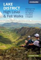
Wandelgids Lake District High Level and Fell Walks | Cicerone
A guidebook to 30 high level day walks in the Lake District, exploring some of the best mountains, ridgewalks, fells and summits within the national park. Mostly circular except for a few linear routes that make use of public transport links, the walks are graded according to difficulty, ensuring there is something for all levels of fitness and experience. The walks range from 7 to 24km (4–15 miles) in length and can be completed in between 3 and 9 hours.   They are arranged geographically into 6 areas: Keswick, Borrowdale and Buttermere, the Western Valleys, Coniston and Langdale, Ambleside and Windermere, and Ullswater. 1:50,000 OS maps for each walkGPX files available to downloadDetailed information on terrain, refreshments and public transport for each walkInformation given on local history and archaeologyHighlights include Scafell Pike, Scafell, Helvellyn, Skiddaw, Newlands Round and the Fairfield Horseshoe   Pocket-sized guide to 30 of the best walks on the higher Lake District…
18,50
Nieuw
Wandelgids 15 Short Walks Isle of Mull | Cicerone
15 of the best short walks on the Isle of Mull, Ulva and Iona, including Tobermory, Aros Park, Glengorm Castle, Treshnish, and the beaches of Langamull, Kilvickeon and Tireragan.   The walks are under 3 hours in duration and between 1.5km and 10.5km, so they're perfect if you're new to walking or looking for something you can enjoy with the whole family.   Easy-to-read OS maps, clear route descriptions and lots of images All routes bar one are accessible by public transport Information on wildlife, beauty spots and refreshment stops GPX files available for download Compactly sized to fit in a jacket pocket
14,95
Nieuw
Wandelgids 15 Short Walks Yorkshire Dales | Cicerone
Discover 15 of the best short walks around Sedbergh, Kirkby Lonsdale and Ingleton. Each walk comes with easy-to-read Ordnance Survey maps, clear route description and lots of images, plus information on beauty spots and refreshment stops. No challenging terrain or complicated navigation means everyone can enjoy walks.   Seasons These routes are suitable for walking at all times of the year, although in winter and extremely wet weather, extra care will be needed on steep slopes and near rivers and waterfalls. Centres Sedbergh and Kirkby Lonsdale are the main centres. The villages of Dent and Barbon also provide a range of more limited facilities. Difficulty The Yorkshire Dales comprise dales (valleys) but also steep hillsides from where extensive views can be enjoyed. Stoney tracks and paths tend to be the norm, rivers and streams are crossed on footbridges, and narrow ‘squeeze’ stiles pass through drystone walls. Must See Sedbergh, Kirkby Lonsdale, Dent, Barbon, Barbondale, Dentdale, …
18,95
Nieuw
Wandelgids 15 Short Walks in Pembrokeshire: Tenby and the South | Cicerone
Dennis and Jan Kelsall have chosen 15 of the best short walks around Tenby and south Pembrokeshire for you to explore. Our guide comes with easy-to-read Ordnance Survey maps and clear route descriptions, perfect if you're new to walking or are looking for something you can enjoy with the whole family. 15 of the best short walks in Tenby and south Pembrokeshire. Our guidebook comes with easy-to-read Ordnance Survey maps and clear route descriptions, perfect if you're new to walking or are looking for something you can enjoy with the whole family.   Easy-to-read Ordnance Survey maps, clear route descriptions and lots of images  Includes Tenby, Saundersfoot, Amroth, Manorbier, Angle and Bosherton All walks are under 4 hours in duration and from 2km to 11km (1–7 miles) Information on local beauty spots and refreshment stops GPX files available for download
13,95
Nieuw
Wandelgids Great Walks on the England Coast Path | Cicerone
Guidebook to 30 routes celebrating the best day and weekend walks on the England Coast Path, a new National Trail. Includes a varied selection of walks along the country's diverse shoreline, on cliff paths, estuaries, beaches and saltmarsh. Routes from 9 to 45km to suit all ages and abilities, many of which can be enjoyed all year round. At around 4500km (2800 miles), the England Coast Path is the longest coastal trail in the world. This inspirational large-format guide presents a handpicked selection of 30 highlight sections, offering a taste of England's stunning and diverse shoreline. Routes range from 9 to 45km, spanning between 3 hours and 2 days, offering options to suit all abilities. They can be accessed by public transport and are walkable year round (weather permitting!). Route descriptions are accompanied by 1:50,000 OS map extracts. Included in each walk are comprehensive listings of public transport, toilets and places to eat and drink, which highlight the excellent walki…
27,95
Nieuw
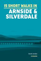
Wandelgids 15 Short Walks Arnside and Silverdale | Cicerone
David Jordan has chosen 15 of the best short walks around Arnside and Silverdale for you to explore. Our guide comes with easy-to-read Ordnance Survey maps and clear route descriptions, perfect if you're new to walking or are looking for something you can enjoy with the whole family. We've included information on local beauty spots and tasty refreshment stops, and most of the walks can be completed in under 3 hours.   We haven't included any walks with challenging terrain or complicated navigation, and all you'll need to take with you are a waterproof jacket and a pair of comfortable trainers.
13,95
Wandelgids 15 Short Walks Dumfries and Galloway | Cicerone
Ronald Turnbull has chosen 15 of the best short walks around Dumfries and Galloway for you to explore. Our guide comes with easy-to-read Ordnance Survey maps and clear route descriptions, perfect if you're new to walking or are looking for something you can enjoy with the whole family. We've included information on local beauty spots and tasty refreshment stops, and most of the walks can be completed in under 4 hours.   We haven't included any walks with challenging terrain or complicated navigation, and all you'll need to take with you are a waterproof jacket and a pair of comfortable trainers.
13,95
Wandelgids 100 outstanding British Walks | Ordnance Survey
Beschrijving van de 100 mooiste Pathfinder wandelingen in Engeland, Wales en Schotland. Uitstekende beschrijving van de route met een zeer duidelijke topografische kaart waarop de route is ingetekend.  This magnificent compendium of outstanding British walks brings together the finest selection of Pathfinder Walks in Britain s officially designated places of scenic beauty and historic interest: National Parks, Areas of Outstanding Natural Beauty, National Scenic Areas, Heritage Coast, National Trails and UNESCO World Heritage Sites. There are 100 walking gems in this collection, recommended by a group of experienced authors and guides. The walks span a range of distances and degrees of challenge and are organised by region with coverage across England, Wales and Scotland. 100 Outstanding British Walks is lavishly illustrated with stunning landscape photography and informative introductions to each of the walks. It is designed to be enjoyed at home, while the OS Maps app provides the p…
27,95

Klanten-reviews van Wandelgids 15 Short Walks Coniston and Langdale | Cicerone

Er zijn nog geen beoordelingen voor dit productBen jij de eerste die een review plaatst?

Meer over Wandelgids 15 Short Walks Coniston and Langdale | Cicerone

Productomschrijving

15 of the best short walks in the southwestern Lake District around Coniston and Langdale. Handpicked by Cicerone's expert author, and with no complicated navigation or challenging terrain, these walks can be enjoyed by everyone.   Easy-to-read Ordnance Survey maps, clear route descriptions and lots of images Includes Coniston Old Man, Tarn Hows, Elterwater, Blea Tarn, Stickle Tarn and the Coppermines Valley Most walks are under 4 hours in duration All routes bar one are accessible by public transport Information on local beauty spots and refreshment stops GPX files available for download

Verken gerelateerde categorieën

Webshop.nl maakt gebruik van cookies. Ga je verder op onze website, ga dan akkoord met het plaatsen van cookies en de verwerking van deze data door ons en vermelde partners.