webshop.nl
Categorieën
  Sluiten

Meer Ordnance Survey

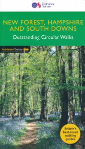
Wandelgids 12 Pathfinder Guides New Forest, Hampshire and South Downs

0
Wandelgids van een deel van Engeland, Schotland of Wales. Deze gids bevat 28 dagwandelingen, variërend van korte tochten tot pittige dagtochten. De bijbehorende kaarten zijn uitstekend: men heeft de topografische kaarten van Ordnance Survey gebruikt waarop de route is ingetekend. Daarnaast praktische informatie over de wandeling en wat beschrijving...

Webshops met dit product

Webshop
Bezorging
Prijs

Anderen bekeken ook

Wandelgids 12 Pathfinder Guides New Forest, Hampshire and South Downs
Wandelgids van een deel van Engeland, Schotland of Wales. Deze gids bevat 28 dagwandelingen, variërend van korte tochten tot pittige dagtochten. De bijbehorende kaarten zijn uitstekend: men heeft de topografische kaarten van Ordnance Survey gebruikt waarop de route is ingetekend. Daarnaast praktische informatie over de wandeling en wat beschrijvingen van het gebied. Pathfinder® Guide to New Forest, Hampshire and South Downs offers interest, regional variety and balance of routes in the New Forest and South Downs National Parks within Hampshire, and in the Itchen and Test valleys, and across the north of the county, providing the best walks in the area.   From an easy stroll across typical New Forest heathland at Bishop's Dyke to the much more energetic downland walking around Kingsclere and Watership Down, this volume contains something for everyone. This newly published OS edition contains a brand new walk on Beaulieu Heath and takes in Hawkhill Inclosure, contrasting two celebrated N…
18,50
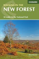
Wandelgids Walking in the New Forest | Cicerone
Goede wandelgids met veel dagtochten, geschikt voor iedereen.   A guidebook to 30 walks of between 3 and 10 miles set throughout the New Forest National Park in Hampshire and Wiltshire. Routes explore ancient woodland, heather-clad heath and dramatic coastline, all within easy reach of Southampton, Bournemouth and Salisbury. Walks for all abilities, easily combined to create longer challenges.   This guidebook presents 30 walks in the New Forest in Hampshire and Wiltshire, Britain's smallest National Park. Easily accessible from Southampton, Bournemouth, Salisbury and Winchester, the New Forest encompasses varied landscapes, from ancient woodlands to open heaths, rivers and coastline. Routes of between 5 and 16km (3 and 10 miles) explore the Forest, mainly on fairly flat terrain, often on well-defined tracks and paths. Most walks are suitable for all the family and many can be combined to make longer outings. Each walk is described in detail, highlighting the many points of interest …
18,50
Wandelgids Walk! La Gomera | Discovery Walking Guides
La Gomera is the ultimate get-away-from-it-all island: easy-going, unspoilt, friendly, isolated from the hustle and bustle of modern living, and so laid back it’s virtually supine - even the volcanoes have been dormant for millions of years. The walks, however, are a bit more energetic. For the new 4th edition of Walk! La Gomera Charles Davis has teamed up with Jan Kostura. Jan brings his wide experience and passion for the Canaries, checking, re-walking and revising existing routes, and adding a couple of his own adventures, including a new Top Three Gomeran walk. Two routes have been dropped as having become too dangerous, but the good news is that many of the more harum-scarum walks have been improved through path clearing and the addition of railings to the vertiginous stretches. Other good news is that the devastating forest fires of 2012 have proved not nearly as damaging as we feared, leaving most of our itineraries unscathed. In short, there is every reason to take off and expl…
17,50
Wandelgids 44 Pathfinder Guides Essex | Ordnance Survey
Pathfinder Guide to Essex offers excellent lowland walking in the south-east of England. The routes are all circular exploring the finer countryside of the county, in a series of parkland, farmland, woodland and coastal and estuarine walks, visiting its places of historic interest, attractive towns and charming villages. Given the pleasant and undramatic nature of the terrain, routes only really vary in length in terms of difficulty and there is a general progression through the book from shortest to longest. Beginning with a short walk linking Laindon Common with Great and Little Burstead, encountering the infant River Crouch, the book progresses to a near 10-mile excursion across Bradwell Marsh, with its wide open horizons, and a visit to the isolated and tiny Saxon chapel of St Peter-on-the-Wall. Sea air can also be taken on walks from Walton-on-the-Naze, a circuit of the eastern end of Mersea Island, along St Osyth Creek, at Maldon, from Burnham-on-Crouch, and overlooking Benfleet …
18,50
Wandelgids 82 Pathfinder Guides Orkney and Shetland | Ordnance Survey
Wandelgids van een deel van Engeland. Deze gids bevat 28 dagwandelingen, variërend van korte tochten tot pittige dagtochten. De bijbehorende kaarten zijn uitstekend: men heeft de topografische kaarten van Ordnance Survey gebruikt waarop de route is ingetekend. Daarnaast praktische informatie over de wandeling en wat beschrijvingen van het gebied. 28 outstanding walks – 23 circular and five there-and-back routes visiting eleven islands across both archipelagos. The size and nature of the islands lend themselves best to short and half-day walks where unhurried and free-range walking is encouraged and the endless distractions of scenery, seabirds, wildflowers and sea watching are best appreciated and enjoyed at a relaxed pace.   In Orkney, the first walk is a short stroll around Hoxa Head with its extensive views across Scapa Flow and subsequent routes go on to explore more widely over Mainland Orkney and take in the islands of Hoy, Rousay and South Ronaldsay, concluding with a ramble alo…
18,50
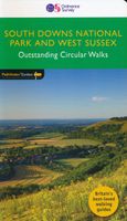
Wandelgids 66 Pathfinder Guides West Sussex and the South Downs Nation
Wandelgids van een deel van Engeland. Deze gids bevat 28 dagwandelingen, variërend van korte tochten tot pittige dagtochten. De bijbehorende kaarten zijn uitstekend: men heeft de topografische kaarten van Ordnance Survey gebruikt waarop de route is ingetekend. Daarnaast praktische informatie over de wandeling en wat beschrijvingen van het gebied. Containing 28 circular, graded walks that have all been created and tested by experienced walkers, this walking guidebook is ideal for both visitors and locals. The routes range from extended strolls to exhilarating hikes, so there is something for everyone. Each route includes a detailed description, the Ordnance Survey map for the route, GPS waypoints and key historical and landscape features to look for.   The South Downs has some great opportunities for scenic, but not too challenging routes, including the South Downs Way. Walks in this book include one around Ardingly Reservoir, Devil's Dyke and the Arun Canal. Routes range from 5.6km (3.…
18,50

Klanten-reviews van Wandelgids 12 Pathfinder Guides New Forest, Hampshire and South Downs

Er zijn nog geen beoordelingen voor dit productBen jij de eerste die een review plaatst?

Meer over Wandelgids 12 Pathfinder Guides New Forest, Hampshire and South Downs

Productomschrijving

Wandelgids van een deel van Engeland, Schotland of Wales. Deze gids bevat 28 dagwandelingen, variërend van korte tochten tot pittige dagtochten. De bijbehorende kaarten zijn uitstekend: men heeft de topografische kaarten van Ordnance Survey gebruikt waarop de route is ingetekend. Daarnaast praktische informatie over de wandeling en wat beschrijvingen van het gebied. Pathfinder® Guide to New Forest, Hampshire and South Downs offers interest, regional variety and balance of routes in the New Forest and South Downs National Parks within Hampshire, and in the Itchen and Test valleys, and across the north of the county, providing the best walks in the area.   From an easy stroll across typical New Forest heathland at Bishop's Dyke to the much more energetic downland walking around Kingsclere and Watership Down, this volume contains something for everyone. This newly published OS edition contains a brand new walk on Beaulieu Heath and takes in Hawkhill Inclosure, contrasting two celebrated New Forest landscapes - heathland and mixed woodland - in one wildlife-rich figure-of-eight route.   28 outstanding circular walks in the Hampshire countryside from 2 to 10 miles with easy-to-follow route descriptions, clear Ordnance Survey route maps, GPS waypoints, where to park, good pubs and places of interest en route. All routes have been researched and written by expert outdoor writer David Foster and showcase beautiful photography of scenes from the walks. Pathfinder® Guides are Britain’s best-loved walking guides. Printed with weather-resistant covers featuring durable rounded corners, they are the perfect companion for country walking throughout Britain. With over 90 titles in the series, and well in excess of 2000 routes to choose from, a wealth of walks is available throughout England, Scotland and Wales from Land's End to John o' Groats and the Lleyn Peninsula to Southwold.

Productspecificaties

Artikelnummer(s)
Brand
Ordnance Survey
Webshop.nl maakt gebruik van cookies. Ga je verder op onze website, ga dan akkoord met het plaatsen van cookies en de verwerking van deze data door ons en vermelde partners.