webshop.nl
Categorieën
  Sluiten

Meer Ordnance Survey

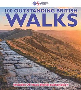
Wandelgids 100 outstanding British Walks | Ordnance Survey

0
Beschrijving van de 100 mooiste Pathfinder wandelingen in Engeland, Wales en Schotland. Uitstekende beschrijving van de route met een zeer duidelijke topografische kaart waarop de route is ingetekend.  This magnificent compendium of outstanding British walks brings together the finest selection of Pathfinder Walks in Britain s officially designated...

Webshops met dit product

Webshop
Bezorging
Prijs

Anderen bekeken ook

Wandelgids 100 outstanding British Walks | Ordnance Survey
Beschrijving van de 100 mooiste Pathfinder wandelingen in Engeland, Wales en Schotland. Uitstekende beschrijving van de route met een zeer duidelijke topografische kaart waarop de route is ingetekend.  This magnificent compendium of outstanding British walks brings together the finest selection of Pathfinder Walks in Britain s officially designated places of scenic beauty and historic interest: National Parks, Areas of Outstanding Natural Beauty, National Scenic Areas, Heritage Coast, National Trails and UNESCO World Heritage Sites. There are 100 walking gems in this collection, recommended by a group of experienced authors and guides. The walks span a range of distances and degrees of challenge and are organised by region with coverage across England, Wales and Scotland. 100 Outstanding British Walks is lavishly illustrated with stunning landscape photography and informative introductions to each of the walks. It is designed to be enjoyed at home, while the OS Maps app provides the pr…
27,95
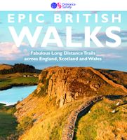
Wandelgids Epic British Walks | Ordnance Survey
This magnificent collection of truly EPIC WALKS brings together Britain’s most beautiful countryside with the long-distance trails that present the very best means of experiencing it.   An inspiring introduction to distance walking, discover thirty-eight amazing trails of immense diversity incorporating National Parks, Areas of Outstanding Natural Beauty, National Scenic Areas, Heritage Coastline, and UNESCO World Heritage Sites.   The perfect book for planning a walking adventure, hiking holiday or weekend ramble, discover insightful introductions to each route, suggested itineraries, the must-see highlights to take in along the way and, of course, the list of Ordnance Survey sheet maps for completing the walks.   Epic in so many ways…   Thirty-eight EPIC long-distance walks across England, Scotland, and Wales 5000 miles of inspirational walking in National parks, AONBs, UNESCO World Heritage Sites and more Stunning and inspiring photography revealing the character of each walk Al…
27,95
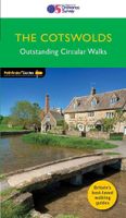
Wandelgids 06 Pathfinder Guides Cotswolds | Ordnance Survey
180 miles of wonderful walking in idyllic, limestone countryside . . .   Take a journey on 28 beautiful walks across the Cotswolds with the OS Pathfinder Guidebooks, graded by length and ranging from 3 to 10 miles.   All walks in this book include written directions, an extract of the OS map for the area and some background on the history and natural environment you see. Most of the walks avoid busy roads and are designed to help you make the most of a holiday or day trips. There are notes on parking, pubs, and things to see en route.   The routes range from extended strolls to longer hikes, something for all levels! Each walk includes a detailed description, an OS map, GPS waypoints and notes of key features and things to see.   This is one of a series of books with great walking routes covering the most popular and scenic areas of Britain. Printed with weather-resistant covers featuring durable rounded corners, they are the perfect companion for country walking throughout Britain.   …
18,50
Wandelgids Epic British Walks | Ordnance Survey
This magnificent collection of truly EPIC WALKS brings together Britain’s most beautiful countryside with the long-distance trails that present the very best means of experiencing it.   An inspiring introduction to distance walking, discover thirty-eight amazing trails of immense diversity incorporating National Parks, Areas of Outstanding Natural Beauty, National Scenic Areas, Heritage Coastline, and UNESCO World Heritage Sites.   The perfect book for planning a walking adventure, hiking holiday or weekend ramble, discover insightful introductions to each route, suggested itineraries, the must-see highlights to take in along the way and, of course, the list of Ordnance Survey sheet maps for completing the walks.   Epic in so many ways…   Thirty-eight EPIC long-distance walks across England, Scotland, and Wales 5000 miles of inspirational walking in National parks, AONBs, UNESCO World Heritage Sites and more Stunning and inspiring photography revealing the character of each walk Al…
27,95
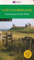
Wandelgids 87 Pathfinder Guides Northumberland | Ordnance Survey
Pathfinder® Guide to Northumberland, featuring 28 outstanding walks designed for a range of abilities covering 180 miles of walking.   Features:   28 guided walks for a range of abilities Large detailed Ordnance Survey map extracts Key information such as parking and type of terrain GPS waypoints for each route Weather-resistant book cover Durable rounded corners   This new guide to Northumberland has ten brand-new Pathfinder walks across the county. There are new short walks at Berwick-upon-Tweed, Almouth and Bellingham. There are new half-day walks in the Coquet Valley at Felton, in the Humbleton Hills from Wooler, exploring the countryside south of the River Tyne from Hexham, and taking you along the scenic Wansbeck Valley to Morpeth from Bothal. And there are new longer walks in Hulne Park, Alnwick; along the coast and inland from Bamburgh; and a lengthy but hugely enjoyable ramble in a circuit from Druridge Bay to Warkworth and a return via Amble along the Northumberlan…
18,50
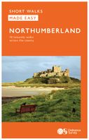
Wandelgids Northumberland | Ordnance Survey
Explore the castles and coast of Northumberland from Dunstanburgh to Hadrian’s Wall with ten walks suitable for all ages and abilities. Discover England’s most northerly county from the North Sea coast to the North Pennines on hand-picked, leisurely rambles for the whole family.   Northumberland Short Walks Made Easy include:   - Circle dramatic Bamburgh Castle, looking out to the Farne Islands from wildlife-rich dunes, and see the grave of lifeboat heroine Grace Darling - Enjoy the tranquility of secluded Wooler Common with its wealth of wildlife and ancient remains on the edge of the Cheviots - Start at picturesque Craster and follow the coast path to Dunstanburgh Castle, a rugged ruin perched on a rocky, wave-battered headland - Ramble the shores of Kielder Water, spot nesting ospreys and stumble upon the fascinating artworks in the forest - Follow Hadrian’s Wall from Cawfields near Haltwhistle to see the iconic Roman structure close up, with stunning views in both directions - Stro…
10,95
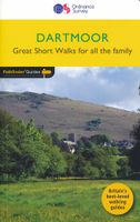
Wandelgids 8 Pathfinder Short Walks Dartmoor | Ordnance Survey
Wandelgids van een deel van Engeland. Deze gids bevat 20 wandelingen, geschikt voor de hele familie. De bijbehorende kaarten zijn uitstekend: men heeft de topografische kaarten van Ordnance Survey gebruikt waarop de route is ingetekend. Daarnaast praktische informatie over de wandeling en wat beschrijvingen van het gebied. Short Walks Dartmoor covering parts of Okehampton, Chagford and Lustleigh. Guidebook with 20 circular walks in an illustrated and easier-to-use layout, suitable for whole family. This selection offers interest and regional variety in Dartmoor, providing the best short walks in the area. Covering walks through the whole of Dartmoor, both popular and little know scenic routes including High Willhays, Haytor Teign gorge and Castle Drogo.   20 circular walks up to 5 miles Clear, large scale Ordnance Survey route maps GPS reference for all Dartmoor waypoints Where to park, good pubs and places of interest en route All routes have been fully researched and written by…
11,50

Klanten-reviews van Wandelgids 100 outstanding British Walks | Ordnance Survey

Er zijn nog geen beoordelingen voor dit productBen jij de eerste die een review plaatst?

Meer over Wandelgids 100 outstanding British Walks | Ordnance Survey

Productomschrijving

Beschrijving van de 100 mooiste Pathfinder wandelingen in Engeland, Wales en Schotland. Uitstekende beschrijving van de route met een zeer duidelijke topografische kaart waarop de route is ingetekend.  This magnificent compendium of outstanding British walks brings together the finest selection of Pathfinder Walks in Britain s officially designated places of scenic beauty and historic interest: National Parks, Areas of Outstanding Natural Beauty, National Scenic Areas, Heritage Coast, National Trails and UNESCO World Heritage Sites. There are 100 walking gems in this collection, recommended by a group of experienced authors and guides. The walks span a range of distances and degrees of challenge and are organised by region with coverage across England, Wales and Scotland. 100 Outstanding British Walks is lavishly illustrated with stunning landscape photography and informative introductions to each of the walks. It is designed to be enjoyed at home, while the OS Maps app provides the practical means to follow each of the routes in the great outdoors. Key features of Outstanding British Walks include: 100 best Pathfinder walks | 625 miles (1,000 km) of inspirational walking | Leisurely strolls, half-day rambles, challenging walks | Route distances from 2½ to 14 miles | Clear and detailed OS Explorer walking maps | Key waypoints with GPS coordinates | Pathfinder walk directions + route elevation profiles | Free 6-month premium subscription to OS Maps online mapping tool South-west England 1: Wistman's Wood - 7.2km (4.5m) 2: Rippon Tor, Pil Tor and Buckland Beacon - 10.3km (6.5m) 3: Lynton and Valley of Rocks - 8.8km (5.5m) 4: Simonsbath and the River Barle - 12.1km (7.5m) 5: Hurlstone and Selworthy Beacon - 10.1km (6.25m) 6: Helford, Little Dennis and Manaccan - 8km (5m) 7: Tollard Royal and Win Green - 11.3km (7m) 8: Corfe Castle and the Purbeck Ridge - 9.7km (6m) 9: Beer and Branscombe - 9.9km (6.25m) 10: Cheddar Gorge and Velvet Bottom - 10.5km (6.5m) 11: Baggy Point and Saunton Down - 11.4km (7.25m) 12: Wills Neck and Triscombe Combe - 10.5km (6.5m) 13: Kingston and the River Erme - 9.1km (5.75m) 14: Cotehele - 5.6km (3.5m) 15: Around St Agnes - 10km (6.25m) 16: Golden Cap - 10.5km (6.5m) 17: Bath and Claverton Down - 13.5km (8.5m) 18: Avebury, West Kennett and Silbury Hill - 10.5km (6.5m) 19: Stonehenge - 12.9km (8m)   South-east England 20: New Forest Snapshot - 4.5km (2.75m) 21: Around Burley - 6.8km (4.25m) 22: Firle Beacon and Charleston Farmhouse - 8km (5m) 23: Friston Forest, the Seven Sisters and Cuckmere Haven - 10.5km (6.5m) 24: Cissbury and Chanctonbury Rings - 17.6km (11m) 25: The Chidham Peninsula - 8km (5m) 26: Ibstone, Turville and Fingest - 12.3km (7.75m) 27: Albury, Ivinghoe Beacon and Ashridge - 11.8km (7.5m) 28: Cranbrook and Sissinghurst - 11.6km (7.25m) 29: Freshwater and Tennyson Down - 6km (3.75m) 30: Wye and Crundale Downs - 13.5km (8.5m) 31: Albury Downs and St Martha's Hill - 11.2km (7m) 32A: Whitehall - 1.4km (0.75m) 32B: St James's - 3.2km (2m)   Heart of England 33: Shugborough Park and Sherbrook Valley - 12km (7.5m) 34: Wotton-under-Edge and the Tyndale Monument - 6.5km (4m) 35: Bourton-on-the-Water, the Slaughters and Naunton - 16km (10m) 36: Great Malvern and the Worestershire Beacon - 8.9km (5.5m) 37: Corvedale and Wenlock Edge - 10.9km (6.75m) 38: Caer Caradoc and Cardington - 11.6km (7.25m) 39: Goodrich Castle - 13.3km (8.25m) 40: Blenheim Park - 10.5km (6.5m) 41: Ironbridge World Heritage Site - 11.6km (7.25m) 42: Cromford and Matlock Bath - 11.3km (7m)   East England 43: Horsey - 6km (3.75m) 44: River Bure and Upton Marshes - 9.7km (6m) 45: The Weavers' Way to The Berney Arms - 14.5km (9m) 46: Constable Country - Flatford and East Bergholt - 8.9km (5.5m) 47: Walesby, Claxby and Normanby le Wold - 8.4km (5.25m) 48: Castle Rising - 3.6km (2.25m) 49: West Runton and Beacon Hill - 11.7km (7.25m) 50: Dunwich Heath and Minsmere Marsh  - 8km (5m)   North of England 51: Elterwater - 8.9km (5.5m) 52: Wray Castle and Blelham Tarn - 9.7km (6m) 53: Crummock Water - 13.8km (8.5m) 54: Kielder Water and the Bull Crag Peninsula - 10.1km (6.25m) 55: Hartside, Salter's Road and High Cantle - 13.7km (8.5m) 56: Farndale - 5.6km (3.5m) 57: The Cook Monument and Roseberry Topping - 10.5km (6.5m) 58: Robin Hood's Bay and Ravenscar - 14.5km (9m) 59: Stanage Edge and Higger Tor - 5.6km (3.5m) 60: Lose Hill - 9.7km (6m) 61: The Manifold Valley - 10.5km (6.5m) 62: Malham Cove, Gordale Scar and Janet's Foss - 8km (5m) 63: Pen-y-ghent - 9.5km (6m) 64: Gunnerside, Kisdon and Muker - 18km (11.25m) 65: Leighton Moss - 7.3km (4.5m) 66: Kirkham Priory and the River Derwent - 7.6km (4.75m) 67: High Cup Nick  - 12.9km (8m) 68: How Stean Gorge and Upper Nidderdale - 7km (4.25m) 69: Craster and Dunstanburgh Castle - 7.6km (4.75m) 70: Fountains Abbey - 9.3km (5.75m) 71: Durham - Riverside and Woods - 8km (5m) 72: Hadrian's Wall at Walton and Thirlwall Castle - 12.5km (7.75m)   Wales 73: Llyn y Fan Fach and the Carmarthen Fans - 9.7km (6m) 74: Waterfalls Walk - 14.5km (9m) 75: Brecon Beacons Horseshoe - 13.7km (8.5m) 76: Porthgain and Abereiddi - 5.6km (3.5m) 77: St David's, Porth Clais and Ramsey Sound - 14km (9m) 78: Precipice Walk - 5.5km (3.5m) 79: Conwy Mountain and Sychnant Pass - 9.5km (6m) 80: Cnicht - 10.7km (6.75m) 81: Moel Famau - 8.25km (5.25m) 82: Llanmadoc Hill - 10.5km (6.5m) 83: Aberdaron and Land's End - 12km (7.5m) 84: Wynford Vaughan Thomas' Viewpoint - 9.7km (6m) 85: Ty Mawr and the Pontcysyllte Aqueduct - 9km (5.5m) 86: Saundersfoot and Tenby - 6.5km (4m)   Scotland 87: Glen Feshie - 5.5km (3.5m) 88: The Lily Loch and Loch an Eileen from Inverdruie - 9.7km (6m) 89: Morrone - 11.3km (7m) 90: Lochnagar and Loch Muick - 22.4km (14m) 91: Lochgoilhead and Donich Water - 4km (2.5m) 92: Ben Lomond - 11.7km (7.25m) 93: Ben Venue - 13.3km (8.25m) 94: Pap of Glencoe - 8km (5m) 95: Isle of Iona - 13.7km (8.5m) 96: Dunkeld, The Hermitage and Birnam - 12.4km (7.75m) 97: Camasunary-Elgol-Glasnakille - 18km (11.25m) 98: The Quiraing and Meall na Suiramach - 6.5km (4m) 99: Rascarrel Bay and Balcary Point - 8km (5m) 100A: Grassmarket and Greyfriars - 2.3km (1.5m) 100B: Georgian New Town - 4.7km (2.75m)

Productspecificaties

Artikelnummer(s)
Brand
Ordnance Survey
Webshop.nl maakt gebruik van cookies. Ga je verder op onze website, ga dan akkoord met het plaatsen van cookies en de verwerking van deze data door ons en vermelde partners.