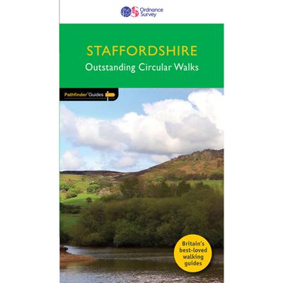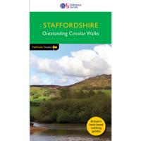
Wandelgids 081 Pathfinder Guides Staffordshire | Ordnance Survey

0
Fraaie, goed verzorgde wandelgidsjes met 28 wandelingen van max. een dag, (beginnend bij korte, eindigend bij langere wandelingen). Weergegeven op duidelijke topografische kaartjes (1:25.000). Bevat verder wetenswaardigheden en praktische informatie voor onderweg. In this Pathfinder guide clear and easy to follow directions are accompanied by deta...

Verkopers met dit product

Verkoper
Bezorging
Prijs
DeZwerver.nl logo
DeZwerver.nl
2,95
18,50

Anderen bekeken ook

Nieuw
Wandelgids 080 Pathfinder Guides Shropshire | Ordnance Survey
Fraaie, goed verzorgde wandelgidsjes met 28 wandelingen van max. een dag, (beginnend bij korte, eindigend bij langere wandelingen). Weergegeven op duidelijke topografische kaartjes (1:25.000). Bevat verder wetenswaardigheden en praktische informatie voor onderweg.   In this Pathfinder guide clear and easy to follow directions are accompanied by detailed 1:25,000 scale maps from Ordnance Survey and specially commissioned photographs. With 28 colour-coded routes to choose from, all tried and tested by seasoned walkers and varying from extended strolls to exhilarating hikes, there is a walk to suit all situations. The guide introduces you to the area and highlights the most scenic walks. Details are included for useful organisations, refreshment stops and places to leave your car. GPS waypoints are included.
18,50
Wandelgids 065 Pathfinder Guides Surrey | Ordnance Survey
Fraaie, goed verzorgde wandelgidsjes met 28 wandelingen van max. een dag, (beginnend bij korte, eindigend bij langere wandelingen). Weergegeven op duidelijke topografische kaartjes (1:25.000). Bevat verder wetenswaardigheden en praktische informatie voor onderweg. Areas covered include the North Downs Way and Box Hill, with all walks accompanied by GPS waypoints, Ordnance Survey maps and beautiful photography. The Pathfinder Guide to Surrey Walks contains 28 fantastic circular walks across the county, much of which lies only a few miles away from the heart of London but which contains some of the country's most beaufiul landscapes, including the oldest untouched area of natural woodland in the UK and the rolling contours of the North Downs. Each walk in Pathfinder Guide to Surrey Walksis accompanied by clear, large-scale Ordnance Survey route maps and GPS waypoints to help you navigate your hike with ease. Exploring one of the most popular Home Counties, Pathfinder Guide to Surrey Wal…
18,50
Nieuw
Wandelgids 060 Pathfinder Guides Lake District | Ordnance Survey
Wandelgids van het Lake District, dit prachtige deel van Engeland. Deze gids bevat 28 dagwandelingen, variërend van korte tochten tot pittige dagtochten. De bijbehorende kaarten zijn uitstekend: men heeft de topografische kaarten van Ordnance Survey gebruikt waarop de route is ingetekend. Daarnaast praktische informatie over de wandeling en wat beschrijvingen van het gebied. Are you planning a visit to the Lake District? Do you enjoy a walk in the country or a leisurely afternoon stroll? Britain's best loved walking guides brings you a brand new Pathfinder Guide to More Lake District Walks containing 28 fabulous walks exploring the wide range of landscapes offered by the UK's most popular walking region. Offering something for walkers of all abilities, Pathfinder Guide to Lake District Walks contains: * 28 easy to follow walks ranging in length from 2-15 miles - all clearly graded * Large-scale Ordnance Survey route maps for each walk * GPS waypoints for easy navigation * Colour photo…
18,50
Nieuw
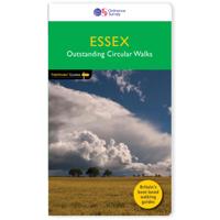
Wandelgids 044 Pathfinder Guides Essex | Ordnance Survey
Pathfinder Guide to Essex offers excellent lowland walking in the south-east of England. The routes are all circular exploring the finer countryside of the county, in a series of parkland, farmland, woodland and coastal and estuarine walks, visiting its places of historic interest, attractive towns and charming villages. Given the pleasant and undramatic nature of the terrain, routes only really vary in length in terms of difficulty and there is a general progression through the book from shortest to longest. Beginning with a short walk linking Laindon Common with Great and Little Burstead, encountering the infant River Crouch, the book progresses to a near 10-mile excursion across Bradwell Marsh, with its wide open horizons, and a visit to the isolated and tiny Saxon chapel of St Peter-on-the-Wall. Sea air can also be taken on walks from Walton-on-the-Naze, a circuit of the eastern end of Mersea Island, along St Osyth Creek, at Maldon, from Burnham-on-Crouch, and overlooking Benfleet…
18,50
Wandelgids 014 Pathfinder Short Walks Snowdonia | Ordnance Survey
Wandelgids van een deel van Wales. Deze gids bevat 20 wandelingen, geschikt voor de hele familie. De bijbehorende kaarten zijn uitstekend: men heeft de topografische kaarten van Ordnance Survey gebruikt waarop de route is ingetekend. Daarnaast praktische informatie over de wandeling en wat beschrijvingen van het gebied. The Snowdonia short walks guidebook is ideal for all the family. Containing 20 splendid short walks ranging from 2 to 6 miles, this guide is perfect for newcomers to country walking and those that prefer gentler rambling. The mountains of Snowdonia are magnificent featuring row-upon-row of jagged peaks and ridges; However, there is more to Snowdonia than its mountains. The region offers the walker plenty of easy low-level walks through delightful valleys ranging from narrow and steep-sided to green and open.   The walks in this guide take in some of Snowdonia’s most famous features – castles, lakes, legends, forests, valleys and waterfalls. The only walk featured that …
11,50
Nieuw
Wandelgids 071 Pathfinder Guides The High Fells of Lakeland | Ordnance Survey
Are you planning a holiday to the Lake District? Do you enjoy a hill-walking challenge with impressive mountain-top views? Inside Pathfinder (R) Guide to the High Fells of Lakeland are 20 majestic and challenging fell walks amid the glorious scenery of the Lake District mountains with clear and easy-to-follow route directions compiled from the author's 40 years' experience of Lakeland walking. For adventurous ramblers and walkers wanting a hill-walking challenge, this brand new Pathfinder (R) walking guide features 20 demanding day-walks in the mountains of the Lake District, from Scafell Pike (highest mountain in the Lake District), to Helvellyn, Skiddaw, Great End and Bowfell - all over 900m (nearly 3000 feet) high. Giving a detailed guide to 20 inspiring expeditions on the high fells of Lakeland, Pathfinder (R) Guide to the High Fells of Lakeland explores some of the best fell walking country in the Lake District. With views over to Buttermere, Derwentwater and Grasmere, the Lakela…
18,50
Nieuw
Wandelgids 023 Pathfinder Guides Loch Lomond , The Trossachs and Stirling | Ordnance Survey
Wandelgids van een deel van Engeland, Schotland of Wales. Deze gids bevat 28 dagwandelingen, variërend van korte tochten tot pittige dagtochten. De bijbehorende kaarten zijn uitstekend: men heeft de topografische kaarten van Ordnance Survey gebruikt waarop de route is ingetekend. Daarnaast praktische informatie over de wandeling en wat beschrijvingen van het gebied. Access 160 miles of breath-taking walking amid the stunning scenery of Loch Lomond National Park and Stirlingshire. This Pathfinder guide book offers 28 great walks varying from 2 to 16 miles complete wit Ordnance Survey mapping and GPS references. Walking in Scotland is quite different from walking south of the border. In England there are only eight summits that top 3000 ft, while in Scotland there are 277, with 45 of them situated in the Southern Highlands. The Trossachs are particularly spectacular when clothed in autumn colours and provided the setting for The Lady of the Lake and Rob Roy, by Sir Walter Scott.   The O…
18,50
Nieuw
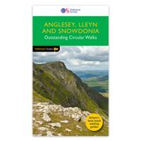
Wandelgids 078 Pathfinder Guides Anglesey, Lleyn and Snowdonia | Ordnance Survey
Fraaie, goed verzorgde wandelgidsjes met 28 wandelingen van max. een dag, (beginnend bij korte, eindigend bij langere wandelingen). Weergegeven op duidelijke topografische kaartjes (1:25.000). Bevat verder wetenswaardigheden en praktische informatie voor onderweg. Experience breathtaking north Wales with 28 unforgettable walks through Anglesey, the Lleyn Peninsula and the Snowdonia National Park. Find stunning views of the Welsh coast, the ‘holy isle’ of Ynys Mon and sublime Snowdonia with a range of walks graded by length and difficulty, from relaxed rambles to challenging climbs.   Featured Anglesey, Lleyn and Snowdonia walks include:   - Enjoy views of Snowdon from the shores of Llyn Padarn, dotted with remnants of the Llanberis slate quarries and a medieval castle - Climb to Holyhead Mountain, Anglesey’s highest point, through the South Stacks Cliff Nature Reserve - See the glorious Lleyn Heritage Coast from the headland of Trywn-y-Tâl, circling back to the pleasant village of Tre…
18,50
Nieuw
Wandelgids 079 Pathfinder Guides Dee Valley, Clwydian Hills and North East Wales | Ordnance Survey
Fraaie, goed verzorgde wandelgidsjes met 28 wandelingen van max. een dag, (beginnend bij korte, eindigend bij langere wandelingen). Weergegeven op duidelijke topografische kaartjes (1:25.000). Bevat verder wetenswaardigheden en praktische informatie voor onderweg. Enjoy 145 miles of lush green walks in north-east Wales with 28 superb country walks, graded by length and difficulty. Choose from 14 routes in the Cylwdian Range and Dee Valley Area of Outstanding Natural Beauty, three on the North Wales coast between Great Orme and Point of Ayr and 11 in Denbighshire and Flintshire to the east of the River Conwy – or do them all!   Featured Dee Valley, Clwydian Hills and North-East Wales walks include:   - Follow the Wales Coast Path along the coastal sand dunes to Point of Ayr and Prestatyn - Circle Great Orme for impressive views of Llandudno, the coast and the mountains of Snowdonia - Stroll along the Llandudno Canal to the magnificent Pontcysyllte Aqueduct, a World Heritage Site - Ramb…
18,50
Nieuw
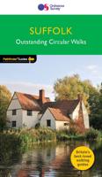
Wandelgids 048 Pathfinder Guides Suffolk | Ordnance Survey
Fraaie, goed verzorgde wandelgidsjes met 28 wandelingen van max. een dag, (beginnend bij korte, eindigend bij langere wandelingen). Weergegeven op duidelijke topografische kaartjes (1:25.000). Bevat verder wetenswaardigheden en praktische informatie voor onderweg. Suffolk's riverside meadows of the Stour valley remain as beautiful today as when Constable painted them two centuries ago. Similarly, the county's lonely expanses of estuarine marsh, which are a feature of the coast, have a quality that appeal to writers as well as artists. A walk through Flatford and East Bergholt passes one of Constable's most famous viewpoints, and Flatford Mill itself. There is a choice of coastal walks, including routes through Southwold, Shingle Street, Dingle Marshes, Thorpeness and the Shotley peninsula. With 28 walks through the Suffolk countryside, if you’re a walker who really wants to make the most of the Suffolk countryside, make sure you don’t set off on your walk without a copy of Pathfinder …
18,50

Klanten-reviews van Wandelgids 081 Pathfinder Guides Staffordshire | Ordnance Survey

Er zijn nog geen beoordelingen voor dit productBen jij de eerste die een review plaatst?

Meer over Wandelgids 081 Pathfinder Guides Staffordshire | Ordnance Survey

Productomschrijving

Fraaie, goed verzorgde wandelgidsjes met 28 wandelingen van max. een dag, (beginnend bij korte, eindigend bij langere wandelingen). Weergegeven op duidelijke topografische kaartjes (1:25.000). Bevat verder wetenswaardigheden en praktische informatie voor onderweg.

In this Pathfinder guide clear and easy to follow directions are accompanied by detailed 1:25,000 scale maps from Ordnance Survey and specially commissioned photographs. With 28 colour-coded routes to choose from, all tried and tested by seasoned walkers and varying from extended strolls to exhilarating hikes, there is a walk to suit all situations. The guide introduces you to the area and highlights the most scenic walks. Details are included for useful organisations, refreshment stops and places to leave your car. GPS waypoints are included.

Verken gerelateerde categorieën

Webshop.nl maakt gebruik van cookies. Ga je verder op onze website, ga dan akkoord met het plaatsen van cookies en de verwerking van deze data door ons en vermelde partners.