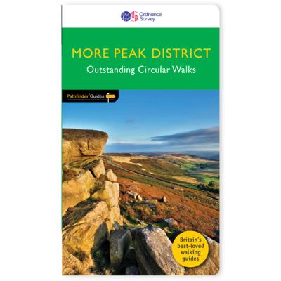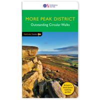
Wandelgids 073 Pathfinder Guides More Peak District | Ordnance Survey

0
This companion to the Pathfinder Peak District Guidebook contains 28 additional circular walks of 3 to 10.5 miles. Like the main book, each is graded length difficulty, and ranger from relatively easy strolls to some of the more challenging routes with considerable vertical ascent.   Each route includes a detailed description, a clear, large scale...

Verkopers met dit product

Verkoper
Bezorging
Prijs
DeZwerver.nl logo
DeZwerver.nl
2,95
18,50

Anderen bekeken ook

Wandelgids 85 Pathfinder Guides Outer Hebrides | Ordnance Survey
This new title to the Outer Hebrides represents a very welcome addition to our Pathfinder® Guide series: 28 outstanding walks – 23 circular and five there-and-back routes visiting ten islands. The size and nature of the islands lend themselves best to short and half-day walks where unhurried and free-range walking is encouraged and the endless distractions of scenery, wildlife, history and Gaelic cultural heritage are best appreciated and enjoyed at a relaxed pace.   Featured Outer Hebrides walks include:   This wonderful collection of island walks is divided into three chapters: Lewis and Harris Berneray, North Uist, Benbecula, South Uist and Eriskay Barra and Vatersay There is an illustrated introduction to each of these island groups and planning information on ferries from the mainland and inter-island connections. Walks are presented sequentially geographically, starting in Stornoway, heading up to the Butt of Lewis and then working southwards along the main touring route down th…
18,50
Nieuw
Wandelgids 006 Pathfinder Guides Cotswolds | Ordnance Survey
180 miles of wonderful walking in idyllic, limestone countryside . . .   Take a journey on 28 beautiful walks across the Cotswolds with the OS Pathfinder Guidebooks, graded by length and ranging from 3 to 10 miles.   All walks in this book include written directions, an extract of the OS map for the area and some background on the history and natural environment you see. Most of the walks avoid busy roads and are designed to help you make the most of a holiday or day trips. There are notes on parking, pubs, and things to see en route.   The routes range from extended strolls to longer hikes, something for all levels! Each walk includes a detailed description, an OS map, GPS waypoints and notes of key features and things to see.   This is one of a series of books with great walking routes covering the most popular and scenic areas of Britain. Printed with weather-resistant covers featuring durable rounded corners, they are the perfect companion for country walking throughout Britain.  …
18,50
Nieuw
Wandelgids 060 Pathfinder Guides Lake District | Ordnance Survey
Wandelgids van het Lake District, dit prachtige deel van Engeland. Deze gids bevat 28 dagwandelingen, variërend van korte tochten tot pittige dagtochten. De bijbehorende kaarten zijn uitstekend: men heeft de topografische kaarten van Ordnance Survey gebruikt waarop de route is ingetekend. Daarnaast praktische informatie over de wandeling en wat beschrijvingen van het gebied. Are you planning a visit to the Lake District? Do you enjoy a walk in the country or a leisurely afternoon stroll? Britain's best loved walking guides brings you a brand new Pathfinder Guide to More Lake District Walks containing 28 fabulous walks exploring the wide range of landscapes offered by the UK's most popular walking region. Offering something for walkers of all abilities, Pathfinder Guide to Lake District Walks contains: * 28 easy to follow walks ranging in length from 2-15 miles - all clearly graded * Large-scale Ordnance Survey route maps for each walk * GPS waypoints for easy navigation * Colour photo…
18,50
Nieuw
Wandelgids 044 Pathfinder Guides Essex | Ordnance Survey
Pathfinder Guide to Essex offers excellent lowland walking in the south-east of England. The routes are all circular exploring the finer countryside of the county, in a series of parkland, farmland, woodland and coastal and estuarine walks, visiting its places of historic interest, attractive towns and charming villages. Given the pleasant and undramatic nature of the terrain, routes only really vary in length in terms of difficulty and there is a general progression through the book from shortest to longest. Beginning with a short walk linking Laindon Common with Great and Little Burstead, encountering the infant River Crouch, the book progresses to a near 10-mile excursion across Bradwell Marsh, with its wide open horizons, and a visit to the isolated and tiny Saxon chapel of St Peter-on-the-Wall. Sea air can also be taken on walks from Walton-on-the-Naze, a circuit of the eastern end of Mersea Island, along St Osyth Creek, at Maldon, from Burnham-on-Crouch, and overlooking Benfleet…
18,50
Nieuw
Wandelgids 005 Pathfinder Guides Cornwall | Ordnance Survey
Wandelgids van een deel van Engeland. Deze gids bevat 28 dagwandelingen, variërend van korte tochten tot pittige dagtochten. De bijbehorende kaarten zijn uitstekend: men heeft de topografische kaarten van Ordnance Survey gebruikt waarop de route is ingetekend. Daarnaast praktische informatie over de wandeling en wat beschrijvingen van het gebied. Each of the Jarrold Pathfinder titles features 28 circular routes, all tried and tested by seasoned walkers. The routes range from extended strolls to exhilarating hikes, so there is something for everyone. They also contain: -Ordnance Survey mapping; -background details of each area; -details of refreshment stops and parking; -walking safety advice; and -information about walkers and the law Cornwall's coastal path gives access to many of Britain's finest marine landscapes, and a great many of the walks in this guide utilise sections of the path, which is maintained to a high standard. Two walks, starting at Polkerris and Little Petherick re…
18,50
Nieuw
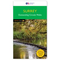
Wandelgids 065 Pathfinder Guides Surrey | Ordnance Survey
Fraaie, goed verzorgde wandelgidsjes met 28 wandelingen van max. een dag, (beginnend bij korte, eindigend bij langere wandelingen). Weergegeven op duidelijke topografische kaartjes (1:25.000). Bevat verder wetenswaardigheden en praktische informatie voor onderweg. Areas covered include the North Downs Way and Box Hill, with all walks accompanied by GPS waypoints, Ordnance Survey maps and beautiful photography. The Pathfinder Guide to Surrey Walks contains 28 fantastic circular walks across the county, much of which lies only a few miles away from the heart of London but which contains some of the country's most beaufiul landscapes, including the oldest untouched area of natural woodland in the UK and the rolling contours of the North Downs. Each walk in Pathfinder Guide to Surrey Walksis accompanied by clear, large-scale Ordnance Survey route maps and GPS waypoints to help you navigate your hike with ease. Exploring one of the most popular Home Counties, Pathfinder Guide to Surrey Wal…
18,50
Nieuw
Wandelgids 063 Pathfinder Guides Peak District | Ordnance Survey
Wandelgids van een deel van Engeland, Schotland of Wales. Deze gids bevat 28 dagwandelingen, variërend van korte tochten tot pittige dagtochten. De bijbehorende kaarten zijn uitstekend: men heeft de topografische kaarten van Ordnance Survey gebruikt waarop de route is ingetekend. Daarnaast praktische informatie over de wandeling en wat beschrijvingen van het gebied. 28 beautiful country walks around the Peak District, graded by length and ranging from 3 to 11 miles. All routes come with a clear, large-scale OS map, GPS waypoints and highlight where to park, good pubs and places of interest en route.  The walk locations are: Eyam and Stoney Middleton - 3.5 miles Higger Tor and Burbage Rocks - 3.75 miles Elton and Robin Hood's Stride - 3.75 miles Chatsworth Estate - 4.25 miles Deep Dale and the Magpie Mine - 4.75 miles Wormhill and Monk's Dale - 4.75 miles Whinstone Lee Tor and Cutthroat Bridge - 4.75 miles Warslow - 5.25 miles Lord's Seat - 5.5 miles Pilsbury Castle - 5.5 miles Win Hil…
18,50
Nieuw
Wandelgids 055 Pathfinder Guides Gower, Swansea and Cardiff | Ordnance Survey
Wandelgids van een deel van Engeland, Schotland of Wales. Deze gids bevat 28 dagwandelingen, variërend van korte tochten tot pittige dagtochten. De bijbehorende kaarten zijn uitstekend: men heeft de topografische kaarten van Ordnance Survey gebruikt waarop de route is ingetekend. Daarnaast praktische informatie over de wandeling en wat beschrijvingen van het gebied. With 28 circular, graded walks that have been tested by experienced walkers, this walking guidebook is ideal for holiday-makers, day trips and locals. The routes range from 4.8km (3 miles) to 14.9km (9.75 miles), so there is something for everyone. Each route includes a detailed description, the Ordnance Survey map for the route, GPS waypoints and key historical and landscape features to spot.   This guidebook covers Wales' capital city, Cardiff, which has a thriving heritage and cultural scene and is surrounded by the beautiful vale of Glamorgan, with includes coastal fringes, pleasant villages and industrial tradition to…
18,50
Nieuw
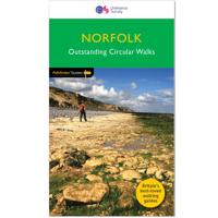
Wandelgids 045 Pathfinder Guides Norfolk | Ordnance Survey
200 miles of inland and coastal walking visiting windpumps and watermills . . .   Walk 28 beautiful trails across Norfolk with the OS Pathfinder Guidebooks, graded by length and ranging from 3 ¾ to 11 miles.   The routes range from extended strolls to longer hikes, offering something for all levels! Explore the area including the stunning coastal scenery in the north of the country, such as the unique inland waterways of the Broads to the east and the remote beauty of the vast fenlands to the west.   Walking routes include some historic highlights: Castle rising and Oxburgh Hall, as well as ancient routes such as Boudicca's and the Peddars way. You can also discover stunning seascapes at Overstand and Wells-next-the-Sea.   Each walk includes a detailed description, an OS map, GPS waypoints and notes ofkey featuresand things to see.   Publication Date: 2019   Walks in this book:   Horsey Binham Priory Oxborough and Gooderstone Hales Green from Loddon Marham Fen and the Nar Valley …
18,50
Nieuw
Wandelgids 031 Pathfinder Guides Oban, Mull & Kintyre | Ordnance Survey
Wandelgids van een deel van Schotland. Deze gids bevat 28 dagwandelingen, variërend van korte tochten tot pittige dagtochten. De bijbehorende kaarten zijn uitstekend: men heeft de topografische kaarten van Ordnance Survey gebruikt waarop de route is ingetekend. Daarnaast praktische informatie over de wandeling en wat beschrijvingen van het gebied. This Pathfinder walking route guidebook for Oban, Mull and Kintyre has 28 circular, graded walks created by experienced seasoned walkers. The routes range from extended strolls of two miles (3.2km) to exhilarating hikes of 13 miles (21km), so there is something for people of all abilities.   Key routes in this book include Campbeltown Loch, the Wishing Tree, Isle of Kerrera, Isle of Ulva and Ben More. Each route includes the path shown on an extract of the OS Explorer map for the area, route notes, waypoints and keey features to look out for. It's ideal for both visitors and locals alike.   Pathfinder Guides are Britain’s best-loved walking …
18,50

Klanten-reviews van Wandelgids 073 Pathfinder Guides More Peak District | Ordnance Survey

Er zijn nog geen beoordelingen voor dit productBen jij de eerste die een review plaatst?

Meer over Wandelgids 073 Pathfinder Guides More Peak District | Ordnance Survey

Productomschrijving

This companion to the Pathfinder Peak District Guidebook contains 28 additional circular walks of 3 to 10.5 miles. Like the main book, each is graded length difficulty, and ranger from relatively easy strolls to some of the more challenging routes with considerable vertical ascent.   Each route includes a detailed description, a clear, large scale OS map, GPS waypoints and details of where to park, good pubs, and places of interest en route. Routes featured in the book include Stanage Edge, Jacob's Ladder, Lantern Pike, and Stanton Moor.

Verken gerelateerde categorieën

Webshop.nl maakt gebruik van cookies. Ga je verder op onze website, ga dan akkoord met het plaatsen van cookies en de verwerking van deze data door ons en vermelde partners.