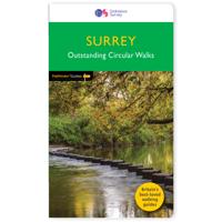
Wandelgids 047 Pathfinder Guides Edinburgh, Pentlands & the Lothians | Ordnance Survey

0
Wandelgids van een deel van Engeland, Schotland of Wales. Deze gids bevat 28 dagwandelingen, variërend van korte tochten tot pittige dagtochten. De bijbehorende kaarten zijn uitstekend: men heeft de topografische kaarten van Ordnance Survey gebruikt waarop de route is ingetekend. Daarnaast praktische informatie over de wandeling en wat beschrijvin...

Verkopers met dit product

Webshop
Bezorging
Prijs
DeZwerver.nl logo
DeZwerver.nl
2,95
18,50

Anderen bekeken ook

Wandelgids 088 Pathfinder Guides Scottish Borders | Ordnance Survey
Pathfinder® Guide to the Scottish Borders, featuring 28 outstanding walks designed for a range of abilities covering 170 miles of walking.   Features:   28 guided walks for a range of abilities Large detailed Ordnance Survey map extracts Key information such as parking and type of terrain GPS waypoints for each route Weather-resistant book cover Durable rounded corners     This new guide to Scottish Borders has 18 brand-new Pathfinder walks across the county. There are new short walks along the Tweed Valley between Peebles and Coldstream, and along the Teviot Valley from Hawick to Kelso. The stunningly scenic coastline has new walks at Eyemouth and Cockburnspath, while inland peaceful circuits explore the heritage at Duns, Greenlaw, Lauder and St Mary’s Loch.   The other much-loved walks in the book feature circuits along the coast at St Abb’s Head; in the Eildon and Leaderfoot National Scenic Area; in the remote Liddesdale countryside and along the Scotland/England border using both …
18,95
Nieuw
Wandelgids 026 Pathfinder Guides Dartmoor | Ordnance Survey
Wandelgids van een deel van Engeland. Deze gids bevat 28 dagwandelingen, variërend van korte tochten tot pittige dagtochten. De bijbehorende kaarten zijn uitstekend: men heeft de topografische kaarten van Ordnance Survey gebruikt waarop de route is ingetekend. Daarnaast praktische informatie over de wandeling en wat beschrijvingen van het gebied. Each of the Jarrold Pathfinder titles features 28 circular routes, all tried and tested by seasoned walkers. The routes range from extended strolls to exhilarating hikes, so there is something for everyone. They also contain: -Ordnance Survey mapping; -background details of each area; -details of refreshment stops and parking; -walking safety advice; and -information about walkers and the law
18,50
Wandelgids Cotswolds | Ordnance Survey
Explore ten easy-paced, family-friendly short walks across the Cotswolds Area of Outstanding Natural Beauty. Originating from a Saxon term meaning ‘wooded hollows, amid gentle hills’, the AONB straddles six counties, and is best known for its honey-coloured stone cottages, lush rolling hills, and deeply-cut wooded valleys. Walks explore quieter corners of the region, covering fine gardens, rivers, parkland, and charming villages.       What to expect from Cotswolds Short Walks Made Easy:   • For quintessential Cotswold views, follow the trail from Broadway, escaping the crowds up a gently sloping hill to a sleepy hamlet and tempting tearooms   • Take a stroll down the magnificent Broad Ride in Cirencester Park, briefly enjoying the beautiful Roman town of Cirencester   • Have your camera ready to snap the country’s most photographed cottages at Arlington Row, whilst on an outing from Bibury   • Admiring formal gardens at the stately homes of Sudeley Castle and Blenheim Palace, you can…
12,95
Wandelgids 85 Pathfinder Guides Outer Hebrides | Ordnance Survey
This new title to the Outer Hebrides represents a very welcome addition to our Pathfinder® Guide series: 28 outstanding walks – 23 circular and five there-and-back routes visiting ten islands. The size and nature of the islands lend themselves best to short and half-day walks where unhurried and free-range walking is encouraged and the endless distractions of scenery, wildlife, history and Gaelic cultural heritage are best appreciated and enjoyed at a relaxed pace.   Featured Outer Hebrides walks include:   This wonderful collection of island walks is divided into three chapters: Lewis and Harris Berneray, North Uist, Benbecula, South Uist and Eriskay Barra and Vatersay There is an illustrated introduction to each of these island groups and planning information on ferries from the mainland and inter-island connections. Walks are presented sequentially geographically, starting in Stornoway, heading up to the Butt of Lewis and then working southwards along the main touring route down th…
18,50
Wandelgids Walk! Dartmoor | Discovery Walking Guides
Engelstalige wandelgids voor Dartmoor, met uitgebreide beschrijvingen van wandelroutes, routekaartjes, praktische informatie zoals bussen en accommodatie. Kate and Alan Hobbs have reviewed and refreshed their Walk! Dartmoor classic guide book for its new 2016 edition. 40 fully detailed walking routes with OS maps and gps waypoints for you to enjoy adventuring on Dartmoor. Walk! Dartmoor with Kate and Alan Hobbs covers walks of varying length across Dartmoor - from the dramatic high moors, gentle riversides, idyllic country lanes, unspoilt villages, to sites of ancient archaeology and former industries, and all with spectacular views.   This user friendly illustrated guide has a summary of walking routes and is rated by time, effort, distance and hills, as well as the availability of refreshments en route and the vertigo risk.Each walk is described in full and there are timings listed in the book to help with navigation and progress. Walk! Dartmoor contains a 1:40,000 scale Ordnance Su…
19,95
Nieuw
Wandelgids 025 Pathfinder Guides Thames Valley and Chilterns | Ordnance Survey
Wandelgids van een deel van Engeland, Schotland of Wales. Deze gids bevat 28 dagwandelingen, variërend van korte tochten tot pittige dagtochten. De bijbehorende kaarten zijn uitstekend: men heeft de topografische kaarten van Ordnance Survey gebruikt waarop de route is ingetekend. Daarnaast praktische informatie over de wandeling en wat beschrijvingen van het gebied. The Chilterns form part of the long line of chalk hills stretching intermittently across southern and eastern England. It is an area characterised by beech woods and dry valleys, and these natural features are explored in the routes.   The Thames Valley is steeped in history, from Windsor Castle and Richmond Park to Runnymede Meadows, where the Magna Carta was signed in 1215, and there are opportunities to absorb this evocative atmosphere, as well as genteel towns like Dorchester, Henley and Princes Risborough.   This book describes and maps 28 circular, graded walks all tried and tested by seasoned walkers. The routes ran…
18,50
Wandelgids Yorkshire Dales | Ordnance Survey
Enjoy the magnificent waterfalls, sweeping scenery and cosy Dale pubs with ten short, leisurely walks suitable for all ages and abilities. Discover the Yorkshire Dales with its natural wonders, lush wildlife and quaint villages on accessible, tried-and-tested walks which everyone can go on – no walking experience required.   Yorkshire Dales Short Walks Made Easy include:   - Walk the banks of the River Eden through Westmorland and explore the limestone scenery around Kirkby Stephen - See some of the iconic waterfalls for which the Yorkshire Dales are famous in Upper Swaledale on a walk to East Gill Force and Kisdon Force - Discover Heriot Country around the village of Askrigg, surrounded by wildflower meadows - See the iconic Ribblehead Viaduct on a moorland walk in the shadow of Whernside, Yorkshire’s highest hill - Follow the River Wharfe through wildflower meadows through Grassington - Take in unmissable Malham Cove, one of England’s most spectacular natural features   OS Short Wal…
10,95
Wandelgids Snowdonia | Ordnance Survey
Everybody can explore Snowdonia, from England and Wales’ highest mountain to magical medieval castles and the spectacular Conwy coastline, with these accessible, family-friendly walks. Get outside and active with the whole family amidst the mysterious legends and natural beauty of Snowdonia.   Snowdonia Short Walks Made Easy include:   - Take Victorian tramcars or the chairlift to the summit of the Great Orme, then wander wildflower-rich meadows for incredible views of the mountains, the sea and the Isle of Anglesey - Follow the Lôn Gwyrfai trail round beautiful Llyn y Gader through Beddgelert Forest to the lovely village, with views of Snowdon and Y Garn throughout - Get off the beaten track in the valley of Cwm Penamnen with views of the cliffs of Moel Sabod and the 13th-century Dolwyddelan castle - Discover Porthmadog on a fascinating walk over Borth-y-Gest headland, the ingenious Cob and the salt marshes home to many seabirds - Explore Dolgellau and the riverside walk to Penmaenpo…
10,95
Wandelgids Edinburgh the Walk | Mica Publishing
This guidebook describes a ‘green chain walk’ of 69km (43 miles) around Edinburgh, Scotland's capital city, linking the city’s green spaces, and highlighting the people who shaped its future and the natural forces that created the landscape. Divided into eight sections of between 8km (5 miles) and 11km (6.75miles), the route can be followed as a continuous multi-day walk or as individual day walks. • A 69km (43 miles) walk around Edinburgh divided into eight sections of between 8km (5 miles) and 11km (6.75miles) • The route can be followed as a multi-day walk, or as individual day walks. • Each section is accompanied by details of public transport between the city centre and the section's start and finish points. 45 fully annotated Ordnance Survey Street View maps detail the route. • Geological, historical, architectural and cultural highlights are included in a variety of panels adjacent to the main text. • Edinburgh The Walk guides the walker through glorious cityscape, coastline, r…
23,95
Wandelgids Epic British Walks | Ordnance Survey
This magnificent collection of truly EPIC WALKS brings together Britain’s most beautiful countryside with the long-distance trails that present the very best means of experiencing it.   An inspiring introduction to distance walking, discover thirty-eight amazing trails of immense diversity incorporating National Parks, Areas of Outstanding Natural Beauty, National Scenic Areas, Heritage Coastline, and UNESCO World Heritage Sites.   The perfect book for planning a walking adventure, hiking holiday or weekend ramble, discover insightful introductions to each route, suggested itineraries, the must-see highlights to take in along the way and, of course, the list of Ordnance Survey sheet maps for completing the walks.   Epic in so many ways…   Thirty-eight EPIC long-distance walks across England, Scotland, and Wales 5000 miles of inspirational walking in National parks, AONBs, UNESCO World Heritage Sites and more Stunning and inspiring photography revealing the character of each walk A…
27,95

Klanten-reviews van Wandelgids 047 Pathfinder Guides Edinburgh, Pentlands & the Lothians | Ordnance Survey

Er zijn nog geen beoordelingen voor dit productBen jij de eerste die een review plaatst?

Meer over Wandelgids 047 Pathfinder Guides Edinburgh, Pentlands & the Lothians | Ordnance Survey

Productomschrijving

Wandelgids van een deel van Engeland, Schotland of Wales. Deze gids bevat 28 dagwandelingen, variërend van korte tochten tot pittige dagtochten. De bijbehorende kaarten zijn uitstekend: men heeft de topografische kaarten van Ordnance Survey gebruikt waarop de route is ingetekend. Daarnaast praktische informatie over de wandeling en wat beschrijvingen van het gebied.

This new edition of Pathfinder: Edinburgh, Pentlands & Lothians has been fully revised to include seven new walking routes, including a classic walk to the summit of Arthur's Seat. The countryside around Edinburgh is ideal for walking with rolling hills and an impressive Scottish coastline. Pathfinder: Edinburgh, Pentlands & Lothians includes new walks in the Pentlands Hills, the Moorfoot and the Lammermuir Hills, perfect for all ages and abilities, and all within 20 miles of Edinburgh; Scotland's historic capital city.

With 28 stunning walking routes, ranging from 3-10 miles, Pathfinder walks are the essential walking guide, as well as including Ordnance Survey maps, GPS waypoint references and public transport information, they offer something for everyone. Pathfinder Guides are Britain's best loved walking guides. They are the perfect companion for country walks throughout Britain.

Each title features 28 circular walks with easy-to-follow route descriptions, all tried and tested by seasoned walkers. The routes range from extended strolls to exhilarating hikes, so there is something for everyone.
They also contain:

-Ordnance Survey mapping;
-background details of each area;
-details of refreshment stops and parking;
-walking safety advice; and
-information about walkers and the law


Verken gerelateerde categorieën

Webshop.nl maakt gebruik van cookies. Ga je verder op onze website, ga dan akkoord met het plaatsen van cookies en de verwerking van deze data door ons en vermelde partners.