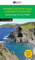
Wandelgids 034 Pathfinder Guides Pembrokeshire & Carmarthenshire | Ordnance Survey

0
Wandelgids van een deel van Wales. Deze gids bevat 28 dagwandelingen, variërend van korte tochten tot pittige dagtochten. De bijbehorende kaarten zijn uitstekend: men heeft de topografische kaarten van Ordnance Survey gebruikt waarop de route is ingetekend. Daarnaast praktische informatie over de wandeling en wat beschrijvingen van het gebied. Eac...

Verkopers met dit product

Verkoper
Bezorging
Prijs
DeZwerver.nl logo
DeZwerver.nl
2,95
18,50

Anderen bekeken ook

Wandelgids 034 Pathfinder Guides Pembrokeshire & Carmarthenshire | Ordnance Survey
Wandelgids van een deel van Wales. Deze gids bevat 28 dagwandelingen, variërend van korte tochten tot pittige dagtochten. De bijbehorende kaarten zijn uitstekend: men heeft de topografische kaarten van Ordnance Survey gebruikt waarop de route is ingetekend. Daarnaast praktische informatie over de wandeling en wat beschrijvingen van het gebied. Each of the Pathfinder titles features 28 circular routes, all tried and tested by seasoned walkers. The routes range from extended strolls to exhilarating hikes, so there is something for everyone. They also contain: -Ordnance Survey mapping; -background details of each area; -details of refreshment stops and parking; -walking safety advice; and -information about walkers and the law Although deep in South Wales, Pembrokeshire and Carmarthenshire have a strong English influence, but their most striking feature, from the point of view of the walker, is that they contain some of the most spectacular coastal scenery and finest stretches of coast p…
18,50
Wandelgids Pembrokeshire | Northern Eye Books
OS Map Books: Wales Coast Path: Pembrokeshire Coast Path Map Atlas | Ordnance Survey ‘Explorer’ Large-scale 1:25,000 maps for the Pembrokeshire Coast in compact book format | Pocket Atlas | Walking Wales | UK Long-Distance Trails | Hiking | Adventure   One of seven handy Ordnance Survey Map Books covering the entire 870 mile/1400 kilometre-long, world-class Wales Coast Path — from Chester in the north to Chepstow in the south.   Enjoy enhanced, large scale (1:25,000) Ordnance Survey Explorer mapping in compact atlas format with all the detailed mapping you need to walk the Pembrokeshire Coast section of the Wales Coast Path.   Continuous, full colour OS mapping covering the Wales Coast Path between Cardigan and Amroth. Contains extracts from large scale Explorer maps OL 35 and OL 36. The enhanced OS 1:25,000 maps are accurate, up-to-date and reliable. Additional map symbols show tea shops, cafes, extra parking, and public toilets.   A brief introduction to Pembrokeshire Coast includes…
17,50
Wandelgids Pembrokeshire Coast Path | Trailblazer Guides
Pembrokeshire Coast Path – Wandelgids van Trailblazer (Engelstalig) Volg een van de mooiste kustpaden van Groot-Brittannië met deze uitgebreide Trailblazer-gids voor het Pembrokeshire Coast Path. Deze National Trail van 299 km (186 mijl) voert je langs de ruige kustlijn van het Pembrokeshire Coast National Park in Zuidwest-Wales – bekend om zijn zandstranden, vissersdorpen, vogelrijke kliffen en verborgen baaien. Wat biedt deze gids? 236 pagina’s boordevol informatie 96 trailkaarten en 15 stadsplattegronden – met routeaanwijzingen direct op de kaart 60 kleurenfoto’s en een kleurrijke 4 pagina’s tellende bloemenherkenningsgids 14 etappekaarten en 2 overzichtskaarten Volledige informatie over accommodaties, eetgelegenheden en openbaar vervoer langs het pad GPS-waypoints te downloaden voor digitale navigatie De unieke cartografie van Trailblazer maakt het verschil: de kaarten bevatten niet alleen het pad, maar ook wandelinstructies, bezienswaardigheden, horeca en wandel…
21,95
Wandelgids Wales Coast Path: Pembrokeshire | Northern Eye Books
Official Guide: Wales Coast Path: Pembrokeshire   One of seven Official Guides to the Wales Coast Path   The 186 mile/300km long Pembrokeshire section of the Wales Coast Path runs through some of Wales’ most varied and dramatic coastal scenery — high, rugged cliffs and long sandy bays, Pembroke Castle, St David’s cathedral and St Govan’s remote cliff-wrapped chapel, with several large offshore islands. Pembrokeshire is also Britain’s only coastal National Park.   This Official Guide splits the route into 14 convenient day sections, each of about 10-17 miles / 16-27 kilometres. It contains everything local and long-distance walkers need to enjoy the path and includes:   An overview of Pembrokeshire with dedicated history and wildlife sections Fourteen day-walk sections with detailed route descriptions and full, enhanced Ordnance Survey mapping Distance charts, section overviews, background information and interpretation of places of interest Stunning professional photographs throughout…
22,50
Wandelgids Day Walks on the Pembrokeshire Coast | Vertebrate Publishing
Day Walks on the Pembrokeshire Coast features 20 classic coastal routes between 6.5 miles and 13 miles (10.4km and 20.8km) in length, suitable for hillwalkers of all abilities. Local author and walker Harri Roberts shares his favourite walks in the national park, including a meander along Bosherston Lily Ponds ¿ a series of interconnected lakes, rich in wildlife; the 650-million-year-old sea cliffs of St Brides, studded with the less-common, upland-loving sessile oak; and retracing the steps of Wales¿s patron saint, from St Davids to St Justinian¿s. The routes are in five areas: the South Pembrokeshire Coast, Daugleddau, the West Pembrokeshire Coast, the North Pembrokeshire Coast, and the Preseli Hills. Written by a local author, each route features Ordnance Survey 1:25,000 maps; easy-to-follow directions; details and distance and navigation info, and refreshment stops and local information.
20,95
Wandelgids National Parks: Pembrokeshire | Northern Eye Books
This superbly-written and good looking book will take you on ten short circular walks to the very best stretches of coast, pubs, tea shops, and viewpoints that the beautiful Pembrokeshire coast, in West Wales, has to offer.   Defining the south-westernmost tip of Wales, Pembrokeshire’s coastline is arguably the most beautiful and varied in the British Isles. Virtually all of it lies within the Pembrokeshire Coast National Park. Relative isolation has left it largely untouched by modern development and most of its length is a wild frontier where the endless confrontation between sea and land is played out. Long stretches of coast face the fury of Atlantic storms and weakness and faults in the high cliffs are eroded into caves, coves and inlets. However, the harder rock, some of which is 700 million years old, resists the onslaught and stands out in rugged promontories and headlands.   Elsewhere, sheltered landings and harbours, fine beaches and secluded bays reveal other aspects of thi…
10,95
Wandelgids Walking in Pembrokeshire | Cicerone
Uitstekende wandelgids van dit mooie gebied aan de kust van Wales: het Pembrokeshire Coast national park. Goed beschreven met veel praktische informatie om de route te kunnen lopen, inclusief redelijke kaarten. Guidebook to 40 circular walks in Pembrokeshire in Wales. The routes, which range from 1 to 12 miles, take in the dramatic beauty of the national park and its coast, the Daugleddau and the Preseli Hills, while exploring wooded gorges, prehistoric hillforts and medieval castles.   Step-by-step route descriptions are accompanied by 1:50,000 mapping. For each route, information is also given regarding parking and public transport options, as well as toilets and refreshments available along the way. The guide also includes a useful route summary table, plus information on tides, the terrain, and weather in the region.   This collection of walks includes something for everyone, from novices to experienced ramblers. None of the walks demand technical skill and, in good weather, pose …
18,50
Wandelgids Walking the Pembrokeshire Coast Path | Cicerone
Engelstalige beschrijving van een mooie wandeltocht in Wales. De gids voldoet aan alle verwachtingen die je kunt hebben. Met apart gidsje met prima wandelkaarten.  This guidebook describes the Pembrokeshire Coast Path National Trail, a scenic 180-mile long-distance walk from Amroth, near Tenby, to St Dogmaels, north of Newport. The route, which takes roughly two weeks to complete, is divided into 14 stages of between 9 and 16 miles. Neither technically demanding nor difficult to navigate, the trail is suitable both for experienced distance walkers and those looking to cut their teeth on a long-distance route.   Detailed two-way route instructions are accompanied by 1:100,000 OS mapping. A route summary table and comprehensive trek planner are also included, with invaluable information on transport, accommodation and facilities en route. The guidebook is packed with interesting snippets of information about the places, landscapes and wildlife encountered along the way. It also includes…
25,95
Wandelkaart 35 OS Explorer Map | Active North Pembrokeshire Active Map | Ordnance Survey
Een van de beste detailkaarten die er op de wereld gemaakt worden: zeer gedetailleerd, prachtig helder kleurgebruik, veel topografische aspecten en - zeer belangrijk - allerlei toeristische en recreatieve aspecten zijn ingetekend. De perfecte kaart voor vakantie en vrije tijd: wandelen, fietsen of gewoon de omgeving verkennen. Door de grootte van de kaart, voor- en achterzijde, bestrijkt het een behoorlijk groot gebied!   The OS Explorer map of North Pembrokeshire and the Pembrokeshire Coast National Park is a must-have when visiting the West coast of Wales.   With a variety of beaches with stretches of sand to small rocky coves, there's an abundance of beauty to explore.   Some must see places on Explorer OL35 are St Davids, Cardigan, Goodwick, and Fishguard, and the Pembrokeshire Coast Path.   Our explorer range comes in both weatherproof and standard options, meaning you'll never get caught out in a storm. Receive a free download of this map, making for a convenient companion.
25,95
Wandelgids Walking the Pembrokeshire Coast Path map booklet | Cicerone
A booklet of all the mapping needed to walk the Pembrokeshire Coast Path National Trail between Amroth near Tenby and St Dogmaels by Cardigan. Covering 290km (180 miles) and over 10,500m of ascent, this trail takes around 2 weeks to complete. The full route is shown on 1:25,000 OS maps The map booklet can be used to walk the trail in either direction Sized to easily fit in a jacket pocket or rucksack The relevant extract from the OS Explorer map legend is includedHigh tide and military range closure alternate routes are providedAn accompanying Cicerone guidebook – Walking the Pembrokeshire Coast Path is also available, which includes a copy of this map booklet   Both native Lancastrians, Dennis and Jan Kelsall have long held a passion for countryside and hill walking. Since their first Cicerone title was published in 1995, they have written and illustrated around 35 guides covering some of Britain’s most popular walking areas and have become regular contributors to various outdoor ma…
15,95

Klanten-reviews van Wandelgids 034 Pathfinder Guides Pembrokeshire & Carmarthenshire | Ordnance Survey

Er zijn nog geen beoordelingen voor dit productBen jij de eerste die een review plaatst?

Meer over Wandelgids 034 Pathfinder Guides Pembrokeshire & Carmarthenshire | Ordnance Survey

Productomschrijving

Wandelgids van een deel van Wales. Deze gids bevat 28 dagwandelingen, variërend van korte tochten tot pittige dagtochten. De bijbehorende kaarten zijn uitstekend: men heeft de topografische kaarten van Ordnance Survey gebruikt waarop de route is ingetekend. Daarnaast praktische informatie over de wandeling en wat beschrijvingen van het gebied.

Each of the Pathfinder titles features 28 circular routes, all tried and tested by seasoned walkers. The routes range from extended strolls to exhilarating hikes, so there is something for everyone.

They also contain:

-Ordnance Survey mapping;
-background details of each area;
-details of refreshment stops and parking;
-walking safety advice; and
-information about walkers and the law

Although deep in South Wales, Pembrokeshire and Carmarthenshire have a strong English influence, but their most striking feature, from the point of view of the walker, is that they contain some of the most spectacular coastal scenery and finest stretches of coast path in Britain. Although the walks in this guide inevitably concentrate on the coast, especially using the Pembrokeshire Coast Path, their characters vary considerably, ranging from the splendid cliff scenery around the peninsula of Dinas Island and to the west of Port-Eynon Bay, to the wooded stretches between Saundersfoot and Tenby.

Productinformatie

    Verken gerelateerde categorieën

    Webshop.nl maakt gebruik van cookies. Ga je verder op onze website, ga dan akkoord met het plaatsen van cookies en de verwerking van deze data door ons en vermelde partners.