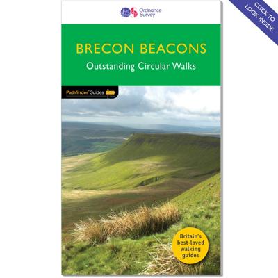
Wandelgids 018 Pathfinder Guides Brecon Beacons | Ordnance Survey

0
Wandelgids van een deel van Engeland. Deze gids bevat 28 dagwandelingen, variërend van korte tochten tot pittige dagtochten. De bijbehorende kaarten zijn uitstekend: men heeft de topografische kaarten van Ordnance Survey gebruikt waarop de route is ingetekend. Daarnaast praktische informatie over de wandeling en wat beschrijvingen van het gebied. ...

Verkopers met dit product

Verkoper
Bezorging
Prijs
DeZwerver.nl logo
DeZwerver.nl
2,95
18,50

Anderen bekeken ook

Wandelgids Brecon Beacons | Ordnance Survey
Get outside and enjoy ten short leisurely strolls across the Brecon Beacons National Park, indulging in wonderful mountain views across Southern Britain’s hilliest terrain. With routes for all abilities, enjoy a diverse range of experiences, including waterfalls, woodlands, riversides and even 12th century castle ruins.   Brecon Beacons Short Walks Made Easy routes include:       • Discover great mountain views from relatively level ground with routes at Mynydd Illtud and Craig y Cilau   • Or for a more strenuous walk, the ascent of Sugar Loaf will reward your uphill efforts with stupendous views across the national park   • Enjoy the thunderous sounds of the spectacular cascading waterfalls of Sgŵd Clun-gwyn and Sgŵd yr Eira, some of Wales most impressive!   • Delve into the Usk Valley for soothing riverside rambles from Brecon and Abergavenny, blessed with stunning views southwards towards the park’s highest peaks   • Spot an abundance of wildlife from the towpath along the Monmouth…
12,95
Nieuw
Wandelgids 031 Pathfinder Short Walks Brecon Beacons | Ordnance Survey
Wandelgids van een deel van Wales. Deze gids bevat 20 wandelingen, geschikt voor de hele familie. De bijbehorende kaarten zijn uitstekend: men heeft de topografische kaarten van Ordnance Survey gebruikt waarop de route is ingetekend. Daarnaast praktische informatie over de wandeling en wat beschrijvingen van het gebied. et outside and get active with all the family in the gorgeous Brecon Beacons with these 20 hand-picked and lovingly illustrated short walks. Everybody can enjoy country walking amidst mountains, lakes and forests and there are even accessible routes up the Sugar Loaf, around the Usk Reservoir and to the top of Pen y Fan.   Featured Brecon Beacons Short Walks include:   - Cross the Usk Bridge and see castle ruins on the riverside walk at Castle Meadows - Discover a legendary lake at Llyn y Fan Fach - Climb grassy mountain paths to the rocky summit of the iconic Sugar Loaf - Enjoy great views from an Iron Age Fort at Mynnyd Illtud - See the dazzling Ystradfellte waterfal…
11,50
Nieuw
Wandelgids Walking on the Brecon Beacons | Cicerone
Uitstekende wandelgids van dit geweldige gebied. goed beschreven met veel praktische informatie om de route te kunnen lopen, inclusief redelijke kaarten. Guidebook to 45 graded circular walks in the Brecon Beacons National Park, perfect for those wishing to discover the diversity of the region, away from the crowds. The routes range from 4 to 24km and cover the north-eastern, eastern and south-western valleys and ridges, Fforest Fawr, Waterfall Country, the Black Mountain (Mynydd Du) and the Black Mountains (y Mynyddoedd Duon). Designed to include all the interesting facts an expert park ranger would provide, the guide contains a wealth of information about local geology, botany, archaeology, history, mythology, industrial heritage and environmental issues.   Clear route description is illustrated with 1:50,000 OS Landranger mapping, summary statistics are provided for each walk and handy tables make it easy to compare routes or choose according to points of interest.   A remarkably v…
20,95
Wandelgids Brecon Beacons | Northern Eye Books
This good looking, modern walking book will take you on ten short circular themed walks across South Wales’ ever-popular Brecon Beacons National Park.   The Brecon Beacons was Britain’s 10th National Park, established in 1957 to preserve and highlight the unique landscape of the area. The Brecon Beacons are said to be named after the historical practice of lighting beacons of fire upon hilltops to forewarn neighbouring valleys of invasion.    The Brecon Beacons cover 1,344 square kilometres / 519 square miles with it’s spectacular waterfalls, valleys and expanse of hilly terrain; the Black Mountain to the west, the Fforest Fawr Geopark, Waterfall Country and the Pen y Fan range at the centre, and The Black Mountains to the east.   The variety of flora and fauna is as vast as the landscape. Rare sub-arctic, alpine plants thrive within this unique climate. Mammals you’re likely to spot include include wild mountain ponies, horseshoe bats, otters and water voles. Often seen birds of prey…
10,95
Nieuw
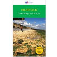
Wandelgids 045 Pathfinder Guides Norfolk | Ordnance Survey
200 miles of inland and coastal walking visiting windpumps and watermills . . .   Walk 28 beautiful trails across Norfolk with the OS Pathfinder Guidebooks, graded by length and ranging from 3 ¾ to 11 miles.   The routes range from extended strolls to longer hikes, offering something for all levels! Explore the area including the stunning coastal scenery in the north of the country, such as the unique inland waterways of the Broads to the east and the remote beauty of the vast fenlands to the west.   Walking routes include some historic highlights: Castle rising and Oxburgh Hall, as well as ancient routes such as Boudicca's and the Peddars way. You can also discover stunning seascapes at Overstand and Wells-next-the-Sea.   Each walk includes a detailed description, an OS map, GPS waypoints and notes ofkey featuresand things to see.   Publication Date: 2019   Walks in this book:   Horsey Binham Priory Oxborough and Gooderstone Hales Green from Loddon Marham Fen and the Nar Valley …
18,50
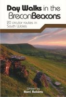
Wandelgids Day Walks in the Brecon Beacons | Vertebrate Publishing
Day Walks in the Brecon Beacons features 20 circular routes between 6.8 and 16.5 miles (11km and 16.6km) in length, suitable for hill walkers of all abilities. Local author and walker Harri Roberts shares his favourite walks in the region, including circuits in the hills around Llangors Lake, the Taf Fechan Skyline and Pen y Fan, and the Llanbedr Horseshoe. The routes are split into four areas - Blorenge and The Black Mountains, The Brecon Beacons, Mynydd Llangatwg and Mynydd Llangynidr, Fforest Fawr and The Black Mountain.   Each route features Ordnance Survey 1:25,000 maps, easy-to-follow directions, details of distance and navigation information, and refreshment stops and local information. The walks are illustrated with stunning photography by the author and outdoor photographer Adam Long.
20,95
Wandelgids 100 outstanding British Walks | Ordnance Survey
Beschrijving van de 100 mooiste Pathfinder wandelingen in Engeland, Wales en Schotland. Uitstekende beschrijving van de route met een zeer duidelijke topografische kaart waarop de route is ingetekend.  This magnificent compendium of outstanding British walks brings together the finest selection of Pathfinder Walks in Britain s officially designated places of scenic beauty and historic interest: National Parks, Areas of Outstanding Natural Beauty, National Scenic Areas, Heritage Coast, National Trails and UNESCO World Heritage Sites. There are 100 walking gems in this collection, recommended by a group of experienced authors and guides. The walks span a range of distances and degrees of challenge and are organised by region with coverage across England, Wales and Scotland. 100 Outstanding British Walks is lavishly illustrated with stunning landscape photography and informative introductions to each of the walks. It is designed to be enjoyed at home, while the OS Maps app provides the p…
27,95
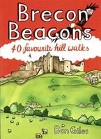
Wandelgids Brecon Beacons | Pocket Mountains
The Brecon Beacons National Park is home to some of the most spectacular mountain and moorland scenary in Britain. Bridging South and Mid Wales, the park can be divided into three distinct upland areas, with the central flat-topped peaks of the Brecon Beacons massif sandwiched by the rolling ridges of the Black Mountains in the East and the similarly named, but quite different, Black Mountain region in the West. As well as being packed full of standing stones, castles, wildlife and waterfalls, the park is also home to the Fforest Fawr UNESCO Global Geopark and is recognised as an International Dark Sky Reserve.   The 40 circular routes in the volume cover all the most popular peaks, as well as highlighting some lesser-known gems in one of Britain's best-loved national parks.  
10,95
Nieuw
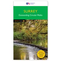
Wandelgids 065 Pathfinder Guides Surrey | Ordnance Survey
Fraaie, goed verzorgde wandelgidsjes met 28 wandelingen van max. een dag, (beginnend bij korte, eindigend bij langere wandelingen). Weergegeven op duidelijke topografische kaartjes (1:25.000). Bevat verder wetenswaardigheden en praktische informatie voor onderweg. Areas covered include the North Downs Way and Box Hill, with all walks accompanied by GPS waypoints, Ordnance Survey maps and beautiful photography. The Pathfinder Guide to Surrey Walks contains 28 fantastic circular walks across the county, much of which lies only a few miles away from the heart of London but which contains some of the country's most beaufiul landscapes, including the oldest untouched area of natural woodland in the UK and the rolling contours of the North Downs. Each walk in Pathfinder Guide to Surrey Walksis accompanied by clear, large-scale Ordnance Survey route maps and GPS waypoints to help you navigate your hike with ease. Exploring one of the most popular Home Counties, Pathfinder Guide to Surrey Wal…
18,50
Nieuw
Wandelgids 041 Pathfinder Guides Mid Wales | Ordnance Survey
Wandelgids van midden Wales. Deze gids bevat 28 dagwandelingen, variërend van korte tochten tot pittige dagtochten. De bijbehorende kaarten zijn uitstekend: men heeft de topografische kaarten van Ordnance Survey gebruikt waarop de route is ingetekend. Daarnaast praktische informatie over de wandeling en wat beschrijvingen van het gebied. Explore Mid Wales over 28 walks with this walking guidebook from the Pathfinder series. Each walk is listed by distance and difficulty, and range from a family-friendly 4km (2.5 miles) to a challenging 20km (12 miles)   Often ignored in favour of the more popular Snowdonia and Brecon Beacons National Parks to the north and south, mid Wales still offers some stunning views and beautiful walks. Both coastal routes and upland walks are featured, and include Catti's Cave, Devil's Bridge and the Mynach Valley, The Claerwen Valley and the source of the river Severn   Each of the 28 circular walks has been created by experienced walkers, and includes a route…
18,50

Klanten-reviews van Wandelgids 018 Pathfinder Guides Brecon Beacons | Ordnance Survey

Er zijn nog geen beoordelingen voor dit productBen jij de eerste die een review plaatst?

Meer over Wandelgids 018 Pathfinder Guides Brecon Beacons | Ordnance Survey

Productomschrijving

Wandelgids van een deel van Engeland. Deze gids bevat 28 dagwandelingen, variërend van korte tochten tot pittige dagtochten. De bijbehorende kaarten zijn uitstekend: men heeft de topografische kaarten van Ordnance Survey gebruikt waarop de route is ingetekend. Daarnaast praktische informatie over de wandeling en wat beschrijvingen van het gebied.   28 fabulous country walks in the Becon Beacons National Park, graded by length and ranging from 3 to 10 miles.   All routes come with a clear, large-scale OS map, GPS waypoints and highlight where to park, good pubs and places of interest en route.   Within the boundaries of the Brecon Beacons National Park there are four separate mountain ranges, including the Black Mountains as well as the Beacons themselves. Most of the area is underlain by old red sandstone, which distinguishes it from the more rugged mountains of North Wales, and several walks explore this terrain of smooth, sweeping grassy uplands and wide, open vistas, including the Brecon Beacons Horseshoe. By extending some walks to the south of the mountains, in the valleys, vale and coast of Glamorgan (including Llantwit Major and the Heritage Coast), the scope of scenic and historic attractions is extended.


Verken gerelateerde categorieën

Webshop.nl maakt gebruik van cookies. Ga je verder op onze website, ga dan akkoord met het plaatsen van cookies en de verwerking van deze data door ons en vermelde partners.