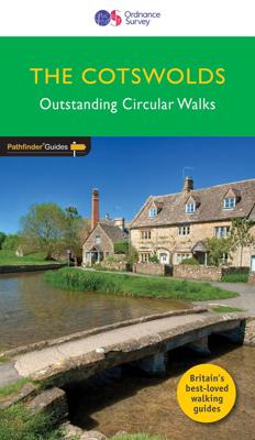
Wandelgids 006 Pathfinder Guides Cotswolds | Ordnance Survey

0
180 miles of wonderful walking in idyllic, limestone countryside . . .   Take a journey on 28 beautiful walks across the Cotswolds with the OS Pathfinder Guidebooks, graded by length and ranging from 3 to 10 miles.   All walks in this book include written directions, an extract of the OS map for the area and some background on the history and natu...

Verkopers met dit product

Verkoper
Bezorging
Prijs
DeZwerver.nl logo
DeZwerver.nl
2,95
18,50

Anderen bekeken ook

Nieuw
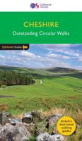
Wandelgids 042 Pathfinder Guides Cheshire | Ordnance Survey
175 miles of delightfully pastoral country walking from Thurstaston Common on the Wirral to Tegg's Nose on the north-western fringes of the Peak District National Park . . .   Uncover 28 beautiful walks around Cheshire with the OS Pathfinder Guidebooks, graded by length and ranging from 3 ½ to 10 ½ miles.   The routes range from extended strolls to longer hikes, something for all levels! Each walk includes a detailed description, an OS map, GPS waypoints, and notes of key features and things to see.   This is one of a series of books with great walking routes covering the most popular and scenic areas of Britain. Printed with weather-resistant covers featuring durable rounded corners, they are the perfect companion for country walking throughout Britain.   Publication Date: 2019   Walks in this book:   Wirswall Hill and Big Mere Bollington and Nab Head Little Budworth Country Park Styal and the Bollin Valley Dane Valley Chester and the River Dee Boothsdale Astbury mere and Vil…
18,50
Nieuw
Wandelgids 045 Pathfinder Guides Norfolk | Ordnance Survey
200 miles of inland and coastal walking visiting windpumps and watermills . . .   Walk 28 beautiful trails across Norfolk with the OS Pathfinder Guidebooks, graded by length and ranging from 3 ¾ to 11 miles.   The routes range from extended strolls to longer hikes, offering something for all levels! Explore the area including the stunning coastal scenery in the north of the country, such as the unique inland waterways of the Broads to the east and the remote beauty of the vast fenlands to the west.   Walking routes include some historic highlights: Castle rising and Oxburgh Hall, as well as ancient routes such as Boudicca's and the Peddars way. You can also discover stunning seascapes at Overstand and Wells-next-the-Sea.   Each walk includes a detailed description, an OS map, GPS waypoints and notes ofkey featuresand things to see.   Publication Date: 2019   Walks in this book:   Horsey Binham Priory Oxborough and Gooderstone Hales Green from Loddon Marham Fen and the Nar Valley …
18,50
Wandelgids 100 outstanding British Walks | Ordnance Survey
Beschrijving van de 100 mooiste Pathfinder wandelingen in Engeland, Wales en Schotland. Uitstekende beschrijving van de route met een zeer duidelijke topografische kaart waarop de route is ingetekend.  This magnificent compendium of outstanding British walks brings together the finest selection of Pathfinder Walks in Britain s officially designated places of scenic beauty and historic interest: National Parks, Areas of Outstanding Natural Beauty, National Scenic Areas, Heritage Coast, National Trails and UNESCO World Heritage Sites. There are 100 walking gems in this collection, recommended by a group of experienced authors and guides. The walks span a range of distances and degrees of challenge and are organised by region with coverage across England, Wales and Scotland. 100 Outstanding British Walks is lavishly illustrated with stunning landscape photography and informative introductions to each of the walks. It is designed to be enjoyed at home, while the OS Maps app provides the p…
27,95
Wandelgids Cotswolds | Ordnance Survey
Explore ten easy-paced, family-friendly short walks across the Cotswolds Area of Outstanding Natural Beauty. Originating from a Saxon term meaning ‘wooded hollows, amid gentle hills’, the AONB straddles six counties, and is best known for its honey-coloured stone cottages, lush rolling hills, and deeply-cut wooded valleys. Walks explore quieter corners of the region, covering fine gardens, rivers, parkland, and charming villages.       What to expect from Cotswolds Short Walks Made Easy:   • For quintessential Cotswold views, follow the trail from Broadway, escaping the crowds up a gently sloping hill to a sleepy hamlet and tempting tearooms   • Take a stroll down the magnificent Broad Ride in Cirencester Park, briefly enjoying the beautiful Roman town of Cirencester   • Have your camera ready to snap the country’s most photographed cottages at Arlington Row, whilst on an outing from Bibury   • Admiring formal gardens at the stately homes of Sudeley Castle and Blenheim Palace, you can…
12,95
Nieuw
Wandelgids 083 Pathfinder Guides North Coast 500 and Northern Highlands | Ordnance Survey
Enhance your North Coast 500 tour with the only walking guidebook featuring routes based on or accessible from Scotland’s ultimate road trip. Discover Britain’s remotest sandy beaches, Scotland’s most northerly munro, some of the oldest rocks on Earth and more with 28 breathtaking walks accessed from the North Coast 500 as well as 32 unmissable stop-off-and-stroll recommendations.   Featured North Coast 500 and Northern Highlands walks include:   - Circle Loch Coulin where Beinn Eighe and Liathach are reflected in the still waters - Wander the astounding landscape of Knockan Crag, where some of the oldest rocks on Earth can be seen - Climb Ben Hope, Scotland’s most northerly munro, towering above the Flow Country - See the waterfalls and rocks walls of the Big Burn as you ascend Ben Bhraggie for views over the Dornoch Firth - Explore the landscape and history of the Applecross peninsula with sublime views of Raasay - Take a moorland and clifftop route to the vast golden sands of Sandw…
18,50
Wandelgids 85 Pathfinder Guides Outer Hebrides | Ordnance Survey
This new title to the Outer Hebrides represents a very welcome addition to our Pathfinder® Guide series: 28 outstanding walks – 23 circular and five there-and-back routes visiting ten islands. The size and nature of the islands lend themselves best to short and half-day walks where unhurried and free-range walking is encouraged and the endless distractions of scenery, wildlife, history and Gaelic cultural heritage are best appreciated and enjoyed at a relaxed pace.   Featured Outer Hebrides walks include:   This wonderful collection of island walks is divided into three chapters: Lewis and Harris Berneray, North Uist, Benbecula, South Uist and Eriskay Barra and Vatersay There is an illustrated introduction to each of these island groups and planning information on ferries from the mainland and inter-island connections. Walks are presented sequentially geographically, starting in Stornoway, heading up to the Butt of Lewis and then working southwards along the main touring route down th…
18,50
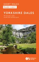
Wandelgids Yorkshire Dales | Ordnance Survey
Enjoy the magnificent waterfalls, sweeping scenery and cosy Dale pubs with ten short, leisurely walks suitable for all ages and abilities. Discover the Yorkshire Dales with its natural wonders, lush wildlife and quaint villages on accessible, tried-and-tested walks which everyone can go on – no walking experience required.   Yorkshire Dales Short Walks Made Easy include:   - Walk the banks of the River Eden through Westmorland and explore the limestone scenery around Kirkby Stephen - See some of the iconic waterfalls for which the Yorkshire Dales are famous in Upper Swaledale on a walk to East Gill Force and Kisdon Force - Discover Heriot Country around the village of Askrigg, surrounded by wildflower meadows - See the iconic Ribblehead Viaduct on a moorland walk in the shadow of Whernside, Yorkshire’s highest hill - Follow the River Wharfe through wildflower meadows through Grassington - Take in unmissable Malham Cove, one of England’s most spectacular natural features   OS Short Wal…
10,95
Nieuw
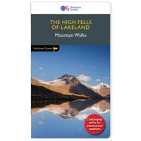
Wandelgids 071 Pathfinder Guides The High Fells of Lakeland | Ordnance Survey
Are you planning a holiday to the Lake District? Do you enjoy a hill-walking challenge with impressive mountain-top views? Inside Pathfinder (R) Guide to the High Fells of Lakeland are 20 majestic and challenging fell walks amid the glorious scenery of the Lake District mountains with clear and easy-to-follow route directions compiled from the author's 40 years' experience of Lakeland walking. For adventurous ramblers and walkers wanting a hill-walking challenge, this brand new Pathfinder (R) walking guide features 20 demanding day-walks in the mountains of the Lake District, from Scafell Pike (highest mountain in the Lake District), to Helvellyn, Skiddaw, Great End and Bowfell - all over 900m (nearly 3000 feet) high. Giving a detailed guide to 20 inspiring expeditions on the high fells of Lakeland, Pathfinder (R) Guide to the High Fells of Lakeland explores some of the best fell walking country in the Lake District. With views over to Buttermere, Derwentwater and Grasmere, the Lakela…
18,50
Nieuw
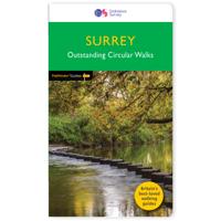
Wandelgids 065 Pathfinder Guides Surrey | Ordnance Survey
Fraaie, goed verzorgde wandelgidsjes met 28 wandelingen van max. een dag, (beginnend bij korte, eindigend bij langere wandelingen). Weergegeven op duidelijke topografische kaartjes (1:25.000). Bevat verder wetenswaardigheden en praktische informatie voor onderweg. Areas covered include the North Downs Way and Box Hill, with all walks accompanied by GPS waypoints, Ordnance Survey maps and beautiful photography. The Pathfinder Guide to Surrey Walks contains 28 fantastic circular walks across the county, much of which lies only a few miles away from the heart of London but which contains some of the country's most beaufiul landscapes, including the oldest untouched area of natural woodland in the UK and the rolling contours of the North Downs. Each walk in Pathfinder Guide to Surrey Walksis accompanied by clear, large-scale Ordnance Survey route maps and GPS waypoints to help you navigate your hike with ease. Exploring one of the most popular Home Counties, Pathfinder Guide to Surrey Wal…
18,50
Nieuw
Wandelgids 044 Pathfinder Guides Essex | Ordnance Survey
Pathfinder Guide to Essex offers excellent lowland walking in the south-east of England. The routes are all circular exploring the finer countryside of the county, in a series of parkland, farmland, woodland and coastal and estuarine walks, visiting its places of historic interest, attractive towns and charming villages. Given the pleasant and undramatic nature of the terrain, routes only really vary in length in terms of difficulty and there is a general progression through the book from shortest to longest. Beginning with a short walk linking Laindon Common with Great and Little Burstead, encountering the infant River Crouch, the book progresses to a near 10-mile excursion across Bradwell Marsh, with its wide open horizons, and a visit to the isolated and tiny Saxon chapel of St Peter-on-the-Wall. Sea air can also be taken on walks from Walton-on-the-Naze, a circuit of the eastern end of Mersea Island, along St Osyth Creek, at Maldon, from Burnham-on-Crouch, and overlooking Benfleet…
18,50

Klanten-reviews van Wandelgids 006 Pathfinder Guides Cotswolds | Ordnance Survey

Er zijn nog geen beoordelingen voor dit productBen jij de eerste die een review plaatst?

Meer over Wandelgids 006 Pathfinder Guides Cotswolds | Ordnance Survey

Productomschrijving

180 miles of wonderful walking in idyllic, limestone countryside . . .   Take a journey on 28 beautiful walks across the Cotswolds with the OS Pathfinder Guidebooks, graded by length and ranging from 3 to 10 miles.   All walks in this book include written directions, an extract of the OS map for the area and some background on the history and natural environment you see. Most of the walks avoid busy roads and are designed to help you make the most of a holiday or day trips. There are notes on parking, pubs, and things to see en route.   The routes range from extended strolls to longer hikes, something for all levels! Each walk includes a detailed description, an OS map, GPS waypoints and notes of key features and things to see.   This is one of a series of books with great walking routes covering the most popular and scenic areas of Britain. Printed with weather-resistant covers featuring durable rounded corners, they are the perfect companion for country walking throughout Britain.   Publication Date: 2020   Walks in this book:  
  • Minster Lovell and the River Windrush
  • Northleach and Hampnett
  • Minchinhampton Common
  • Blockley and Norcombe Wood
  • Wotton-under-Edge, the Tyndale monument, and Coombe Hill
  • Broadway and Broadway Tower
  • Sapperton and Daneway
  • Chipping Campden and Dover's Hill
  • Cooper's Hill and Buckholt Wood
  • Castle Combe
  • Dyrham Park and West Littleton
  • Burford, Fulbrook, and Widford
  • Brimpsfield and Syde
  • Bibury and the River Coln
  • The Guitings and Guiting Wood
  • Blenheim Park
  • Haresfield beacon and Standish Wood
  • Wychwood Forest
  • Adlestrop, Cornwell, and Oddington
  • Laurie Lee Country
  • Cleeve Common
  • Bath and Claverton Down
  • Standton, Stanway, and Snowshill
  • Winchcombe, Hailes Abbey, and Sudeley Castle,/li>
  • Chedworth and Withington
  • The Rollright Stones
  • Bourton-on-the-Water, The Slaughters, and Naunton
  • Bredon Hill

Verken gerelateerde categorieën

Webshop.nl maakt gebruik van cookies. Ga je verder op onze website, ga dan akkoord met het plaatsen van cookies en de verwerking van deze data door ons en vermelde partners.