webshop.nl
Categorieën
  Sluiten

Meer Cicerone
Meer Cicerone in Literatuur boeken

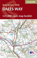
Wandelatlas The Dales Way Map Booklet | Cicerone

0
Heel handig bedacht van uitgever Cicerone: een boekje dat dienst doet als atlas met alle topografische kaarten die je nodig hebt voor het lopen van de Dales Way. Past goed in binnenzak of broekzak. Map of the 79 mile (127km) Dales Way through the Yorkshire Dales between Ilkley and Bowness-on-Windermere. This booklet is included with the Cicerone gu...

Webshops met dit product

Webshop
Bezorging
Prijs

Anderen bekeken ook

Wandelatlas The Dales Way Map Booklet | Cicerone
Heel handig bedacht van uitgever Cicerone: een boekje dat dienst doet als atlas met alle topografische kaarten die je nodig hebt voor het lopen van de Dales Way. Past goed in binnenzak of broekzak. Map of the 79 mile (127km) Dales Way through the Yorkshire Dales between Ilkley and Bowness-on-Windermere. This booklet is included with the Cicerone guidebook and shows the full route on OS 1:25K maps. One of the most gentle multi-day walks in Britain, it passes through Grassington, Kettlewell, Dent, Sedbergh and Staveley.
10,50
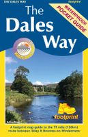
Wandelkaart The Dales Way | Footprint maps
Handzame wandelkaart voor de Dales Way in Noord Engeland.  The Dales Way is a 79 mile (127km) long distance trail in the north of England, running between Ilkley, in North Yorkshire and Bowness-on-Windermere, in Cumbria. Much of the route passes through the Yorkshire Dales and Lake District National Parks. Starting out in Ilkley, the route runs along Wharfedale, passing the impressive ruins of Bolton Priory and the attractive market town of Grassington. It continues along the River Wharfe through dramatic limestone scenery before it crosses The Pennines to reach Dentdale and Sedbergh. It then skirts the Howgill Fells and crosses the M6 motorway to finish overlooking Lake Windermere.   This map-guide is laid out for walkers travelling from Ilkley to Bowness, although walkers travelling in the opposite direction should find it equally useful. Each panel includes a detailed route map, route profile and helpful notes on navigation.   There are link routes from Bradford, Leeds and Harrogate…
12,95
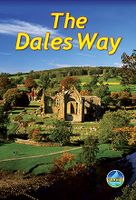
Wandelgids The Dales Way | Rucksack Readers
This charming walk runs for 79 miles (127 km) from Ilkley in the Yorkshire Dales to Bowness in the Lake District. The route heads north through Wharfedale, crisscrossing the river, and rises over high moorland to pick up River Dee through Dentdale. It joins River Lune briefly before heading west to Bowness on Lake Windermere. The LDWA has documented Link Routes for walkers beginning in Leeds, Harrogate and Bradford.   Along the Way, you’ll see impressive railway viaducts and fine stone bridges; Bolton Priory and many small churches; limestone scenery with stone walls, hay meadows and lime kilns; and heritage centres you can visit. Above all, the route is blessed with many small villages with B&Bs and welcoming pubs at strategic intervals. Gradients are modest and most people will complete it comfortably in 6 or 7 days.   This guidebook has all you need to plan and enjoy the Dales Way:   detailed directions for the main Way walked south to north detailed directions for the Bradford…
17,50
Wandelgids Dales Way | Trailblazer Guides
The popular Dales Way long-distance footpath begins in Ilkley, West Yorkshire and runs for 84 miles (135km) to end in the Lake District, in Bowness-on-Windermere. It follows riverside paths along the River Wharf towards Ribblehead and the watershed of northern England, then meanders along the river valleys of Dentdale, the River Mint and the River Kent dropping down into the Lake District to end beside Lake Windermere. It's a relatively easy walk that takes about a week. Includes 40 large-scale maps (3 1/8 inches to 1 mile); 9 town plans and 8 overview maps. Full details of all accommodations and campsites, restaurants and pubs; plus full public transport information. Plus day-walks. - 40 large-scale walking maps - at just under 1:20,000 - showing route times, places to stay, points of interest and much more - 9 town plans - 8 area maps and trail profiles - Itineraries for all walkers - whether walking the route in its entirety over a week or sampling the highlights on day walks and sh…
19,95
Fietsgids Cycling in the Yorkshire Dales | Cicerone
This guide describes 23 day routes, graded by a combination of distance, climb and overall gradient, all suitable for road bikes and illustrated by detailed maps and profiles. In addition a six-stage tour takes in all the highlights, including Grassington, Leyburn, Hawes, Kirkby Stephen, Ingleton and Settle. And for those who really want to test themselves, the route of the Stage 1 of the 2014 Tour de France, a 206km loop from Leeds to Harrogate, is also included, with an option to close the loop without adding many extra miles.   Appendices include a route summary table to help you choose your route, lots of information about facilities for cyclists along the routes, taking bikes on public transport and basic bike maintenance.   The Vuelta a Dales takes in the best dales, passes and viewpoints as it passes through Grassington, Leyburn, Hawes, Kirkby Stephen, Sedbergh, Ingleton and Settle. The Yorkshire Dales have always welcomed visitors who enjoy the views. For cyclists, the national…
20,95
Wandelgids The Dales Way | Cicerone
A fully waymarked trail from Ilkley to Bowness-on-Windermere, the Dales Way links two of England's most celebrated national parks, the Yorkshire Dales and the Lake District. Well served for accommodation and facilities, and with easy walking on riverside paths, it is one of the gentlest multi-day walks in Britain and therefore an ideal introduction to long-distance walking. It can be comfortably completed in 6-8 days.   The guide offers comprehensive notes on local points of interest, as well as an overview of Dales geology, history, plants and wildlife to enhance the walking experience. The practical information is all there too, including when to go, how to get there and what to take, making for an ideal companion to enjoying this delightful route.   Presented in six daily stages of 7-19 miles (with suggestions for alternative schedules), this guide describes the Way in both directions, with the main route description running from south to north. Step-by-step route description is acc…
20,95
Wandelgids Walking in the Yorkshire Dales: South and West | Cicerone
Veelzijdige wandelgids van een deel van de Yorkshire Dales, goede kaarten en beschrijvingen en veel keuze uit een behoorlijk aantal wandelingen. Part of a two-book set, this guidebook describes 44 walks in the southern and western Yorkshire Dales, including the famous 23 mile Three Peaks circuit over Pen-y-Ghent, Whernside and Ingleborough. The other, mostly circular routes of 3½ to 13 miles cover the scenic region between Sedbergh, Kirkby Lonsdale, Settle, Skipton and Grassington. The Yorkshire Dales need little introduction: their picturesque scenery and hundreds of miles of footpaths, tracks and bridleways have been attracting walkers for decades. Part of a two-volume set, this guidebook presents over 40 routes in the south and west of the National Park, with bases including Sedburgh, Malham, Grassington, Skipton, Settle and Kirkby Lonsdale. The walks cover the valleys of Wharfedale, Littondale, Malhamdale, Ribblesdale and Dentdale – each with its own distinctive landscape and chara…
19,95

Klanten-reviews van Wandelatlas The Dales Way Map Booklet | Cicerone

Er zijn nog geen beoordelingen voor dit productBen jij de eerste die een review plaatst?

Meer over Wandelatlas The Dales Way Map Booklet | Cicerone

Productomschrijving

Heel handig bedacht van uitgever Cicerone: een boekje dat dienst doet als atlas met alle topografische kaarten die je nodig hebt voor het lopen van de Dales Way. Past goed in binnenzak of broekzak. Map of the 79 mile (127km) Dales Way through the Yorkshire Dales between Ilkley and Bowness-on-Windermere. This booklet is included with the Cicerone guidebook and shows the full route on OS 1:25K maps. One of the most gentle multi-day walks in Britain, it passes through Grassington, Kettlewell, Dent, Sedbergh and Staveley.

Productspecificaties

Artikelnummer(s)
Brand
Cicerone

Verken gerelateerde categorieën

Webshop.nl maakt gebruik van cookies. Ga je verder op onze website, ga dan akkoord met het plaatsen van cookies en de verwerking van deze data door ons en vermelde partners.