Wandelatlas South West Coast Path Map Booklet - Vol 3 | Cicerone

0
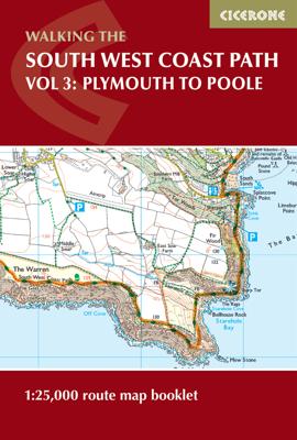
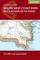
This booklet of Ordnance Survey 1:25,000 Explorer maps shows the full line of the section of the National Trail between Plymouth and Poole, providing all the mapping you need to walk the trail in either direction. It is conveniently sized for slipping into a jacket pocket or top of a rucksack. Two separate booklets cover the route from Minehead to...

Verkopers met dit product

Verkoper
Bezorging
Prijs
DeZwerver.nl logo
DeZwerver.nl
2,95
17,95

Anderen bekeken ook

Wandelatlas South West Coast Path Map Booklet - Vol 3 | Cicerone
This booklet of Ordnance Survey 1:25,000 Explorer maps shows the full line of the section of the National Trail between Plymouth and Poole, providing all the mapping you need to walk the trail in either direction. It is conveniently sized for slipping into a jacket pocket or top of a rucksack. Two separate booklets cover the route from Minehead to St Ives and from St Ives to Plymouth.   The map booklets accompany the Cicerone guidebook - The South West Coast Path - which describes the full National Trail in 45 stages, with lots of other practical information and local points of interest. The South West Coast Path is Britain's longest National Trail, stretching some 630 miles (1014km) between Minehead in Somerset and Poole in Dorset.  
17,95
Wandelgids South West Coast Path Map Booklet | Cicerone
A booklet of all the mapping needed to walk the South West Coast Path between Minehead and St Ives. Covering the northern section of this 1014km (630 mile) National Trail along the north Devon and Cornish coastline.   The full route is shown on 1:25,000 OS maps Route passes through Lynmouth, Westward Ho!, Clovelly, Bude, Padstow, Newquay The map booklet can be used to walk the path in either direction Sized to easily fit in a jacket pocket The relevant extract from the OS Explorer map legend is included An accompanying Cicerone guidebook – The South West Coast Path – is also available
19,50
Wandelatlas Hadrian's Wall Path Map Booklet | Cicerone
All the mapping you need to walk the 84 mile (135km) Hadrian's Wall Path from Bowness-on-Solway in Cumbria to Wallsend, Newcastle. This booklet of Ordnance Survey 1:25,000 Explorer maps has been designed for convenient use on the trail. It shows the full and up-to-date line of the Hadrian's Wall Path, along with the relevant extract from the OS Explorer map legend. It can be used when walking the trail west-east or east-west, and includes an extension to the east coast at South Shields. It is conveniently sized for slipping into a jacket pocket or top of a rucksack. This booklet is included with the Cicerone guidebook to Hadrian's Wall Path National Trail.
17,95
Wandelatlas Ridgeway Map Booklet | Cicerone
Heel handig bedacht van uitgever Cicerone: een boekje dat dienst doet als atlas met alle topografische kaarten die je nodig hebt voor het lopen van de Ridgeway. Past goed in binnenzak of broekzak. Map of the 87 mile (139km) Ridgeway National Trail through the south of England from Avebury in Wiltshire to Ivinghoe Beacon in Buckinghamshire. This booklet is included with the Cicerone guidebook to the trail, and shows the full route on Ordnance Survey 1:25,000 maps. Presented in 12 stages in the guidebook, the trail typically takes 6-8 days.
11,50
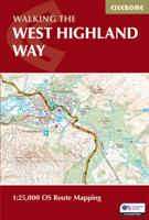
Wandelatlas West Highland Way Map Booklet - Kaartenset | Cicerone
Heel handig bedacht van uitgever Cicerone: een boekje dat dienst doet als atlas met alle topografische kaarten die je nodig hebt voor het lopen van de West Highland Way. Past goed in binnenzak of broekzak. This compact booklet of maps shows the full route of the 95-mile West Highland Way Scottish Long Distance Route, via Loch Lomond and Rannoch Moor. This booklet is included with the Cicerone guidebook to the trail, and shows the full route on Ordnance Survey 1:25,000 maps.
14,95
Wandelgids The South West Coast Path | Cicerone
Goede wandelgids van het langste gemarkeerde wandelpad van Groot Brittanië; 1015 km! Uit de bekende Cicerone serie, dus met mooie foto's en duidelijke routebeschrijvingen en kaartjes. The South West Coast Path is Britain's longest way-marked trail, measuring a staggering 1015km (630 miles). Written by the well-known outdoor writer, Paddy Dillon, the guide provides a wealth of detailed knowledge to help tackle this immense route with confidence. It describes the way-marked trail from Minehead to Poole along the north Devon, Cornish and south Devon coastline to finish at Poole Harbour. A full introduction provides the route's historical background, advice on accommodation along the route and details on travelling to and around the South West.There is detailed information on how to use this guide to make the most of your walk, whether you choose to walk the whole route in one go or decide to achieve sections at intervals.Day-by-day route summaries accompany the 45-day stages and the fina…
24,95
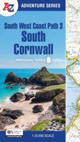
Wandelatlas 3 Adventure Atlas South West Coast Path South Cornwall | A-Z Map Company
AZ heeft de meest gedetailleerde wandelkaarten van delen van het South West Coast Path  gebundeld in een atlasje. Daardoor is het heel handig qua formaat. De kaarten zelf zijn perfect voor het wandelen. Schaal 1:25.000 Plan your next adventure along the South Cornwall section of the South West Coast Path with trusted mapping from A-Z The perfect companion for those who love the great outdoors, the A-Z Adventure Series features 1:25000 Ordnance Survey mapping in a convenient book, complete with index. The South West Coast Path is a National Trail along the Somerset, Devon, Cornwall and Dorset coasts. This stunning walk from Minehead, Somerset covers 630 miles to South Haven Point in Poole Harbour, passing through two World Heritage Sites (the Jurassic Coast and the Cornwall and West Devon Mining Landscape), Exmoor National Park, Land's End and many areas of outstanding natural beauty.   A series of five A-Z Adventure Atlases together cover the South West Coast Path: South West Coast…
17,95
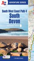
Wandelatlas 4 Adventure Atlas South West Coast Path South Devon | A-Z Map Company
AZ heeft de meest gedetailleerde wandelkaarten van delen van het South West Coast Path  gebundeld in een atlasje. Daardoor is het heel handig qua formaat. De kaarten zelf zijn perfect voor het wandelen. Schaal 1:25.000 Plan your next adventure along the South Devon section of the South West Coast Path with trusted mapping from A-Z The perfect companion for those who love the great outdoors, the A-Z Adventure Series features 1:25000 Ordnance Survey mapping in a convenient book, complete with index. The South West Coast Path is a National Trail along the Somerset, Devon, Cornwall and Dorset coasts. This stunning walk from Minehead, Somerset covers 630 miles to South Haven Point in Poole Harbour, passing through two World Heritage Sites (the Jurassic Coast and the Cornwall and West Devon Mining Landscape), Exmoor National Park, Land's End and many areas of outstanding natural beauty.   This A-Z Adventure Atlas of the South West Coast Path: South Devon features 50 pages of continuous O…
17,95
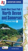
Wandelatlas 1 Adventure Atlas South West Coast Path North Devon & Somerset | A-Z Map Company
AZ heeft de meest gedetailleerde wandelkaarten van delen van het South West Coast Path  gebundeld in een atlasje. Daardoor is het heel handig qua formaat. De kaarten zelf zijn perfect voor het wandelen. Schaal 1:25.000 Plan your next adventure along the North Devon & Somerset section of the South West Coast Path with trusted mapping from A-Z The perfect companion for those who love the great outdoors, the A-Z Adventure Series features 1:25000 Ordnance Survey mapping in a convenient book, complete with index. The South West Coast Path is a National Trail along the Somerset, Devon, Cornwall and Dorset coasts. This stunning walk from Minehead, Somerset covers 630 miles to South Haven Point in Poole Harbour, passing through two World Heritage Sites (the Jurassic Coast and the Cornwall and West Devon Mining Landscape), Exmoor National Park, Land's End and many areas of outstanding natural beauty.   This guide to the North Devon and Somerset section features 36 pages of continuous Ordnan…
17,95
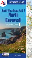
Wandelatlas 2 Adventure Atlas South West Coast Path North Cornwall | A-Z Map Company
AZ heeft de meest gedetailleerde wandelkaarten van delen van het South West Coast Path  gebundeld in een atlasje. Daardoor is het heel handig qua formaat. De kaarten zelf zijn perfect voor het wandelen. Schaal 1:25.000 Plan your next adventure along the North Devon & Somerset section of the South West Coast Path with trusted mapping from A-Z The perfect companion for those who love the great outdoors, the A-Z Adventure Series features 1:25000 Ordnance Survey mapping in a convenient book, complete with index. The South West Coast Path is a National Trail along the Somerset, Devon, Cornwall and Dorset coasts. This stunning walk from Minehead, Somerset covers 630 miles to South Haven Point in Poole Harbour, passing through two World Heritage Sites (the Jurassic Coast and the Cornwall and West Devon Mining Landscape), Exmoor National Park, Land's End and many areas of outstanding natural beauty.   This guide to the North Devon and Somerset section features 36 pages of continuous Ordnan…
17,95

Klanten-reviews van Wandelatlas South West Coast Path Map Booklet - Vol 3 | Cicerone

Er zijn nog geen beoordelingen voor dit productBen jij de eerste die een review plaatst?

Meer over Wandelatlas South West Coast Path Map Booklet - Vol 3 | Cicerone

Productomschrijving

This booklet of Ordnance Survey 1:25,000 Explorer maps shows the full line of the section of the National Trail between Plymouth and Poole, providing all the mapping you need to walk the trail in either direction. It is conveniently sized for slipping into a jacket pocket or top of a rucksack. Two separate booklets cover the route from Minehead to St Ives and from St Ives to Plymouth.   The map booklets accompany the Cicerone guidebook - The South West Coast Path - which describes the full National Trail in 45 stages, with lots of other practical information and local points of interest. The South West Coast Path is Britain's longest National Trail, stretching some 630 miles (1014km) between Minehead in Somerset and Poole in Dorset.  

Productinformatie

    Verken gerelateerde categorieën

    Webshop.nl maakt gebruik van cookies. Ga je verder op onze website, ga dan akkoord met het plaatsen van cookies en de verwerking van deze data door ons en vermelde partners.