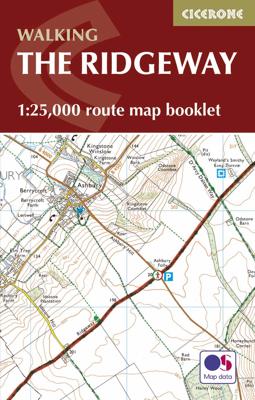
Wandelatlas Ridgeway Map Booklet | Cicerone

0
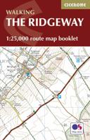
Heel handig bedacht van uitgever Cicerone: een boekje dat dienst doet als atlas met alle topografische kaarten die je nodig hebt voor het lopen van de Ridgeway. Past goed in binnenzak of broekzak. Map of the 87 mile (139km) Ridgeway National Trail through the south of England from Avebury in Wiltshire to Ivinghoe Beacon in Buckinghamshire. This bo...

Verkopers met dit product

Verkoper
Bezorging
Prijs
DeZwerver.nl logo
DeZwerver.nl
2,95
11,50

Anderen bekeken ook

Nieuw
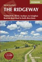
Wandelgids The Ridgeway | Cicerone
Uitstekende wandelgids van de Ridgeway, waarbij naast alle noodzakelijke informatie ook gebruik gemaakt wordt van de echte topografische kaart. Inclusief gidsje met routekaarten van 1:25000   This guidebook - which includes both a guide to the route and a separate OS map booklet - describes the Ridgeway National Trail, an 87 mile (139km) route through southern England from Avebury in Wiltshire to Ivinghoe Beacon in Buckinghamshire. Typically walked in 6 or 8 days, this is a low-level waymarked route suitable for all abilities and for year round walking.   The guidebook details the trail in both directions, west to east and east to west. Step-by-step route descriptions are accompanied by 1:100,000 OS mapping and a separate OS 1:25,000 map booklet showing the entire route is included. Packed with details on points of interest and a trek planner giving at-a-glance information about facilities, public transport and accommodation available along the way, this book is an indispensable guide…
23,95
Wandelatlas Hadrian's Wall Path Map Booklet | Cicerone
All the mapping you need to walk the 84 mile (135km) Hadrian's Wall Path from Bowness-on-Solway in Cumbria to Wallsend, Newcastle. This booklet of Ordnance Survey 1:25,000 Explorer maps has been designed for convenient use on the trail. It shows the full and up-to-date line of the Hadrian's Wall Path, along with the relevant extract from the OS Explorer map legend. It can be used when walking the trail west-east or east-west, and includes an extension to the east coast at South Shields. It is conveniently sized for slipping into a jacket pocket or top of a rucksack. This booklet is included with the Cicerone guidebook to Hadrian's Wall Path National Trail.
17,95
Wandelkaart - Fietskaart Ridgeway | Harvey Maps
Mooie, duidelijke kaart van de Ridgeway in Engeland. Geplastificeerd met veel extra informatie en uitsnedes van de route.    Leap forward in technical excellence. Tough, light and 100% wateproof   Compact and light - the map itself weighs just 60gms - a third of the weight of a laminated map, and much less bulky. And you can fold or refold it time and again, or stuff it in your back pocket and it won't fall to pieces.   Shows the entire route on one sheet.   From Overton Hill near Avebury in Wiltshire to Ivinghoe Beacon, east of Tring in Hertfordshire 137km (85 miles).   Suitable for walkers, cyclists and horseriders.   Information on finding accommodation, camping, food. Directions to the start. Also Ranger Service contact numbers and enlargements of towns/villages showing facilities available and tips on weather and clothing   Detailed mapping, full legend. National Grid - can be used with GPS. 1:40,000 scale. Waterproof. Supplied in clear plastic pocket     What the press says: '..…
25,95
Nieuw
Wandelatlas West Highland Way Map Booklet - Kaartenset | Cicerone
Heel handig bedacht van uitgever Cicerone: een boekje dat dienst doet als atlas met alle topografische kaarten die je nodig hebt voor het lopen van de West Highland Way. Past goed in binnenzak of broekzak. This compact booklet of maps shows the full route of the 95-mile West Highland Way Scottish Long Distance Route, via Loch Lomond and Rannoch Moor. This booklet is included with the Cicerone guidebook to the trail, and shows the full route on Ordnance Survey 1:25,000 maps.
14,95
Nieuw
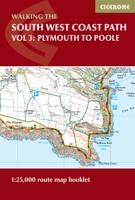
Wandelatlas South West Coast Path Map Booklet - Vol 3 | Cicerone
This booklet of Ordnance Survey 1:25,000 Explorer maps shows the full line of the section of the National Trail between Plymouth and Poole, providing all the mapping you need to walk the trail in either direction. It is conveniently sized for slipping into a jacket pocket or top of a rucksack. Two separate booklets cover the route from Minehead to St Ives and from St Ives to Plymouth.   The map booklets accompany the Cicerone guidebook - The South West Coast Path - which describes the full National Trail in 45 stages, with lots of other practical information and local points of interest. The South West Coast Path is Britain's longest National Trail, stretching some 630 miles (1014km) between Minehead in Somerset and Poole in Dorset.  
17,95
Nieuw
Wandelgids Walking on the North Wessex Downs | Cicerone
Guidebook to 30 circular walks in the North Wessex Downs Area of Outstanding Natural Beauty (AONB). The routes, which range from 7 to 21km (4 to 13 miles), take in parts of four counties - Berkshire, Hampshire, Wiltshire and Oxfordshire.   The North Wessex Downs are accessible hills rising above the towns and rural plains of southern England and rolling gently west from Reading and Basingstoke to Swindon and down past Marlborough to Andover. The walks allow you to explore parts of the Ridgeway National Trail, the Kennet and Avon Canal and stunning historic sites such as Avebury, the 3000-year-old Uffington White Horse, impressive Neolithic long barrows and Iron Age hill forts.   Alongside clear route descriptions and OS maps are plenty of details about points of interest, as well as practical information on the area, from public transport links to ideal refreshment stops on each walk. The result is an ideal companion to exploring both the popular and untouched corners of the North Wes…
19,95
Nieuw
Wandelgids Walking the Pembrokeshire Coast Path map booklet | Cicerone
A booklet of all the mapping needed to walk the Pembrokeshire Coast Path National Trail between Amroth near Tenby and St Dogmaels by Cardigan. Covering 290km (180 miles) and over 10,500m of ascent, this trail takes around 2 weeks to complete. The full route is shown on 1:25,000 OS maps The map booklet can be used to walk the trail in either direction Sized to easily fit in a jacket pocket or rucksack The relevant extract from the OS Explorer map legend is includedHigh tide and military range closure alternate routes are providedAn accompanying Cicerone guidebook – Walking the Pembrokeshire Coast Path is also available, which includes a copy of this map booklet   Both native Lancastrians, Dennis and Jan Kelsall have long held a passion for countryside and hill walking. Since their first Cicerone title was published in 1995, they have written and illustrated around 35 guides covering some of Britain’s most popular walking areas and have become regular contributors to various outdoor ma…
15,95
Nieuw
Wandelgids The Ridgeway | Trailblazer Guides
Goede wandelgids waarin met veel details alle etappes zijn beschreven. Tevens informatie over overnachtingen en openbaar vervoer. The go-to, all-in-one guide to walking The Ridgeway path. Running from Wiltshire to Buckinghamshire, in southern England, this ancient trackway is Britain's oldest road. In this fully revised and updated, two-way edition all routes have been completely rewalked in both directions from Avebury to Ivinghoe Beacon near Aylesbury and Ivinghoe Beacon to Avebury.   Coverage includes: Marlborough, Avebury, West Overton, Avebury Stone Circle, Kennett and East Kennett, Foxhill, Liddington, Wantage, Bishopstone, Ashbury, Woolstone, Uffington, Goring, Streatley, Wallingford, Crowmarsh Gifford, Watlington, Princes Risborough, Tring, Ivinghoe Beacon   In this guide you will find: - 53 detailed walking maps - the largest scale maps available - at just under 1:20,000 (8cm or 31/8 inches to one mile) these are bigger than even the most detailed walking maps currently avail…
21,95
Nieuw
Wandelgids Walking in the Thames Valley | Cicerone
Walking in the Thames Valley offers 25 challenging circular walks around the River Thames and River Kennet in the south of England, taking in the Southern Chilterns, the Berkshire and North Hampshire Downs, Southern Oxfordshire and the eastern edge of Wiltshire. All routes are within easy reach of Reading, Newbury, Abingdon and London. While some walks visit Iron Age hill forts, others pass more modern features such as Wilton Windmill and the Kennet and Avon Canal. Some follow sections of the Ridgeway, while others meander along the banks of the Thames. What they all have in common is that they take the keen rambler to some of the best parts of the Thames Valley – a patchwork of open chalk grassland, broadleaved woodland and farmland and home to two Areas of Outstanding Natural Beauty. • walks from 10 to 18 miles, including one 2-day route • shorter, less strenuous alternatives for many of the walks • detailed route descriptions with information on local points of interest, OS mapping…
18,50
Nieuw
Wandelatlas The Dales Way Map Booklet | Cicerone
Heel handig bedacht van uitgever Cicerone: een boekje dat dienst doet als atlas met alle topografische kaarten die je nodig hebt voor het lopen van de Dales Way. Past goed in binnenzak of broekzak. Map of the 79 mile (127km) Dales Way through the Yorkshire Dales between Ilkley and Bowness-on-Windermere. This booklet is included with the Cicerone guidebook and shows the full route on OS 1:25K maps. One of the most gentle multi-day walks in Britain, it passes through Grassington, Kettlewell, Dent, Sedbergh and Staveley.
10,50

Klanten-reviews van Wandelatlas Ridgeway Map Booklet | Cicerone

Er zijn nog geen beoordelingen voor dit productBen jij de eerste die een review plaatst?

Meer over Wandelatlas Ridgeway Map Booklet | Cicerone

Productomschrijving

Heel handig bedacht van uitgever Cicerone: een boekje dat dienst doet als atlas met alle topografische kaarten die je nodig hebt voor het lopen van de Ridgeway. Past goed in binnenzak of broekzak.

Map of the 87 mile (139km) Ridgeway National Trail through the south of England from Avebury in Wiltshire to Ivinghoe Beacon in Buckinghamshire. This booklet is included with the Cicerone guidebook to the trail, and shows the full route on Ordnance Survey 1:25,000 maps. Presented in 12 stages in the guidebook, the trail typically takes 6-8 days.

Verken gerelateerde categorieën

Webshop.nl maakt gebruik van cookies. Ga je verder op onze website, ga dan akkoord met het plaatsen van cookies en de verwerking van deze data door ons en vermelde partners.