webshop.nl
Categorieën
  Sluiten

Meer Michelin
Meer Michelin in Gezondheid & psychologie boeken

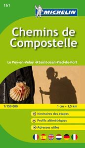
Wandelatlas - Pelgrimsroute (kaart) 161 Chemins de Compostelle GR65 |

0
Heel handzaam boekje met de kaarten voor de route van Le Puy en Velay naar St-Jean-Pied-de-Port.    Met praktische informatie zoals overnachtingsplekken, stadsplattegronden, grafieken van landschap, km-traject per pagina met de ingetekende route.   Voor de rest van de route naar Santiago kunt u Michelin kaartgids 160 gebruiken   GR-65   Le livret ...

Webshops met dit product

Webshop
Bezorging
Prijs

Anderen bekeken ook

Wandelatlas - Pelgrimsroute (kaart) 161 Chemins de Compostelle GR65 |
Heel handzaam boekje met de kaarten voor de route van Le Puy en Velay naar St-Jean-Pied-de-Port.    Met praktische informatie zoals overnachtingsplekken, stadsplattegronden, grafieken van landschap, km-traject per pagina met de ingetekende route.   Voor de rest van de route naar Santiago kunt u Michelin kaartgids 160 gebruiken   GR-65   Le livret MICHELIN Chemins de Compostelle / Le Puy-en-Velay à Saint-Jean Pied de Port (fond cartographique mis à jour cette année)est un outil indispensable pour tous les marcheurs sur le chemin de Saint Jacques. Du Puy en Velay à Saint Jean Pied de Port, les plus de 730 km du parcours sont découpés en étapes de 4H30 à 7H30 de marche. Grâce à son FORMAT CARTE-ATLAS, retrouvez chaque étape avec des INFORMATIONS PRATIQUES qui vous seront utiles sur votre chemin : AUBERGES, REFUGES, PHARMACIES, EPICERIES, KM RESTANTS, KM PARCOURUS.... Pour une étape donnée, consultez le PROFIL ALTIMETRIQUE de votre trajet ainsi que la carte au 1/150 000 soit 1 cm = 1,5 km…
9,95
Wandelgids - Pelgrimsroute Miam Miam Dodo Vezelay - Saint Jean Pied de
Toonaangevende Franstalige wandelgids met zowel de route, kaarten en praktische informatie. Met een overzicht van de eetadressen en overnachtingsadressen langs het lange afstandswandelpad naar Santiago de Compostela, deze gids beschrijft de route tussen Vezelay via 2 mogelijkheden (Bourges of Nevers)  naar Saint Jean Pied de Port in de Pyreneeen.    De uitgebreid in het Frans beschreven adressen (met prijzen en condities) van restaurants, cafe's en slaapplekken, zoals kloosters, herbergen, gastverblijven en campings liggen allen binnen een straal van 5km van de wandelroute. De gids geeft ook andere praktische informatie zoals adressen van postkantoren, apotheken, banken, etc.   At the beginning, the pilgrim has the choice between the northern branch, via Bourges, and the southern branch, via Nevers. In this book, we have decided to promote the itinerary of the associations of pilgrims to Santiago de Compostela, which is the most faithful to the historical itinerary of the Way of Vezel…
25,50
Wandelatlas La via podiensis GR65 - La voie du puy Atlas Chemins de Co
Superhandig atlasje met de alle IGN 1:25.000 wandelkaarten van de hele route (755 km) Via de Podiensis van Le Puy-en-Velay en Saint-Jean-Pied-de-Port. Wel in in het Frans maar dat is geen probleem want het zijn eigenlijk alleen maar wandelkaarten. L’atlas : Maniable et pratique, cet atlas compact contient l’ensemble du tracé de la Via Podiensis, avec un fond de carte IGN au 1 : 25 000. - 92 cartes très précises - Idéal sur le terrain ou à la maison - Un découpage de l’itinéraire en 33 étapes - Les 755 km du tracé en surbrillance - 8 départements traversés : Haute-Loire, Lozère, Aveyron, Lot, Tarn-et-Garonne, Gers, Landes, Pyrénées-Atlantiques - Format 14 x 21 cm - 176 pages   GR65 Chemin du Puy
17,95
Wandelgids Camino de Santiago - Via Podiensis GR65 | Cicerone
Handzaam boekje met de routebeschrijving inclusief een heleboel praktische informatie. Uitstekende beschrijving en redelijke kaarten.   This guidebook describes in full the 735km Via Podiensis (GR65), a historic pilgrimage route through southern France from Le Puy-en-Velay to Saint-Jean-Pied-de-Port, where the trail meets the famous Camino Francés to Santiago de Compostela (Spain). Also detailed are 2 major variants: the Célé Valley (GR651) and Rocamadour (GR6 and GR46). Split into 28 stages, the full route takes 4 to 6 weeks to complete but can be divided into shorter sections - Figeac and Condom are well positioned to break the walk into three 2-week chunks. It can be adapted to suit all abilities, with regularly spaced accommodation and baggage transport available, and is best walked in spring and autumn, with May and September the most popular months. Abundant accommodation options offer a warm welcome to walkers and pilgrims and a chance to enjoy delicious home-cooked meals made …
24,95
Wandelgids Miam Miam Dodo Section 1 Le Puy en Velay - Cahors GR65 Via
Toonaangevende Franstalige wandelgids met zowel de route, kaarten en praktische informatie. Met een overzicht van de eetadressen en overnachtingsadressen langs het lange afstandswandelpad GR 65 van Puy-en-Velay naar Cahors. De uitgebreid in het Frans beschreven adressen (met prijzen en condities) van restaurants, cafe's en slaapplekken, zoals kloosters, herbergen, gastverblijven en campings liggen allen binnen een straal van 5km van de wandelroute GR 65. De gids geeft ook andere praktische informatie zoals adressen van postkantoren, apotheken, banken, etc. Two guides cover the entire route of the GR®65, also called Via Podiensis, between Le Puy-en-Velay and Roncesvalles. Here is the first guide, which covers the first part of the way of Puy: from Puy-en-Velay to Cahors.   The Via Podiensis, also called "the way of Puy", is one of the 4 main roads that cross France and converge towards Spain and then Santiago de Compostela. It starts in Le Puy-en-Velay and crosses the Pyrenees through t…
21,50
Wandelatlas La via podiensis GR65 - La voie du puy Atlas Chemins de Co
Superhandig atlasje met de alle IGN 1:25.000 wandelkaarten van de hele route (755 km) Via de Podiensis van Le Puy-en-Velay en Saint-Jean-Pied-de-Port. Wel in in het Frans maar dat is geen probleem want het zijn eigenlijk alleen maar wandelkaarten. L’atlas : Maniable et pratique, cet atlas compact contient l’ensemble du tracé de la Via Podiensis, avec un fond de carte IGN au 1 : 25 000. - 92 cartes très précises - Idéal sur le terrain ou à la maison - Un découpage de l’itinéraire en 33 étapes - Les 755 km du tracé en surbrillance - 8 départements traversés : Haute-Loire, Lozère, Aveyron, Lot, Tarn-et-Garonne, Gers, Landes, Pyrénées-Atlantiques - Format 14 x 21 cm - 176 pages   GR65 Chemin du Puy
17,95
Wandelatlas - Pelgrimsroute (kaart) 160 Camino de Santiago | Michelin
Camino de Santiago - St Jean Pied de Port, Santiago de Compstela - 1 : 150.000 - Michelin kaartboekje. Heel handzaam boekje met de kaarten voor de route van St. Jean Pied de Port, Santiago de Compstela met praktische informatie zoals overnachtingsplekken inclusief contactgegevens, stadsplattegronden, grafieken van landschap, km-traject per pagina met de ingetekende route. De legenda is in 6 verschillende talen, waaronder het Nederlands. Ook ontbreekt een stempel-deel niet!  Voor het Franse deel kunt u Michelin kaartgids 161 gebruiken.
9,95

Klanten-reviews van Wandelatlas - Pelgrimsroute (kaart) 161 Chemins de Compostelle GR65 |

Er zijn nog geen beoordelingen voor dit productBen jij de eerste die een review plaatst?

Meer over Wandelatlas - Pelgrimsroute (kaart) 161 Chemins de Compostelle GR65 |

Productomschrijving

Heel handzaam boekje met de kaarten voor de route van Le Puy en Velay naar St-Jean-Pied-de-Port.    Met praktische informatie zoals overnachtingsplekken, stadsplattegronden, grafieken van landschap, km-traject per pagina met de ingetekende route.   Voor de rest van de route naar Santiago kunt u Michelin kaartgids 160 gebruiken   GR-65   Le livret MICHELIN Chemins de Compostelle / Le Puy-en-Velay à Saint-Jean Pied de Port (fond cartographique mis à jour cette année)est un outil indispensable pour tous les marcheurs sur le chemin de Saint Jacques. Du Puy en Velay à Saint Jean Pied de Port, les plus de 730 km du parcours sont découpés en étapes de 4H30 à 7H30 de marche. Grâce à son FORMAT CARTE-ATLAS, retrouvez chaque étape avec des INFORMATIONS PRATIQUES qui vous seront utiles sur votre chemin : AUBERGES, REFUGES, PHARMACIES, EPICERIES, KM RESTANTS, KM PARCOURUS.... Pour une étape donnée, consultez le PROFIL ALTIMETRIQUE de votre trajet ainsi que la carte au 1/150 000 soit 1 cm = 1,5 km. Les PLANS DE VILLE de Figeac, Cahors, Moissac, Condom, Saint-Jean-Pied-de-Port et du Puy-en-Velay sont également intégrés. Avec les cartes et atlas MICHELIN, trouvez bien plus que votre route !

Productspecificaties

Artikelnummer(s)
Brand
Michelin

Verken gerelateerde categorieën

Webshop.nl maakt gebruik van cookies. Ga je verder op onze website, ga dan akkoord met het plaatsen van cookies en de verwerking van deze data door ons en vermelde partners.