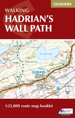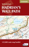
Wandelatlas Hadrian's Wall Path Map Booklet | Cicerone

0
All the mapping you need to walk the 84 mile (135km) Hadrian's Wall Path from Bowness-on-Solway in Cumbria to Wallsend, Newcastle. This booklet of Ordnance Survey 1:25,000 Explorer maps has been designed for convenient use on the trail. It shows the full and up-to-date line of the Hadrian's Wall Path, along with the relevant extract from the OS Ex...

Verkopers met dit product

Verkoper
Bezorging
Prijs
DeZwerver.nl logo
DeZwerver.nl
2,95
17,95

Anderen bekeken ook

Nieuw
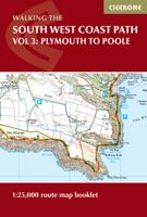
Wandelatlas South West Coast Path Map Booklet - Vol 3 | Cicerone
This booklet of Ordnance Survey 1:25,000 Explorer maps shows the full line of the section of the National Trail between Plymouth and Poole, providing all the mapping you need to walk the trail in either direction. It is conveniently sized for slipping into a jacket pocket or top of a rucksack. Two separate booklets cover the route from Minehead to St Ives and from St Ives to Plymouth.   The map booklets accompany the Cicerone guidebook - The South West Coast Path - which describes the full National Trail in 45 stages, with lots of other practical information and local points of interest. The South West Coast Path is Britain's longest National Trail, stretching some 630 miles (1014km) between Minehead in Somerset and Poole in Dorset.  
17,95
Wandelgids Hadrian's Wall Path | Aurum Press
Beschrijving van Hadrian's Wall Path. Historische en culturele aspecten komen vrij uitgebreid aan bod, praktische informatie is wel summier. Kaartmateriaal van Ordnance Survey is zonder meer uitstekend! Since it opened in 2003 Hadrian's Wall Path has become one of Britain's most popular long-distance paths. Its 84 miles are a convenient week's walking, shadowing for the most part the historic line of Hadrian's Wall in its spectacular progress across the superbly wild landscape of the north of England. Starting in what used to be Tyneside's shipbuilding heart, and joining Newcastle in the east with Carlisle in the west, it takes you via the extraordinary Roman forts of Vindolanda and Housesteads, close to handsome towns like Hexham and Corbridge, to finish on the lonely shores of the Solway Firth with views of Scotland. Comprehensive and engrossing, this official guide, published in conjunction with Natural England, is the only companion you need. Ordnance Survey mapping for the entire…
20,95
Wandelkaart Hadrian's Wall Path | Vertebrate Publishing
The 138-kilometre Hadrian's Wall Path traces a grey line along Great Whin Sill, the dolerite ridge chosen by the Romans for their historic wall. The route, one of Britain's most popular National Trails, is dotted with milecastles and forts, and attracts trail runners and walkers all year round due to its sweeping views. Beginning in Newcastle, the trail passes through rolling grassy paths and grey-green crags to reach Bowness-on-Solway on the Cumbrian Coast.   Hadrian's Wall Path appeals to people who have different levels of experience and travel at all speeds, and this Vertebrate Publishing Guidemap is unique in that it caters for four categories of user, providing custom itineraries for walkers, trekkers, fastpackers and trail runners. This lightweight, waterproof, durable and easy-to-use folding map features all the essential information for a successful Hadrian's Wall Path, including 1:40,000-scale mapping for the linear route starting in Wallsend and finishing in Bowness-on-Solw…
24,50
Nieuw
Wandelgids South West Coast Path Map Booklet | Cicerone
A booklet of all the mapping needed to walk the South West Coast Path between Minehead and St Ives. Covering the northern section of this 1014km (630 mile) National Trail along the north Devon and Cornish coastline.   The full route is shown on 1:25,000 OS maps Route passes through Lynmouth, Westward Ho!, Clovelly, Bude, Padstow, Newquay The map booklet can be used to walk the path in either direction Sized to easily fit in a jacket pocket The relevant extract from the OS Explorer map legend is included An accompanying Cicerone guidebook – The South West Coast Path – is also available
19,50
Wandelkaart National Trail Map Hadrian's Wall Path | Collins
Overzichtskaart op vrij grove schaal van deze LAW Lange Afstands Wandeling in Engeland. Let op: je kunt er niet op lopen. Wel met veel informatie op de kaart, goed ingetekend, een route-schema op de achterzijde en een beschrijving van een aantal bezienswaardigheden.  Perfect guide and map for planning your adventure along Hadrian’s Wall.   Highlights of this Planning Map include:   More than 20 highlighted places of interest with detailed descriptions and attractive photographs, including: the Vindolanda archaeological site, Chester’s Roman fort, and Steel Rigg viewpoint. A comprehensive index to more than 400 cities, towns and villages A clear, visible route plotted across the map Advice on safety and security when travelling along the route, as well as the countryside code and the code of conduct Part of the National Trail network, this long-distance footpath covers 84 miles (135 km) along the line of Hadrian's Wall from coast-to-coast. Starting in Wallsend in Newcastle and ending i…
11,50
Nieuw
Fietsgids Bikeline Iron Curtain Trail 3 - German-German Border Trail | Esterbauer
Praktische fietsgids met detailkaarten, ingetekende route, informatie over overnachten en fietsenmakers, zwaarte en hoogteprofiel. In spiraalbinding, Engelstalig   The Iron Curtain ran for about 7,000 km from the Barents Sea in the north straight through Europe to the Black Sea and divided the continent in East and West. Until the Velvet Revolution in Eastern Europe it was a physical and ideological border between two blocks which conceived each other as enemies. Not only were many neighbouring states divided, but Germany itself was divided into east and west. Today there are hardly any reminders that the wall ever existed.   The border in Germany was 1,400 km long. The former death strip was composed of 3.000 km of fences, car-trenches for 730 km, 830 observation towers, the brightly lit roads, walls and bunkers – most of it is gone. Remaining are the vehicle roads with their perforated paving stones and several observation towers. And in a few years the sparse vegetation will be sup…
17,95
Nieuw
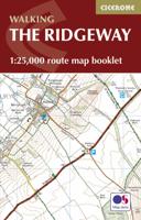
Wandelgids The Ridgeway | Cicerone
Uitstekende wandelgids van de Ridgeway, waarbij naast alle noodzakelijke informatie ook gebruik gemaakt wordt van de echte topografische kaart. Inclusief gidsje met routekaarten van 1:25000   This guidebook - which includes both a guide to the route and a separate OS map booklet - describes the Ridgeway National Trail, an 87 mile (139km) route through southern England from Avebury in Wiltshire to Ivinghoe Beacon in Buckinghamshire. Typically walked in 6 or 8 days, this is a low-level waymarked route suitable for all abilities and for year round walking.   The guidebook details the trail in both directions, west to east and east to west. Step-by-step route descriptions are accompanied by 1:100,000 OS mapping and a separate OS 1:25,000 map booklet showing the entire route is included. Packed with details on points of interest and a trek planner giving at-a-glance information about facilities, public transport and accommodation available along the way, this book is an indispensable guide…
23,95
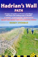
Wandelgids Hadrian's Wall Path | Trailblazer Guides
Goede wandelgids van de hele route van kust naar kust. Met veel details zijn alle etappes beschreven. Tevens informatie over overnachtingen en openbaar vervoer. Hadrian’s Wall Path, 84 miles from end to end, follows the course of northern Europe’s largest surviving Roman monument, a 2nd-century fortification built – in the border country between England and Scotland – on the orders of the Emperor Hadrian in AD122. Hadrian’s Wall Path is the first National Trail to follow the course of a UNESCO World Heritage Site. This week-long walk is regarded as one of the least challenging of the National Trails. 7 town plans and 45 large scale walking maps – at just under 1:20,000 – showing route times, places to stay, points of interest and much more Itineraries for all walkers – whether walking the route in its entirety over seven to eight days or sampling the highlights on day walks and short breaks Practical information for all budgets, all updated for the new edition – camping, bunkhouses, h…
19,95
Nieuw
Wandelgids St Oswald's Way and Northumberland Coast Path | Cicerone
This guidebook describes the St Oswald's Way and Northumberland Coast Paths, both long-distance trails through Northumberland. St Oswald's Way (156km, 97 miles) begins in Heavenfield and traverses parts of Northumberland National Park and visits Hadrian's Wall, the Simonside Hills and the beautiful Coquet Valley, before continuing up the coast to Lindisfarne (Holy Island). The Northumberland Coast Path (100km, 62 miles) takes in the whole of the Northumberland Coast AONB with its breathtaking coastal scenery and birdlife.   Both trails converge on Holy Island, with the Coast Path continuing up to Berwick-upon-Tweed. Each trail can be walked in a week. The guide includes practical advice on when to go and what to take, and information on the region, its weather, wildlife, history and heritage.   Detailed route descriptions and clear, step-by-step instructions are accompanied by 1:50K OS mapping. Public transport options and accommodation listings are also given. Described as the cradle…
23,95
Wandelgids Hadrian's coastal route | The History Press
Dit is meer een reisgids dan een wandelgids: de kaarten zijn slechts schetsmatig, een wandelkaart er bij is wel zo handig! Hadrian's Wall, running from Wallsend to Bowness, is a much visited attraction and an iconic landmark with over 200 years of serious research behind it. The Western Frontier has had barely 70 but through the efforts of a small band of archaeologists and the Hadrian's Wall Heritage Trust Ltd this is gradually changing. The frontier route followed in this guide, running from Ravenglass to Bowness on Solway, is punctuated by Roman forts, the visible remains of a frontier of watchtowers, mileforts and manned bases. ‘Be part of history, walk a frontier lost for over fifteen hundred years.’The Western Hadrianic Frontier of the Roman Empire is little known by the general public. Until recently the frontier was viewed as merely a series of forts with a fluid means of defence and administration between them, and the public was understandably drawn to the physical remains o…
18,50

Klanten-reviews van Wandelatlas Hadrian's Wall Path Map Booklet | Cicerone

Er zijn nog geen beoordelingen voor dit productBen jij de eerste die een review plaatst?

Meer over Wandelatlas Hadrian's Wall Path Map Booklet | Cicerone

Productomschrijving

All the mapping you need to walk the 84 mile (135km) Hadrian's Wall Path from Bowness-on-Solway in Cumbria to Wallsend, Newcastle. This booklet of Ordnance Survey 1:25,000 Explorer maps has been designed for convenient use on the trail. It shows the full and up-to-date line of the Hadrian's Wall Path, along with the relevant extract from the OS Explorer map legend. It can be used when walking the trail west-east or east-west, and includes an extension to the east coast at South Shields. It is conveniently sized for slipping into a jacket pocket or top of a rucksack. This booklet is included with the Cicerone guidebook to Hadrian's Wall Path National Trail.

Verken gerelateerde categorieën

Webshop.nl maakt gebruik van cookies. Ga je verder op onze website, ga dan akkoord met het plaatsen van cookies en de verwerking van deze data door ons en vermelde partners.