Wandelatlas Adventure Atlas Minehead to Brean Down - England Coast Path | A-Z Map Company

0
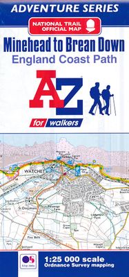
Gedetailleerde wandelkaart van een gedeelte van het England Coast Path.   The A-Z Adventure Series of maps combines the best of OS and A-Z, creating the perfect companion for walkers, off-road cyclists, horse riders and anyone wishing to explore the great outdoors.   This official* Minehead to Brean Down Adventure Map covers a 58 mile (93km) secti...

Verkopers met dit product

Verkoper
Bezorging
Prijs
DeZwerver.nl logo
DeZwerver.nl
2,95
7,95

Anderen bekeken ook

Wandelatlas 3 Adventure Atlas South West Coast Path South Cornwall | A-Z Map Company
AZ heeft de meest gedetailleerde wandelkaarten van delen van het South West Coast Path  gebundeld in een atlasje. Daardoor is het heel handig qua formaat. De kaarten zelf zijn perfect voor het wandelen. Schaal 1:25.000 Plan your next adventure along the South Cornwall section of the South West Coast Path with trusted mapping from A-Z The perfect companion for those who love the great outdoors, the A-Z Adventure Series features 1:25000 Ordnance Survey mapping in a convenient book, complete with index. The South West Coast Path is a National Trail along the Somerset, Devon, Cornwall and Dorset coasts. This stunning walk from Minehead, Somerset covers 630 miles to South Haven Point in Poole Harbour, passing through two World Heritage Sites (the Jurassic Coast and the Cornwall and West Devon Mining Landscape), Exmoor National Park, Land's End and many areas of outstanding natural beauty.   A series of five A-Z Adventure Atlases together cover the South West Coast Path: South West Coast…
17,95
Wandelatlas 2 Adventure Atlas South West Coast Path North Cornwall | A-Z Map Company
AZ heeft de meest gedetailleerde wandelkaarten van delen van het South West Coast Path  gebundeld in een atlasje. Daardoor is het heel handig qua formaat. De kaarten zelf zijn perfect voor het wandelen. Schaal 1:25.000 Plan your next adventure along the North Devon & Somerset section of the South West Coast Path with trusted mapping from A-Z The perfect companion for those who love the great outdoors, the A-Z Adventure Series features 1:25000 Ordnance Survey mapping in a convenient book, complete with index. The South West Coast Path is a National Trail along the Somerset, Devon, Cornwall and Dorset coasts. This stunning walk from Minehead, Somerset covers 630 miles to South Haven Point in Poole Harbour, passing through two World Heritage Sites (the Jurassic Coast and the Cornwall and West Devon Mining Landscape), Exmoor National Park, Land's End and many areas of outstanding natural beauty.   This guide to the North Devon and Somerset section features 36 pages of continuous Ordnan…
17,95
Wandelatlas 1 Adventure Atlas South West Coast Path North Devon & Somerset | A-Z Map Company
AZ heeft de meest gedetailleerde wandelkaarten van delen van het South West Coast Path  gebundeld in een atlasje. Daardoor is het heel handig qua formaat. De kaarten zelf zijn perfect voor het wandelen. Schaal 1:25.000 Plan your next adventure along the North Devon & Somerset section of the South West Coast Path with trusted mapping from A-Z The perfect companion for those who love the great outdoors, the A-Z Adventure Series features 1:25000 Ordnance Survey mapping in a convenient book, complete with index. The South West Coast Path is a National Trail along the Somerset, Devon, Cornwall and Dorset coasts. This stunning walk from Minehead, Somerset covers 630 miles to South Haven Point in Poole Harbour, passing through two World Heritage Sites (the Jurassic Coast and the Cornwall and West Devon Mining Landscape), Exmoor National Park, Land's End and many areas of outstanding natural beauty.   This guide to the North Devon and Somerset section features 36 pages of continuous Ordnan…
17,95
Wandelatlas 4 Adventure Atlas South West Coast Path South Devon | A-Z Map Company
AZ heeft de meest gedetailleerde wandelkaarten van delen van het South West Coast Path  gebundeld in een atlasje. Daardoor is het heel handig qua formaat. De kaarten zelf zijn perfect voor het wandelen. Schaal 1:25.000 Plan your next adventure along the South Devon section of the South West Coast Path with trusted mapping from A-Z The perfect companion for those who love the great outdoors, the A-Z Adventure Series features 1:25000 Ordnance Survey mapping in a convenient book, complete with index. The South West Coast Path is a National Trail along the Somerset, Devon, Cornwall and Dorset coasts. This stunning walk from Minehead, Somerset covers 630 miles to South Haven Point in Poole Harbour, passing through two World Heritage Sites (the Jurassic Coast and the Cornwall and West Devon Mining Landscape), Exmoor National Park, Land's End and many areas of outstanding natural beauty.   This A-Z Adventure Atlas of the South West Coast Path: South Devon features 50 pages of continuous O…
17,95
Wandelatlas Adventure Atlas Peddars Way and Norfolk Coast Path | A-Z Map Company
The A-Z Adventure Series uses Ordnance Survey mapping and is the perfect companion for walkers, off-road cyclists, and anyone wishing to explore the great outdoors. Together, Peddars Way and the Norfolk Coast Path form a 93 mile (150km) National Trail across west Norfolk and along its northern coast. The route is clearly shown on the map and passes through a rich landscape with fantastic scenery, places of interest, and an abundance of wildlife. This National Trail Map features detailed Ordnance Survey mapping at a scale of 1:25 000, providing complete coverage of Peddars Way and the Norfolk Coast Path. There is also a route planner included to show distances between places and the amenities available making it easy to plan your adventure. Additional features include: Information Centres Hotels/B&Bs Youth Hostels Campsites (seasonal opening) Public Houses Shops Restaurants Cafes (seasonal opening) Petrol Stations Other books available in the A-Z Adventure series include: Peak…
17,95
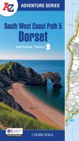
Wandelatlas 5 Adventure Atlas South West Coast Path - Dorset | A-Z Map Company
AZ heeft de meest gedetailleerde wandelkaarten van delen van het South West Coast Path  gebundeld in een atlasje. Daardoor is het heel handig qua formaat. De kaarten zelf zijn perfect voor het wandelen. Schaal 1:25.000 Plan your next adventure along the Dorset section of the South West Coast Path with trusted mapping from A-Z The perfect companion for those who love the great outdoors, the A-Z Adventure Series features 1:25000 Ordnance Survey mapping in a convenient book, complete with index. The South West Coast Path is a National Trail along the Somerset, Devon, Cornwall and Dorset coasts. This stunning walk from Minehead, Somerset covers 630 miles to South Haven Point in Poole Harbour, passing through two World Heritage Sites (the Jurassic Coast and the Cornwall and West Devon Mining Landscape), Exmoor National Park, Land's End and many areas of outstanding natural beauty.   This A-Z Adventure Atlas of the South West Coast Path: Dorset features 36 pages of continuous Ordnance Su…
17,95
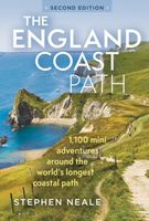
Wandelgids - Reisgids The England Coast Path | Bloomsbury
The definitive guidebook to the entire 3,000-mile length of the new England Coast Path. For anyone planning a trip to the coast or a UK summer holiday, the new England Coast Path national trail is a hugely exciting prospect, and this guidebook shows you how to make the most of every single glorious mile. Environmentalists, volunteers, campaigners, land owners and politicians all came together to create this 'ninth wonder of the world', and from the opening of the path in 2020 onwards, anyone has been able to walk and wild camp along the entire 3,000-mile length of the English coast.   It's a fantastic opportunity for all walkers, campers, fans of the coast and the outdoors. Stephen Neale has spent many happy months walking, camping and surveying the path, and from that experience has written a fantastically detailed and rich guidebook covering the route itself, along with everything from the best places to swim, hunt for fossils and eat seafood to hidden away beaches and canoeing spot…
26,50
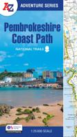
Wandelatlas Adventure Atlas Pembrokeshire Coast Path | A-Z Map Company
The A-Z Adventure Series of maps is the perfect companion for walkers, off-road cyclists, and anyone wishing to explore the great outdoors.   The Pembrokeshire Coast Path is a 186 mile (299 km) National Trail in south-west Wales. From Amroth in the south to St Dogmaels in the north and running mainly through the Pembrokeshire National Park, the route passes through some of the most scenic parts of Wales.   This official National Trail Map features detailed mapping at a scale of 1:25 000, providing complete coverage of the Pembrokeshire Coast Path. There is also a route planner included to show distances between places and the amenities available making it easy to plan your adventure. Additional features include:   Information Centres Hotels/B&Bs Youth Hostels Campsites (seasonal opening) Public Houses Shops Restaurants Cafes (seasonal opening) Petrol Stations Other walks available in the A-Z Adventure series include: Cotswold Way, Peddars Way and Norfolk Coast Path, Coast to Coast Pat…
17,95
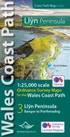
Wandelatlas Wales Coast Path Llyn Peninsula Map | Northern Eye Books
Enhanced, large scale (1: 25,000) Ordnance Survey mapping in a handy atlas format with all the mapping you need to walk a complete circuit of the Anglesey section of the Wales Coast Path.   Continuous OS mapping covering the complete route from Bangor to Porthmadog. Contains coastal extracts from large scale Explorer maps 253 and 254.   The Llyn Peninsula Ordnance Survey mapping book is part of a series of map atlases covering the whole of the 870-mile long Wales Coast Path. The enhanced OS 1:25,000 maps are accurate, up-to-date and reliable. Additional map symbols show tea shops, cafes, extra parking, and public toilets.   A brief introduction to the Llyn Peninsula includes a fascinating photo mosaic highlighting notable views, places of interest and wildlife you’ll meet along the way. There is also a section of detailed Useful Information at the back of the atlas.   Laminated flapped covers showing Wales Coast Path signs and waymarkers, route details and map symbols make these atlas…
13,95
Wegenatlas Adventure Atlas North Coast 500 | A-Z Map Company
The A-Z Adventure Series of maps is the perfect companion for walkers, off-road cyclists, and anyone wishing to explore the great outdoors.   The scenic North Coast 500 is one of the most popular routes in Scotland and journeying along it makes for an incredible adventure. The 516 mile (830 km) route passes through picturesque landscapes and abundant wildlife, linking a wide range of tourist destinations in the Highlands.   This A-Z North Coast 500 Adventure Atlas features more than 90 pages of continuous 1:50 000 mapping, providing detailed coverage of the entire route. A route planner showing distances between places and the amenities available is also included, along with the locations of:   Campsites (seasonal opening) Information Centres Hotels/B&Bs Youth Hostels Pubs, Restaurants and Cafes Shops Petrol Stations Now with NEW electric charge point data from Zapmap! Other walks available in the A-Z Adventure series include: Cotswold Way, Peddars Way and Norfolk Coast Path, Coast to…
13,95

Klanten-reviews van Wandelatlas Adventure Atlas Minehead to Brean Down - England Coast Path | A-Z Map Company

Er zijn nog geen beoordelingen voor dit productBen jij de eerste die een review plaatst?

Meer over Wandelatlas Adventure Atlas Minehead to Brean Down - England Coast Path | A-Z Map Company

Productomschrijving

Gedetailleerde wandelkaart van een gedeelte van het England Coast Path.   The A-Z Adventure Series of maps combines the best of OS and A-Z, creating the perfect companion for walkers, off-road cyclists, horse riders and anyone wishing to explore the great outdoors.   This official* Minehead to Brean Down Adventure Map covers a 58 mile (93km) section of the England Coast Path, a new National Trail around England's coast. More than just a path, it represents a new right of way that gives everyone the legal right to explore the coast for the very first time. Opening in sections, the England Coast Path is scheduled to complete in 2020.   The path along the Somerset coastline has marvellous seaward and inland views with access to sandy beaches and shores rich with geology. Salt marshes, sand dunes and mudflats provide a vital habitat for wildlife, especially birds. A number of seaside towns along the way provide the opportunity for refreshment.   This self-covered sheet map is double sided with Ordnance Survey Explorer** mapping showing the new coastal access verge. The path is clearly highlighted in yellow with mileage markers to gauge distances when planning sections of the walk to enjoy. The map folds down to a handy DL size.   A useful gradient profile for the section of path is included along with a selection of QR codes linked to useful websites, including temporary route updates from the National Trails, travel information and weather reports.

Verken gerelateerde categorieën

Webshop.nl maakt gebruik van cookies. Ga je verder op onze website, ga dan akkoord met het plaatsen van cookies en de verwerking van deze data door ons en vermelde partners.