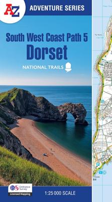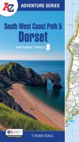
Wandelatlas 5 Adventure Atlas South West Coast Path - Dorset | A-Z Map Company

0
AZ heeft de meest gedetailleerde wandelkaarten van delen van het South West Coast Path  gebundeld in een atlasje. Daardoor is het heel handig qua formaat. De kaarten zelf zijn perfect voor het wandelen. Schaal 1:25.000 Plan your next adventure along the Dorset section of the South West Coast Path with trusted mapping from A-Z The perfect companio...

Verkopers met dit product

Verkoper
Bezorging
Prijs
DeZwerver.nl logo
DeZwerver.nl
2,95
17,95

Anderen bekeken ook

Wandelatlas 3 Adventure Atlas South West Coast Path South Cornwall | A-Z Map Company
AZ heeft de meest gedetailleerde wandelkaarten van delen van het South West Coast Path  gebundeld in een atlasje. Daardoor is het heel handig qua formaat. De kaarten zelf zijn perfect voor het wandelen. Schaal 1:25.000 Plan your next adventure along the South Cornwall section of the South West Coast Path with trusted mapping from A-Z The perfect companion for those who love the great outdoors, the A-Z Adventure Series features 1:25000 Ordnance Survey mapping in a convenient book, complete with index. The South West Coast Path is a National Trail along the Somerset, Devon, Cornwall and Dorset coasts. This stunning walk from Minehead, Somerset covers 630 miles to South Haven Point in Poole Harbour, passing through two World Heritage Sites (the Jurassic Coast and the Cornwall and West Devon Mining Landscape), Exmoor National Park, Land's End and many areas of outstanding natural beauty.   A series of five A-Z Adventure Atlases together cover the South West Coast Path: South West Coast…
17,95
Wandelatlas 4 Adventure Atlas South West Coast Path South Devon | A-Z Map Company
AZ heeft de meest gedetailleerde wandelkaarten van delen van het South West Coast Path  gebundeld in een atlasje. Daardoor is het heel handig qua formaat. De kaarten zelf zijn perfect voor het wandelen. Schaal 1:25.000 Plan your next adventure along the South Devon section of the South West Coast Path with trusted mapping from A-Z The perfect companion for those who love the great outdoors, the A-Z Adventure Series features 1:25000 Ordnance Survey mapping in a convenient book, complete with index. The South West Coast Path is a National Trail along the Somerset, Devon, Cornwall and Dorset coasts. This stunning walk from Minehead, Somerset covers 630 miles to South Haven Point in Poole Harbour, passing through two World Heritage Sites (the Jurassic Coast and the Cornwall and West Devon Mining Landscape), Exmoor National Park, Land's End and many areas of outstanding natural beauty.   This A-Z Adventure Atlas of the South West Coast Path: South Devon features 50 pages of continuous O…
17,95
Wandelatlas 2 Adventure Atlas South West Coast Path North Cornwall | A-Z Map Company
AZ heeft de meest gedetailleerde wandelkaarten van delen van het South West Coast Path  gebundeld in een atlasje. Daardoor is het heel handig qua formaat. De kaarten zelf zijn perfect voor het wandelen. Schaal 1:25.000 Plan your next adventure along the North Devon & Somerset section of the South West Coast Path with trusted mapping from A-Z The perfect companion for those who love the great outdoors, the A-Z Adventure Series features 1:25000 Ordnance Survey mapping in a convenient book, complete with index. The South West Coast Path is a National Trail along the Somerset, Devon, Cornwall and Dorset coasts. This stunning walk from Minehead, Somerset covers 630 miles to South Haven Point in Poole Harbour, passing through two World Heritage Sites (the Jurassic Coast and the Cornwall and West Devon Mining Landscape), Exmoor National Park, Land's End and many areas of outstanding natural beauty.   This guide to the North Devon and Somerset section features 36 pages of continuous Ordnan…
17,95
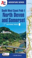
Wandelatlas 1 Adventure Atlas South West Coast Path North Devon & Somerset | A-Z Map Company
AZ heeft de meest gedetailleerde wandelkaarten van delen van het South West Coast Path  gebundeld in een atlasje. Daardoor is het heel handig qua formaat. De kaarten zelf zijn perfect voor het wandelen. Schaal 1:25.000 Plan your next adventure along the North Devon & Somerset section of the South West Coast Path with trusted mapping from A-Z The perfect companion for those who love the great outdoors, the A-Z Adventure Series features 1:25000 Ordnance Survey mapping in a convenient book, complete with index. The South West Coast Path is a National Trail along the Somerset, Devon, Cornwall and Dorset coasts. This stunning walk from Minehead, Somerset covers 630 miles to South Haven Point in Poole Harbour, passing through two World Heritage Sites (the Jurassic Coast and the Cornwall and West Devon Mining Landscape), Exmoor National Park, Land's End and many areas of outstanding natural beauty.   This guide to the North Devon and Somerset section features 36 pages of continuous Ordnan…
17,95
Reisgids The South West Coast Path | Bloomsbury
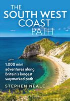
Often featuring in lists of the world's best walks, the South West Coast Path is 630 miles long, and passes through two World Heritage Sites. This guide to the path is a modern take on the traditional (turn right at the stile, and follow the footpath to the bridge) guidebook: instead of telling readers where to go step by step, Stephen gives fantastic ideas for what to do as they travel along the path. There are so many amazing adventures and places to visit (some 'secret' and some well known) and this guide highlights 1,000 of them, all situated along the route.   After an Introduction giving a history of the path and the stories of the people who made it (Why is this path the most popular National Trail? Why is it so closely associated with tales of King Arthur? When is the best time to visit?) the bulk of the book focuses on all the amazing things you can do along the path itself. It is divided into regions, with over 70 adventures/highlights per region: West Somerset, North Devon,…
27,95
Wandelgids South West Coast Path | Rother Bergverlag
Rother Wandelgids – South West Coast Path: Zuidwestkust Engeland 46 etappes langs de spectaculaire kliffen en baaien van Somerset, Devon, Cornwall en Dorset De South West Coast Path (SWCP) is de langste nationale wandelroute van Engeland en een droom voor elke kustwandelaar. Deze Rother Wandelgids beschrijft de hele route van Minehead tot Poole Harbour in 46 etappes – goed voor ruim 1.000 kilometer langs de ruige zuidwestkust van Engeland. De route slingert door vier graafschappen: Somerset, Devon, Cornwall en Dorset. Je wandelt langs steile kliffen, verlaten stranden, historische vissersdorpen, oude kastelen en vuurtorens – een prachtig mozaïek van natuur, cultuur en zeezicht. Onderweg passeer je beroemde plekken uit de boeken van Agatha Christie en Rosamunde Pilcher, en met wat geluk zie je dolfijnen, zeehonden of zelfs walvissen. ✅ Voordelen Volledige beschrijving van het South West Coast Path 46 etappes met route-informatie, overnachtingsopties en bezienswaardigheden – ideaal vo…
20,95
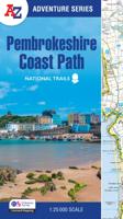
Wandelatlas Adventure Atlas Pembrokeshire Coast Path | A-Z Map Company
The A-Z Adventure Series of maps is the perfect companion for walkers, off-road cyclists, and anyone wishing to explore the great outdoors.   The Pembrokeshire Coast Path is a 186 mile (299 km) National Trail in south-west Wales. From Amroth in the south to St Dogmaels in the north and running mainly through the Pembrokeshire National Park, the route passes through some of the most scenic parts of Wales.   This official National Trail Map features detailed mapping at a scale of 1:25 000, providing complete coverage of the Pembrokeshire Coast Path. There is also a route planner included to show distances between places and the amenities available making it easy to plan your adventure. Additional features include:   Information Centres Hotels/B&Bs Youth Hostels Campsites (seasonal opening) Public Houses Shops Restaurants Cafes (seasonal opening) Petrol Stations Other walks available in the A-Z Adventure series include: Cotswold Way, Peddars Way and Norfolk Coast Path, Coast to Coast Pat…
17,95
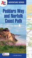
Wandelatlas Adventure Atlas Peddars Way and Norfolk Coast Path | A-Z Map Company
The A-Z Adventure Series uses Ordnance Survey mapping and is the perfect companion for walkers, off-road cyclists, and anyone wishing to explore the great outdoors. Together, Peddars Way and the Norfolk Coast Path form a 93 mile (150km) National Trail across west Norfolk and along its northern coast. The route is clearly shown on the map and passes through a rich landscape with fantastic scenery, places of interest, and an abundance of wildlife. This National Trail Map features detailed Ordnance Survey mapping at a scale of 1:25 000, providing complete coverage of Peddars Way and the Norfolk Coast Path. There is also a route planner included to show distances between places and the amenities available making it easy to plan your adventure. Additional features include: Information Centres Hotels/B&Bs Youth Hostels Campsites (seasonal opening) Public Houses Shops Restaurants Cafes (seasonal opening) Petrol Stations Other books available in the A-Z Adventure series include: Peak…
17,95
Wandelkaart 1 South West Coast Path 1 | Harvey Maps
Een bijzonder handige kaart voor een deel van dit lange-afstands-wandelpad (Minehead tot St Ives) van het in totaal maar liefst 1014 km lange South West Coast Path. Op waterafstotend papier met veel details, uitstekend en voldoende voor dit deel van de route. De totale route bestaat uit 3 kaarten.  Ideal map for walkers on Britiain's longest and one of its most popular National Trails. It runs along the coast of Somerset, Cornwall, Devon, and Dorset from Minehead round via Land's End to Poole. It includes all 95 miles of the World Heritage site known as the Jurassic Coast. 3 HARVEY maps will cover the whole 630-mile route. Each map covers a section of the Path suitable for 16 days of walking. Map 1 covers the Path from the start at Minehead to St Ives   This map is bio-degradable   Information on finding accommodation, camping, food. Directions to the start. Also Ranger Service contact numbers and enlargements of towns/villages showing facilities available and tips on weather and clot…
25,95
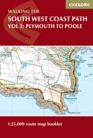
Wandelatlas South West Coast Path Map Booklet - Vol 3 | Cicerone
This booklet of Ordnance Survey 1:25,000 Explorer maps shows the full line of the section of the National Trail between Plymouth and Poole, providing all the mapping you need to walk the trail in either direction. It is conveniently sized for slipping into a jacket pocket or top of a rucksack. Two separate booklets cover the route from Minehead to St Ives and from St Ives to Plymouth.   The map booklets accompany the Cicerone guidebook - The South West Coast Path - which describes the full National Trail in 45 stages, with lots of other practical information and local points of interest. The South West Coast Path is Britain's longest National Trail, stretching some 630 miles (1014km) between Minehead in Somerset and Poole in Dorset.  
17,95

Klanten-reviews van Wandelatlas 5 Adventure Atlas South West Coast Path - Dorset | A-Z Map Company

Er zijn nog geen beoordelingen voor dit productBen jij de eerste die een review plaatst?

Meer over Wandelatlas 5 Adventure Atlas South West Coast Path - Dorset | A-Z Map Company

Productomschrijving

AZ heeft de meest gedetailleerde wandelkaarten van delen van het South West Coast Path  gebundeld in een atlasje. Daardoor is het heel handig qua formaat. De kaarten zelf zijn perfect voor het wandelen. Schaal 1:25.000

Plan your next adventure along the Dorset section of the South West Coast Path with trusted mapping from A-Z The perfect companion for those who love the great outdoors, the A-Z Adventure Series features 1:25000 Ordnance Survey mapping in a convenient book, complete with index. The South West Coast Path is a National Trail along the Somerset, Devon, Cornwall and Dorset coasts. This stunning walk from Minehead, Somerset covers 630 miles to South Haven Point in Poole Harbour, passing through two World Heritage Sites (the Jurassic Coast and the Cornwall and West Devon Mining Landscape), Exmoor National Park, Land's End and many areas of outstanding natural beauty.   This A-Z Adventure Atlas of the South West Coast Path: Dorset features 36 pages of continuous Ordnance Survey mapping covering the South West Coast Path from Lyme Regis, following the route east, to its finishing point at South Haven Point in Poole Harbour. This atlas includes a route planner providing the distances between places and the amenities available, featuring: Information CentresVisitor CentresHotels/B&BsYouth HostelsCampsites (seasonal opening)Public HousesShopsRestaurantsCafes (seasonal opening)Petrol stations A series of five A-Z Adventure Atlases together cover the South West Coast Path: •South West Coast Path: North Devon and Somerset •South West Coast Path: North Cornwall •South West Coast Path: South Cornwall •South West Coast Path: South Devon •South West Coast Path: Dorset Other National Trails available within the A-Z Adventure Series include: Peak District (Dark Peak), Cotswold Way, Peddars Way and Norfolk Coast Path, Pembrokeshire Coast Path, North Coast 500 and South Downs Way.


Verken gerelateerde categorieën

Webshop.nl maakt gebruik van cookies. Ga je verder op onze website, ga dan akkoord met het plaatsen van cookies en de verwerking van deze data door ons en vermelde partners.