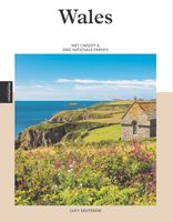
Wales (Paperback)

0
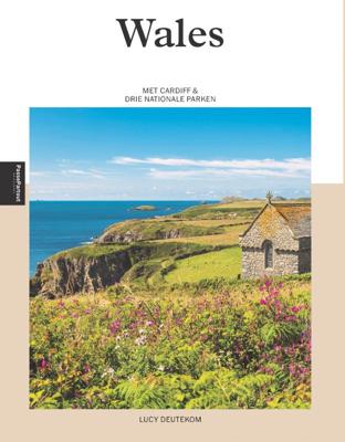
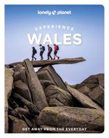
Wie Wales zegt, zegt schitterende natuur, vriendelijke mensen en een rijke Keltische geschiedenis. Het land in het Verenigd Koninkrijk telt maar liefst drie nationale parken: het berggebied Snowdonia, de Brecon Beacons en de kustlijn van Pembrokeshire. Hoofdstad Cardiff is een verrassend gezellige stad die bruist van de cultuur, sportevenementen en...

Verkopers met dit product

Verkoper
Bezorging
Prijs

Anderen bekeken ook

Reisgids PassePartout Wales | Edicola
Wie Wales zegt, zegt schitterende natuur, vriendelijke mensen en een rijke Keltische geschiedenis.    Het land in het Verenigd Koninkrijk telt maar liefst drie nationale parken: het berggebied Snowdonia, de Brecon Beacons en de kustlijn van Pembrokeshire. Hoofdstad Cardiff is een verrassend gezellige stad die bruist van de cultuur, sportevenementen en gastro-pubs. De Welsh zijn een eigenzinnig volk dat trots is op hun eigen taal en tradities. Het land leent zich uitstekend voor natuurwandelingen en valt goed te bereizen met zowel auto als openbaar vervoer. In een vakantie zijn de charmante kustdorpjes gemakkelijk te combineren met het bergachtige binnenland.  Een uitnodigende gids voor een prachtig verblijf in een betoverende omgeving
24,50
Nieuw
Wegenkaart - landkaart Planning Map Wales | Lonely Planet
🗺️ Lonely Planet Wales Planning Map – Watervaste reiskaart van Wales Plan je ideale rondreis door Wales met deze duurzame, watervaste en opvouwbare kaart van Lonely Planet. Van de ruige bergen van Snowdonia tot de puffins op Skomer Island – met deze overzichtelijke kaart navigeer je moeiteloos door het hart van Wales. 🧭 Wat vind je op deze kaart? Volledige kleurenkaart in een gemakkelijk opvouwbaar, waterbestendig formaat Alfanumeriek raster om bezienswaardigheden snel terug te vinden Reisplanner met reistijden – handig voor het uitstippelen van routes Topaanraders: kastelen, natuurparken, stranden, bergen, pubs en erfgoed Reistips en informatie over evenementen, vervoer en basis-Welshe woorden 🗺️ Gebieden op de kaart Cardiff, Brecon Beacons, Snowdonia, Pembrokeshire, Gower Peninsula, Anglesey, Aberystwyth en meer ✅ Voordelen Water- en scheurvast – perfect voor gebruik onderweg Compact en licht – past in je dagrugzak of jaszak ⚠️ Aandachtspunten …
10,95
Reisgids Wales | Rough Guides
Zeer goede reisgids voor zowel de georganiseerde maar vooral voor de zelfstandige reiziger. Boordevol informatie over reizen, slapen, eten, maar ook musea en cultuur. Voor Europese landen - zeker de Engelse deelgebieden - meestal completer en beter dan de Lonely Planet ! This Wales guidebook is perfect for independent travellers planning a longer trip. It features all of the must-see sights and a wide range of off-the-beaten-track places. It also provides detailed practical information on preparing for a trip and what to do on the ground. And this Wales travel guidebook is printed on paper from responsible sources, and verified to meet the FSC's strict environmental and social standards.   This Wales guidebook covers: Cardiff and southeast Wales, Southwest Wales, The Brecon Beacons and Powys, The Cambrian coast, The Dee Valley and around, Snowdonia and the Llyn, The north coast and Anglesey.   Inside this Wales travel book, you'll find:   - A wide range of sights - Rough Guides…
25,95
Reisgids South Wales - Zuid Wales | Bradt Travel Guides
Voor vele landen net zo goed, zo niet beter dan de Planet. Beduidend soberder uitgevoerd, maar ook met veel informatie voor backpackers en met veel kaartmateriaal. Een aanrader! This new Bradt guidebook is the first solely dedicated to a specific part of Wales, encompassing the country's southern third. Covering Monmouthshire, Glamorgan, Carmarthenshire, Pembrokeshire and Brecon Beacons National Park, this guide provides in-depth coverage of a broad range of attractions. Catering for walkers, heritage aficionados, wildlife lovers, families, mountain bikers, foodies and city-lovers, it furnishes all the practical information you need to plan and enjoy time in South Wales.The region boasts 400 miles of coastline, along which some of Britain's finest beaches nestle between comely resorts and traditional fishing villages, including in the dramatic Pembrokeshire Coast National Park. Inland, The Valleys encompass a former powerhouse of the British coal-mining industry where abandoned collie…
22,50
Wandelgids Wales | Uitgeverij Elmar
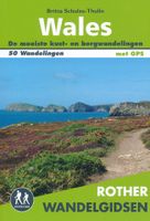
De Rother wandelgids Wales beschrijft de 50 mooiste kust- en bergwandelingen in het westen van het Verenigd Koninkrijk - van Pembrokeshire tot Anglesey, van de Ierse Zee tot de grens met Engeland, in de bergachtige regio's, het binnenland en langs de kust.   * Betrouwbare routebeschrijvingen * Gedetailleerde wandelkaarten * Informatieve hoogteprofielen * Downloadbare GPS Tracks   Aanbevolen wandelkaarten bij deze gids:   The Gower + directe omgeving Wandelkaart - Topografische kaart 164 Explorer Gower, Gwyr | Ordnance Survey 1:25.000 Wandelkaart - Topografische kaart 178 Explorer Llanelli, Ammanford, Rhydaman | Ordnance Survey 1:25.000   Pembrokeshire Wandelkaart - Topografische kaart OL35 Explorer Pembrokeshire North - Gogledd Sir Benfro | Ordnance Survey 1:25.000 Wandelkaart - Topografische kaart OL36 Explorer South Pembrokeshire - De Sir Benfro | Ordnance Survey 1:25.000 Wandelkaart - Topografische kaart 198 Explorer Cardigan, New Quay | Ordnance Survey 1:25.000 Wandelkaart - Topog…
19,99
Wegenatlas Wales road atlas | A-Z Map Company
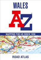
Handige wegenatlas op A5 formaat, makkelijk te gebruiken met grote letters en heel goed leesbaar. De schaal is behoorlijk gedetaileerd en zeker ook voor fietsers goed te gebruiken. Met veel aanduidingen van toeristisch interessante plekken. Full-colour road atlas of Wales, with extended coverage into England and including all the major routes into the country. The detailed road mapping also includes Liverpool, Warrington, Nantwich, Shrewsbury, Hereford, Bristol and Severn River Crossings.   Published at a clear 2.5 miles to 1 inch the following features are shown on the road mapping:   Motorways open with full junction detail, motorways under construction and proposed, motorway service areas, primary routes and destinations, A and B roads, selected minor roads, gradients 1:5 and steeper, tolls, mileages, national and county boundaries, spot heights and hill shading Selected places of interest, tourist information centres and golf courses National Park boundaries for Snowdonia, …
11,95
Wegenatlas Wales Navigator | A4 | Ringband | Philip's Maps
Ideaal voor fietsers! Explore the many attractions of Wales with this easy-to-use road atlas showing all the top spots. Easy-to-read mapping, superb extra detail, and a great lie-flat format make this the ultimate Welsh road trip companion. – Unrivalled level of detail from motorways to country lanes. – Exceptional clarity at a scale of 1.6 miles to 1 inch (1:100,000). – Ideal for explorers: heritage sites, spectacular sights, and the best walks around Snowdonia, the Brecon Beacons, the Pembrokeshire Coast and more. – Tourist attractions and places of interest clearly highlighted, from Caernarfon Castle to St David’s Cathedral. – Indexed town plans for all major centres, including Aberystwyth, Bangor, Cardiff, Holyhead, Llandudno, Llanelli, Merthyr Tydfil, Newport, Newtown, Swansea, and Wrexham. – Packed with hundreds of individually named farms, houses, and hamlets, alongside airports, airfields, stations, ferries, canals, and harbours. – Key to map symbols are clearly indexed and sh…
14,95
Campergids 85 Entdeckertouren mit dem Wohnmobil - Wales | WOMO verlag
Bijzonder nuttige camperreisgids van een bepaald land of streek. Deze Duitstalige campergids beschrijft aan de hand van een aantal routes de mooiste gebieden. Naast een beschrijving van de routes zelf biedt de gids handige tips voor het reizen met de camper en een groot aantal officiële en niet-officiële standplaatsen. Deze camperplaatsen worden met GPS coordinaten duidelijk weergeven en zijn daardoor goed te vinden. Handige reisgids voor de Camper. Aan de hand van 10 routes worden camperplaatsen in Wales beschreven met o.a. camper vriendelijke plekken en beschrijvingen van allerlei bezienswaardigheden. TourenkartenRund 2800 km in 10 Touren zu allen großen Attraktionen und weniger bekannten Tipps. Genaue Markierung vieler freier Stell-, Bade-, Picknick-, Wander- und Campingplätze incl. Ausstattung. Einzeichnung von Museen, Burgen, Herrenhäusern, Kirchen, neolithischen Anlagen usw. Natur erleben, wandernWandern in den schroffen Bergmassiven Snowdonias, den lieblichen Hügeln der Brecon…
27,50
Wandelkaart Cumbria Way South XT40 | Harvey Maps
The first dedicated maps for "The Mountain Connoisseur's Walk"   The Cambrian Way is a challenging mountain trail that runs from Cardiff Castle in South Wales to Conwy Castle in North Wales.   This map is Cambrian Way South - it covers the route from Cardiff to Devil's Bridge.   The entire route is 479km (298 miles) long and has nearly 24,000 metres of elevation - the route goes over many of Wales' major mountains and takes in some of the country's finest scenery, traversing both Bannau Brycheiniog (Brecon Beacons) and Eryri (Snowdonia) National Parks.   The route takes approximately 3 weeks to walk and is covered on 2 separate waterproof maps - Cambrian Way South (Cardiff to Devil's Bridge) and Cambrian Way North (Devil's bridge to Conwy).   As this is often a remote route, a map and compass are essential for the long, un-waymarked stretches of exposed and unspoiled wilderness. If you like peace and quiet then this is the walk for you!   Tough, light, durable and 100% waterproof In…
29,95
Nieuw
Wandelgids The Cambrian Way | Cicerone
Uitstekende wandelgids van de Cambrian Way, waarbij naast alle noodzakelijke informatie ook gebruik gemaakt wordt van de echte topografische kaart.  Dubbed 'the mountain connoisseurs' walk', the Cambrian Way stretches 479km between the mighty castles of Cardiff in the south and Conwy on the north coast. Traversing the heartland of Wales, the challenging route crosses the Brecon Beacons, the Cambrian Mountains and Snowdonia, passing through two national parks and visiting many of the country's iconic summits, including Pen y Fan, Pumlumon, Cadair Idris and Snowdon itself. It can be walked in three weeks (or in shorter sections) and is suitable for experienced hillwalkers with sound navigational skills.   The guide presents the route in 21 stages, offering comprehensive route description illustrated with OS 1:50,000 mapping and elevation profiles. Details of accommodation and facilities are provided, along with a helpful trek planner showing their distribution along the route: although …
20,95

Klanten-reviews van Wales (Paperback)

Er zijn nog geen beoordelingen voor dit productBen jij de eerste die een review plaatst?

Meer over Wales (Paperback)

Productomschrijving

Wie Wales zegt, zegt schitterende natuur, vriendelijke mensen en een rijke Keltische geschiedenis. Het land in het Verenigd Koninkrijk telt maar liefst drie nationale parken: het berggebied Snowdonia, de Brecon Beacons en de kustlijn van Pembrokeshire. Hoofdstad Cardiff is een verrassend gezellige stad die bruist van de cultuur, sportevenementen en gastro-pubs. De Welsh zijn een eigenzinnig volk dat trots is op hun eigen taal en tradities. Het land leent zich uitstekend voor natuurwandelingen en valt goed te bereizen met zowel auto als openbaar vervoer. In een vakantie zijn de charmante kustdorpjes gemakkelijk te combineren met het bergachtige binnenland. Een uitnodigende gids voor een prachtig verblijf in een betoverende omgeving

Verken gerelateerde categorieën

Webshop.nl maakt gebruik van cookies. Ga je verder op onze website, ga dan akkoord met het plaatsen van cookies en de verwerking van deze data door ons en vermelde partners.