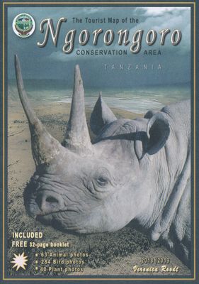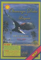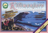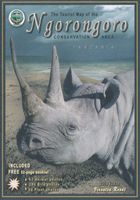
Tourist map of the Ngorongoro conservation area Tanzania | Veronica Roodt

0
Zeer bijzondere landkaart van Ngorongoro conservation area in Tanzania. Uitermate handig zijn de GPS coördinaten van de meest belangrijke punten als campings of uitzichtspunten. De kaart is gebaseerd op een luchtfoto, waarbij alle details zijn ingetekend. The cartographic design displays the information of the Tourist Map of the Ngorongoro Conser...

Verkopers met dit product

Verkoper
Bezorging
Prijs
DeZwerver.nl logo
DeZwerver.nl
2,95
17,50

Anderen bekeken ook

Natuurgids - Reisgids Ngorongoro | Shell
  Description: Veronica Roodt’s travel and field guide is made for tourists seeking for nature impressions. The first section is a travel guide with the usual travelling information on routes, accommodation, road conditions, ideal season to visit and climate. Also, it includes detailed maps and information on the topography, geology, archaeology, history and people of Tanzania’s famous conservation area.   The second section is a field guide and provides information and photographs of over 500 plants, animals, birds, reptiles, amphibians and insects. Further on contact details for hotels and lodges in the general area and safari companies operating from Arusha are provided at the back of the book.   Maps included:   Ngorongoro Conservation Area Arusha Africa, simplified overview Tanzania, to show position of the NCA Serengeti Ecosystem Topography of the NCA Walking trails Ngorongoro Crater Olmoti Crater Embulbul Depression, Losirua & Lolmalasin Empakaai Crater Oldoinyo Lengai, Kerimas…
22,50
Reisgids Northern Tanzania Safari guide - Noord Tanzania | Bradt Travel Guides
The Bradt safari guide with Kilimanjaro & Zanzibar. Perfecte gids voor alle safari-gangers in dit waanzinnige land: Ngorogoro, Serengeti, maar ook Tangarire en onbekende vulkanen. Zeer compleet met meer informatie dan de Lonely Planet. This new, thoroughly updated fifth edition of Bradt's Northern Tanzania Safari Guide remains the only full-length guidebook focussed exclusively on the country's north and on Zanzibar. Reflecting tourism's shift away from backpackers and budget camping safaris to upper-end and mid-range safaris and beach holidays, it is tailored closely to the requirements of anyone going on a safari to northern Tanzania, followed by a few days on Zanzibar. Northern Tanzania is dominated by Africa's finest safari circuit, offering spectacular game-viewing year round.   Centred on the legendary Serengeti National Park and its world-famous wildebeest migration, this circuit also incorporates the Ngorongoro Crater and surrounding Ngorongoro Conservation Area, Lake Manya…
26,50
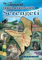
Reisgids The tourist travel and field guide of the Serengeti National Park | Veronica Roodt
Veronica Roodt’s travel and field guide is consequently designed for nature loving tourists. The first section consists of a travel guide with information on how to get there, where to stay, road conditions, best season to visit and climate. It also includes detailed maps and background information on the history, people, topography, geology and archaeology. The second part is a field guide that includes check lists and over 500 photographs of the plants, mammals, birds, reptiles and amphibians one is most likely to see. Read about the nutritional value and medicinal uses of plants, habitat preferences of large mammals as well as interesting animal and bird behaviour. Maps included: Road map of the Serengeti National Park Map of Africa Map of Tanzania The Serengeti Ecosystem Acess to the SNP Topographical map Lobo Area Western Corridor / Kirawira Seronera Area Seronera Camping Sites Short Grass Plains Gol Kopjes Lake Magadi Moru Kopjes Lake Ndutu Lake Ndutu camp sites
27,50
Vogelgids Birds of Serengeti & Ngorongoro Conservation Area | Struik Nature
Offers a visually stunning exploration of over 300 bird species in Tanzania's Serengeti and Ngorongoro Conservation Area. Discover the diverse birdlife of Tanzania's Serengeti National Park and Ngorongoro Conservation Area with this visually stunning guide. More than 300 commonly seen bird species are described in concise, engaging prose, highlighting their main characteristics. The text is accompanied by excellent full-colour photographs. Viewing notes, including tips about where and when birds are best observed, are given throughout. For ease of use, the book is categorized into six sections: ground-dwelling, bush and woodland, nocturnal, waterbirds, birds of prey, and birds of the air. A brief introduction presents the key features of each wildlife sanctuary and the habitats that shelter the birds. The Serengeti and Ngorongoro Conservation Area, a UNESCO World Heritage site, are two of the world's most popular safari destinations, renowned for the annual migration of over 1.5 mi…
15,50
Reisgids Tanzania & Zanzibar | Rough Guides
Zeer goede reisgids voor zowel de georganiseerde maar vooral voor de zelfstandige reiziger. Boordevol informatie over reizen, slapen, eten, maar ook musea en cultuur. Voor veel landen meestal completer en beter dan de Lonely Planet ! This Tanzania & Zanzibar guidebook is perfect for independent travellers planning a longer trip. It features all of the must-see sights and a wide range of off-the-beaten-track places. It also provides detailed practical information on preparing for a trip and what to do on the ground. And this Tanzania & Zanzibar travel guidebook is printed on paper from responsible sources, and verified to meet the FSC's strict environmental and social standards.   This Tanzania & Zanzibar guidebook covers: Dar es Salaam, The north coast, The south coast, Central Tanzania, The northern highlands, Arusha and around, The northern Safari Circuit, Lake Victoria and northwestern Tanzania, Lake Tanganyika and western Tanzania, Southern Tanzania, Zanzibar.   Inside this Tanzan…
25,95
Natuurgids Wildlife of Serengeti & Ngorongoro Conservation Area | Struik Nature
Highlights over 60 mammal species, 50 birds, 30 reptiles, and more in Tanzania's Serengeti and Ngorongoro, offering stunning photos and insightful profiles. This vibrant, informative guide showcases the diverse wildlife of Tanzania's Serengeti National Park and Ngorongoro Conservation Area. It profiles over 60 mammal species - from the wildebeest that migrate in vast herds to the big cats that lie in wait, as well as smaller species such as caracals, genets and bats. It also features 50 of the more common and charismatic bird species, 30 reptile and amphibian species, 10 iconic trees and a range of interesting insects. Stunning full-colour photos capture the essence of this popular game-viewing and birdwatching destination: the action-packed river crossings, evocative landscapes and African creatures great and small. This book is both a useful guide in the field and a valuable memento. The Serengeti and Ngorongoro Conservation Area, a UNESCO World Heritage site, are two of the worl…
15,50
Wandelkaart - Topografische kaart 44 OS Explorer Map | Active Torquay / Dawlish / Newton Abbot area | Ordnance Survey
Met zijn 4cm voor 1 km (2 ½ cm voor 1 mijl) schaal, is de OS Explorer kaartenserie de ideale en meest gedetailleerde kaartenreeks voor mensen die graag outdoor-activiteiten zoals fietsen, wandelen, paardrijden, klimmen en watersporten.   Deze kaart is nog gedetailleerder dan de 'gewone' Landranger maps. Voor- en achterzijde bedrukt! Zeker op de moors en andere natuurgebieden van onschatbare waarden met echt alle aspecten van het landschap op de kaart ingetekend. Zeer goede detailkaart met topografische ondergrond. Hierop zijn toeristische symbolen van bezienswaardigheden ingetekend, daarnaast staan bijvoorbeeld campings en jeugdherbergen vermeld en - voor wandelaars het belangrijkst - alle right of way paden en Lange afstands Wandelpaden zijn er op te vinden. De ideale kaart voor het wandelen in Engeland, Wales of Schotland.   Ingetekende Langeafstandswandelroute South west coast Path Map sheet OL 44 Map is the perfect map for exploring the Eastern edge of Dartmoor national park and t…
25,95
Reisgids Tanzania safari guide | Bradt Travel Guides
Zeer goede gids voor Tanzania en betrouwbaar alternatief voor de Lonely Planet. Zo mogelijk nog completer! Zelfde soort informatie als de Lonely Planet: vol met praktische feiten en achtergronden. This new, thoroughly updated ninth edition of Bradt's Tanzania Safari Guide remains the only practical guidebook to the country that reflects tourism's shift away from backpackers and budget camping safaris to upper-end and mid-range safaris and beach holidays. Unlike other guidebooks, the main focus is practical information about Tanzania's peerless collection of national parks, game reserves and other safari destinations, including the Serengeti, Ngorongoro Crater, Tarangire, Ruaha, Katavi, Gombe Stream, Mahale Mountains, and four new national parks designated in 2019, including Nyerere, which encompasses much of the former Selous Game Reserve and is thought Africa's largest National Park. Every major reserve is given a dedicated chapter detailing its ecology, wildlife, accommodation opt…
27,95
Wandelkaart - Topografische kaart 8 OS Explorer Map | Active Chichester South Harting area | Ordnance Survey
Explore the South Downs National Park, follow the South Downs Way up to the picturesque village of South Harting sheltered beneath Harting Down. Discover Chichester Harbour with its delightful fishing villages or range further afield to Selsey at the tip of the Manhood Peninsula.    Seek unspoiled coastlines and countryside on Hayling Island, where windsurfing was invented  Marvel at Chichester’s intact Roman walls and cathedral tower now home to a family of peregrine falcons  Walk or cycle the South Downs Way through gorgeous countryside past South Harting, or explore Chichester Harbour on the Sussex Border Path and Shipwrights Way    Met zijn 4cm voor 1 km (2 ½ cm voor 1 mijl) schaal, is de OS Explorer kaartenserie de ideale en meest gedetailleerde kaartenreeks voor mensen die graag outdoor-activiteiten zoals fietsen, wandelen, paardrijden, klimmen en watersporten.   Deze kaart is nog gedetailleerder dan de 'gewone' Landranger maps. Voor- en achterzijde bedrukt! Zeker op de moors en…
25,95
Wandelkaart - Topografische kaart 5 OS Explorer Map | Active The English Lakes - North Eastern area | Ordnance Survey
Geplastificeerde versie   Met zijn 4cm voor 1 km (2 ½ cm voor 1 mijl) schaal, is de OS Explorer kaartenserie de ideale en meest gedetailleerde kaartenreeks voor mensen die graag outdoor-activiteiten zoals fietsen, wandelen, paardrijden, klimmen en watersporten.   Deze kaart is nog gedetailleerder dan de 'gewone' Landranger maps. Voor- en achterzijde bedrukt! Zeker op de moors en andere natuurgebieden van onschatbare waarden met echt alle aspecten van het landschap op de kaart ingetekend. Zeer goede detailkaart met topografische ondergrond. Hierop zijn toeristische symbolen van bezienswaardigheden ingetekend, daarnaast staan bijvoorbeeld campings en jeugdherbergen vermeld en - voor wandelaars het belangrijkst - alle right of way paden en Lange afstands Wandelpaden zijn er op te vinden. De ideale kaart voor het wandelen in Engeland, Wales of Schotland.   These highly detailed maps show all the administrative boundaries, settlements as small as isolated farms, the road network down to un…
25,95

Klanten-reviews van Tourist map of the Ngorongoro conservation area Tanzania | Veronica Roodt

Er zijn nog geen beoordelingen voor dit productBen jij de eerste die een review plaatst?

Meer over Tourist map of the Ngorongoro conservation area Tanzania | Veronica Roodt

Productomschrijving

Zeer bijzondere landkaart van Ngorongoro conservation area in Tanzania. Uitermate handig zijn de GPS coördinaten van de meest belangrijke punten als campings of uitzichtspunten. De kaart is gebaseerd op een luchtfoto, waarbij alle details zijn ingetekend.

The cartographic design displays the information of the Tourist Map of the Ngorongoro Conservation Area with strong accents and is based on satellite photography. The main map and the enlarged maps show grids of parallels and meridians with degree data and a choice of 180 GPS coordinates. The legend indicates boundaries, tarred and gravel main routes, secondary routs that require 4x4, walking trails including distance and time, day and long walking trails, walking trail camp sites, bomas, villages and protected areas. Also indicated are gas stations, public, NCA and special camp sites, lodges, rangers posts, airstrips, look-out points, places of interest, picnic sites and toilets, distance legs and aggregated distances. There is information on park regulation of the Ngorongoro Conservation Area, fingertip facts on locality, size, history, climate, and geological history. Along with the map comes a decent photographic checklist of 280 birds, 40 plants and 75 animals of the region, many of them featuring the Swahili names.   Index of maps and insets:   Ngorongoro Conservation Area 1:390.000 Ngorongoro Crater 1:50.000 Lake Ndutu 1:50.000 Empakaai Crater 1:100.000  Olmoti Crater 1: 125.000 Olduvai Gorge 1:200.000 Reference Map Simplified overview map of Tanzania Migratory Routes in the Serengeti Ecosystem


Verken gerelateerde categorieën

Webshop.nl maakt gebruik van cookies. Ga je verder op onze website, ga dan akkoord met het plaatsen van cookies en de verwerking van deze data door ons en vermelde partners.