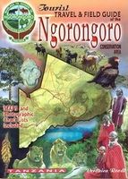
Tourist map of the Ngorongoro conservation area Tanzania | Veronica Ro
Zeer bijzondere landkaart van Ngorongoro conservation area in Tanzania. Uitermate handig zijn de GPS coördinaten van de meest belangrijke punten als campings of uitzichtspunten. De kaart is gebaseerd op een luchtfoto, waarbij alle details zijn ingetekend. The cartographic design displays the information of the Tourist Map of the Ngorongoro Conservation Area with strong accents and is based on satellite photography. The main map and the enlarged maps show grids of parallels and meridians with degree data and a choice of 180 GPS coordinates. The legend indicates boundaries, tarred and gravel main routes, secondary routs that require 4x4, walking trails including distance and time, day and long walking trails, walking trail camp sites, bomas, villages and protected areas. Also indicated are gas stations, public, NCA and special camp sites, lodges, rangers posts, airstrips, look-out points, places of interest, picnic sites and toilets, distance legs and aggregated distances. There is info…
17,50

