Topografische kaart - Wandelkaart 1 Discovery Donegal (NW) | Ordnance Survey Ireland

0
Zeer gedetailleerde topografische kaart met een aantal toegevoegde toeristische symbolen voor bijv. bezienswaardigheden, campings en jeugdherbergen. Met hoogtelijnen, mooi kleurgebruik en ingetekende lange-afstands-wandelroutes. Op deze kaart zijn de nationale parken en de 'national reserves ' uitstekend te vinden. De kaart is dus zowel voor de ge...

Verkopers met dit product

Verkoper
Bezorging
Prijs
DeZwerver.nl logo
DeZwerver.nl
2,95
19,50

Anderen bekeken ook

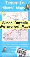
Wandelkaart Tour & Trail Tenerife | Discovery Walking Guides
Uitstekende wandelkaart, met ingetekende wandelroutes, voor specifieke wandelgebieden van Tenerife. Let op: dit is niet een kaart van het hele eiland, maar puur en alleen voor de wandelgebieden > daar is deze kaart de beste in! Our latest hiking research on Tenerife has resulted in new editions of Walk! Tenerife and Tenerife Hikers' Super-Durable Maps. Thanks to Jan Kostura's research we have several new hiking adventures described in detail in Walk! Tenerife. Jan's gps records of his research for new routes and updating of current routes has provided the detailed information to produce our new fourth edition of Tenerife Hiker's Super-Durable Maps. Note that Tenerife Hikers' Super-Durable Maps is a collection of four 30k scale map sections on a double sided sheet of 840mm by 600mm which folds up to 220mm by 120mm. It is not a map of all of Tenerife.  In this edition you will find 30k scale maps covering Valle de Orotava, West, Anaga and Adeje/Arona - Teide printed on a double sided…
17,95
Wandelkaart - Topografische kaart OL11 OS Explorer Map Brighton & Hove, Lewes & Burgess Hill | Ordnance Survey
Met zijn 4cm voor 1 km (2 ½ cm voor 1 mijl) schaal, is de OS Explorer kaartenserie de ideale en meest gedetailleerde kaartenreeks voor mensen die graag outdoor-activiteiten zoals fietsen, wandelen, paardrijden, klimmen en watersporten. Deze kaart is nog gedetailleerder dan de 'gewone' Landranger maps. Voor- en achterzijde bedrukt! Zeker op de moors en andere natuurgebieden van onschatbare waarden met echt alle aspecten van het landschap op de kaart ingetekend. Zeer goede detailkaart met topografische ondergrond. Hierop zijn toeristische symbolen van bezienswaardigheden ingetekend, daarnaast staan bijvoorbeeld campings en jeugdherbergen vermeld en - voor wandelaars het belangrijkst - alle right of way paden en Lange afstands Wandelpaden zijn er op te vinden. De ideale kaart voor het wandelen in Engeland, Wales of Schotland. Map sheet number OL11 in the OS Explorer map series is ideal for those seeking adventure in the Brighton and Hove area. The coast can be explored by foot taking in …
19,50
Nieuw
Topografische kaart - Wandelkaart 51 Discovery Clare, Galway | Ordnance Survey Ireland
Zeer gedetailleerde topografische kaart met een aantal toegevoegde toeristische symbolen voor bijv. bezienswaardigheden, campings en jeugdherbergen. Met hoogtelijnen, mooi kleurgebruik en ingetekende lange-afstands-wandelroutes. Op deze kaart zijn de nationale parken en de 'national reserves ' uitstekend te vinden.   De kaart is dus zowel voor de geoefende kaartlezer als voor diegene die een kaart zoekt voor gewoon recreatief gebruik bijzonder handig. Met het 1km ITM grid en graden-indeling is de kaart geschikt voor gebruik met GPS. Per kaart uit deze serie wordt een gebied gedekt van ca. 40 x 30 kilometer.    De kaart is dan ook als wandelkaart Ierland te gebruiken, maar ook als topografische kaart Ierland.       OSI Discovery Sheet No. 51 covers part of County Clare and County Galway at a 1:50 000 scale and is designed for all sorts of leisure activities including walking, cycling and tourism.   Features shown on the Discovery series include:   Walking Trails Cycle Routes Fo…
19,50
Wandelkaart - Topografische kaart 170 OS Explorer Map Abingdon, Wantage & Vale of White Horse | Ordnance Survey
Discover the Vale of White Horse, rolling hills dominated by the extraordinary, eponymous White Horse, an enigmatic Bronze Age chalk carving which can be seen for miles leaping across the hillside. Explore the historic market towns of Abingdon-on-Thames, dating back to Saxon times; Wantage, birthplace of King Alfred the Great; Wallingford and Faringdon, known for its 100-foot high folly tower.     Visit the iconic White Horse and the ancient landscape that surrounds it, including Uffington Castle and Dragon Hill, where St George slew the dragon  Follow streams flowing through the chalk uplands and discover unique locations like the Manger and its Giant Steps, remnants of the Ice Age  Walk, hike or cycle along the ancient Ridgeway through the wold or a number of other popular recreational paths including sections of the Thames Path, Lambourn Valley Way and Chiltern Way    Met zijn 4cm voor 1 km (2 ½ cm voor 1 mijl) schaal, is de OS Explorer kaartenserie de ideale en meest gedetaille…
19,50
Nieuw
Wandelkaart - Topografische kaart 11 OS Explorer Map | Active Brighton / Hove / Lewes / Burgess Hil | Ordnance Survey
Met zijn 4cm voor 1 km (2 ½ cm voor 1 mijl) schaal, is de OS Explorer kaartenserie de ideale en meest gedetailleerde kaartenreeks voor mensen die graag outdoor-activiteiten zoals fietsen, wandelen, paardrijden, klimmen en watersporten.   Deze kaart is nog gedetailleerder dan de 'gewone' Landranger maps. Voor- en achterzijde bedrukt! Zeker op de moors en andere natuurgebieden van onschatbare waarden met echt alle aspecten van het landschap op de kaart ingetekend. Zeer goede detailkaart met topografische ondergrond. Hierop zijn toeristische symbolen van bezienswaardigheden ingetekend, daarnaast staan bijvoorbeeld campings en jeugdherbergen vermeld en - voor wandelaars het belangrijkst - alle right of way paden en Lange afstands Wandelpaden zijn er op te vinden. De ideale kaart voor het wandelen in Engeland, Wales of Schotland.   Map sheet number OL11 in the OS Explorer map series is ideal for those seeking adventure in the Brighton and Hove area. The coast can be explored by foot taking…
25,95
Wandelkaart - Topografische kaart OL62 OS Explorer Map Coreen Hills & Glenlivet | Ordnance Survey
Met zijn 4cm voor 1 km (2 ½ cm voor 1 mijl) schaal, is de OS Explorer kaartenserie de ideale en meest gedetailleerde kaartenreeks voor mensen die graag outdoor-activiteiten zoals fietsen, wandelen, paardrijden, klimmen en watersporten. Deze kaart is nog gedetailleerder dan de 'gewone' Landranger maps. Voor- en achterzijde bedrukt! Zeker op de moors en andere natuurgebieden van onschatbare waarden met echt alle aspecten van het landschap op de kaart ingetekend. Zeer goede detailkaart met topografische ondergrond. Hierop zijn toeristische symbolen van bezienswaardigheden ingetekend, daarnaast staan bijvoorbeeld campings en jeugdherbergen vermeld en - voor wandelaars het belangrijkst - alle right of way paden en Lange afstands Wandelpaden zijn er op te vinden. De ideale kaart voor het wandelen in Engeland, Wales of Schotland. Map sheet OL 62 covers Correen Hills and Glenlivet. Highlights include Cairngorms National Park, Gordon Way and Badingair Hill. Also includes Water of Bogie, Rhynie…
19,50
Nieuw
Wandelkaart - Topografische kaart 170 OS Explorer Map | Active Abingdon / Wantage / Vale | Ordnance Survey
Discover the Vale of White Horse, rolling hills dominated by the extraordinary, eponymous White Horse, an enigmatic Bronze Age chalk carving which can be seen for miles leaping across the hillside. Explore the historic market towns of Abingdon-on-Thames, dating back to Saxon times; Wantage, birthplace of King Alfred the Great; Wallingford and Faringdon, known for its 100-foot high folly tower.     Visit the iconic White Horse and the ancient landscape that surrounds it, including Uffington Castle and Dragon Hill, where St George slew the dragon  Follow streams flowing through the chalk uplands and discover unique locations like the Manger and its Giant Steps, remnants of the Ice Age  Walk, hike or cycle along the ancient Ridgeway through the wold or a number of other popular recreational paths including sections of the Thames Path, Lambourn Valley Way and Chiltern Way    Met zijn 4cm voor 1 km (2 ½ cm voor 1 mijl) schaal, is de OS Explorer kaartenserie de ideale en meest gedetailleerd…
25,95
Wandelkaart - Topografische kaart 162 OS Explorer Map Greenwich, Gravesend | Ordnance Survey
Consider yourself at home as you explore London's East End, a byword for cheeky Cockneys, gruesome murders and political activism. See the Thames in a new light in Greenwich, where you can stand on the Meridian Line at the Royal Observatory and climb aboard the Cutty Sark.    Explore the maritime town of Gravesend, visit a Cold War bunker  Uncover London's history as an Imperial trading hub at West India Docks, built in 1802  Walk and cycle along the London Loop through West Thurrock and Sidcup, and other recreational paths including the Thames Path National Trail through the heart of London Met zijn 4cm voor 1 km (2 ½ cm voor 1 mijl) schaal, is de OS Explorer kaartenserie de ideale en meest gedetailleerde kaartenreeks voor mensen die graag outdoor-activiteiten zoals fietsen, wandelen, paardrijden, klimmen en watersporten. Deze kaart is nog gedetailleerder dan de 'gewone' Landranger maps. Voor- en achterzijde bedrukt! Zeker op de moors en andere natuurgebieden van onschatbare waard…
19,50
Wandelkaart - Topografische kaart OL32 OS Explorer Map Winchester | Ordnance Survey
Met zijn 4cm voor 1 km (2 ½ cm voor 1 mijl) schaal, is de OS Explorer kaartenserie de ideale en meest gedetailleerde kaartenreeks voor mensen die graag outdoor-activiteiten zoals fietsen, wandelen, paardrijden, klimmen en watersporten. Deze kaart is nog gedetailleerder dan de 'gewone' Landranger maps. Voor- en achterzijde bedrukt! Zeker op de moors en andere natuurgebieden van onschatbare waarden met echt alle aspecten van het landschap op de kaart ingetekend. Zeer goede detailkaart met topografische ondergrond. Hierop zijn toeristische symbolen van bezienswaardigheden ingetekend, daarnaast staan bijvoorbeeld campings en jeugdherbergen vermeld en - voor wandelaars het belangrijkst - alle right of way paden en Lange afstands Wandelpaden zijn er op te vinden. De ideale kaart voor het wandelen in Engeland, Wales of Schotland.   Map sheet OL 32 in the OS Explorer map series is the ideal map for days out in the Winchester area. Winchester, capital of England in Saxon times is a beautiful c…
19,50
Wandelkaart 27 Discoverer Upper Lough Erne | Ordnance Survey Northern Ireland
Zeer gedetailleerde topografische kaart met een aantal toegevoegde toeristische symbolen voor bijv. Bezienswaardigheden en campings. Met hoogtelijnen, mooi kleurgebruik   Op deze kaart aanwezige plaatsen: Fermanagh, Cootehill, Cavan, Derrylin, Maguiresbridge. Key Features: Each map covers an area of 40km x 30km and is based on the Irish Grid co-ordinate system The OSNI Discoverer Series is fully compatible with the Republic of Ireland Discovery  Series, using the same sheet numbering system, same co-ordinate system, same data  source in the border areas and a similar cartographic style and feature content The OSNI Discoverer Series contains important tourist information including youth  hostels, picnic areas, view points, camp sites and shows road classification,  way marked walks, paths and numbered national cycle networks Some maps include a townland map on the reverse, with an index for easy reference Shows water features such as loughs, rivers and canals with names, as…
19,50

Klanten-reviews van Topografische kaart - Wandelkaart 1 Discovery Donegal (NW) | Ordnance Survey Ireland

Er zijn nog geen beoordelingen voor dit productBen jij de eerste die een review plaatst?

Meer over Topografische kaart - Wandelkaart 1 Discovery Donegal (NW) | Ordnance Survey Ireland

Productomschrijving

Zeer gedetailleerde topografische kaart met een aantal toegevoegde toeristische symbolen voor bijv. bezienswaardigheden, campings en jeugdherbergen. Met hoogtelijnen, mooi kleurgebruik en ingetekende lange-afstands-wandelroutes. Op deze kaart zijn de nationale parken en de 'national reserves ' uitstekend te vinden.

De kaart is dus zowel voor de geoefende kaartlezer als voor diegene die een kaart zoekt voor gewoon recreatief gebruik bijzonder handig. Met het 1km ITM grid en graden-indeling is de kaart geschikt voor gebruik met GPS. Per kaart uit deze serie wordt een gebied gedekt van ca. 40 x 30 kilometer. 

De kaart is dan ook als wandelkaart Ierland te gebruiken, maar ook als topografische kaart Ierland.

Discovery Series Sheet 1 includes an array of coastal settlements, many of which can be reached while travelling along the Wild Atlantic Way. Dunglow, Burtonport, Bunbeg, and Derrybeg all feature on Irelands West Coast. The N56 provides an excellent route north, passing along the coast before heading inland through Gweedore.   A series of beaches can be found on this Sheet including Maghery Strand, Dunmore Strand, and Ballyness Bar.    As the Atlantic Ocean has such a strong presence on Sheet 1, it features a host of islands to be seen. Aran Island, Inishbofin and Tory Island can all be viewed if travelling along the magnificent Wild Atlantic Way.    The Gaeltacht districts of Na Rosa (The Rosses), Gaoth Dobhair (Gweedore) and Cloich Chionnaola (Cloghaneely) all fall within the boundaries of Sheet 1.   This Sheet is also home to part of the Glenveagh National Park. It is the second largest national park in Ireland covering 170 square kilometres.   The Derryveagh Mountains help to give Donegal the honour of being the most mountainous county in Ulster. The mountains’ highest peak is Mount Errigal, at 751 metres.


Verken gerelateerde categorieën

Webshop.nl maakt gebruik van cookies. Ga je verder op onze website, ga dan akkoord met het plaatsen van cookies en de verwerking van deze data door ons en vermelde partners.