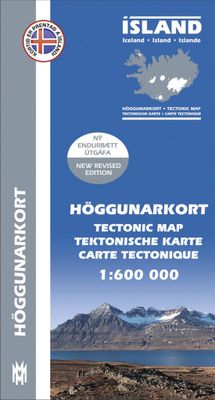
Topografische kaart Höggunakort Tectonic Map of Iceland | Mal og Menning

0
The Höggunarkort is a map about tectonics in Iceland. On the front side you will find a 1:600,000 map of the island with the different layers of land differentiated according to their period of formation and not their composition, but also various volcanic formations.   On the back, photos and explanatory texts illustrate, among other things, the ...

Verkopers met dit product

Webshop
Bezorging
Prijs
DeZwerver.nl logo
DeZwerver.nl
niet bekend
22,50

Anderen bekeken ook

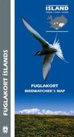
Vogelgids Birdwatcher's Map of Iceland / Vogelkaart van IJsland | Mal og Menning
Handige kaart met kleine gids van de verspreiding en het voorkomen van de meest bekende en opmerkelijke vogels van IJsland. Erg makkelijk als de reis naar IJsland in het teken staat van vogels! A simple and accessible guide to Iceland's birdlife, covering 70 species ofbreeding bird and 37 migrants, winter visitors and vagrant. Breeding birdsare pictured together with maps showing their distribution and illustrations indicating the size and appearance of their eggs. The map is based on thebook Íslenskir fuglar (Icelandic Birds) by Ævar Petersen an ornithologistwith the Icelandic Institute of Natural History. The water-colourillustrations are by Jón Baldur Hlíðberg. The Birdwatcher's Map of Iceland is an essential companion for all naturelovers who want to learn more about Iceland's birdlife on their travelsaround the country.
22,50
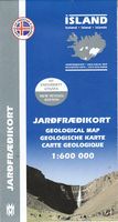
Wegenkaart - landkaart Geologische kaart van IJsland - Jardfraedikort | Mal og Menning
Prachtige geologische kaart van IJsland. Aan de hand van veel verschillende kleuren wordt de samenstelling, leeftijd en type van de bodem duidelijk weergegeven. Voor een eiland als IJsland zeer aan te raden! The Geological Map of Iceland shows the main features of the bedrock geology. Formations are classified by age, type and composition. The map also clearly shows the island's volcanic zones and the distribution of the recent eruption sites. Lava fields of the Holocene are shown as pre-historic or historic. This is the second, revised, edition of the map.
22,50
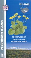
Natuurgids Botanical map Ijsland | Mal og Menning
The botanical map provides clear and accessible information on Iceland's main plants. It shows 78 flowering plants, together with distribution maps and information on size, habitat and season of flowering. The map also includes pictures of Iceland's principal cryptograms (spore-bearing plants), grasses, algae, lichens and fungi. The map's sources include Flowering Plants and Ferns of Iceland by Hörður Kristinsson. The watercolour illustrations areby Jón Baldur Hlíðberg, one of the authors of the Mál og menning Birdwatchers' Map. The botanical map is indispensable to all lovers of Icelandic nature, who wish to learn about Icelandic flora on their travels.
22,50
Fotoboek Lost in Iceland | Mal og Menning
Eén van IJsland's meest gerenomeerde fotografen heeft een schitterend fotoboek samengesteld van dit magische land. Mooie uitvoering, harde kaft. Stunning colour photographs of the barren beauty of the Icelandic landscape. The sounds evoked by Sigurgeir Sigurjonsson's photographs are the eternal sounds of nature - the sighing of the wind, the lapping of waves, the hissing of steam and the unchanging roar of a waterfall. In the elemental world of these pictures, man is largely absent. The brief initimate glimpses we are given of human life - a farmhouse kitchen, a man fishing, a family attending the lambing - only serve to underline the overwhelming emptiness of the Icelandic landscape. It is these very qualities of peace, quiet and solitude that many visitors are seeking when they come to iceland - one of the last places in Europe where you can lose yourself in a wilderness seemingly untouched by man. Lost in Iceland is an astounding book presenting pictures of superb quality. Iceland …
56,95
Natuurgids Hvalakort Walviskaart Ijsland | Mal og Menning
De walviskaart toont alle belangrijke walvissoorten rond IJsland, inclusief verspreidingskaarten en informatie over grootte en leeftijd. The Whale Map shows all the major whale species around Iceland, including distribution maps and information about sizes and age. The water-colour illustrations are by Jón Baldur Hlíðberg. The Whale Map is an essential companion for all nature lovers who want to learn more about Iceland´s whales on their travels around the country. All text is in Icelandic, English, German and French.
22,50
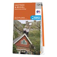
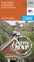
Wandelkaart - Topografische kaart 124 OS Explorer Map Hastings & Bexhill | Ordnance Survey
Experience the history-rich countryside where the High Weald, an Area of Outstanding Natural Beauty, sweeps down to the shore where the fate of Britain was decided in 1066. Explore Battle and visit the actual spot where the Battle of Hastings took place, now a beautiful wildflower meadow dotted with the ruins of a grand abbey built in penance for the slaughter.  Visit the seaside towns of Hastings and Bexhill with their medieval Old Towns, Victorian and Edwardian seafronts and pavilions  Glimpse wild deer and boar roaming in the forests near Robertsbridge and Dartwell Reservoir in the High Weald  Walk or cycle in the footsteps of William the Conqueror on the 1066 Path, or start the Saxon Shore Way from Hastings to head north to Winchelsea  Met zijn 4cm voor 1 km (2 ½ cm voor 1 mijl) schaal, is de OS Explorer kaartenserie de ideale en meest gedetailleerde kaartenreeks voor mensen die graag outdoor-activiteiten zoals fietsen, wandelen, paardrijden, klimmen en watersporten. Deze kaart…
19,50
Wandelkaart 13 Serkort Tröllaskagi | Mal og Menning
De wandelkaartenserie van Mal og Menning is bijzonder duidelijk en geschikt voor alle recreatieve doeleinden, ze zijn gebaseerd op de topografische kaarten van IJsland.   De kaart laat een gedetailleerd beeld zien van de landschapskenmerken, hoogtelijnen op basis van 20 m. met hoogtepunten apart vermeld. Verschil in kleur en symbolen geven een beeld van het soort terrein en vegetatie zoals lava, zand, modderstromen en gletsjers. De berijdbare wegen worden aangeven in verschillende soorten als gravel etc, met markeringen voor bruggen en doorsteken van rivieren.   Het wandelpadennetwerk staat er heel leesbaar en duidelijk op! Met symbolen vind je zaken als campings, hutten, noodhutten en zwemplekken.   A quality hiking map (1: 100 000) of Tröllaskagi. The map includes all hiking- and driving routes of the area, along with place names and other useful information. On the reverse side you will find a more detailed hiking map (1: 50 000) with descriptions and photographs of the area‘s mai…
22,50
Wandelkaart 14 Serkort Austfirðir | Mal og Menning
De wandelkaartenserie van Mal og Menning is bijzonder duidelijk en geschikt voor alle recreatieve doeleinden, ze zijn gebaseerd op de topografische kaarten van IJsland.   De kaart laat een gedetailleerd beeld zien van de landschapskenmerken, hoogtelijnen op basis van 20 m. met hoogtepunten apart vermeld. Verschil in kleur en symbolen geven een beeld van het soort terrein en vegetatie zoals lava, zand, modderstromen en gletsjers. De berijdbare wegen worden aangeven in verschillende soorten als gravel etc, met markeringen voor bruggen en doorsteken van rivieren.   Het wandelpadennetwerk staat er heel leesbaar en duidelijk op! Met symbolen vind je zaken als campings, hutten, noodhutten en zwemplekken.   A quality hiking map (1: 100 000) of Austfirdir. The map includes all hiking- and driving routes of the area, along with place names and other useful information. On the reverse side you will find a more detailed hiking map (1: 50 000) with descriptions and photographs of the area‘s main…
22,50
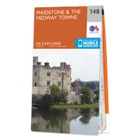
Wandelkaart - Topografische kaart 148 OS Explorer Map Maidstone, Medway Towns | Ordnance Survey
Walk a beautiful stretch of the North Downs Way offering spectacular views of the Kent Downs, Medway Valley and towards the Channel. Discover Kentish villages with their distinctive oast-house chimneys, vineyards on sunny slopes and romantic ruins as you head towards Rochester and its imposing castle guarding the road to London.    Visit the Historic Dockyard Chatham, a beautifully-preserved relic of the Age of Sail home to three historic warships and much more  Travel back in time at Leeds Castle near Maidstone, described as ‘the loveliest castle in the world’, or even further back at the megalithic dolmen known as Kit’s Coty  Walk, hike or cycle along the North Downs Way and other recreational maps including the Medway Valley Walk and Wealdway Met zijn 4cm voor 1 km (2 ½ cm voor 1 mijl) schaal, is de OS Explorer kaartenserie de ideale en meest gedetailleerde kaartenreeks voor mensen die graag outdoor-activiteiten zoals fietsen, wandelen, paardrijden, klimmen en watersporten. Deze…
19,50
Historische Kaart Scotland Clans and Tartans Map | Collins
Prachtige kaart van Schotland waarin duideljk wordt welke cland er zijn geweest en nog zijn. Met een mooi overzicht van alle Tartans (Stoffen) die er aan gekoppeld zijn.    Discover Scotland with this authoritative guide to clans, tartans, and their origins. These popular maps are highly detailed, showing hundreds of arms, official insignia, crests, and tartans of the Scottish clans. This beautifully illustrated map is both decorative and informative.   This map includes: Two double-sided, full-colour maps of ScotlandMore than 170 arms, the official insignia of clan chiefs, crest badges, and the locations of their ancient territories around the time of King James VIMore than 240 tartans with corresponding clan/ family names, alphabetically arranged for easy look-upAdditional information about the history of the clans and their tartans The map is ideal for those those with an interest in Scottish heraldry, clans and family history. Other titles in the series include:* Castles Map of Sc…
12,95

Klanten-reviews van Topografische kaart Höggunakort Tectonic Map of Iceland | Mal og Menning

Er zijn nog geen beoordelingen voor dit productBen jij de eerste die een review plaatst?

Meer over Topografische kaart Höggunakort Tectonic Map of Iceland | Mal og Menning

Productomschrijving

The Höggunarkort is a map about tectonics in Iceland. On the front side you will find a 1:600,000 map of the island with the different layers of land differentiated according to their period of formation and not their composition, but also various volcanic formations.   On the back, photos and explanatory texts illustrate, among other things, the terms of the legend (period and volcanic formations). Some of the concepts developed are: fault, Tertiary, Miocene, caldera, central volcano...

Verken gerelateerde categorieën

Webshop.nl maakt gebruik van cookies. Ga je verder op onze website, ga dan akkoord met het plaatsen van cookies en de verwerking van deze data door ons en vermelde partners.