Topografische kaart - Atlas Hiking and Trekking in Sajama National Park Bolivia Chili Andes | Mazitto

0
Updated 2018 edition. Detailed topographic map 1:50.000 & 20 meter contours for hiking and trekking, printed as an atlas book (with overlapping pages). Covers the full area of the Sajama National Park in Bolivia with some surrounding area and part of the Lauca National Park (Chile) across the border. 20 meter contour lines, road network, trails & ...

Verkopers met dit product

Webshop
Bezorging
Prijs
DeZwerver.nl logo
DeZwerver.nl
niet bekend
27,50

Anderen bekeken ook

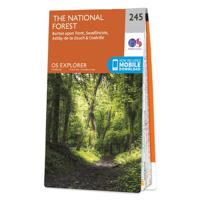
Wandelkaart - Topografische kaart 245 OS Explorer Map National Forest | Ordnance Survey
Met zijn 4cm voor 1 km (2 ½ cm voor 1 mijl) schaal, is de OS Explorer kaartenserie de ideale en meest gedetailleerde kaartenreeks voor mensen die graag outdoor-activiteiten zoals fietsen, wandelen, paardrijden, klimmen en watersporten. Deze kaart is nog gedetailleerder dan de 'gewone' Landranger maps. Voor- en achterzijde bedrukt! Zeker op de moors en andere natuurgebieden van onschatbare waarden met echt alle aspecten van het landschap op de kaart ingetekend. Zeer goede detailkaart met topografische ondergrond. Hierop zijn toeristische symbolen van bezienswaardigheden ingetekend, daarnaast staan bijvoorbeeld campings en jeugdherbergen vermeld en - voor wandelaars het belangrijkst - alle right of way paden en Lange afstands Wandelpaden zijn er op te vinden. De ideale kaart voor het wandelen in Engeland, Wales of Schotland.   These highly detailed maps show all the administrative boundaries, settlements as small as isolated farms, the road network down to unfenced roads and country tra…
19,50
Wandelkaart - Topografische kaart 318 OS Explorer Map Galloway Forest Park North | Ordnance Survey
Met zijn 4cm voor 1 km (2 ½ cm voor 1 mijl) schaal, is de OS Explorer kaartenserie de ideale en meest gedetailleerde kaartenreeks voor mensen die graag outdoor-activiteiten zoals fietsen, wandelen, paardrijden, klimmen en watersporten. Deze kaart is nog gedetailleerder dan de 'gewone' Landranger maps. Voor- en achterzijde bedrukt! Zeker op de moors en andere natuurgebieden van onschatbare waarden met echt alle aspecten van het landschap op de kaart ingetekend. Zeer goede detailkaart met topografische ondergrond. Hierop zijn toeristische symbolen van bezienswaardigheden ingetekend, daarnaast staan bijvoorbeeld campings en jeugdherbergen vermeld en - voor wandelaars het belangrijkst - alle right of way paden en Lange afstands Wandelpaden zijn er op te vinden. De ideale kaart voor het wandelen in Engeland, Wales of Schotland.   These highly detailed maps show all the administrative boundaries, settlements as small as isolated farms, the road network down to unfenced roads and country tra…
19,50
Wandelkaart - Topografische kaart 319 OS Explorer Map Galloway Forest Park South | Ordnance Survey
Met zijn 4cm voor 1 km (2 ½ cm voor 1 mijl) schaal, is de OS Explorer kaartenserie de ideale en meest gedetailleerde kaartenreeks voor mensen die graag outdoor-activiteiten zoals fietsen, wandelen, paardrijden, klimmen en watersporten. Deze kaart is nog gedetailleerder dan de 'gewone' Landranger maps. Voor- en achterzijde bedrukt! Zeker op de moors en andere natuurgebieden van onschatbare waarden met echt alle aspecten van het landschap op de kaart ingetekend. Zeer goede detailkaart met topografische ondergrond. Hierop zijn toeristische symbolen van bezienswaardigheden ingetekend, daarnaast staan bijvoorbeeld campings en jeugdherbergen vermeld en - voor wandelaars het belangrijkst - alle right of way paden en Lange afstands Wandelpaden zijn er op te vinden. De ideale kaart voor het wandelen in Engeland, Wales of Schotland.   These highly detailed maps show all the administrative boundaries, settlements as small as isolated farms, the road network down to unfenced roads and country tra…
19,50
Wandelkaart - Topografische kaart 150 OS Explorer Map Canterbury, Isle of Thanet | Ordnance Survey
Discover Canterbury, city of saints and kings, ancient heartland of England at the foot of the Kent Downs and the head of the River Stour Valley with its vineyards. Follow the river to the coast to discover unspoiled Deal, artistic Margate and picturesque Whitstable.  Starting in Canterbury, take the Stour Valley Walk to Sandwich and the long sweeping sand and shingle beach of Sandwich Bay  Walk the Long Rock from Whitstable to Herne Bay before taking the Thanet Coastal Path around the Isle of Thanet and its three famous Georgian and Victorian resorts of Margate, Ramsgate and Broadstairs   Take the National Trails of the England Coast Path and North Downs Way or choose from a lattice of other popular recreational paths  Met zijn 4cm voor 1 km (2 ½ cm voor 1 mijl) schaal, is de OS Explorer kaartenserie de ideale en meest gedetailleerde kaartenreeks voor mensen die graag outdoor-activiteiten zoals fietsen, wandelen, paardrijden, klimmen en watersporten. Deze kaart is nog gedetailleer…
19,50
Wandelkaart - Topografische kaart 147 OS Explorer Map Sevenoaks and Tonbridge | Ordnance Survey
Met zijn 4cm voor 1 km (2 ½ cm voor 1 mijl) schaal, is de OS Explorer kaartenserie de ideale en meest gedetailleerde kaartenreeks voor mensen die graag outdoor-activiteiten zoals fietsen, wandelen, paardrijden, klimmen en watersporten. Deze kaart is nog gedetailleerder dan de 'gewone' Landranger maps. Voor- en achterzijde bedrukt! Zeker op de moors en andere natuurgebieden van onschatbare waarden met echt alle aspecten van het landschap op de kaart ingetekend. Zeer goede detailkaart met topografische ondergrond. Hierop zijn toeristische symbolen van bezienswaardigheden ingetekend, daarnaast staan bijvoorbeeld campings en jeugdherbergen vermeld en - voor wandelaars het belangrijkst - alle right of way paden en Lange afstands Wandelpaden zijn er op te vinden. De ideale kaart voor het wandelen in Engeland, Wales of Schotland.   These highly detailed maps show all the administrative boundaries, settlements as small as isolated farms, the road network down to unfenced roads and country tra…
19,50
Wandelkaart - Topografische kaart OL32 OS Explorer Map Winchester | Ordnance Survey
Met zijn 4cm voor 1 km (2 ½ cm voor 1 mijl) schaal, is de OS Explorer kaartenserie de ideale en meest gedetailleerde kaartenreeks voor mensen die graag outdoor-activiteiten zoals fietsen, wandelen, paardrijden, klimmen en watersporten. Deze kaart is nog gedetailleerder dan de 'gewone' Landranger maps. Voor- en achterzijde bedrukt! Zeker op de moors en andere natuurgebieden van onschatbare waarden met echt alle aspecten van het landschap op de kaart ingetekend. Zeer goede detailkaart met topografische ondergrond. Hierop zijn toeristische symbolen van bezienswaardigheden ingetekend, daarnaast staan bijvoorbeeld campings en jeugdherbergen vermeld en - voor wandelaars het belangrijkst - alle right of way paden en Lange afstands Wandelpaden zijn er op te vinden. De ideale kaart voor het wandelen in Engeland, Wales of Schotland.   Map sheet OL 32 in the OS Explorer map series is the ideal map for days out in the Winchester area. Winchester, capital of England in Saxon times is a beautiful c…
19,50
Wandelkaart - Topografische kaart OL15 OS Explorer Map Purbeck and South Dorset | Ordnance Survey
Gaze back through 185 million years of history as you explore the Jurassic Coast or go wildlife spotting in the South Dorset countryside. Sweeping golden beaches and spectacular cliff scenery await you on the Purbeck Peninsula as the South West Coast Path takes you from Chesil Beach to Europe’s largest natural bay at Poole.   - Hunt for fossils and dinosaur tracks on the unique Jurassic Coast beaches of Kimmeridge Bay, Lulworth Cove and the iconic sweeping shingle ridge of Chesil Beach - Discover the world-famous Sandbanks Beach in Poole, climb Europe’s largest Iron Age hillfort at Maiden Castle and relax in sunny Weymouth, home of the sailing at London 2012 - Explore the Purbeck Peninsula with its chalk cliffs, the magnificent ruin of Corfe Castle, Victorian pier at Swanage and Brownsea Island Een van de beste detailkaarten die er op de wereld gemaakt worden: zeer gedetailleerd, prachtig helder kleurgebruik, veel topografische aspecten en - zeer belangrijk - allerlei toeristische …
19,50
Wandelkaart - Topografische kaart 163 OS Explorer Map Gravesend, Rochester | Ordnance Survey
Immerse yourself in Gravesend with its maritime history, Charles Dickens links and even a Cold War bunker! Contrast the medieval magnificence of Rochester where the cathedra was founded in 604 and the imposing Rochester Castle keeps watch over the Medway crossing.   Explore the Hoo Peninsula and the North Kent marshes that inspired Charles Dickens to write Great Expectations Discover the Medway towns of Chatham and Gillingham, home to the Historic Dockyard Chatham and the Royal Engineers Museum Walk and cycle along the Saxon Shore Way and other popular recreational paths including the Wealdway and North Downs Way Met zijn 4cm voor 1 km (2 ½ cm voor 1 mijl) schaal, is de OS Explorer kaartenserie de ideale en meest gedetailleerde kaartenreeks voor mensen die graag outdoor-activiteiten zoals fietsen, wandelen, paardrijden, klimmen en watersporten. Deze kaart is nog gedetailleerder dan de 'gewone' Landranger maps. Voor- en achterzijde bedrukt! Zeker op de moors en andere natuurgebieden…
19,50
Wandelkaart - Topografische kaart 162 OS Explorer Map Greenwich, Gravesend | Ordnance Survey
Consider yourself at home as you explore London's East End, a byword for cheeky Cockneys, gruesome murders and political activism. See the Thames in a new light in Greenwich, where you can stand on the Meridian Line at the Royal Observatory and climb aboard the Cutty Sark.    Explore the maritime town of Gravesend, visit a Cold War bunker  Uncover London's history as an Imperial trading hub at West India Docks, built in 1802  Walk and cycle along the London Loop through West Thurrock and Sidcup, and other recreational paths including the Thames Path National Trail through the heart of London Met zijn 4cm voor 1 km (2 ½ cm voor 1 mijl) schaal, is de OS Explorer kaartenserie de ideale en meest gedetailleerde kaartenreeks voor mensen die graag outdoor-activiteiten zoals fietsen, wandelen, paardrijden, klimmen en watersporten. Deze kaart is nog gedetailleerder dan de 'gewone' Landranger maps. Voor- en achterzijde bedrukt! Zeker op de moors en andere natuurgebieden van onschatbare waard…
19,50
Wandelkaart - Topografische kaart 172 OS Explorer Map Chiltern Hills East | Ordnance Survey
Discover the east Chiltern Hills where they meet the Thames Valley, replete with lovely countryside, beautiful views and rich history. Delight in the unrivalled sailing reaches of Maidenhead; the Georgian architecture of High Wycome, the onetime furniture capital of England and the market town of Rickmansworth, set in beautiful country but a stone’s throw from London.    Bathe in natural beauty, from carpets of bluebells in the beech woods to red kites on the chalk grasslands and wildflower meadows where rare butterflies like the Adonis Blue flutter  Discover stately homes and historic houses including the gorgeous Italianate mansion of Clevedon, the charming Tudor manor Chenies and Milton’s Cottage where Paradise Lost was finished  Walk, cycle or hike a wide range of recreational paths including the Chiltern Way, South Bucks Way, Shakespeare’s Way and the Thames Path  Met zijn 4cm voor 1 km (2 ½ cm voor 1 mijl) schaal, is de OS Explorer kaartenserie de ideale en meest gedetailleer…
19,50

Klanten-reviews van Topografische kaart - Atlas Hiking and Trekking in Sajama National Park Bolivia Chili Andes | Mazitto

Er zijn nog geen beoordelingen voor dit productBen jij de eerste die een review plaatst?

Meer over Topografische kaart - Atlas Hiking and Trekking in Sajama National Park Bolivia Chili Andes | Mazitto

Productomschrijving

Updated 2018 edition. Detailed topographic map 1:50.000 & 20 meter contours for hiking and trekking, printed as an atlas book (with overlapping pages).
Covers the full area of the Sajama National Park in Bolivia with some surrounding area and part of the Lauca National Park (Chile) across the border.
20 meter contour lines, road network, trails & paths, transportation, food, campsites, shelters, guest houses & hotels.Mercator projection with both UTM and WGS84 coordinate grids.
The map scale of 1:50000 (1 cm = 500 meters) provides a wealth of detail while keeping low the weight of the atlas itself. The largepage format of 8.5x11in minimizes page count and along with an overlapping map design allows for comfortable navigation.
The details included in the topographic maps of this atlas were specifically selected to be useful for trekkers, hikers and walkers ofall interests, and make it easy to plan and enjoy both short excursions and hikes as well as long multi-day adventures along themain marked routes and/or adjacent trails and paths, which are also shown on the maps.
With this ultralight atlas you will always have a detailed, reliable, information-rich, battery-independent, shatter-proof map for youradventure.

Verken gerelateerde categorieën

Webshop.nl maakt gebruik van cookies. Ga je verder op onze website, ga dan akkoord met het plaatsen van cookies en de verwerking van deze data door ons en vermelde partners.