Topografische kaart - Atlas Hiking and Trekking in Sajama National Park Bolivia Chili Andes | Mazitto

0
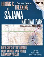
Updated 2018 edition. Detailed topographic map 1:50.000 & 20 meter contours for hiking and trekking, printed as an atlas book (with overlapping pages). Covers the full area of the Sajama National Park in Bolivia with some surrounding area and part of the Lauca National Park (Chile) across the border. 20 meter contour lines, road network, trails & ...

Verkopers met dit product

Verkoper
Bezorging
Prijs
DeZwerver.nl logo
DeZwerver.nl
2,95
27,50

Anderen bekeken ook

Topografische kaart - Atlas Hiking and Trekking in Sajama National Park Bolivia Chili Andes | Mazitto
Updated 2018 edition. Detailed topographic map 1:50.000 & 20 meter contours for hiking and trekking, printed as an atlas book (with overlapping pages). Covers the full area of the Sajama National Park in Bolivia with some surrounding area and part of the Lauca National Park (Chile) across the border. 20 meter contour lines, road network, trails & paths, transportation, food, campsites, shelters, guest houses & hotels.Mercator projection with both UTM and WGS84 coordinate grids. The map scale of 1:50000 (1 cm = 500 meters) provides a wealth of detail while keeping low the weight of the atlas itself. The largepage format of 8.5x11in minimizes page count and along with an overlapping map design allows for comfortable navigation. The details included in the topographic maps of this atlas were specifically selected to be useful for trekkers, hikers and walkers ofall interests, and make it easy to plan and enjoy both short excursions and hikes as well as long multi-day adventures along them…
27,50
Wandelkaart Dilijan National Park - Hiking Topo Map Armenia | Cartisan
Detailed topographical map of Dilijan National Park and the surrounding area, highlighting available hiking routes including the long-distance Transcaucasian Trail and Janapar Trail, as well as the official national park trail network and many more regional attractions. Attractions: Dilijan city, Parz Lake, Gosh Lake, Aghjka Berd fortress, Mantash fortress. Monasteries: Haghartsin, Goshavank, Aghavnavank, Jukhtakvank, Matosavank Villages: Gosh, Kalavan, Hovk, Khachardzan. 5 % of each map sold is used to maintaine the local trail network
16,95
Wegenkaart - landkaart 3406 Adventure Map Bolivia | National Geographic
Wegenkaart van Bolivia met vermelding van veel bezienswaardigheden, nationale parken en attrakties. Watervast en scheurvast. Juist door deze vermeldingen onderscheidt de kaart zich van andere wegenkaarten. National Geographic's Bolivia Adventure Map is designed to meet the unique needs of adventure travelers with its durability and accurate information. Each folded map provides global travelers with the perfect combination of detail and perspective, highlighting the area’s terrain and best locations for adventure activities like snorkeling, surfing, fishing, and more. Adventure Maps include hundreds of points of interest that highlight diverse and unique destinations within the country.   The map includes the locations of thousands of cities and towns with a user-friendly index, plus a clearly marked road network complete with distances and designations for major highways, main roads, and tracks and trails for those seeking to explore more remote regions.   Key Features: Waterproof a…
17,50
Wandelgids Pacific Crest Trail Hiking - 3-part guidebook and map books | Cicerone
A comprehensive three-book set providing all the information needed to prepare for and hike the Pacific Crest Trail (PCT), a 2650-mile hike through California, Oregon and Washington. Designed to be compact and lightweight the set is separated into three books, an introduction to the trail (130g) and two map books (200g and 170g).   The introductory book covers all at-home planning and preparation for hiking the PCT.   Detailed explanation of the trail structure, timings and how to approach the PCT Suggested itineraries for 110-, 120-, 130- and 140-day thru-hikes and an easy-going start option to aid with planning Advice on equipment and permits required on trail A background of the trail’s history A look at the wildlife, flora and fauna encountered on the trail The two map books are designed to be used on the trail, one covering the southern stages from the Mexico border to northern California at Interstate 5, the other detailing the northern stages in Oregon and Washington to the Can…
41,95
Wandelkaart - Topografische kaart 243 Everglades National Park | National Geographic
Prachtige geplastificeerde kaart van het nationaal park. Met alle recreatieve voorzieningen als campsites, maar ook met topografische details en wandelroutes ed. Door uitgekiend kleurgebruik zeer prettig in gebruik. Scheur en watervast! This Trails Illustrated topographic map for Everglades National Park and surrounding area is the perfect map for hiking, boating, paddling, biking, fishing, exploring, camping, and sightseeing in this unique national treasure.   This two-sided map includes the Key Largo, Everglades City, Chokoloskee, Everglades National Park, portions of Big Cypress National Preserve, Fakahatchee Strand State Preserve, Cape Romano Ten Thousand Islands Aquatic Preserve, Shark Valley Tram Road, Old Ingraham highway and campsite, North Nest Key, West Lake Canoe Trail, Snake Bight Trail, backcountry campsites, beach sites, ground sites, and chickees, and detailed insets of Flamingo, Whitewater Bay, Pineland Trails of the Long Pine Key area, and Nine Mile Pond. The map also…
16,95
Wandelgids Hiking Lysefjord and Beyond | Koninx
Our hiking guide prints on demand: please disregard "out of stock" notices from online retailers. Explore world-famous hikes and discover hidden gems in Norway's western fjords. Trek up popular Pulpit Rock and Kjeragbolten, or the steep 4444-step staircase at Flørli. Then, continue hiking where others finish. Explore glacier-carved valleys, windswept coastlines and beaches, rugged peaks and thundering waterfalls. 'Hiking Lysefjord and Beyond: day trips in the Stavanger Region' sets you on the right track to explore this marvellous part of western Norway. Two double-sided area maps, marked with the locations of all hikes, make it easy to orient yourself in the area. Detailed descriptions to all 50 hikes help you navigate with confidence; they provide information on how to actually find the trail head, include sketch maps as well as height profiles. Tailor your hiking adventures to the season and weather, your interests, mood and personal needs; get ideas on where to go and how to hi…
34,95
Wandelkaart - Topografische kaart 221 Trails Illustrated Death Valley National Park | National Geographic
Prachtige geplastificeerde kaart van het bekende nationaal park. Met alle recreatieve voorzieningen als campsites, maar ook met topografische details en wandelroutes ed. Door uitgekiend kleurgebruik zeer prettig in gebruik. Scheur en watervast! This Trails Illustrated topographic map for Death Valley National Park, which straddles the state lines of eastern California and western Nevada, is the perfect recreational map for this dramatic park, which encompasses the hottest, driest, and lowest places in the US. Within its three million acres you will find oceans of sand dunes, dramatic snow-capped mountains, spectacular geological formations, and breathtaking views. The map includes the entire national park area, with detailed trails and topographic information. The trails have been enhanced and road and trail mileage have been added to create a map that is an essential guide for the area. Includes UTM grids for use with your GPS unit.
16,95
Wandelgids - Fietsgids Hiking and Cycling the California Missions Trail - Californie | Cicerone
Guidebook to hiking or cycling the 800 mile (1289km) California Missions Trail between San Francisco Bay and San Diego. The pilgrimage trail takes in 21 historic Spanish missions and can be completed in 50-60 walking days or 2-3 weeks cycling. With 1:100,000 mapping, route description, and details of accommodation and facilities for each stage. Ancient footpaths became connecting routes between the Spanish missions, pueblos, and presidios in the period 1769 to 1823. Over time these routes became automobile roadways and were marked with bells starting in 1906 to promote and preserve the El Camino Real. Today, the California Missions Trail follows a pedestrian route through urban cities and historic towns, through forest paths and country lanes, to each of the twenty-one historic Spanish missions. The 800-mile California Missions Trail leads walkers and cyclists through some of the most scenic and historic sites of one of America's most beautiful states. The 21 missions, founded 200-250…
26,50
Wandelkaart - Topografische kaart 210 Canyonlands National Park | National Geographic
Prachtige geplastificeerde kaart van het nationaal park. Met alle recreatieve voorzieningen als campsites, maar ook met topografische details en wandelroutes ed. Door uitgekiend kleurgebruik zeer prettig in gebruik. Scheur en watervast! Trails Illustrated maps are the most trusted and popular recreation maps available. Continually setting the standard for accuracy, each map is crafted in conjunction with local land managers, and undergoes rigorous review and enhancement before being printed on waterproof, tear-resistant material. Each Trails Illustrated map contains detailed topographic information, clearly marked and named trails, recreational points of interest, and navigational aids. National Park series maps contain useful details for planning your visit. State series titles cover popular recreation areas, ideal for done-in-a-day activities. Included on the map are Canyonlands National Park, the Island in the Sky district, the Needles district, and the Maze district. The map also …
16,95
Wandelkaart - Topografische kaart 250 Cape Cod | National Geographic
Prachtige geplastificeerde topografische wandel- en vaarkaart van het Cape Cod kustgebied. Met alle recreatieve voorzieningen als campsites, stranden, en watersport maar ook met topografische details en wandelroutes ed. Door uitgekiend kleurgebruik zeer prettig in gebruik. Scheur en watervast! National Geographic's Cape Cod Coastal Recreation map is the ideal companion for adventures along shore and on the water.National Geographic's new family of Coastal Recreation maps are two-sided, waterproof maps designed specifically for recreation along America's most beautiful shorelines. These hybrid maps strike the perfect balance between professional boating charts and detailed topographic maps for land. There is no other map in the market today that provides as much versatility for coastal recreation as National Geographic's Coastal Recreation series. For paddlers, sail, and power boaters these maps are ideal for planning, cover waters up to three nautical miles off-shore, conveniently siz…
16,95

Klanten-reviews van Topografische kaart - Atlas Hiking and Trekking in Sajama National Park Bolivia Chili Andes | Mazitto

Er zijn nog geen beoordelingen voor dit productBen jij de eerste die een review plaatst?

Meer over Topografische kaart - Atlas Hiking and Trekking in Sajama National Park Bolivia Chili Andes | Mazitto

Productomschrijving

Updated 2018 edition. Detailed topographic map 1:50.000 & 20 meter contours for hiking and trekking, printed as an atlas book (with overlapping pages).
Covers the full area of the Sajama National Park in Bolivia with some surrounding area and part of the Lauca National Park (Chile) across the border.
20 meter contour lines, road network, trails & paths, transportation, food, campsites, shelters, guest houses & hotels.Mercator projection with both UTM and WGS84 coordinate grids.
The map scale of 1:50000 (1 cm = 500 meters) provides a wealth of detail while keeping low the weight of the atlas itself. The largepage format of 8.5x11in minimizes page count and along with an overlapping map design allows for comfortable navigation.
The details included in the topographic maps of this atlas were specifically selected to be useful for trekkers, hikers and walkers ofall interests, and make it easy to plan and enjoy both short excursions and hikes as well as long multi-day adventures along themain marked routes and/or adjacent trails and paths, which are also shown on the maps.
With this ultralight atlas you will always have a detailed, reliable, information-rich, battery-independent, shatter-proof map for youradventure.

Productinformatie

    Verken gerelateerde categorieën

    Webshop.nl maakt gebruik van cookies. Ga je verder op onze website, ga dan akkoord met het plaatsen van cookies en de verwerking van deze data door ons en vermelde partners.