webshop.nl
Categorieën
  Sluiten

Meer christopher-glyn
Meer christopher-glyn in Boeken

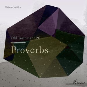
The Old Testament 20 - Proverbs

The genre of Proverbs is mainly "Proverbs" as the name describes, there are also some Parables and Poetry......
9,99

Webshops met dit product

Webshop
Bezorging
Prijs

Anderen bekeken ook

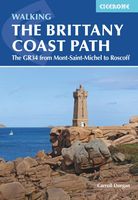
Wandelgids The Brittany Coast Path | Cicerone
Uitstekende wandelgids van deze mooie route. goed beschreven met veel praktische informatie om de route te kunnen lopen, inclusief redelijke kaarten This guide describes a 624km section of French long-distance route the GR34, following the north coast of Brittany from ever-popular Mont-Saint-Michel to the port of Roscoff. (The full GR34--also known as 'Sentier des Douaniers, ' the Customs Officers Path--totals some 2000km and follows in the footsteps of customs officers of old who patrolled the coast in attempt to curb smuggling.) The trail is waymarked and well maintained, offering mainly easy hiking, though there are a few more strenuous sections and some short steep ascents and descents. It takes around a month to complete but the guide also includes suggestions for four five-day 'highlight' sections. The route is described from east to west and presented in 28 stages. For each stage, you will find clear route description and mapping, summary statistics and notes on facilities, acco…
23,95
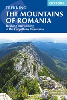
Wandelgids The Mountains of Romania - Roemenië | Cicerone
Guidebook to walks and multi-day treks in the Carpathian mountains of Romania. Includes routes in the Maramures and Bucovina regions, Piatra Craiului ridge, and the Retezat and Fagaras mountains. This guide describes 27 short treks of 2-6 days and 10 day walks in the mountains of Romania. Although there is a slight focus on Transylvania, most of the main massifs are included, with chapters covering the Mountains of Maramures, the Eastern Carpathians, the mountains around Brasov, the Fagara?, the region between the Olt and the Jiu, the Retezat, the mountains of Banat and the Apuseni. Also included is an ascent of Moldoveanu, Romania's highest peak at 2544m.   There is a wealth of advice to help you plan your trip and organise the logistics of your walk or trek. Some routes avail of the network of mountain huts; others offer opportunities to camp in attractive wild locations. Overviews and a route summary table make it easy to choose an appropriate excursion. Each route includes clear de…
26,50
Fietskaart 01 Cycling guides Cornwall | Goldeneye
Our maps are double-sided, printed on an A2 sheet with a concertina fold. This allows for easy folding and folding, and an ease of access to the mapping. The material is rain and tear-resistant. Our early maps were designed at the scale of 2 miles to 1 inch/1:126,720. The later designs along with digitalisation are 1: 100,000. We were encouraged by the Cycle Touring Club to convert our cartography toward the cycle market (to replace the out-of-print Bartholomew series). As time and the series progressed we have added more data: The National Cycle Network routes, Regional Routes, and Traffic-Free Family Routes, as and when they are developed. These routes are in addition to the Circular Routes Goldeneye Commissioned at the outset of our publishing schedule. We are also adding to new editions; bike shops, cycle hire, and tea rooms, along with the tourist attractions already featured. Our plan is to make available digital versions for cell phones and tablets and to update, on an annual ba…
15,95
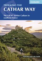
Wandelgids The Cathar Way | Cicerone
Guidebook to the GR367 Cathar Way (Sentier Cathare) in the Languedoc region of southern France. The 260km waymarked trail from Port la Nouvelle on the Mediterranean to Foix traces the history of the Cathars through the Eastern foothills of the Pyrenees. Split into 13 stages and offering a northern variant, the route takes about 2 weeks to complete. Two of the southernmost départements of France, the Pyrénées-Orientales and Ariège are inextricably linked with the history of the Cathars, a heretical Christian sect who were subjected to a crusade in the thirteenth century. Striking castles built on jagged rocky precipices are a highlight of the region and a reminder of those turbulent times. This guidebook describes the 260km Cathar Way (Sentier Cathare or GR367), a long-distance trail from Port-la-Nouvelle on the Mediterranean coast to Ariége's departmental capital Foix linking several of the impressive Cathar castles. The route follows ancient footpaths, jeep tracks and country lanes an…
22,95
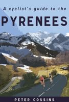
Fietsgids A Cyclist's Guide to the Pyrenees | Great Northern Books
Where do you turn when you want to ride in the mountains, to follow in the wheeltracks of professional racers by climbing the famous passes of the Tour de France? There are several books and websites that highlight these renowned ascents, detailing their location, length and every little change in gradient. But how do you go about finding a route that links these passes together, that describes not only where they are and what they're like to ride, but highlights which is the best side to tackle them from and which roads to avoid?Award-winning author Peter Cossins's new series of guides to riding in the Western Europe's high mountains will provide these details - and much more. Inspired by Alfred Wainwright's walking guides to the Lake District, they are intended as the bible for any cyclist riding in Europe's most stunning terrain.   The first in the series is The Roads, Cols and Passes of the Pyrenees, which is duefor publication by Great Northern Books in June 2020. Featuring 120 ro…
23,95
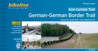
Fietsgids Bikeline Iron Curtain Trail 3 - German-German Border Trail | Esterbauer
Praktische fietsgids met detailkaarten, ingetekende route, informatie over overnachten en fietsenmakers, zwaarte en hoogteprofiel. In spiraalbinding, Engelstalig   The Iron Curtain ran for about 7,000 km from the Barents Sea in the north straight through Europe to the Black Sea and divided the continent in East and West. Until the Velvet Revolution in Eastern Europe it was a physical and ideological border between two blocks which conceived each other as enemies. Not only were many neighbouring states divided, but Germany itself was divided into east and west. Today there are hardly any reminders that the wall ever existed.   The border in Germany was 1,400 km long. The former death strip was composed of 3.000 km of fences, car-trenches for 730 km, 830 observation towers, the brightly lit roads, walls and bunkers – most of it is gone. Remaining are the vehicle roads with their perforated paving stones and several observation towers. And in a few years the sparse vegetation will be supp…
17,95
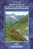
Wandelgids Trekking in the Silvretta and Ratikon Alps | Cicerone
Aanbevolen wandelkaarten bij deze gids: Schaal 1:60.000 Wandelkaart 14 Unterengadin | Kümmerly & Frey Wandelkaart 13 Davos - Arosa | Kümmerly & Frey Of schaal 1:25.000 Wandelkaart 26 Alpenvereinskarte Silvrettagruppe This guide describes three treks, between 5 and 8 days, in the Silvretta and Rätikon Alps starting near Klosters, and 12 half-day hut-to-hut routes. These contrasting ranges form a line on the borders of Switzerland, Austria and Liechtenstein. The Tour of the Silvretta, the Prättigauer Höhenweg and the Rätikon Höhenweg. Straddling the borders of Austria, Switzerland and Liechtenstein, the limestone Rätikon Alps reach into the snow-bound and glacier-hung Silvretta Alps to provide a richly diverse series of landscapes. The Tour of the Silvretta, the Prättigauer Höhenweg and the Rätikon Höhenweg, all within easy reach of Klosters, have been devised to help trekkers explore the best of the region. Given sifficient time they can also be combined to create a continuous 2-week to…
25,95
Wegenatlas Australië - Great Desert Tracks Atlas & Guide | Hema Maps
Whether you're a desert lover or just looking to tackle some of Australia's favourite 4WD destinations, the Hema Great Desert Tracks Atlas & Guide - Edition 5 is an indispensable companion to this country's arid centre. The complete atlas contains Hema's entire Great Desert Tracks map series. The guide features 25 4WD tracks, each with its own detailed map inset showing the route taken, with GPS location and points of interest featured. All of the tracks are colour-coded to make it simple to find the treks that suit your type of vehicle and handy symbols show towing suitability also! The track descriptions are written by some of Australia's top four-wheel driving enthusiasts and experienced travel writers. Each track's notes contain all the information you need to plan for the trip, including permits and contact details. There's also plenty of essential pre-trip reading on how to prepare for your trek, safety in the outback and driving techniques!   Features Contains Hema's entire G…
55,95
Fietskaart 09 Cycling guides Norfolk | Goldeneye
Norfolk is the fourth largest county in England and one of the most rural. It is also one of the flattest and our circular routes have been chosen to explore the quiet lanes linking the isolated and picturesque villages and places of interest. This is ideal cycling territory and fortunately, the Norfolk County Council (and its District Councils) are seriously committed in providing and developing cycling routes and in promoting a cycling culture that is sustainable and family friendly. Some of their routes are illustrated, hitherto.   The County has been described as flat (rather gentle undulations) and does not in fact rise much over 300 feet, but it offers great scenic interest; the dark forests of Breckland, the rolling chalk lands of the northwest, the unique watery patch of the Broads, and a coastline of great variety. Ancient churches and picturesque villages are there in abundance, the latter often decorated with the attractive signs designed by Harry Carter in the 1950’s.   Rec…
14,95
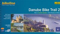
Fietsgids Bikeline Danube Bike Trail 2 (Engels - Donau Radweg) | Esterbauer
Praktische fietsgids met detailkaarten, ingetekende route, informatie over overnachten en fietsenmakers, zwaarte en hoogteprofiel. In spiraalbinding, Engelstalig.   Danube Bike Trail In the last decade the Danube bike trail has emerged as Europe’s most important long-distance bicycle touring route. Its popularity is due primarily to the Danube’s natural beauty and the wealth of cultural and historical sites that line its banks. But the large numbers of bicycle tourists visiting the Danube would not be possible without well-developed infrastructure and services. The Danube bike route has benefited from well-built posted bike trails and an extensive network of services oriented to meeting the needs of bicycle tourists. The following pages provide a few practical notes about how to use the book, and some tips on getting ready for the tour.   Length The total distance from the start in Passau to the final destination, Vienna, is 320?kilometres. This figure does not include about 160?kilome…
16,50

Klanten-reviews van The Old Testament 20 - Proverbs

Er zijn nog geen beoordelingen voor dit productBen jij de eerste die een review plaatst?

Meer over The Old Testament 20 - Proverbs

Productomschrijving

The genre of Proverbs is mainly "Proverbs" as the name describes, there are also some Parables and Poetry...

Productspecificaties

Artikelnummer(s)
EAN
9788711674291
Brand
christopher-glyn
Webshop.nl maakt gebruik van cookies. Ga je verder op onze website, ga dan akkoord met het plaatsen van cookies en de verwerking van deze data door ons en vermelde partners.