webshop.nl
Categorieën
  Sluiten

Meer THQ
Meer THQ in PS2 games

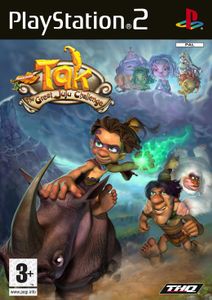
Tak the Great Juju Challenge

The top teams from across the world have come to compete in The Great Juju Challenge. Representing the Pupanunu tribe are Tak and Lok who will face great adversity in the form of Jujus, wild animals and some menacing new tribes.Tak: The Great Juju Challenge is an innovative, cooperative videogame that combines unique puzzles, time-based strategies ...
9,99

Webshops met dit product

Webshop
Bezorging
Prijs

Anderen bekeken ook

Tak the Great Juju Challenge
The top teams from across the world have come to compete in The Great Juju Challenge. Representing the Pupanunu tribe are Tak and Lok who will face great adversity in the form of Jujus, wild animals and some menacing new tribes.Tak: The Great Juju Challenge is an innovative, cooperative videogame that combines unique puzzles, time-based strategies and a robust combat system. Players will have to use all their skills to win this race against the toughest competitors and receive the grandest reward ever given by the Great Jujus!
29,99
Tak and the Power of Juju
Tak and the Power of Juju is a fantasy tale of good and evil set in an ancient, tribal world where Juju magic really works. Players assume the role of Tak, a young and playful shaman's apprentice, and will need to recover moonstones stolen by an evil Jujuman to save the Moon Juju and restore her powers. Tak will have to stretch beyond his shaman training and use his wits, environment and the power of the Juju gods to overcome the villain, Tlaloc. His challenge is to return the five moonstones to the Temple of the Moon Juju and reinstate peace in his mystical world.
14,99
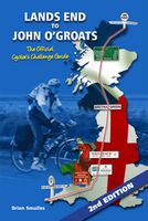
Fietsgids Lands End to John O'Groats (2nd Edition) The Official Cycllist's Challenge Guide | Challenge Publications
There are numerous outdoor challenges in life around the UK. Canoeing the Caledonian Canal from one side of the country to the other, walking around Britain on the coastal footpath or completing a marathon. This book looks at another great challenge, cycling from Lands End to John O’Groats. To walk, run or cycle from Lands End, the most south-westerly tip of mainland Britain to John O’Groats, the most northerly tip, represents a challenge that people in ever increasing numbers want to take up. This book describes the main ‘classic’ route that many people have cycled, and what the author feels is the most direct route to cycle virtually 910miles on roads or cycle paths, but not motorways. The planning, training, full route and B&Bs are all included to help you, with many tips to ensure you complete the journey and get as much pleasure from it as the author did. Following the advice contained in the 2nd edition of this book should enable anyone who is determined enough, to complete this …
12,50
Fotoboek - Reisgids National Parks of America | Lonely Planet
Hardcover fotoboek met reisinformatie van alle 59 nationale parken van Amerika. Perfect ter inspiratie voor de volgende reis. To celebrate America's amazing national parks, Lonely Planet, the world's leading travel publisher, takes you on an informative and gorgeous tour of all 59 parks with our lavishly finished hardcover gift guide packed with detailed itineraries and practical tips on what to do and see in each park to get you started planning your next adventure. America's national parks are full of timeless marvels that still rejuvenate the soul: the world's largest trees in Sequoia; its most spectacular geothermal site in Yellowstone; the grandest canyon. Perhaps the movement's most eloquent description that is still resonates came from national parks advocate John Muir: 'Thousands of tired, nerve-shaken, over-civilized people are beginning to find out that going to the mountains is going home; that wildness is a necessity...' Fortunately for the nerve-shaken, over-civilized peop…
27,95
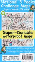
Wandelkaart National 3 Peaks Challenge Map | Discovery Walking Guides
Goede scheur- en watervaste wandelkaart. National 3 Peaks Challenge Maps. Ben Nevis, Scafell Pike and Snowdon at 20k scale. Waterproof, tearproof and 100% recyclable 820mm by 420mm double sided map sheet.   Taking OS mapping at 50k scale we expand the mapping to produce 20k scale maps of the three challenge peaks, Ben Nevis, Scafell Pike and Snowdon. By expanding the OS mapping the features of names, roads, tracks and trails are more than doubled in size making them easier to read under Challenge conditions. We then add the Challenge Routes, specially highlighted to make them stand out against the OS map background information and add in additional information that will help your challenge.   Each map covers the region to show the access roads as well as the walking routes. Ben Nevis includes the Glen Nevis Information Centre starting point and Glen Nevis Youth Hostel starting point. Scafell Pike includes the Wasdale and Seathwaite Challenge Routes.   Snowdon includes the Pyg Track, Mi…
15,95
Reisgids Great West Way | Rough Guides
Discover the Great West Way with this comprehensive, entertaining, 'tell it like it is' Rough Guide, packed with comprehensive practical information and our experts' honest and independent recommendations. Whether you plan to paddle-board through Bath, visit Windsor Castle, marvel at Stonehenge, narrow-boat down the Kennet & Avon Canal or explore the Ridgeway on horseback, The Rough Guide to The Great West Way will help you discover the best places to explore, sleep, eat, drink and shop along the way. Features of The Rough Guide to The Great West Way: - Detailed regional coverage: provides in-depth practical information for each step of all kinds of trip, from intrepid off-the-beaten-track adventures, to chilled-out breaks in popular tourist areas. Regions covered include: West of London, Berkshire, the southern Cotswolds, Wiltshire, Bath and Bristol. - Honest independent reviews: written with Rough Guides' trademark blend of humour, honesty and expertise, and recommendations you can…
15,50
Wegenkaart - landkaart Western Canada | ITMB
Een degelijke kaart met aanduidingen van o.a. nationale parken, vliegveld, benzinepomp, dirt-roads. Als overzichtskaart goed te gebruiken. This is actually our second attempt at mapping the western portion of Canada; the first covered everything from northwestern Ontario to the Pacific Ocean and, while it was an excellent map, the scale that such a huge area covered necessitated severe problems. In this version, all of British Columbia, Alberta, and the Yukon have been mapped from fresh digital data and presented at 1:1.4T scale. This would have been impossible when we prepared the first map. The Northwest Territories portion had to be compressed in two ways; first, the scale is 1:2M; second, only the portion with roads is shown. This is still an extremely large area. One has to consider the actual size of Canada when designing a map. Most countries in Europe would fit into this area, which only covers 20% of Canada. The Fort McMurray forest fire of a year ago covered an area larger th…
13,95
Vogelgids Birds of the Indian Subcontinent | Bloomsbury
This is the second edition of the authors' groundbreaking Birds of the Indian Subcontinent (1998) and covers all the bird species found in India, Pakistian, Sri Lanka, Nepal, Bhutan, Bangladesh and the Maldives. The plates face the descriptions and maps for quick at-a-glance reference. Many of the plates have been repainted for this edition and a number of new species added. This guide also provides tables, summarising identification features of particularly difficult groups such as nightjars, warblers and rosefinches.   "[...] Overall, Birds of the Indian Subcontinent is an excellent piece of work and a very welcome field guide, and I am greatly looking forward to using it on my upcoming trip to Arunachal Pradesh and Assam. Comprehensive and authoritative, this is an indispensable guide for anyone birding anywhere in the Indian Subcontinent." - Frank Lambert (22-02-2012), read the full review at The Birder's Library   "The Indian subcontinent, always exciting for visitors, is no less …
54,95
Creators Opinion PVC Statue 1/4 Miu Minami Bunny Ver. 23 cm
Popular Illustrator Warabino Matusri's 3rd Original Designed Bunny Girl, Miu Minami Is Here!Popular Illustrator Warabino Matusri's 3rd Original Designed Bunny Girl, Miu Minami is here to rock!A lil' different from previously designed bunnies, we have a bunny girl who came rockin' to Playing God! Boldly arranged bunny suit which highlights her beautiful Nasty taut body line,A design you can't help but feel The Audacity of a new Bunny Girl, delivered straight to you.Of course, the iconic Warabino Matsuri Saucy eyeglasses are included! A must for any Bunny illustrated by Warabino Sensei! These pair of Look But Don't Touch glasses will add more feminine touch to Miu.Rock 'n' Roll style with fabric mesh tights in a big 1/4 scale that will overcome the Loud rough seas and adversity of the times.Highly recommended not only to our G.O.A.T. veteran bunny fans living in the modern world of rock,But also to ladies and gents who yearn for their first bunny experience while rocking in life.Both all…
379,50
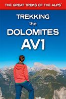
Wandelgids Trekking the Dolomites Av1 | Knife Edge Outdoor
Superhandige wandelgids voor de Alta Via 1 in de Dolomieten. Met deze gids heb je verder niks nodig: alle benodigde Tabacco wandelkaarten zitten in deze gids! The only guidebook exclusively for the AV1.Everything you need to know to plan and walk Italy's most popular long distance route.Real maps inside (Tabacco 1:25,000): the finest maps available for the Dolomites. This makes navigation easy and there is no need to carry additional maps. Also includes:* Numbered waypoints linking maps to text* Unique Itinerary Planner: plan a bespoke itinerary to match your ability and vacation schedule. All difficult calculations of time, distance and altitude gain are done for you* 7 Proposed Itineraries of between 6 and 11 days* Everything the trekker needs to know to plan the route: route descriptions, costs, budget, difficulty, weather, how to get there, and more* Full accommodation listings: spectacularly situated mountain huts* Section on Camping* Exciting variants to the main route* Informati…
19,95

Klanten-reviews van Tak the Great Juju Challenge

Er zijn nog geen beoordelingen voor dit productBen jij de eerste die een review plaatst?

Meer over Tak the Great Juju Challenge

Productomschrijving

The top teams from across the world have come to compete in The Great Juju Challenge. Representing the Pupanunu tribe are Tak and Lok who will face great adversity in the form of Jujus, wild animals and some menacing new tribes.Tak: The Great Juju Challenge is an innovative, cooperative videogame that combines unique puzzles, time-based strategies and a robust combat system. Players will have to use all their skills to win this race against the toughest competitors and receive the grandest reward ever given by the Great Jujus!

Productspecificaties

Artikelnummer(s)
Brand
THQ
Webshop.nl maakt gebruik van cookies. Ga je verder op onze website, ga dan akkoord met het plaatsen van cookies en de verwerking van deze data door ons en vermelde partners.