webshop.nl
Categorieën
  Sluiten

Meer Lebowski
Meer Lebowski in Boeken

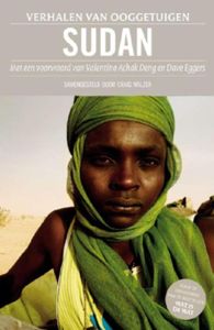
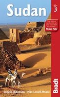
Sudan - - ebook

13,99

Webshops met dit product

Webshop
Bezorging
Prijs

Anderen bekeken ook

Wegenkaart - landkaart Sudan - south Sudan, Soedan | ITMB
Een degelijke kaart met aanduidingen van o.a. nationale parken, vliegveld, benzinepomp, dirt-roads en kleine plattegrond van hoofdstad. Als overzichtskaart goed te gebruiken. This latest edition comes out at a time when a good map of the largest country in Africa needs a good map the most. Sudan is not a country with an improving infrastructure, nor is it one of the safest countries for travellers. However, its position in Africa makes it pivotal to the politics and ethnicity of much of northeastern Africa, and its importance can be gauged by the fact that this ITMB title is already into its third edition. It is one of the most difficult countries in the world to map, simply because so much of it is difficult to enter. We wish to dedicate this map to those brave souls who continue to provide food and medical support for all the peoples of Sudan – the humanitarians, whose contributions have made this map possible. Legend Includes: Roads by classification, international and national airp…
13,95
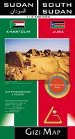
Wegenkaart - landkaart Sudan and South Sudan | Gizi Map
Sudan and South Sudan as separate countries on an excellent indexed map at 1:2,500,000 from Gizi Maps with detailed presentation of the topography, administrative divisions, street plans of Khartoum and Juba, etc. Excellent presentation of the terrain in the publisher’s characteristic style provides a vivid picture of the region’s geography: bold altitude colouring with plenty of spot heights and names of peaks, mountain ranges, etc, plus additional graphics for flood plains, swamps, salt flats, deserts, lava fields, wadis and water wells. National parks or other protected areas and interesting natural sites are highlighted. The map indicates the boundary of the disputed Abyei area and shows the internal administrative boundaries and names of the provinces. Within North Sudan names of larger towns and of the provinces are also given in Arabic. Where appropriate, alternative versions of town names are provided (Khartoum/Al Khartum, Omdurman/Umm Durman, etc). The map shows the road ne…
15,95
Reisgids Sudan - Soedan | Bradt Travel Guides
Er bestaat geen Lonely Planet van Sudan. Daarom vermelden wij de enige goede gids van Sudan, die van Bradt Guides. Voor Afrikaanse landen net zo goed, zo niet beter dan de Planet. Beduidend soberder uitgevoerd, maar ook met veel informatie voor backpackers en met veel kaartmateriaal. Een aanrader! Bradt: This third edition is the only stand-alone guide to Sudan with practical information on getting around a country where the travelling is rugged but the rewards immense. As the largest country in Africa, Sudan is vast, often described by its people as the whole of Africa in one country. With more pyramids than Egypt, and rock gongs and engravings (petroglyphs) that are 7000 years old, it has one of the richest and least-explored histories in Africa. Improved infrastructure has made the archaeological riches of the Sudanese Nile more accessible. The Red Sea remains one of the world's greatest diving sites and the wildlife of the south will entice visitors to explore. This latest edition …
26,50
Wegenkaart - landkaart Sudan - Südsudan | Reise Know-How Verlag
Tweetalige kaart van Soedan en Zuid-Soedan (Engels en Duits). Door ingetekende lengte- en breedtegraden is het gebruik van GPS mogelijk. Met hoogtelijnen en uitgebreid wegennetwerk: daarnaast worden ook de afstanden tussen belangrijke plaatsen duidelijk leesbaar weergegeven. Het kleurgebruik is zodanig dat je een goede indruk krijgt van hoogteverschillen en soorten landschap. Natuurlijk staan de toeristische bezienswaardigheden duidelijk vermeld.   Gedrukt op water- en scheurvast papier! Polyart is een synthetisch product vrij van giftige stoffen dus duurzaam. Het papier gaat echt lang mee.   Topography is indicated by altitude colouring with numerous spot heights and names of mountain ranges and passes. Salt lakes, swamps, seasonal rivers and glacier are also shown. Detailed presentation of the road network includes minor roads and tracks and railways are also shown.   Internal administrative units are presented with their boundaries and names. National parks and other protected areas…
11,50

Klanten-reviews van Sudan - - ebook

Er zijn nog geen beoordelingen voor dit productBen jij de eerste die een review plaatst?

Meer over Sudan - - ebook

Productspecificaties

Artikelnummer(s)
EAN
9789048806782
Brand
Lebowski
Webshop.nl maakt gebruik van cookies. Ga je verder op onze website, ga dan akkoord met het plaatsen van cookies en de verwerking van deze data door ons en vermelde partners.