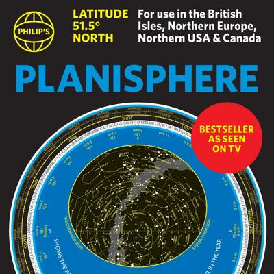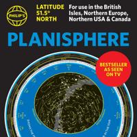
Sterrenkaart - Planisfeer Planisphere (Latitude 51. 5 North) | Philip's Maps

0
The first thing that every stargazer needs - an hour-by-hour and night-by-night moveable map of the stars 'A really useful bit of kit...a map of the night sky for any time of the year' Mark Thompson, TV Astronomer on BBC Stargazing Live   - Just turn the disc and 'dial up' tonight's night sky - Bestselling and accurate sky map for every hour of ev...

Verkopers met dit product

Verkoper
Bezorging
Prijs
DeZwerver.nl logo
DeZwerver.nl
2,95
18,95

Anderen bekeken ook

Sterrenkaart - Planisfeer The Night Sky | Waterford Press
Een handige uitklapbare glow in the dark sterrenkaart. De kaart is het accuraatst tussen 35 en 45 graden NB, maar kan prima gebruikt worden in het hele noordelijke halfrond. This simplified guide to the night sky includes seasonal GLOW-IN-THE-DARK charts to the stars and constellations and introduces the reader to the solar system, our moon, planets (visible with the naked eye), meteor showers and eclipses. Simply shine a flashlight on the charts to illuminate them and then use your fingers to "walk" between major star groups. Laminated for durability, this indispensable pocket reference is ideal for astronomers of all ages. 
10,95
Wandelkaart Tour & Trail Mallorca - Tramuntana North | Discovery Walking Guides
Let op: deze kaart dekt het noordelijke deel van Mallorca.   For your best adventures, use the best map. Water-proof, split-proof, tear-proof, adventure-proof. Mallorca's Tramuntana North Tour & Trail Super-Durable Map is simply the toughest, most accurate, easy-to-read, easy-to-use multi-purpose map that you can get.   Whether you plan to walk, or explore northern Tramuntana by car or the bus, this is the map for you. A large 960mm by 694mm double sided map sheet covers northern half of Serra de Tramuntana at 1:30,000 scale. This 8th edition sees a significant upgrade from the previous Mallorca North & Mountains Tour & Trail Map, as we have split Serra de Tramuntana in two halves to produce TWO much more detailed maps of larger scale.   This map covers a continuous area from Tramuntana's northern-most Cap de Formentor, including all the coastal resorts such as Port de Pollenca and Port d'Alcudia, all the way to Soller and Deia at the opposite end of the map (for the area from S…
18,95
Wegenkaart - landkaart Savannah Way - Cairns to Broome | Hema Maps
Detailkaart van een deel van Australië. Zeer goed leesbaar, met naast de topografische details veel symbolen waarmee allerhande toeristische zaken worden aangeduid als campsites, nationale parken, attracties, wandelmogelijkheden etc. Find out all you need to know about travelling the Savannah Way between Cairns and Broome. As well as providing a detailed road map for the entire length of the Savannah Way, this map includes handy advice on road conditions, average rainfall and safe driving tips. The useful information also highlights the features you pass in Queensland, Northern Territory and Western Australia. Routes between Cairns and Broome in Hema’s range of very popular touring maps showing roads connecting Australia’s main centres of population along some of the most spectacular routes such as the Great Ocean Road or the Savannah Way. The maps highlight 24-hour fuel supplies, roadside rest areas, camping facilities, places of interest, etc., and include distance charts and, in so…
17,50
Reisgids Stargazing Around the World | Lonely Planet
Embark on an adventure to see the stars with this inspiring guide that spotlights the world's best places to explore the night sky. Discover 100 spectacular sites including dark sky parks, observatories and wild mountains and experience the meditative wonder of stargazing - with essential travel tips so you can have the ultimate starry-eyed trip.   See shooting stars soar through the cosmos from the Brecon Beacons in Wales; or visit the Grand Canyon National Park for its mesmerising views of the glittering night sky. Featuring an introduction to stargazing, in-depth profiles of dark sky sites, calendars of meteor showers and eclipses, and a further collection of must-visit locations to watch space phenomena, this fascinating book is perfect for those interested in astronomy, astrology, and the amazing world around us.   Inside Stargazing Around the World: A Tour of the Night Sky:   - A comprehensive collection of the best stargazing sites around the world offering unforgettable views …
27,95
Wegenkaart - landkaart Brisbane to Cairns | Hema Maps
Detailkaart van een deel van Australië. Zeer goed leesbaar, met naast de topografische details veel symbolen waarmee allerhande toeristische zaken worden aangeduid als campsites, nationale parken, attracties, wandelmogelijkheden etc. An easy-to-follow map that shows both the coastal and inland routes from Brisbane to Cairns. Roadside rest areas, intermediate distances, and a quick-find distance chart are also shown. The map shows all the popular tourist destinations along the Queensland coast. Routes between Brisbane with Cairns in a series of touring maps connecting Australia’s main centres of population along some of the most spectacular routes such as the Great Ocean Road or the Savannah Way. The maps highlight 24-hour fuel supplies, roadside rest areas, camping facilities, places of interest, etc., and include distance charts and, in some titles, city maps. Road network indicates unsurfaced roads and tracks. The maps also show railway lines. There is no topographical information b…
17,50
Wegenkaart - landkaart The Cotswolds | Philip's Maps
A new edition of this double-sided map of the Cotswolds clearly featuring places of tourist and historic interest in an easy-to-read style of mapping, alongside six handy town centre plans. This leisure and tourist map of the Cotswolds gives detailed coverage of the area's road network at a scale of approximately 2 miles to 1 inch (1:125,000). The coverage stretches from Abingdon in the east to Gloucester in the west, and from Swindon in the south to Great Malvern in the north. The map shows places of tourist and historic interest, including castles, camping and caravanning sites, country parks, galleries, gardens, golf courses, museums, nature trails, historic sites, sports venues, theatres and wildlife parks. An index to principal places of interest is also featured. With some of the most enchanting towns and cities in England in the area - all with extraordinary history and notable natural beauty - use the Philip's Leisure Map to explore and delight in the Cotswold magic. Includ…
11,50
Wegenkaart - landkaart Orkney Shetland | Philip's Maps
Whether it's the outstanding natural beauty, ancient sites or an activity-packed break calling you, the Philip's leisure and tourist map of Orkney and Shetland is all you need. Places of interest are clearly marked on the easy-to-read mapping - ideal for planning that all-important route.   This double-sided Philip's leisure and tourist map of Orkney and Shetland gives detailed coverage of the islands' road networks at an easy-to-read scale of approximately 2.5 miles to 1 inch. The Orkney Islands are featured on side one of the map, with the Shetland Islands shown on the reverse.   The maps show places of tourist and historic interest, including beaches, castles, camping sites, distilleries, galleries, gardens, golf courses, museums, nature trails, historic sites, sports and entertainment venues. From the ancient settlement of Orkney's Skara Brae and Scapa Flow to the Shetland Museum and Bobby's Bus Shelter, all the top places of interest are featured on each side of the map for Orkne…
11,50
Wegenatlas Navigator Camping and Caravanning - Atlas of Britain | Philip's Maps
THE MUST-HAVE ATLAS OF BRITAIN FOR CAMPING, CARAVANNING AND MOTORHOMES'A map that beats all others' - The Daily Telegraph'Scale, accuracy and clarity are without parallel' - Driving Magazine'No. 1 in the UK for clear maps' - Independent research surveyThe lure of the open road and British countryside has never waned and the appeal of independent exploration has surely grown in recent years. However, the adventurous need practical information about what lies ahead - from bridge heights, widths and weights to places to stop and enjoy.   Philip's Navigator Camping and Caravanning Atlas of Britain is the No. 1 Choice of Road Atlas for the independent travelling motorist and camper van owner. * Scale: 1.5 miles to 1 inch = 1:100,000 (Northern Scotland: 3 miles to 1 inch = 1:200,000)* Over 1,880 approved campsites located, plus essential advice from The Camping and Caravanning Club* Includes essential information for caravanning motorists: 6000 bridge height limits, 1500 bridge weight limit…
37,50
Wandelkaart - Wegenkaart - landkaart 322 Skyros | Terrain maps
Gedetailleerde wegenkaart en wandelkaart met alle kleine wegen, wandelpaden, hoogtelijnen en toeristische informatie aangegeven. Alle tekst is tweetalig in Engels en Grieks en de waterproof kaart is geschikt voor gebruik met GPS. Skyros belongs to the island complex of the Northern Sporades, but in terms of natural environment it is divided into two: the northern part of the island is covered by a dense pine forest like all the other islands of the northern Sporades, while the southern part is characterized by the wild rocky landscapes of Mount Kochylas, more reminiscent of the Cyclades. Throughout the island there are many old walking trails, making Skyros a growing hiking destination, although - so far - the marking and maintenance of the paths remains problematic.   This fully updated hiking and touring map of Skyros by TERRAIN accurately shows all the paths and trails of the island with point-to-point distances, and of course the entire road network, beaches, archaeological sit…
12,50
Wegenatlas Navigator Britain - Engeland en Schotland 1:100.000 | Ringband | Philip's Maps
Bijzonder gedetaileerde wegenatlas van Engeland en Schotland op schaal 1:100.000 (met het noorden van Schotland 1:200.000). Alle wegen, bezienswaardigheden,  National Trails, campings ... noem maar op en je vindt het in deze atlas. Voorzien van een stevige ringband, iets groter dan A4. Philip's Navigator are Britain's bestselling detailed road atlases - exceptional for their scale and clarity. 'A map that beats all others.' - The Daily Telegraph 'Scale, accuracy and clarity are without parallel.' - Driving Magazine 'No.1 in the UK for clear maps.' - Independent research survey - Scale: 1.5 miles to 1 inch = 1:100,000 (Northern Scotland: 3 miles to 1 inch = 1:200,000) - Super-detailed 6-page route-planning section. - Every street in Britain is marked on the maps.   - Over 3000 roads clearly named. - Featuring major National Trails such as: Hadrian Wall's Path, Offa's Dyke Path, Pennine Way, South Downs Way, Thames Path, The Ridgeway, West Highland Way and Southern Upland Way. - 100 ind…
37,95

Klanten-reviews van Sterrenkaart - Planisfeer Planisphere (Latitude 51. 5 North) | Philip's Maps

Er zijn nog geen beoordelingen voor dit productBen jij de eerste die een review plaatst?

Meer over Sterrenkaart - Planisfeer Planisphere (Latitude 51. 5 North) | Philip's Maps

Productomschrijving

The first thing that every stargazer needs - an hour-by-hour and night-by-night moveable map of the stars 'A really useful bit of kit...a map of the night sky for any time of the year' Mark Thompson, TV Astronomer on BBC Stargazing Live   - Just turn the disc and 'dial up' tonight's night sky - Bestselling and accurate sky map for every hour of every night 24/7/365 - Simple and fun to use for beginners - and an essential tool for experienced astronomers - All the stars and constellations down to magnitude 5 (visible with the naked eye) - Planet Tracker for the major visible planets - Full instructions and hints on exploring the skies by season - Suitable for UK, Ireland, Northern Europe, Canada and Northern USA (51.5N plus or minus 10 degrees)   Philip's have created a bestselling, practical, hour-by-hour tracker of the stars and constellations. Turn the oval panel to tonight's date and time - and reveal the whole sky star by star visible from where you are. The map shows stars down to magnitude 5, plus several important deep-sky objects such as the Pleiades, the Andromeda Galaxy (M31) and the Orion Nebula (M42) The Planisphere is based at 51.5 degrees North.   So it's perfect for stargazers in the UK, Ireland, Northern Europe, the Northern US and Canada and comes in it's own wallet.

Verken gerelateerde categorieën

Webshop.nl maakt gebruik van cookies. Ga je verder op onze website, ga dan akkoord met het plaatsen van cookies en de verwerking van deze data door ons en vermelde partners.