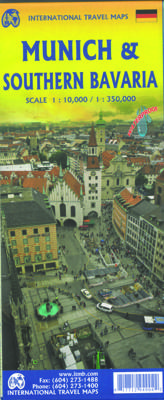
Stadsplattegrond - Wegenkaart - landkaart Munich Southern Bavaria - München / Beieren Zuid | ITMB

0

Verkopers met dit product

Verkoper
Bezorging
Prijs
DeZwerver.nl logo
DeZwerver.nl
2,95
12,95

Anderen bekeken ook

Wegenkaart - landkaart - Stadsplattegrond Toronto & Southern Ontario - Ontario zuid | ITMB
Overzichtskaart van het zuiden van Ontario - schaal 1:600.000 - met op de andere kant een grote plattegrond van Toronto op schaal 1:12.000 Legend Includes: Roads by classification, Accomodations, Museum, Churches, Buildings, Points of tourist, Public Interests, Post Offices, Police Stations, Schools, Live Theatres, Cinemas, Ruins, Bus Terminals, Ferry Terminals, Service Areas, Hospitals, Ports, Mines, RCMP, Major Airports, Secondary Airports, Camp Grounds, National Park and Equivalent Reserves, Ski, Picnic Sites, and much more.   Toronto is the largest city in Canada by far. Touristically, its attraction rests with its central core, from High Park in the west to the Don River in the east, and from the park-like islands in Lake Ontario to Bloor Street in the north. In this area, one finds remnants of the oldest portion of ‘muddy York’, the original fort built to deter American raiders (close to the exhibition grounds), Campbell House (at Queen & University), and the first public schoo…
13,95
Wegenkaart - landkaart - Stadsplattegrond Edinburgh & Southern Scotland | ITMB
Plattegrond van Edinburgh, schaal 1:10.000, met op de achterzijde een overzichtskaart van zuid Schotland, schaal 1:370.000. Legend Includes: Roads by classification, Airports, Ferry lines, Railways, Railway stations, Bus terminals, Bicycle Trails, Pedestrian streets, Staircases, Fishing, Caves, Camps sites, Accomodation, Tourism information centers, Museums, Live Theatres, Cinemas, Post offices, Police Stations, Shopping centers, Schools, Universities, Hospitals, Churches, Mosques, Synagogues, Buddhist temples, Stadiums, Playing fields, Golfing, Beaches, Points of interest, Ruins, Lighthouses, Castles and much more.
13,95
Wegenkaart - landkaart - Stadsplattegrond Montreal & Southern Quebec | ITMB
Stadsplattegrond van Montreal met register. Op de achterzijde een kaart van het zuiden van Quebec. 1:12,500/1:850,000 on waterproof paper. In this third, updated, edition of Canada's third largest city, we have added a user-friendly bonus. As is common now to most of our city maps, we have included a regional map of the hinterland of the urban area, so buyers won't have to purchase a second map to explore the environs of the city being presented. In the case of Montreal, being in a huge geographic country, this means Southern Quebec which, because of its size, dictates a map of more than one to a million scale. In the European context this would be the equivalent of Paris and all of France as a 'regional' map of the surrounds of Paris - but that's France and this is Canada.   Montreal (or Mont Royale in its original) was a village called Hochelaga when the early French explorers arrived in the early 1600s. They established a trading fort and, generally speaking, maintained good relati…
13,95
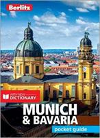
Reisgids Pocket Guide Munich and Bavaria - Munchen & Beieren | Berlitz
Pocket Guide Berlitz is een handzaam engelstalige reisgids met bezienswaardigheden, kaartjes, hotels en restaurants. Past makkelijk in de binnenzak. BerlitzPocket Guide Munich and Bavariacombines snappy text with full-colour photography to highlight the very bestthat Germany's most popular state has to offer. TheWhere To Go chapter details allthe key sights in Munich that you will not want to miss; from the historic Marienplatz,to the regal Residenz and the beer gardens of the Englischer ......
10,95
Wegenkaart - landkaart Southern Quebec - Zuid Quebec | ITMB
Een degelijke kaart met aanduidingen van o.a. nationale parken, vliegveld, benzinepomp, dirt-roads en kleine plattegrond van hoofdstad. Als overzichtskaart goed te gebruiken. La Belle Province has a lot in common with Ontario. It is a huge political entity, with most of the land mass unusable due to permafrost. Almost all the roads and settlements are in the southern half of the province, so we expanded the scale of our artwork and created a map that will be of greater practical use for visitors than one of the entire province. Even so, the distances are formidable (say it in French; it sounds much more dramatic!) Side one concentrates on the region north of Montreal, and includes the Canadian Shield region of Abitibi. The second side follows the St. Lawrence River eastward to Quebec City, where one can continue eastward on the north shore for hundreds of kilometers or cross over an enormous bridge to the south shore and do essentially the same; ending up in the picturesque Gaspe Peni…
13,95
Wegenkaart - landkaart South America Southern - Zuid Amerika, deel Zuid | ITMB
1:2,600,000 scale 6th Edition, double-sided printing. This map shows the southern third of South America in better detail than any other map.gIt starts at northern Chile, southern Paraguay, and central Brasil, and moves south to cover all of Argentina and almost all of Chile. Side 1 is a detailed road map of the region as far south as Buenos Aires. Side 2 covers Patagonia, the coast of Chile, and Tierra del Fuego. Map size: 27"X39"
13,95
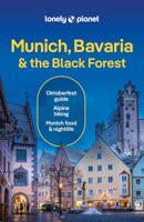
Reisgids Munich, Bavaria & The Black Forest | Munchen, Beieren & Zwarte WOud | Lonely Planet
De perfecte reisgids voor zowel de georganiseerde als de zelfstandige reiziger. Naast een algemene inleiding van het land / streek vol met praktische informatie over hoe je er het beste kunt reizen: slapen, eten, vervoer, excursies ... alles kun je er in vinden. Lonely Planet's local travel experts reveal all you need to know to plan the trip of a lifetime to Munich, Bavaria & the Black Forest.   Discover popular and off the beaten track experiences from visiting the fairytale castle of Neuschwanstein to celebrating lager and Bavarian culture at Oktoberfest, and exploring Germany's tallest mountain with a hike to the top of the Zugspitze.   Build a trip to remember with Lonely Planet's Munich, Bavaria & the Black Forest travel guide:   Our classic guidebook format provides you with the most comprehensive level of information for planning multi-week trips Updated with an all new structure and design so you can navigate Munich, Bavaria & the Black Forest and connect experiences…
24,95

Klanten-reviews van Stadsplattegrond - Wegenkaart - landkaart Munich Southern Bavaria - München / Beieren Zuid | ITMB

Er zijn nog geen beoordelingen voor dit productBen jij de eerste die een review plaatst?

Meer over Stadsplattegrond - Wegenkaart - landkaart Munich Southern Bavaria - München / Beieren Zuid | ITMB

Productinformatie

    Verken gerelateerde categorieën

    Webshop.nl maakt gebruik van cookies. Ga je verder op onze website, ga dan akkoord met het plaatsen van cookies en de verwerking van deze data door ons en vermelde partners.