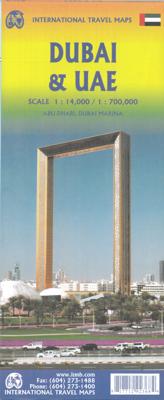
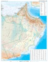
Stadsplattegrond - Wegenkaart - landkaart Dubai / Verenigde Arabische Emiraten Oman | ITMB

0

Verkopers met dit product

Verkoper
Bezorging
Prijs
DeZwerver.nl logo
DeZwerver.nl
2,95
12,95

Anderen bekeken ook

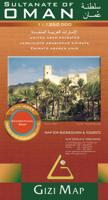
Wegenkaart - landkaart Oman en Verenigde Arabische Emiraten | Gizi Map
Oman met Verenigde Arabische Emiraten op 1: 1,250,000 op een geïndexeerde kaart van Gizi Map met uitstekende presentatie van de topografie, veel plaatsnamen in zowel Arabisch als Latijns schrift, olie- of gasplatforms en pijpleidingen in de zuidelijke Perzische Golf, enz.   Vetgedrukte kleuring toont de topografie, met extra afbeeldingen voor woestijnen, zoutvlakten, wadi's, oases, bronnen, enz., Plus koraalriffen in kustwateren en bathymetrische verven van de zeeën. De kaart heeft veel namen van verschillende geografische kenmerken: woestijnen, bergketens, enz. In Oman zijn de namen van steden en dorpen in zowel het Arabische als het Latijnse alfabet, evenals topografische kenmerken op de hele kaart.   Wegennet omvat woestijnsporen en toont afstanden op hoofdroutes en locaties van grensovergangen. Binnenlandse luchthavens en havens zijn gemarkeerd. Binnen Oman worden administratieve grenzen en namen van de provincies weergegeven en in VAE namen van de afzonderlijke Emiraten. Ook gema…
15,95
Wegenkaart - landkaart Muscat / Oman | ITMB
The very name Muscat and Oman entices one! The peninsula at the access point to the Persian/Arabian Gulf sounds very exotic – and it is! This double-sided map focuses on the city and region of Muscat on side one at a detailed scale, noting the Grand Mosque, the Mutrah Souk, and the Royal Opera House as well as showing hotels, shopping areas, and other sites of touristic interest. Muscat used to be a British protectorate, but is now part of Oman, albeit physically separated from it by a portion of the UAE. The country fills side 2. Oman is portrayed as a north-south alignment, as it is long and not particularly wide, and nicely fills the sheet, with an inset of Salalah, close to the Yemeni border. Connections to nearby Abu Dhabi and Dubai are also shown. Oman is a haven of peaceful co-existence, and tourists are welcome, so this map is designed to encourage visitors  
13,95
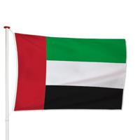
Verenigde Arabische Emiraten Vlag
[split] [block-content] De vlag van de Verenigde Arabische Emiraten heeft een rode verticale baan aan de hijszijde en drie horizontale banen in groen, wit en zwart. De vlag werd geïntroduceerd op 2 december 1971. Kenmerken van de Verenigde Arabische Emiraten vlag De vlag van Verenigde Arabische Emiraten is beschikbaar in verschillende gangbare afmetingen. Je kiest de gewenste afbeelding via de keuze optie. De vlag is gemaakt van 3-draads geweven glanspolyester vlaggendoek (115 gr/m2). De vlag heeft een kwalitatieve afwerking, is uw-werend en kan gewassen worden op maximaal 40 graden. De vlag heeft een gemiddelde levensduur van 3 tot 6 maanden bij continue gebruik. De levensduur is afhankelijk van de locatie en weersomstandigheden. Voordelen van de Verenigde Arabische Emiraten vlag kopen bij Vlaggen Unie De Verenigde Arabische
11,49
Wegenkaart - landkaart Oman & Yemen - Jemen | ITMB
Een degelijke kaart met aanduidingen van o.a. nationale parken, vliegveld, benzinepomp, dirt-roads en kleine plattegrond van hoofdstad. Als overzichtskaart goed te gebruiken.    We were in Oman a couple of weeks before year end and can certify that it is a safe and attractive country to visit; completely different from its neighbours. The main city is Muscat, which has an inset map on the country side of the sheet, as well as a map of Salalah, in the far west of the country. The road network of the country is well developed, with several crossings to the UAE. Unfortunately, none are available to Saudi Arabia, and the crossing to Yemen, while open, is not advised, due to on-going fighting. Oman also has two enclaves surrounded by UAE; a small one north of Fujairah, and another at the northern tip of the peninsula, separating the Gulf of Oman from the Persian (or Arabic) Gulf. Oman has a long history and an interesting culture, and is well worth a visit. The other side of the sheet con…
13,95
Wegenkaart - landkaart USA Verenigde Staten | ITMB
Een degelijke kaart met aanduidingen van o.a. nationale parken, vliegveld, benzinepomp, dirt-roads en kleine plattegrond van hoofdstad. Als overzichtskaart goed te gebruiken. United States of America (USA) Travel Reference Map has been mapped before, but the USA is a huge country, extremely developed, and almost impossible to show on a map without over-simplification. Most commercial maps use small sheets of paper and print single-sided, making it impossible to show this vast country to advantage. Well, Lan’s been hard at work developing a ‘proper’ traveller’s aid to navigating around the USA, and here it is. We printed it on an exceptionally large sheet of paper, 39” tall by 54” wide (our normal printing size is 27”x39”). To do this, we merged our four existing databases into one, then split them so that the west side is on one side and the east side on the other. What results is a very large sheet, but a map at a VERY good scale. We were able to fit in 6,765 urban areas, all the Int…
13,95
Wegenkaart - landkaart - Stadsplattegrond Hongarije - Boedapest | ITMB
Central Europe emergence from Soviet Russia control has revealed one of the historic gems of Europe. It is difficult to think of Hungary without including Budapest, and the Danube River. This updated edition of Hungary shows the entire country on one side, with Budapest filling the other. This is the perfect map for a trip to the heart of Europe. The map has also been upgraded to plastic paper for durability. With this map, a traveller would not need another map to explore beautiful Hungary   Legend Includes: Road by classification, Major road, Tram, Long distance train, Ferry dock, Church, Post office, Point of interest, Police station, Shopping centre, Pedestrian zone and much more...
13,95
Stadsplattegrond - Wegenkaart - landkaart Cardiff & Wales | ITMB
Een dubbelzijdige kaart met aan de ene zijde een plattegrond van Cardiff, schaal 1:8.000 en op de andere zijde een wegenkaart, schaal 1:300.000, met aanduidingen van o.a. nationale parken, vliegveld, benzinepompen. ITMB finds the UK to be a never-ending source of maps needing to be prepared, such as this one of Cardiff and Wales. Cardiff is the capital of Wales, and is also an international access point to the UK; a map seems desirable. The city is based at the mouth of the River Taff, with most touristic points being concentrated in the harbour area, the city centre, and a concentration of eateries along Albany Road. Cardiff is shaped by two parallel motorways; the A4232close to the waterfront, and the A48 near the northern extremities. Both are included in our map, which also shows historic sites, hotels, and tourist amenities. The reverse side shows all of Wales as an entity, showing roads, rail lines, ferry crossing points, and access routes to England. It also shows historic site…
13,95

Klanten-reviews van Stadsplattegrond - Wegenkaart - landkaart Dubai / Verenigde Arabische Emiraten Oman | ITMB

Er zijn nog geen beoordelingen voor dit productBen jij de eerste die een review plaatst?

Meer over Stadsplattegrond - Wegenkaart - landkaart Dubai / Verenigde Arabische Emiraten Oman | ITMB

Productinformatie

    Verken gerelateerde categorieën

    Webshop.nl maakt gebruik van cookies. Ga je verder op onze website, ga dan akkoord met het plaatsen van cookies en de verwerking van deze data door ons en vermelde partners.