webshop.nl
Categorieën
  Sluiten

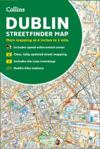
Stadsplattegrond Streetfinder Dublin | Collins

Explore the city of Dublin with this detailed, fully updated colour map. Street by street map covering central Dublin and the surrounding area. The map, at a scale of 4 inches to 1 mile (1:15,840), has clear, colour-classified streets named and numbered plus places of interest, all fully colour coded for ease of use. It covers the area from Ballymu...
7,95

Webshops met dit product

Webshop
Bezorging
Prijs

Anderen bekeken ook

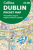
Stadsplattegrond Pocket Map Dublin | Collins
Explore new places with handy pocket maps from Collins. Handy little full colour Collins map of central Dublin with a high level of detail. Map at a scale of 1:7,800 (8 inches to 1 mile).   Includes major tourist landmarks. Clear, detailed, full colour Collins mapping is presented in a handy format ideal for the pocket or handbag. It is excellent value and covers the most visited areas of central Dublin.   It is an essential buy for tourists and residents alike. This map includes:* Detailed central area map* Tourist locations* Tram, train, bus stations and ferry information* Listing of major places to visit, with additional details for the main attractions* Detailed street index* Around Dublin area map extending to airport, Dun Laoghaire and Maynooth  
7,95
Wegenatlas Handy Road Atlas Scotland - Schotland | Collins
Handzame A% wegenatlas van Schotland met register en stadsplattegronden. Discover new places with handy road atlases from Collins. Your ideal companion for navigating around Scotland. It has extremely clear, route planning maps of Scotland, detailed city plans of the major cities and towns and fits neatly into your glovebox, briefcase or bag.   Main featuresClear, attractive route planning maps of the whole of Scotland supported by comprehensive, fully indexed city centre street maps of Aberdeen, Dundee, Edinburgh, Glasgow, Inverness and Perth. Scale of main maps: 1:625,000 (9.9 miles to 1 inch). Also includes* Places of tourist interest are highlighted* Attractive layer colouring showing land height* Road network fully classified and colour coded* Detailed street mapping of Edinburgh, including the Royal Mile with all its attractions clearly marked, Leith and Holyrood Park* Detailed street mapping of Glasgow, including the West End, city centre and M74 extension* Detailed street mappi…
9,95
Stadsplattegrond Pocket Street Map Liverpool | A-Z Map Company
Navigate your way around Liverpool with detailed street maps from A-Z This fully updated, folded map covers all of Central London, including: Regent's Park, King's Cross, The Barbican, Spitalfields, Tower Bridge, The South Bank, Waterloo Station, Westminster, South Kensington, Paddington Station and Lord's Cricket Ground.   The large scale 1 mile to 5.5 inch (1 km to 8.68 cm) street map includes the following:   • Places of interest   • One-way streets and car parks   • Index to streets, places of interest, place and area names, park and ride sites, national rail stations, hospitals and hospices   • Separate lists of streets, places of interest, cinemas, theatres and stations (which include London Underground, National Rail and Docklands Light Railway stations)   • A central London Underground Map is printed on the back cover.   The perfect reference map for finding your way around Central London.
7,95
Wegenatlas Big Road Atlas Britain and Northern Ireland 2025 | A3 | Ringband | Collins
Grote wegenatlas, a3-formaat in ringband. The ultimate 3.2 miles to 1 inch scale large-format, spiral-bound road atlas of Britain, featuring Collins’ popular and well established road mapping, and designed for exceptional clarity and ease of use.   The atlas has a wide range of urban area maps at even larger scale and 64 detailed town centre street plans.   This fully updated road atlas covers the whole of Britain with each scale of mapping colour-coded for ease of use. The smallest scale maps are great for long distance route planning and the street plans help you locate your final destination.   Main features:   Easy to use, clear road maps at a scale of 3.2 miles to 1 inch of England, Wales and Southern Scotland. Northern Scotland is shown at 5 miles to 1 inch Route planning section including maps at a scale of 15.8 miles to 1 inch, motorway services information and a handy distance calculator 22 urban area approach maps at 1 mile to 1 inch which clearly show the best rou…
20,95
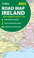
Wegenkaart - landkaart Ireland - Ierland road map 2025 | Collins
Explore Ireland with easy-to-read mapping from Collins. Full-color map of Ireland at 9 miles to 1 inch (1:570,240), with clear, detailed road network and counties and new administrative areas shown in color. This double-sided map covers the whole of Ireland, and is ideal for reference or route planning.   This map of Ireland shows the road network in detail. It is ideal for business users, with coloring of local council areas, but it is also perfect for tourists as a route planning map.   Main features include:   Fully updated New administrative areas shown in color Clear, detailed road network Town and city names, rivers, lakes, spot heights, railway lines and canals are clearly shown City/town centre street plans of Belfast, Cork, Dublin, Dún Laoghaire, Galway, Limerick, Londonderry/Derry and Waterford showing places of interest Full index to place names Mileage chart Car ferry routes Key in English, French and German Area of coverage Covers the whole of the Republic of Ireland and N…
11,50
Stadsplattegrond Pocket Map Aberdeen | Collins
Handy little full colour Collins map of Aberdeen with a high level of detail. Clear mapping of the central area extending to the airport and along the coast, with all tourist locations. Map at a scale of 1:10 725 (5.8 inches to 1 mile).   Clear, detailed, full colour Collins mapping is presented in a handy format ideal for the pocket or handbag. It is excellent value and covers the most visited area of central Aberdeen. It is an essential buy for tourists and residents alike.   This map includes: • Detailed central area map • Around Aberdeen map extending to airport and along the coast • Tourist locations • Train and bus stations • Listing of major places to visit, with additional details for Aberdeen Maritime Museum and Duthie Park Winter Gardens • Detailed street index
7,95
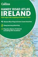
Wegenatlas Handy Road Atlas Ireland - Ierland | Collins
Handzame wegenatlas op A5 formaat van Ierland. Vrij grove schaal maar heel handig door formaat en goed kaartbeeld.  Met enkele stadsplattegronden en een paar pagina's met hoogtepunten van het land.  Explore Ireland with this handy format route-planning atlas in full colour, complete with information on places of tourist interest. There are also fully indexed town centre plans of Belfast, Cork, Dublin, Galway, Limerick and Londonderry. Now with places of interest marked including famous film locations. This atlas, at A5 size, contains mapping of the whole of Ireland at 9 miles to 1 inch (1:570,240). The mapping is beautifully designed with colour classified roads and subtle layered height tinting. The atlas is ideal for residents, visitors and tourists alike. Key features of the atlas include:* All Ireland route planning maps* Town centre plans* Places of interest including TV and film locations such as Game of Thrones, Star Wars and Harry Potter* Blue Flag and Green Coast beaches map* …
8,95
Stadsplattegrond Dublin | Borch
Borch Dublin is een duidelijke, geplastificeerde plattegrond van het centrum met informatie over openbaar vervoer en bezienswaardigheden. Inclusief straatnamenregister. Our soft-laminated folded map of Dublin shows: Central Dublin 1:12 000, Phoenix Park 1:25 000, Temple Bar & Grafton Street 1:10 000, Dublin & Environs 1:125 000, East Coast 1:700 000, Public Transport Dublin, Ireland administrative & time zones, Top 30 Sights. Borch Maps are easy to fold, durable and water-repellent with a wipeable surface. Borch Maps show hotels, museums, moanuments, markets, public transport, top sights and points of interest, useful statistics, conversion charts for temperatures, weights and measurements, climate charts showing temperatures, sunshine hours, precipitation and humidity, overview maps, time zones, and much more...   The bustling Irish capital has much to offer the visitor, especially with regard to literary history. Once home to Oscar Wilde, James Joyce, W.B. Yeats, G.B. Shaw, Samuel Be…
10,25
Stadsplattegrond Pocket Map Edinburgh | Collins
Handy little full colour map of central Edinburgh with a high level of detail. Clear mapping from Leith in the north to The Meadows in the south, and Edinburgh Zoo in the west to Holyrood Park in the east. Map at a scale of 1:11,000 (6 inches to 1 mile).   Clear, detailed, full colour mapping is presented in a handy format ideal for the pocket or handbag. It is excellent value and covers the most visited area of central Edinburgh. It is an essential buy for tourists and residents alike.   This map includes: • Detailed central area map • Around Edinburgh map extending to airport, Pentland Hills and Forth Road Bridge • Tourist locations • Tram, train and bus stations • Listing of major places to visit, with additional details for Edinburgh Castle and Holyroodhouse • Detailed street index
7,95
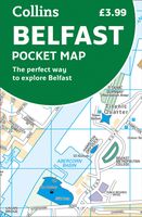
Stadsplattegrond Pocket Map Belfast | Collins
Handige kleine stadsplattegrond van Belfast.   Handy little full color Collins map of central Belfast with a high level of detail. Clear mapping from Cliftonville in the north to Botanics in the south, and Shankill in the west to City Airport in the east. Map at a scale of 1:10,000 (6 inches to 1 mile).     Clear, detailed, full color Collins mapping is presented in a handy format ideal for the pocket or handbag. It is excellent value and covers the most visited area of central Belfast. It is an essential buy for tourists and residents alike.     This map includes: • Detailed central area map • Tourist locations • Tram, Train and bus stations • Extra information on entertainment, festivals, places of interest, shopping and transport links • Detailed street index
7,95

Klanten-reviews van Stadsplattegrond Streetfinder Dublin | Collins

Er zijn nog geen beoordelingen voor dit productBen jij de eerste die een review plaatst?

Meer over Stadsplattegrond Streetfinder Dublin | Collins

Productomschrijving

Explore the city of Dublin with this detailed, fully updated colour map. Street by street map covering central Dublin and the surrounding area. The map, at a scale of 4 inches to 1 mile (1:15,840), has clear, colour-classified streets named and numbered plus places of interest, all fully colour coded for ease of use. It covers the area from Ballymun and Baldoyle in the north to Dundrum in the south, and includes Castleknock and Phoenix Park in the west to the coast in the east. It is ideal for residents, businesses and visitors alike. The map includes: - A guide to central Dublin, including information on its history, and travel, transport and shopping. - Full index to street names. - Route planning map of the area around Dublin. - Luas tramways and inner and outer orbital routes. - Important buildings and places of interest. - Car parks and railway stations. - Speed enforcement zones as highlighted by the Garda and the National Roads Authority. - Fixed safety camera locations.

Verken gerelateerde categorieën

Webshop.nl maakt gebruik van cookies. Ga je verder op onze website, ga dan akkoord met het plaatsen van cookies en de verwerking van deze data door ons en vermelde partners.