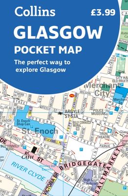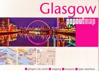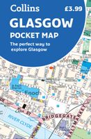
Stadsplattegrond Pocket Map Glasgow | Collins

0
Clear, detailed, full color Collins mapping is presented in a handy format ideal for the pocket or handbag. It is excellent value and covers the most visited area of central Glasgow. It is an essential buy for tourists and residents alike. This map includes: Detailed central area map Around Glasgow map extending to airport, Pollok Park and Strat...

Verkopers met dit product

Webshop
Bezorging
Prijs
DeZwerver.nl logo
DeZwerver.nl
niet bekend
7,95

Anderen bekeken ook

Stadsplattegrond Pocket Map Aberdeen | Collins
Handy little full colour Collins map of Aberdeen with a high level of detail. Clear mapping of the central area extending to the airport and along the coast, with all tourist locations. Map at a scale of 1:10 725 (5.8 inches to 1 mile).   Clear, detailed, full colour Collins mapping is presented in a handy format ideal for the pocket or handbag. It is excellent value and covers the most visited area of central Aberdeen. It is an essential buy for tourists and residents alike.   This map includes: • Detailed central area map • Around Aberdeen map extending to airport and along the coast • Tourist locations • Train and bus stations • Listing of major places to visit, with additional details for Aberdeen Maritime Museum and Duthie Park Winter Gardens • Detailed street index
7,95
Stadsplattegrond Pocket Map Dublin | Collins
Explore new places with handy pocket maps from Collins. Handy little full colour Collins map of central Dublin with a high level of detail. Map at a scale of 1:7,800 (8 inches to 1 mile).   Includes major tourist landmarks. Clear, detailed, full colour Collins mapping is presented in a handy format ideal for the pocket or handbag. It is excellent value and covers the most visited areas of central Dublin.   It is an essential buy for tourists and residents alike. This map includes:* Detailed central area map* Tourist locations* Tram, train, bus stations and ferry information* Listing of major places to visit, with additional details for the main attractions* Detailed street index* Around Dublin area map extending to airport, Dun Laoghaire and Maynooth  
7,95
Stadsplattegrond Pocket Map Edinburgh | Collins
Handy little full colour map of central Edinburgh with a high level of detail. Clear mapping from Leith in the north to The Meadows in the south, and Edinburgh Zoo in the west to Holyrood Park in the east. Map at a scale of 1:11,000 (6 inches to 1 mile).   Clear, detailed, full colour mapping is presented in a handy format ideal for the pocket or handbag. It is excellent value and covers the most visited area of central Edinburgh. It is an essential buy for tourists and residents alike.   This map includes: • Detailed central area map • Around Edinburgh map extending to airport, Pentland Hills and Forth Road Bridge • Tourist locations • Tram, train and bus stations • Listing of major places to visit, with additional details for Edinburgh Castle and Holyroodhouse • Detailed street index
7,95
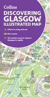
Stadsplattegrond Glasgow Illustrated Map | Collins
Explore new places with dependable maps from Collins. As the largest city in Scotland, Glasgow is a vibrant and bustling hub, enjoyed by thousands of visitors each year. This updated map displays delightful water-colour mapping, and includes individual illustrations of all the main sights and landmarks in the city.   Covers the centre of Glasgow from the Botanic Gardens in the north and the Riverside Museum to the west to the 12th century Cathedral and the gritty Barras Market to the east. Further mapping stretches southwest to Pollok Park and the newly refurbished Burrell Collection. The map features: Historical and contemporary anecdotesPopular areas at larger scale, hundreds of shops, restaurants, cafes and barsComprehensive travel information and indexShop-by-shop street maps of Buchanan Street and the Merchant CityRailway stations, taxi ranks and car parksBus routes shown for tour companies and airport linksBeautiful illustrations of Glasgow's top sights The perfect companion or …
9,95
Wegenkaart - landkaart Pocket Map Skye | Collins
Handy little full colour Collins map of Skye with a high level of detail. Clear mapping of the Isle of Skye showing the road network, ferries and places of interest. Map at a scale of 1:175 000 (3 miles to 1 inch).   Clear, detailed, full colour Collins road mapping is presented in a handy format ideal for the pocket or handbag. It is excellent value and covers the whole of the Isle of Skye. This map includes:* Scotland route map* Caravan and camping sites* Tourist locations* Ferry links* Listing of major places to visit, with additional details for Dunvegan Castle, Old Man of Storr and Loch Coruisk* Detailed place names index
7,95
Stadsplattegrond Pocket Street Map Liverpool | A-Z Map Company
Navigate your way around Liverpool with detailed street maps from A-Z This fully updated, folded map covers all of Central London, including: Regent's Park, King's Cross, The Barbican, Spitalfields, Tower Bridge, The South Bank, Waterloo Station, Westminster, South Kensington, Paddington Station and Lord's Cricket Ground.   The large scale 1 mile to 5.5 inch (1 km to 8.68 cm) street map includes the following:   • Places of interest   • One-way streets and car parks   • Index to streets, places of interest, place and area names, park and ride sites, national rail stations, hospitals and hospices   • Separate lists of streets, places of interest, cinemas, theatres and stations (which include London Underground, National Rail and Docklands Light Railway stations)   • A central London Underground Map is printed on the back cover.   The perfect reference map for finding your way around Central London.
7,95
Wegenkaart - landkaart Pocket Map Wild Atlantic Way | Collins
Handy full-colour map of Ireland’s Wild Atlantic Way with a high level of detail. Clear mapping of the full 2500 km (over 1500 miles) route, showing the road network and places of interest.   Clear, detailed Collins road mapping is presented in a handy format ideal for the pocket or handbag. It is excellent value and very detailed for its size, covering the whole of the Wild Atlantic Way.   Ideal for tourists, locals, hikers and adventurers. Places of interest marked, including famous film locations.   This map includes: • Clear mapping at a scale of 8.7 miles to 1 inch • National Tourist Routes showing best routes through the most scenic areas • Places of interest include film locations such as Star Wars • Tourist and signature locations clearly marked • Suggested itineraries • Detailed place names index • Ideal companion to a sat-nav – it enables route planning and route sense-checking
7,95
Stadsplattegrond Popout Map Orlando | Compass Maps
Handig ( borstzak- ) formaat stadsplattegrond met voldoende detail, zodat je ook de kleinere straatjes erop aantreft. Van veel wereldsteden inmidddels leverbaar en dat is mooi, want juist in dit soort steden wil je je handen liever vrij houden en niet teveel hoeven stoeien met het uitvouwen van een grote plattegrond, en/of teveel als "toerist" opvallen. Door het unieke vouwsysteem blijft alles zeer compact en biedt het kaartje een razendvlugge manier van orientatie. Wel is dit product alleen geschikt voor het ( grote ) centrum van de stad.Verder geven de kaartjes uit deze reeks ook de meeste highlights van de stad aan en ( indien van toepassing ) een overzichtskaartje van de metro. Explore Florida's playground, Walt Disney World and Orlando, with the help of this genuinely pocket-sized, pop-up, map. Small in size yet big on detail, this compact, dependable, Walt Disney World and Orlando pop-up map will ensure you don't miss a thing. * Includes 2 PopOut maps - a detailed pop-up street…
7,95
Wegenkaart - landkaart National Park Pocket Map Pembrokeshire Coast | Collins
Duidelijke pocket wandelkaart met belangrijke toeristische informatie, bezienswaardigheden, campeerplekken e.d. Handy little full colour map and guide of Pembrokeshire Coast National Park. Detailed mapping and visitor information to the National Park along with a selection of photographs. Map at a scale of 1:133,000 (2.1 miles to 1 inch or 1.33 km to 1cm).   This small map with additional text and photographs gives a great overview of the Pembrokeshire Coast National Park, and is the perfect companion for exploring this beautiful area of West Wales.   Clear, detailed mapping Key park, tourist and travel information Ideal for planning visits to the National Park Index to help locate and plan your trip
7,95
Stadsplattegrond Pocket Street Map Cambridge | A-Z Map Company
Stadsplattegrond van Cambridge in 48 pagina´s, inclusief index met straatnamen en belangrijke plaatsen. Bevat tevens een detail weergave van het centrum.   Navigate your way around Cambridge with detailed street maps from A-Z This up-to-date, folded A-Z street map includes more than 2,000 streets in and around Norwich. As well as the Norwich Cathedral and central Norwich, the other areas covered include Cringleford, Lakenham, Whitlingham Country Park, Thorpe St Andrew, New Catton and Hellesdon. The large scale 1 mile to 5.5 inch (1 km to 8.68 cm) street map includes the following: • Places of interest • One-way streets and car parks • Index to streets, places of interest, place and area names, park and ride sites, national rail stations, hospitals and hospices The perfect reference map for finding your way around Norwich.  
7,95

Klanten-reviews van Stadsplattegrond Pocket Map Glasgow | Collins

Er zijn nog geen beoordelingen voor dit productBen jij de eerste die een review plaatst?

Meer over Stadsplattegrond Pocket Map Glasgow | Collins

Productomschrijving

Clear, detailed, full color Collins mapping is presented in a handy format ideal for the pocket or handbag. It is excellent value and covers the most visited area of central Glasgow. It is an essential buy for tourists and residents alike.

This map includes:

  • Detailed central area map
  • Around Glasgow map extending to airport, Pollok Park and Strathclyde Park
  • Tourist locations
  • Train and bus stations
  • Listing of major places to visit
  • Detailed street index

Verken gerelateerde categorieën

Webshop.nl maakt gebruik van cookies. Ga je verder op onze website, ga dan akkoord met het plaatsen van cookies en de verwerking van deze data door ons en vermelde partners.