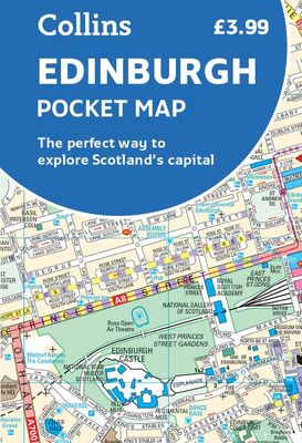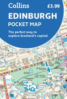
Stadsplattegrond Pocket Map Edinburgh | Collins

0
Handy little full colour map of central Edinburgh with a high level of detail. Clear mapping from Leith in the north to The Meadows in the south, and Edinburgh Zoo in the west to Holyrood Park in the east. Map at a scale of 1:11,000 (6 inches to 1 mile).   Clear, detailed, full colour mapping is presented in a handy format ideal for the pocket or ...

Verkopers met dit product

Webshop
Bezorging
Prijs
DeZwerver.nl logo
DeZwerver.nl
niet bekend
7,95

Anderen bekeken ook

Stadsplattegrond Pocket Map Aberdeen | Collins
Handy little full colour Collins map of Aberdeen with a high level of detail. Clear mapping of the central area extending to the airport and along the coast, with all tourist locations. Map at a scale of 1:10 725 (5.8 inches to 1 mile).   Clear, detailed, full colour Collins mapping is presented in a handy format ideal for the pocket or handbag. It is excellent value and covers the most visited area of central Aberdeen. It is an essential buy for tourists and residents alike.   This map includes: • Detailed central area map • Around Aberdeen map extending to airport and along the coast • Tourist locations • Train and bus stations • Listing of major places to visit, with additional details for Aberdeen Maritime Museum and Duthie Park Winter Gardens • Detailed street index
7,95

Stadsplattegrond Pocket Map Dublin | Collins
Explore new places with handy pocket maps from Collins. Handy little full colour Collins map of central Dublin with a high level of detail. Map at a scale of 1:7,800 (8 inches to 1 mile).   Includes major tourist landmarks. Clear, detailed, full colour Collins mapping is presented in a handy format ideal for the pocket or handbag. It is excellent value and covers the most visited areas of central Dublin.   It is an essential buy for tourists and residents alike. This map includes:* Detailed central area map* Tourist locations* Tram, train, bus stations and ferry information* Listing of major places to visit, with additional details for the main attractions* Detailed street index* Around Dublin area map extending to airport, Dun Laoghaire and Maynooth  
7,95
Stadsplattegrond Pocket Map Glasgow | Collins
Clear, detailed, full color Collins mapping is presented in a handy format ideal for the pocket or handbag. It is excellent value and covers the most visited area of central Glasgow. It is an essential buy for tourists and residents alike. This map includes: Detailed central area map Around Glasgow map extending to airport, Pollok Park and Strathclyde Park Tourist locations Train and bus stations Listing of major places to visit Detailed street index
7,95
Wegenkaart - landkaart Pocket Map Fife | Collins
Handy little full colour map of the coastal Kingdom of Fife. Detailed mapping and tourist information from Dundee in the North to Edinburgh in the south and from Fife coast in the east to Stirling in the west.   Ancestral home of Scottish monarchs, world-famous for its golf and some of Scotland's best scenic attractions, the Kingdom of Fife has a distinct identity. Discover this unique area with this handy pocket map.   Main features of this map include: • Clear mapping at a scale of 2.3 miles to 1 inch / 1.5 km to 1 cm • Main tourist attractions located and described • Ideal for touring with sights, places to stay, cafe/restaurant, golf courses, things to do all on the map • Essential travel information • Index to places of interest and place names   Essential for those planning a trip around the mighty Kingdom of Fife.
7,95
Wegenkaart - landkaart Pocket Map Somerset | Collins
Explore new places with handy pocket maps from Collins. Handy little full-colour map of county of Somerset. Detailed mapping, photographs and tourist information.   Famed for its cheddar cheese, cider, and apple orchards, Somerset has a distinct identity. Discover this unique area with this handy pocket map. Main features of this map include: Clear mapping at a scale of 2.3 miles to 1 inch / 1.5 km to 1 cmMain tourist attractions located and describedIdeal for touring with sights, places to stay, cafe/restaurant, golf courses, things to do all on the mapEssential travel informationIndex to places of interest and place names Essential for those planning a trip around Somerset.
7,95
Stadsplattegrond Pocket Street Map Bath | A-Z Map Company
This up-to-date detailed A-Z street map includes more than 1,700 streets in and around Bath. This street map includes the following: Postcode districts, one-way streets and car parks Tourist attractions and places of interest marked On the reverse side of the map there is a handy index to streets, places of interest, place and area names, park and ride sites, national rail stations, hospitals and hospicesIdeal companion to a sat-nav - it enables route planning and route sense-checking Extensive mapping covers an area from Charlcombe in the north to Combe Down in the south, and from Bathampton Down in the east to Whiteway in the west. With clear mapping at a scale of 5.5 inches to 1 mile, this is the perfect reference map for finding your way around Bath.
7,95
Wegenkaart - landkaart Pocket Map Outer Hebrides | Collins
Explore new places with handy pocket maps from Collins. Handy little full-colour map of the Western Isles of Scotland. Detailed mapping and tourist information for the islands of Lewis, Harris, Uist, Benbecula, Barra and St Kilda.   Excellent value and very detailed for its size. Famed for its stunning coastline, wildlife and traditional food and drink, the Outer Hebrides have a distinct identity. Discover these unique islands with this handy pocket map.   Main features of this map include: Clear mapping at a scale of 3.2 miles to 1 inchTourist attractions located and describedSights, places to stay, cafe/restaurant, things to do are all highlighted on the mapTransport links map showing how to get to and depart the islandsIndex to places of interest and place names Essential for those planning a trip around the Western Isles.
7,95
Wegenkaart - landkaart Pocket Map Suffolk | Collins
Explore new places with handy pocket maps from Collins. Handy little full-colour map of county of Suffolk. Detailed mapping, photographs, and tourist information.   Famed for its archaeological finds, swathes of rural farmland and open skies, Suffolk has a distinct identity. Discover this unique area with this handy pocket map. Main features of this map include: Clear mapping at a scale of 2.3 miles to 1 inch / 1.5 km to 1 cmMain tourist attractions located and describedSights, places to stay, cafe/restaurant, golf courses, and things to do all highlighted on the mapEssential travel informationIndex to places of interest and place names Essential for those planning a trip around Suffolk.
7,95
Stadsplattegrond Discovering Edinburgh Illustrated Map | Collins
Explore new places with dependable maps from Collins. This brand new edition retains the delightful water-colour mapping, with individual paintings of all the main sights and landmarks.   This brand new edition retains the delightful water-colour mapping, with individual paintings of all the main sights and landmarks.   Popular areas at larger scale, hundreds of shops, restaurants, cafés and bars, comprehensive travel information and index.   This map includes:   • Large-scale plans of the Castle, Royal Mile, Botanic Gardens, Leith and Newington   • Shop-by-shop street maps of Princes Street, George Street, Victoria Street and the Grassmarket   • Railway stations, bus routes, taxi ranks and car parks   • Historical and contemporary anecdotes   • Suggestions for day trips out of the city   • Comprehensive index   Area of coverage:   Covers the centre of Edinburgh from Inverleith Park in the north to The Meadows in the south, and from the Scottish National Gallery of Modern Art in the w…
12,50
Wegenkaart - landkaart National Park Pocket Map Snowdonia | Collins
Duidelijke pocket wandelkaart met belangrijke toeristische informatie, bezienswaardigheden, campeerplekken e.d.   Handy little full colour map and guide of Snowdonia National Park. Detailed mapping and visitor information to the National Park along with a selection of photographs. Map at a scale of 1:119 000 (1.2cm to 1km, 1.9 miles to 1 inch).   This small map with additional text and photographs gives a great overview of the Snowdonia National Park, and is the perfect companion for exploring this beautiful area of North Wales.   Clear, detailed mapping Key park, tourist and travel information Ideal for planning visits to the National Park Index to help locate and plan your trip Information on historic railways, stargazing, mountain biking and places of interest
7,95

Klanten-reviews van Stadsplattegrond Pocket Map Edinburgh | Collins

Er zijn nog geen beoordelingen voor dit productBen jij de eerste die een review plaatst?

Meer over Stadsplattegrond Pocket Map Edinburgh | Collins

Productomschrijving

Handy little full colour map of central Edinburgh with a high level of detail. Clear mapping from Leith in the north to The Meadows in the south, and Edinburgh Zoo in the west to Holyrood Park in the east. Map at a scale of 1:11,000 (6 inches to 1 mile).   Clear, detailed, full colour mapping is presented in a handy format ideal for the pocket or handbag. It is excellent value and covers the most visited area of central Edinburgh. It is an essential buy for tourists and residents alike.   This map includes: • Detailed central area map • Around Edinburgh map extending to airport, Pentland Hills and Forth Road Bridge • Tourist locations • Tram, train and bus stations • Listing of major places to visit, with additional details for Edinburgh Castle and Holyroodhouse • Detailed street index

Verken gerelateerde categorieën

Webshop.nl maakt gebruik van cookies. Ga je verder op onze website, ga dan akkoord met het plaatsen van cookies en de verwerking van deze data door ons en vermelde partners.