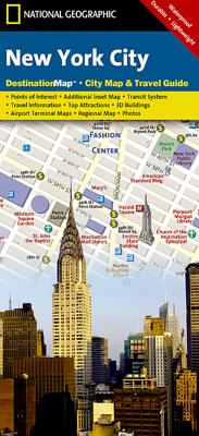
Stadsplattegrond New York City | National Geographic

0

Verkopers met dit product

Verkoper
Bezorging
Prijs
DeZwerver.nl logo
DeZwerver.nl
2,95
11,95

Anderen bekeken ook

Stadsplattegrond New York City | Borch
Borch New York City is een duidelijke, geplastificeerde plattegrond van het centrum van New York (Manhattan) en nog een stukje van Brooklyn en Queens met informatie over openbaar vervoer en bezienswaardigheden. Inclusief straatnamenregister.   Our soft-laminated folded map of New York City shows: Central New York City 1:15 000, Flushing Meadows 1:15 000, Five Boroughs 1:100 000, Public Transport New York City, USA administrative & time zones. Borch Maps are easy to fold, durable and water-repellent with a wipeable surface. Borch Maps show hotels, museums, monuments, markets, public transport, top sights and points of interest, useful statistics, conversion charts for temperatures, weights and measurements, climate charts showing temperatures, sunshine hours, precipitation and humidity, overview maps, time zones, and much more...   Nicknamed "The Big Apple", NYC is the most populous city in the United States. Situated in the state of New York, the city has served as the gateway to the …
9,95
Stadsplattegrond Manhattan (New York City) | Borch
Borch Manhattan is een duidelijke, geplastificeerde plattegrond met informatie over openbaar vervoer en bezienswaardigheden. Inclusief straatnamenregister.   Our soft-laminated folded map of Manhattan shows: Manhattan (Lower & Midtown) 1:15 000, Manhattan (Upper) 1:15 000, Midtown 1:10 000, Financial District 1:9 000, Public Transport New York City, USA administrative & time zones, Manhattan Zip-Codes, USA administrative & time zones and the Top 30 Sights. Borch Maps are easy to fold, durable and water-repellent with a wipeable surface. Borch Maps show hotels, museums, monuments, markets, public transport, top sights and points of interest, useful statistics, conversion charts for temperatures, weights and measurements, climate charts showing temperatures, sunshine hours, precipitation and humidity, overview maps, time zones, and much more...   Manhattan is one of the five boroughs of New York City (the other four boroughs are the Bronx, Queens, Brooklyn and Staten Island) and on a la…
9,95
Stadsplattegrond City map New York | Lonely Planet
De stadsplattegronden van Lonely Planet zijn uitgevoerd op scheur- en watervast papier, zijn lichtgewicht en kennen een handig formaat. Het centrum van de stad is in heldere kleuren in beeld gebracht met straatnamen, bezienswaardigheden en symbolen voor openbaar vervoer. Op de achterzijde staat informatie over de toeristische hoogtepunten en in de meeste gevallen een schematische plattegrond van het openbaar vervoer. Met een register. Durable and waterproof, with a handy slipcase and an easy-fold format, Lonely Planet's New York City Map is your conveniently sized passport to traveling with ease. Get more from your map and your trip with images and information about top city attractions, walking tour routes, transport maps, itinerary suggestions, an extensive street and site index, and practical travel tips and directory. With this easy-to-use, full-color navigation tool in your back pocket, you can truly get to the heart of New York, so begin your journey now! Durable and waterproof…
9,95
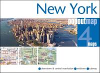
Stadsplattegrond Popout Map New York | Compass Maps
Handig ( borstzak- ) formaat stadsplattegrond met voldoende detail, zodat je ook de kleinere straatjes erop aantreft. Van veel wereldsteden inmidddels leverbaar en dat is mooi, want juist in dit soort steden wil je je handen liever vrij houden en niet teveel hoeven stoeien met het uitvouwen van een grote plattegrond, en/of teveel als "toerist" opvallen. Door het unieke vouwsysteem blijft alles zeer compact en biedt het kaartje een razendvlugge manier van orientatie. Wel is dit product alleen geschikt voor het ( grote ) centrum van de stad.Verder geven de kaartjes uit deze reeks ook de meeste highlights van de stad aan en ( indien van toepassing ) een overzichtskaartje van de metro.   Let PopOut New York guide you around this wonderful city.   The Big Apple in a little map! Get to the heart of New York with this handy, pop-up map. This New York map has been fully revised and updated and includes a detailed map of Midtown. Small in size yet big on detail, this compact, dependable, …
8,95

Klanten-reviews van Stadsplattegrond New York City | National Geographic

Er zijn nog geen beoordelingen voor dit productBen jij de eerste die een review plaatst?

Meer over Stadsplattegrond New York City | National Geographic

Productinformatie

    Verken gerelateerde categorieën

    Webshop.nl maakt gebruik van cookies. Ga je verder op onze website, ga dan akkoord met het plaatsen van cookies en de verwerking van deze data door ons en vermelde partners.