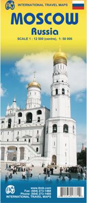
Stadsplattegrond Moskou - Moscow | ITMB

0
Een overzichtelijke stadsplattegrond met stratenindex en aanduiding van toeristische informatie en culturele instellingen zoals musea, monumenten, schouwburgen en sportaccomodaties. Daarnaast bevaten de meeste kaarten een heldere aanduiding van het openbaarvervoer (opstappunten van metro), parkeergelegenheden, postkantoren en andere praktische inf...

Verkopers met dit product

Verkoper
Bezorging
Prijs
DeZwerver.nl logo
DeZwerver.nl
2,95
13,95

Anderen bekeken ook

Nieuw
Wegenkaart - landkaart - Stadsplattegrond Istanbul & Northwest Turkey | ITMB
Dubbelzijdige kaart van ITMB met aan een kant een wegenkaart  1:550.000 met aanduidingen van o.a. nationale parken, vliegveld, benzinepomp, dirt-roads. Als overzichtskaart goed te gebruiken. Aan de andere kant een overzichtelijke stadsplattegrond 1: 11.000 met stratenindex en aanduiding van toeristische informatie en culturele instellingen zoals musea, monumenten, schouwburgen en sportaccomodaties. Daarnaast bevaten de meeste kaarten een heldere aanduiding van het openbaarvervoer (opstappunten van metro), parkeergelegenheden, postkantoren en andere praktische informatie. Istanbul is one of the most interesting cities in Europe. It is loaded with interesting places to see and places to go. The map shows all major touristic sites (my favourite is Constantine s Column), the ferry routes that criss cross the Bosphorus, and the transit lines that move everyone around the city. We have made a significant change to the regional map on the second side of the sheet; in this edition, we provide…
13,95
Nieuw
Stadsplattegrond Moskou | Freytag & Berndt
Stadsplattegrond met register. Helder kaartbeeld waarbij de naamgeving goed leesbaar is weergegeven. Met de toeristische bezienswaardigheden in symbolen weergeven: monumenten, musea, stadions e.a. Daarnaast handige zaken als postkantoren, parkeergarages en stations. Veelal ook met een openbaar vervoer of metro kaart als inzet Street plan of Moscow showing hotels, theatres, metro stations, bus route numbers and much besides. Minor streets are named in the Russian alphabet (so you can read the street signs) with major streets in Russian and Roman script. The main landmarks are named in Russian and English. An enlargement of the city centre is included, and also a further enlargement of the Kremlin and its immediate environs.
13,95
Stadsplattegrond Rome | Freytag & Berndt
Stadsplattegrondkaart met register. De benaming is goed leesbaar door het helder kaartbeeld. Met de toeristische bezienswaardigheden in symbolen weergeven: monumenten, musea, stadions e.a. Daarnaast handige zaken als postkantoren, parkeergarages en stations. Veelal ook met een openbaar vervoer of metro kaart als inzet.    Symbolen geven de plaats aan van  toeristische bezienswaardigheden, monumenten, historisch belangrijke plekken, uitzichtpunten, postkantoren, parkeergarages en stations. In de inzet vind je meer informatie over het openbaar vervoer of metro. Explore Rome with this Freytag & Berndt street map. The best way to plan your trip, prepare your itinerary, and to travel independently in the Italian capital.   Der Stadtplan Rom 1:10.000 bietet zahlreiche Zusatzinformationen wie öffentliche Verkehrsmittel und touristische Informationen. Im umfangreichen Index finden Sie außerdem jede Adresse. Alle Inhalte werden natürlich regelmäßig aktualisiert. Details: Touristische Informat…
14,95
Nieuw
Stadsplattegrond Washington D.C | Freytag & Berndt
Goede stadsplattegrond van Washington D.C. met openbaar vervoer, register. Stadsplattegrond met register. Helder kaartbeeld waarbij de naamgeving goed leesbaar is weergegeven. Met de toeristische bezienswaardigheden in symbolen weergeven: monumenten, musea, stadions e.a. Daarnaast handige zaken als postkantoren, parkeergarages en stations. Veelal ook met een openbaar vervoer of metro kaart als inzet Central Washington DC at 1:12,500 on street plan from Freytag & Berndt clearly showing locations of various government institutions, US and international organizations, numerous foreign embassies, cultural centres, educational establishments and other and places of interest. Metro and railway stations are prominently marked and for drivers access to and from highways is clearly laid out.   Coverage extends north beyond the Howard University Campus to the National Zoological Park; east across the Potomac to Arlington, including the National Cemetery, Fort Myer and the Pentagon; south to the…
13,95
Nieuw
Stadsplattegrond Singapore | Freytag & Berndt
Stadsplattegrond met register. Helder kaartbeeld waarbij de naamgeving goed leesbaar is weergegeven. Met de toeristische bezienswaardigheden in symbolen weergeven: monumenten, musea, stadions e.a. Daarnaast handige zaken als postkantoren, parkeergarages en stations. Veelal ook met een openbaar vervoer of metro kaart als inzet This city map of Singapore at 1: 15,000 by Freytag & Berndt clearly shows tourists attractions, public transport and feature a small inset of central Singapore and a useful index at the back. The map covers an area which extends from the Queenstown New Town district in the west to the Bedok Reservoir in the east and from Bishan metro station and MacRitchie Reservoir Park in the north to the northern part of Sentosa island in the south. The roads network is clearly represented and shows the main motorways reaching the city as well as main and secondary roads and symbols locate the car parks around the city. Colourful lines and symbols illustrate metro lines and st…
13,95
Nieuw
Stadsplattegrond Helsinki | Freytag & Berndt
Stadsplattegrond met register. Helder kaartbeeld waarbij de naamgeving goed leesbaar is weergegeven. Met de toeristische bezienswaardigheden in symbolen weergeven: monumenten, musea, stadions e.a. Daarnaast handige zaken als postkantoren, parkeergarages en stations. Veelal ook met een openbaar vervoer of metro kaart als inzet. Covers the whole city including the airport, and reaching southern Vantaa. One-way streets are indicated and pedestrian zones, car parks and public transport routes - bus, tram, metro, rail and ferry - are marked. Other details include: churches, police stations, hospitals, schools, post offices, campsites, tourist information offices, monuments, parks, forests, marshes. Legend includes English.   There is a diagram of the commuter rail and metro system and a small road map of the Helsinki - Turku region
13,95
Nieuw
Stadsplattegrond Jakarta | Freytag & Berndt
Stadsplattegrond met register. Helder kaartbeeld waarbij de naamgeving goed leesbaar is weergegeven. Met de toeristische bezienswaardigheden in symbolen weergeven: monumenten, musea, stadions e.a. Daarnaast handige zaken als postkantoren, parkeergarages en stations. Veelal ook met een openbaar vervoer of metro kaart als inzet Main through routes are highlighted; the number of smaller streets with names varies from district to district. Public buildings are prominently marked and most are also named, and colouring indicates industrial areas. Symbols highlight locations of selected hotels, museums, shopping centres, car parks, bus terminals, golf courses, hospitals, etc. as well as numerous mosques and other religious buildings. Map legend includes English. Extensive street index is on the reverse of the map.  
13,95
Nieuw
Stadsplattegrond München | Freytag & Berndt
Stadsplattegrond met register. Helder kaartbeeld waarbij de naamgeving goed leesbaar is weergegeven. Met de toeristische bezienswaardigheden in symbolen weergeven: monumenten, musea, stadions e.a. Daarnaast handige zaken als postkantoren, parkeergarages en stations. Veelal ook met een openbaar vervoer of metro kaart als inzet   Large street plan of Munich within its administrative boundaries, with an enlargement of the city centre, a plan of its airport, a diagram of the U and S-Bahn networks and a map of the outer suburbs all conveniently placed in a separate booklet.    The main plan covers Munich at 1:22,500, showing the city’s public transport network: tram and bus routes with stops and line numbers, plus U- and S-Bahn stations. Campsites and youth hostels are marked, as well as the usual range of facilities shown on street plans; public buildings, religious establishments, police, etc.   Map legend which includes English is in a separate booklet attached to the map cover. The boo…
13,95

Klanten-reviews van Stadsplattegrond Moskou - Moscow | ITMB

Er zijn nog geen beoordelingen voor dit productBen jij de eerste die een review plaatst?

Meer over Stadsplattegrond Moskou - Moscow | ITMB

Productomschrijving

Een overzichtelijke stadsplattegrond met stratenindex en aanduiding van toeristische informatie en culturele instellingen zoals musea, monumenten, schouwburgen en sportaccomodaties. Daarnaast bevaten de meeste kaarten een heldere aanduiding van het openbaarvervoer (opstappunten van metro), parkeergelegenheden, postkantoren en andere praktische informatie.

Verken gerelateerde categorieën

Webshop.nl maakt gebruik van cookies. Ga je verder op onze website, ga dan akkoord met het plaatsen van cookies en de verwerking van deze data door ons en vermelde partners.