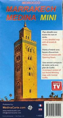
Stadsplattegrond Marrakech Medina Mini | MedinaCarte

0
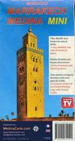
Unlike other maps of Marrakesh, this plan names not only the main streets within the Medina but also smaller ones, including over 400 derb passages. Coloring differentiates between buildings of traditional or modern architecture, indicates public parks or gardens, street markets, etc. Symbols mark various facilities: over 600 hotels and guesthouse...

Verkopers met dit product

Verkoper
Bezorging
Prijs
DeZwerver.nl logo
DeZwerver.nl
2,95
10,95

Anderen bekeken ook

Stadsplattegrond Streetwise London | Michelin
Handige stadsplattegrond van Londen in de vorm van een uitklapkaart, die aan twee zijden bedrukt is. Prettig leesbaar, helder kaartbeeld, met een register en een kleine kaart van het openbaar vervoer. Deze kaart is geplastificeerd. REVISED 2023Streetwise London Map is a laminated city center map of London, England. The accordion-fold pocket size travel map includes a London Underground map with tube lines & stations. Cover includes:Main London City Map 1:20,000London Underground Map - London Tube MapDimensions: 4" x 8.5" folded, 8.5" x unfoldedLondon is one of the most popular, populated and accessible cites on earth.   People love London. And why not? Londoners are charming and helpful, and their city operates on such a high dosage of civility that it could be considered an art form. London is an urban oasis where you can search out cutting edge design, cuisine, fashion, chic neighborhoods, or traditional culture.   When visiting London, be prepared to walk. Whether its basic window …
9,95
Stadsplattegrond Streetwise Streetwise Manhattan Map | Michelin
Some people think Manhattan and New York City are synonymous, but technically they are not. Manhattan is one of the five boroughs that make up New York City. The others are Brooklyn, The Bronx, Queens, and Staten Island. It's a persnickety detail, but detail is what STREETWISE® is about. For example, the architectural details drawn on the Manhattan New York map are in outline form. A solid drawing would obscure the streets surrounding the location, and therefore hamper the usability of the map. Only in unobstructed locations will you find a solid drawing. You may not notice this or any of the many other details that combine to make a NY city map that has been called the best selling map on earth*.    The STREETWISE® Manhattan Map is detailed from lower tip to upper tip. It is layered with information about sites and mass transit routes. The New York City Subway system is one of the most important and vital rail networks in the world. It is also the fastest and cheapest way to travel n…
9,95
Stadsplattegrond Northern Morocco - Marokko & Marrakesh - Marrakech | ITMB
Een degelijke kaart met aanduidingen van o.a. nationale parken, vliegveld, benzinepomp, dirt-roads. The fabled city of Marrakesh (also can be spelled Marrakech), with its enormous Medina (old town) and its souks and mosques, is one of the most visited cities in Africa. This map is double-sided, with a very large-scale and detailed map of the city occupying one side, showing both the older Medina and the newer ‘French quarter’. Hotels, markets, squares, souks, palaces, and mosques are well-portrayed. The other side covers the northern half of Morocco and will assist drivers and those exploring Morocco as part of a tour. Insets of Rabat/Sale and Tangier are included. Printed on ITM plastic paper; Legend Includes: International and provincial borders, roads by classification, road distances, parks, lakes, rivers, contours, airports, hotels, car and scooter rental, places of interest, historic sites, and other information. Includes insets of: Casablanca, Rabat, Sale, Tangier and Medina
13,95
Stadsplattegrond Popout Map Marrakesh | Compass Maps
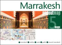
Handig ( borstzak- ) formaat stadsplattegrond met voldoende detail, zodat je ook de kleinere straatjes erop aantreft. Van veel wereldsteden inmidddels leverbaar en dat is mooi, want juist in dit soort steden wil je je handen liever vrij houden en niet teveel hoeven stoeien met het uitvouwen van een grote plattegrond, en/of teveel als "toerist" opvallen. Door het unieke vouwsysteem blijft alles zeer compact en biedt het kaartje een razendvlugge manier van orientatie. Wel is dit product alleen geschikt voor het ( grote ) centrum van de stad.Verder geven de kaartjes uit deze reeks ook de meeste highlights van de stad aan en ( indien van toepassing ) een overzichtskaartje van de metro. Uncover the exotic charms of Marrakesh with this genuinely pocket-sized, pop-up map. Small in size, yet big on detail, this compact, dependable Marrakesh city map will ensure you don't miss a thing.   * Includes two pop-up maps covering Marrakesh & the Medina * Additional maps covering the souks, Guéliz…
7,95
Reisgids Rough Guide Pocket Marrakesh | Rough Guides
Een kleinere versie in zakformaat van de grotere versies van de Rough Guides. Als altijd weer vol met goede informatie over cultuur en praktische zaken. Achterin een kaart van de stad. This compact, practical and entertaining travel guide to Marrakesh will help you discover the best of the destination. Our slim, trim treasure trove of trustworthy travel information is ideal for travellers on short trips. It covers all the key sights such as the Ben Youseff Medersa, Jemaa el-Fna and El Badi Palace, restaurants, shops, cafes and bars, plus inspired ideas for day-trips, with honest independent recommendations from expert authors.   This Marrakesh guide book has been fully updated post-COVID-19 and it comes with a free ebook. The Pocket Rough Guide Marrakesh covers: Jemaa el Fna and the Koutoubia, the Northern Medina, the Southern Medina and Agdal Gardens, The Ville Nouvelle and Palmery, Atlas Excursions, and Essaouira. Inside this guide book to Marrakesh you will find:RECOMMENDATIONS FOR…
13,95
Wegenkaart - landkaart Kgalagadi - Tourist Map of Kgalagadi Transfrontier Park Botswana | Shell
Zeer bijzondere landkaart van het grensgebied van Botswana en Zuid Afrika. Uitermate handig zijn de GPS coordinaten van de meest belangrijke punten als campings of uitzichtpunten. De kaart is gebaseerd op een luchtfoto, waarbij alle details zijn ingetekend. The map: The map consists of a large map of the entire Park on the front of the map. On the back is enlargements of six maps - the South African side, Mabuasehube, Swart Pan area, Gemsbok Wilderness Trail, Mabuasehube Wilderness Trail and of the Kaa Kalahari Concession. Satellite images were used and the roads were tracked by GPS. There are 168 GPS coordinates on this map. Establishment of a Transfrontier Park: On the 7 th of April 1999 Botswana and South Africa signed a bilateral agreement in which they agreed to manage their adjacent national parks, Gemsbok National Park in Botswana and Kalahari Gemsbok National Park in South Africa, as a single ecological unit – the Kgalagadi Transfrontier Park. It is the first formally declared…
17,50
Stadsplattegrond Fleximap Copenhagen - Kopenhagen | Insight Guides
Geplastificeerde kaart van Kopenhagen, met register. Voor de 'gewone' toerist een handige kaart, geen groot formaat, overzichtelijk met alle belangrijke plaatsen goed weergegeven.   Flexi Map Copenhagen is a laminated, tear-resistant map which has 3 maps, each accompanied by its own index.  It includes a list - with descriptions and some photographs - of 23 recommended sights, divided by theme and linked to the mapping by numbered markers. There is also a handy information section with concise details on getting around, tourist offices, money, tipping, opening times, public holidays, telecommunications, emergency telephone numbers and climate.   On the main map, shown at a scale of 1:11,000 (1cm = 0.110km), streets are named and a selection of hotels, public buildings and key sights are prominently marked, pedestrian areas and one-way systems are also shown. The comprehensive index is divided into categories for ease of use. A detailed Metro plan is located on the back cover for eas…
9,95
Wandelkaart Toubkal & Marrakech | Cordee
Een uitstekende (geplastificeerde) wandelkaart (1:50.000) van de omgeving van de Toubkal. Uitermate geschikt voor de beklimming en aansluitende trektocht. Met op de achterkant een stadsplattegrond van Marrakech. A detailed, accurate and up-to-date trekking map of Jebel Toubkal in the High Atlas mountains of Morocco, the highest peak in North Africa and popular trekking destination. A street plan of Marrakech is on the reverse. 1:50,000 topographic map detail includes contours at 20m intervals, hill-shading, woodland and scrub areas, springs, creeks, rivers and dry riverbeds. Road detail includes tracks and footpaths, and funicular railways and ski-lifts are also indicated. Isolated buildings are marked and symbols show ski-stations, refuges and religious buildings. A 1km UTM grid is drawn over the map and margin ticks are at 1’ intervals. n the reverse is a clear plan of Marrakech at approximately 1:8,700. It covers the Medina district and extends westwards to the main railway terminu…
19,95
Wegenkaart - landkaart - Stadsplattegrond Fleximap Shanghai | Insight Guides
Geplastificeerde centrumkaart van Shanghai, met register. Voor de 'gewone' toerist een handige kaart, geen groot formaat, overzichtelijk met alle belangrijke plaatsen goed weergegeven.   Flexi Map Shanghai is laminated, tear-resistant comprising 2 separate maps featuring the city and its surroundings; each map has its own index which has been categorised for ease of use.    It includes a list - with descriptions and some photographs - of 37 recommended sights, divided by theme and linked to the mapping by numbered markers. There is also a handy information section with concise details on getting around, tourist offices, money, tipping, opening times, public holidays, telecommunications, emergency tel...ephone numbers and climate.   On one side is a street plan of the city's central districts at a scale of 1:18 500 (1cm = 0.18km). One way streets, car parks, train and metro routes are clearly shown, in addition a Metro map is located on the back cover for easy reference. Many prom…
9,95
Wegenkaart - landkaart Chobe | Shell
Zeer bijzondere goede landkaart van Chobe National Park in Botswana. Uitermate handig zijn de GPS coordinaten van de meest belangrijke punten als campings of uitzichtpunten. De kaart is gebaseerd op een luchtfoto, waarbij alle details zijn ingetekend. The map: The Chobe map consists of a complete map of Chobe on the front of the map and there are 5 individual maps of the major tourist areas on the back of the map. These are Chobe river front east, Chobe river front west, Nogatsaa, Savute and a small orientation map. The map was compiled by using satellite images, giving one a birds eye-view of the area. The roads were tracked by means of a GPS and then super-imposed on the photographs. Detailed GPS co-ordinates are supplied for game-drive areas. The Chobe map contains 126 GPS co-ordinates. The four main tourist areas: The Chobe National Park consists of a variety of vegetation types and geological features, offering extreme contrasts and a wide range of wildlife experiences within the…
17,50

Klanten-reviews van Stadsplattegrond Marrakech Medina Mini | MedinaCarte

Er zijn nog geen beoordelingen voor dit productBen jij de eerste die een review plaatst?

Meer over Stadsplattegrond Marrakech Medina Mini | MedinaCarte

Productomschrijving

Unlike other maps of Marrakesh, this plan names not only the main streets within the Medina but also smaller ones, including over 400 derb passages. Coloring differentiates between buildings of traditional or modern architecture, indicates public parks or gardens, street markets, etc. Symbols mark various facilities: over 600 hotels and guesthouses, cafes and restaurants, banks, ranks for taxis or horse drawn carriages, public phones and internet cafes, medical help, etc. The route of the cross-Medina bus line is shown with stops. Streets with souks and markets are highlighted, indicating what goods are sold there and where appropriate, doors which are locked at night.    The ramparts, the Koutoubia Mosque, the kasbah, the Saâdians tombs, the ruins of Badiâ Palace, Menara water feature and pavilion, are examples of many monuments that clearly reflect the Outstanding Universal Value of the property. The authenticity of the inner urban structure and of the monuments remains intact.    There is an index of streets and derbs, a list of hotels and guesthouses marked on it, plus a list of GPS coordinates for 36 important buildings and locations within the area. On the back cover of the map there are two at-a-glance plans highlighting locations of main points of interest and of the Medina’s gates and districts. Map legend and accompanying text are in French and English.    It would be worth anyone buying even if one did not ever intend to go to Marrakech. But once you start to look at it, a bit like flying over the city in a light aeroplane, you would feel that somehow you really must go!    Please note: this map covers just the Medina area of Marrakesh, the rest of the city is not included. 

Verken gerelateerde categorieën

Webshop.nl maakt gebruik van cookies. Ga je verder op onze website, ga dan akkoord met het plaatsen van cookies en de verwerking van deze data door ons en vermelde partners.