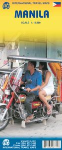
Stadsplattegrond Manila | ITMB
Goede overzichtelijke stadskaart van Manila en directe omgeving. Manila is the capital of the Philippines and a historic city, as well as a major economic and governmental centre. It is also a very big, sprawling city, like many in Asia, and difficult to map. We have prepared a double-sided map of the city, divided north/south, from Quezon City in the north to the new Alaya shopping centre and the world trading centre in the south. The heart of Manila is the area just north of the Pasig River, with its bustling streets and many shops. The hotel region is south of the river, close to the ocean, and we have done our best to show the hotels well, but there are too many to show all of them. This is an excellent map of a major Asian city; one that has never been mapped to this extent for travel previously. Legend Includes: Roads by classification, domestic airports, public transport lines, ferries, prominent buildings, parks, police stations, hospitals, banks, cinemas, hotels, temples, muse…
13,95


