Stadsplattegrond London - Londen | Borch

0
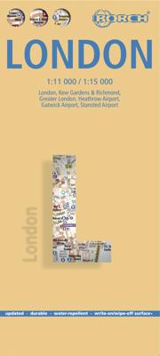
Stevige, geplastificeerde stadsplattegrond van Londen op een handzaam formaat. Schaal 1:11.000 en 1:15.000, afhankelijk van de deelkaart. De kaart bevat een gedetailleerde kaart van centraal Londen. Verder zijn er inzetten van Greater Londen en detailkaartjes van de vliegvelden en enkele toeristische plaatsen in opgenomen. Bevat ook een kaart van ...

Verkopers met dit product

Verkoper
Bezorging
Prijs
DeZwerver.nl logo
DeZwerver.nl
2,95
9,95

Anderen bekeken ook

Stadsplattegrond Tokyo - Tokio | Borch
Borch Tokio is een duidelijke, geplastificeerde plattegrond van het centrum met informatie over openbaar vervoer en bezienswaardigheden. Inclusief straatnamenregister.   Our soft-laminated folded map of Tokyo shows: Tokyo 1:17 000, Tokyo Bay & Shinagawa 1:19 000, Tokyo & Region 1:1 300 000, Tokyo Subway Route Map, Japan administrative and time zones, Top 30 Sights. Borch Maps are easy to fold, durable and water-repellent with a wipeable surface. Borch Maps show hotels, museums, monuments, markets, public transport, top sights and points of interest, useful statistics, conversion charts for temperatures, weights and measurements, climate charts showing temperatures, sunshine hours, precipitation and humidity, overview maps, time zones, and much more...   Tokyo, the vast capital city of Japan, is also one of the 47 Japanese prefectures. Tokyo means "Eastern Capital", is located in the Kanto region on the southeastern tip of Honshu (the main island of Japan), is home to the Japanese gove…
9,95
Stadsplattegrond Istanbul | Borch
Borch Istanbul is een duidelijke, geplastificeerde plattegrond van het centrum met informatie over openbaar vervoer en bezienswaardigheden. Inclusief straatnamenregister.   Our soft-laminated folded map of Istanbul shows: Istanbul 1:11 000, Topkapi Palace 1:4 000, Grand Bazaar 1:3 000, Üsküdar 1:13 000, Greater Istanbul 1:150 000, Northwestern Turkey 1:2 000 000, Public Transport Istanbul, Turkey administrative & time zones, Top 30 sights. Borch Maps are easy to fold, durable and water-repellent with a wipeable surface. Borch Maps show hotels, museums, monuments, markets, public transport, top sights and points of interest, useful statistics, conversion charts for temperatures, weights and measurements, climate charts showing temperatures, sunshine hours, precipitation and humidity, overview maps, time zones, and much more...   Istanbul (formerly known as Byzantium and Constantinople) is Europe's most populous city (circa 13 million inhabitants) and is located on the Bosphorus Strait.…
9,95
Stadsplattegrond Parijs - Paris | Borch
Borch Parijs is een duidelijke, geplastificeerde plattegrond van het centrum met informatie over openbaar vervoer en bezienswaardigheden. Inclusief straatnamenregister.   Our soft-laminated folded map of Paris shows: Paris North 1:15 000, Paris South 1:15 000, Central Paris 1:12 000, La Defense 1:15 000, Paris & Region 1:130 000, Public Transport Paris, Top 30 Sights and France administrative. Borch Maps are easy to fold, durable and water-repellent with a wipeable surface. Borch Maps show hotels, museums, monuments, markets, public transport, top sights and points of interest, useful statistics, conversion charts for temperatures, weights and measurements, climate charts showing temperatures, sunshine hours, precipitation and humidity, overview maps, time zones, and much more...   Paris is the capital city of France and French commerce, fashion, art, design and science. The "city of love" or "city of light" ("la ville lumière") is home to the Eiffel Tower, the Louvre housing Leonardo…
9,95
Stadsplattegrond Madrid | Borch
Borch Madrid is een duidelijke, geplastificeerde plattegrond van het centrum met informatie over openbaar vervoer en bezienswaardigheden. Inclusief straatnamenregister.   Our soft-laminated folded map of Madrid shows: Central Madrid 1:10 000, Madrid & Region 1:200 000, Province of Madrid 1:700 000, Toledo 1:9 000, Segovia 1:8 500, Public Transport Madrid, Spain administrative. Borch maps are easy to fold, durable and water-repellent with a wipeable surface. Borch Maps show hotels, museums, monuments, markets, public transport, top sights and points of interest, useful statistics, conversion charts for temperatures, weights and measurements, climate charts showing temperatures, sunshine hours, precipitation and humidity, overview maps, time zones, and much more...   Madrid, located on the Manzanares River, is the capital and largest city of Spain and also its political and geographic center. Local residents are called Madrileños. Not only is Madrid one of the main financial centers of …
9,95
Stadsplattegrond Sydney | Borch
Borch Sydney is een duidelijke, geplastificeerde plattegrond van het centrum met informatie over openbaar vervoer en bezienswaardigheden. Inclusief straatnamenregister. Our soft-laminated folded map of Sydney shows: Inner Sydney 1:15 000, Sydney CBD 1:7 500, Sydney 1:120 000, Sydney & Region 1:450 000, Homebush Bay Olympic Park 1:15 000, Airport Sydney 1:25 000, Public Transport Sydney, Australia administrative & time zones, Top 30 Sights. Borch Maps show hotels, museums, monuments, markets, public transport, top sights and points of interest, useful statistics, conversion charts for temperatures, weights and measurements, climate charts showing temperatures, sunshine hours, precipitation and humidity, overview maps, time zones, and much more...   Sydney, the capital city of the state New South Wales, is Australia's most populous city with an estimated 4.2 million inhabitants in its metropolitan area. Located on the southeastern coast, Sydney is built around Port Jackson, a section of…
9,95
Stadsplattegrond Rome | Borch
Borch Rome is een duidelijke, geplastificeerde plattegrond van het centrum met informatie over openbaar vervoer en bezienswaardigheden. Inclusief straatnamenregister.   Our soft-laminated folded map of Rome shows: Rome 1:15 000, Rome Centre 1:11 000, Vatican 1:7 000, Rome & Region 1:250 000, Roman Forum 1:7 000, Public Transport Rome, Italy administrative and Top 30 Sights. Borch Maps are easy to fold, durable and water-repellent with a wipeable surface. Borch Maps show hotels, museums, monuments, markets, public transport, top sights and points of interest, useful statistics, conversion charts for temperatures, weights and measurements, climate charts showing temperatures, sunshine hours, precipitation and humidity, overview maps, time zones, and much more...   According to legend the Roman Empire's capital city was founded by Romulus and Remus, two brothers reared by a she-wolf. Rome was built on seven hills and was the centre of the ancient world. Classical masonic ruins bear witne…
9,95
Stadsplattegrond Montréal | Borch
Borch Montréal is een duidelijke, geplastificeerde plattegrond van het centrum met informatie over openbaar vervoer en bezienswaardigheden. Inclusief straatnamenregister.   Our soft-laminated folded map of Montreal shows: Montreal Center 1:15 000, Olympic Park 1:15 000, Old Montreal 1:6500, Montreal & Region 1:250 000, Public Transport Montreal, Underground City Montreal, Top 30 Sights, Canada administrative & time zones. Borch Maps are easy to fold, durable and water-repellent with a wipeable surface. Borch Maps show hotels, museums, monuments, markets, public transport, top sights and points of interest, useful statistics, conversion charts for temperatures, weights and measurements, climate charts showing temperatures, sunshine hours, precipitation and humidity, overview maps, time zones, and much more...   Named for Mont Royal in the center of downtown, which provides some interesting vistas, Canada's third-largest city is the largest in Quebec province. Montreal, the cultural cen…
9,95
Stadsplattegrond Bangkok | Borch
Borch Bangkok is een duidelijke, geplastificeerde plattegrond van het centrum met informatie over openbaar vervoer en bezienswaardigheden. Inclusief straatnamenregister. Our soft-laminated folded map of Bangkok shows: Bangkok City 1:14 000, Wat Phra Kaeo & Royal Grand Palace 1:6 000, Bangkok & Region 1:100 000, Public Transport Bangkok, Top 30 Sights, Thailand administrative and time zones. Borch Maps are easy to fold, durable and water-repellent with a wipeable surface. Borch Maps show hotels, museums, monuments, markets, public transport, top sights and points of interest, useful statistics, conversion charts for temperatures, weights and measurements, climate charts showing temperatures, sunshine hours, precipitation and humidity, overview maps, time zones, and much more...   Krung Thep Maha Nakhon (Bangkok) on the Chao Phraya river is the capital city of Thailand and the country's economic center. It is one of the most populous cities in the world with its number of inhabitants ve…
9,95
Stadsplattegrond Budapest - Boedapest | Borch
Borch Budapest is een duidelijke, geplastificeerde plattegrond van het centrum met informatie over openbaar vervoer en bezienswaardigheden. Inclusief straatnamenregister.   Our soft-laminated folded map of Budapest shows: Budapest 1:11 000, Budapest & Region 1:400 000, Margaret Island 1:11 000, Public Transportation Budapest, Top 30 Sights, Hungary administrative and time zones. Borch Maps are easy to fold, durable and water-repellent with a wipeable surface. Borch Maps show hotels, museums, monuments, markets, public transport, top sights and points of interest, useful statistics, conversion charts for temperatures, weights and measurements, climate charts showing temperatures, sunshine hours, precipitation and humidity, overview maps, time zones, and much more...   Budapest is the capital and largest city of Hungary and its commercial, transport and cultural center. Located on the famous Danube river, the Buda half of the city lies on the western bank while Pest is located on the ea…
9,95
Stadsplattegrond Praag | Borch
Borch Praag is een duidelijke, geplastificeerde plattegrond van het centrum met informatie over openbaar vervoer en bezienswaardigheden. Inclusief straatnamenregister. Our soft-laminated folded map of Prague shows: Old Town & Lesser Quarter 1:10 000, Prague 1:15 000, Prague Castle 1:5 000, Prague & Region 1:100 000, Czech Republic (West) 1:1 200 000, Public Transport Prague, Czech Republic administrative. Borch Maps are easy to fold, durable and water-repellent with a wipeable surface. Borch Maps show hotels, museums, monuments, markets, public transport, top sights and points of interest, useful statistics, conversion charts for temperatures, weights and measurements, climate charts showing temperatures, sunshine hours, precipitation and humidity, overview maps, time zones, and much more...   Prague, also known as "the Golden City" or "the City of a Hundred Spires" is the capital and largest city in the Czech Republic. Situated in the center of Bohemia it is set romantically on the b…
9,95

Klanten-reviews van Stadsplattegrond London - Londen | Borch

Er zijn nog geen beoordelingen voor dit productBen jij de eerste die een review plaatst?

Meer over Stadsplattegrond London - Londen | Borch

Productomschrijving

Stevige, geplastificeerde stadsplattegrond van Londen op een handzaam formaat. Schaal 1:11.000 en 1:15.000, afhankelijk van de deelkaart. De kaart bevat een gedetailleerde kaart van centraal Londen. Verder zijn er inzetten van Greater Londen en detailkaartjes van de vliegvelden en enkele toeristische plaatsen in opgenomen. Bevat ook een kaart van de metrolijnen. Ideaal voor een stedentrip of zakenreis naar de City.   Our soft-laminated folded map of London shows: London 1:15 000, Kew Gardens & Richmond 1:35 000, Central Sights 1:11 000, Greater London 1:375 000, Airports Heathrow, Gatwick, Stansted, Public Transport London, Great Britain administrative. Borch Maps are easy to fold, durable and water-repellent with a wipeable surface. Borch Maps show hotels, museums, monuments, markets, public transport, top sights and points of interest, useful statistics, conversion charts for temperatures, weights and measurements, climate charts showing temperatures, sunshine hours, precipitation and humidity, overview maps, time zones, and much more...   London is - in every sense - global! It is one of the largest and most populous cities in Europe, a centre of world trade, transport, tourism, finance, fashion and culture. London is unique in its diversity and is a melting pot of countless cultures. Its inhabitants are courteous and friendly, they contribute to making this world capital a pleasure to visit. London is served by five international airports, it has one of the oldest underground public transport systems in Europe and - we must mention it again - the friendliest taxi drivers in the world. The vast list of sights in and around London includes several world heritage sites including the Tower of London, Westminster Palace, Westminster Abbey, Greenwich, the Royal Botanic Gardens in Kew. London also offers innumerable museums, galleries and monuments, parks, gardens, more botanic gardens, stunning architecture, trendy and traditional world-class shopping and among the best restaurants and nightlife you’ll find anywhere.  

Verken gerelateerde categorieën

Webshop.nl maakt gebruik van cookies. Ga je verder op onze website, ga dan akkoord met het plaatsen van cookies en de verwerking van deze data door ons en vermelde partners.