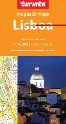
Stadsplattegrond Lissabon - Lisboa | Turinta

0
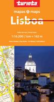
Folded paper street map of Lisbon. The large map of Lisbon, printed on the first side, includes an inset, expanded section of the city centre / sea port area, clearly indicating points where ferry routes leave for the different destinations. A comprehensive street name index features on the reverse, plus a host of really useful addresses and telep...

Verkopers met dit product

Verkoper
Bezorging
Prijs
DeZwerver.nl logo
DeZwerver.nl
2,95
11,50

Anderen bekeken ook

Wegenkaart - landkaart - Stadsplattegrond San Diego - California south | ITMB
Wegenkaart en stadsplattegrond in een kaart: aan de ene zijde San Diego stadsplattegrond en op de andere kant een kaart van het zuiden van Californië. San Diego on a clear, well presented street plan from ITMB, with a transit system diagram, a road map of the city and its environs, and a street plan of central Tijuana, plus on the reverse a road map of the US/Mexico border region extending east beyond El Paso and within USA north to Las Vegas.   On one side is an indexed street plan of San Diego, covering the city’s central districts (as indicated in our coverage image), including the downtown area, the Old Town for which an enlargement is provided, Balboa Park, University Heights, the Mission Bay Park with the SeaWorld, and the city’s international airport. The plan clearly shows the MTS and other public transit stations, highlights main traffic arteries and indicates one way streets. Also marked are recommended cycle routes. Streets are annotated with selected block numbers for easi…
13,95
Reisgids The 500 Hidden Secrets of Lisbon - Lissabon | Luster
Miguel Júdice verzamelde in The 500 Hidden Secrets of Lisbon 500 fantastische plekken in en interessante weetjes over zijn stad Lissabon, zoals het restaurant van fotograaf en foodie Adriana Freire dat deel uitmaakt van een sociaal integratieproject, een bijzonder kunstwerk van street artist Vhils, opgedragen aan de legendarische Fado zangeres Amália Rodrigues, en een drijvend kunstwerk op de Taag dat het midden houdt tussen de iconische ferryboten van Lissabon en de typische vaporetta's van Venetië.   500 adressen in handige lijstjes van 5 - inclusief kaartjes en index.   Where are the 5 best restaurants for petiscos? What are the 5 best bars from another time? What are the 5 best street markets? Where are the 5 best places to enjoy the river? Where should you go for the 5 best fado experiences? The 500 Hidden Secrets of Lisbon reveals these good-to-know addresses and many more. Miguel Júdice selected 500 great places to be and interesting facts about his home town, Lisbon, l…
21,95
Stadsplattegrond Streetwise Budapest | Michelin
REVISED 2023Streetwise Budapest Map is a laminated city center map of Budapest, Hungary. The accordion-fold pocket size travel map has an integrated metro map including lines & stations. Coverage includes:Main Budapest Map Front 1: 17,000Main Budapest Map Back 1:11,000Budapest City Center Map 1:11,000Millennium City Center Map 1:17,000Budapest Metro MapDimensions: 4" x 8.5" folded, 8.5" x 27" unfoldedPeople say Budapest is the Paris of Central Europe.   Maybe that statement is true because it combines a combination of western luxuries, architectural beauty, and cosmopolitan European traditions. But this baroque city is still connected to its Eastern European heritage with the steaming baths, incredibly complex language and lusty cuisine. Budapest straddles a curve in the river Danube which bisects two distinct parts.   The east side is known as Pest and the west side is known as Buda, hence Budapest. It's a very logical, well laid out city. Castle Hill is the premier destination for v…
9,95
Nieuw
Stadsplattegrond - Wegenkaart - landkaart Quito & Ecuador Central | ITMB
Een degelijke wegenkaart van Ecuador met aanduidingen van o.a. nationale parken, vliegveld, benzinepomp, dirt-roads en kleine plattegrond van hoofdstad. Als overzichtskaart goed te gebruiken. Finally, ITMB releases its long-awaited re-worked map of the wonderful South America city of Quito. The city is squeezed in between mountain ranges and, the entire city stretches from north (on the right-hand side of the map) to the south. The "bottom" of the map is, actually the eastern portion. A regional inset map clarifies the situation. The street network is clearly shown, along with the rapid line bus way and the city's Metro. The Old Town is perhaps the most interesting portion of the city for visitors and is on the left-hand portion of the map. The newer downtown is centered on La Carolina Park on the right-hand side of the map. This is where most of the shopping malls and hotels are located. The old airport is shown in part on the far right, but the new international airport is located f…
13,95
Historische Kaart Major & Mrs Holt's Battle Map of Market Garden | Pen and Sword publications
This is the only map of its kind devised and created by Major and Mrs Holt and is used by many guides   It shows the locations of 300 memorials and war cemeteries over THE WHOLE OPERATION MARKET-GARDEN AREA   It shows the progress of the battle from Leopoldsburg to  Eindhoven, Nijmegen, Arnhem and Oosterbeek overlaid on modern roads   In four colours, double sided and with 10 inset maps it shows all drop and landing zones   Suitable for navigation by car, bicycle or foot   Size - The map measures 19.5 inches (49cm) by 28 inches (71cm). It is printed in four colours and is on firm glossy paper.   On one side at a scale of 1:180,000 is shown the whole of the Market Garden corridor of operations from Arnhem in the north to Leopoldsburg in the south and from Vught in the west to Overloon in the east. See below for details of the other side.   What is Marked on the Map   This map is quite unique and no other exists that shows the Market Garden Corridor in such detail. Over 230 memor…
9,95
Stadsplattegrond Streetwise Streetwise Manhattan Map | Michelin
Some people think Manhattan and New York City are synonymous, but technically they are not. Manhattan is one of the five boroughs that make up New York City. The others are Brooklyn, The Bronx, Queens, and Staten Island. It's a persnickety detail, but detail is what STREETWISE® is about. For example, the architectural details drawn on the Manhattan New York map are in outline form. A solid drawing would obscure the streets surrounding the location, and therefore hamper the usability of the map. Only in unobstructed locations will you find a solid drawing. You may not notice this or any of the many other details that combine to make a NY city map that has been called the best selling map on earth*.    The STREETWISE® Manhattan Map is detailed from lower tip to upper tip. It is layered with information about sites and mass transit routes. The New York City Subway system is one of the most important and vital rail networks in the world. It is also the fastest and cheapest way to travel n…
9,95
Nieuw
Wegenkaart - landkaart Taiwan and Taipei | ITMB
Een degelijke kaart met aanduidingen van o.a. nationale parken, vliegveld, benzinepomp, dirt-roads en kleine plattegrond van hoofdstad. Als overzichtskaart goed te gebruiken. Wegenkaart Taiwan en stadsplan Taipei   Combining a map of Taiwan with a street plan of Taipei. The map of the island shows the road and rail networks, indicating local airports and airfields, national parks and scenic areas, places of interest and beaches. The country’s administrative divisions are marked, with names of the provinces and provincial capitals shown in both Roman alphabet and Chinese. All other place names are in Roman alphabet only. Topography is shown by altitude colouring with spot heights. Brief descriptions are provided for main places of interest and a separate inset shows the route of the Taiwan Highspeed Railway.   On the reverse is an street plan of Taipei, highlighting places of interest, railway and metro stations, bus and ferry terminals, selected accommodation, etc. Street and district…
14,50
Nieuw
Stadsplattegrond Lissabon - Lisbon | Borch
Borch Lissabon is een duidelijke, geplastificeerde plattegrond van het centrum met informatie over openbaar vervoer en bezienswaardigheden. Inclusief straatnamenregister.   Our soft-laminated folded map of Lissabon shows: Lisbon 1:14 000, Baixa, Alfama, Mouraria 1:8 250, Cascais & Estoril 1:12 500, Lisbon & Region 1:135 000, Lisbon District 1:650 000, Portugal administrative & time zones, Public Transport Lisbon and Top 30 sights. Borch Maps show hotels, museums, monuments, markets, public transport, top sights and points of interest, useful statistics, conversion charts for temperatures, weights and measurements, climate charts showing temperatures, sunshine hours, precipitation and humidity, overview maps, time zones, and much more...   Lisbon is the capital, largest city and political center of Portugal, and the westernmost capital city in central Europe. It has been invaded by the Romans, Moors and even Napoleon and boasts some fabulous historical sites and architecture all bearin…
9,95
Stadsplattegrond Popout Map Popout Map Lisbon | Compass Maps
Handig ( borstzak- ) formaat stadsplattegrond met voldoende detail, zodat je ook de kleinere straatjes erop aantreft. Van veel wereldsteden inmidddels leverbaar en dat is mooi, want juist in dit soort steden wil je je handen liever vrij houden en niet teveel hoeven stoeien met het uitvouwen van een grote plattegrond, en/of teveel als "toerist" opvallen. Door het unieke vouwsysteem blijft alles zeer compact en biedt het kaartje een razendvlugge manier van orientatie. Wel is dit product alleen geschikt voor het ( grote ) centrum van de stad.Verder geven de kaartjes uit deze reeks ook de meeste highlights van de stad aan en ( indien van toepassing ) een overzichtskaartje van de metro. Uncover Portugal's majestic capital city of Lisbon with this genuinely pocket-sized, pop-up map. Small in size, yet big on detail, this compact, dependable Lisbon city map will ensure you don't miss a thing.- Includes two pop-up maps covering Lisbon city centre and greater Lisbon- Additional maps covering t…
7,95

Klanten-reviews van Stadsplattegrond Lissabon - Lisboa | Turinta

Er zijn nog geen beoordelingen voor dit productBen jij de eerste die een review plaatst?

Meer over Stadsplattegrond Lissabon - Lisboa | Turinta

Productomschrijving

Folded paper street map of Lisbon.

The large map of Lisbon, printed on the first side, includes an inset, expanded section of the city centre / sea port area, clearly indicating points where ferry routes leave for the different destinations. A comprehensive street name index features on the reverse, plus a host of really useful addresses and telephone numbers of hotels, museums, embassies etc.

Verken gerelateerde categorieën

Webshop.nl maakt gebruik van cookies. Ga je verder op onze website, ga dan akkoord met het plaatsen van cookies en de verwerking van deze data door ons en vermelde partners.