webshop.nl
Categorieën
  Sluiten

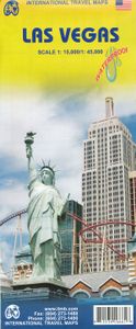
Stadsplattegrond Las Vegas | ITMB

Stadsplattegrond met register. The "Strip’" not only refers to a burlesque dance but to the pedestrian haven in Las Vegas that entrances and titillates millions of visitors every day. The world’s largest travel destination is Las Vegas, not London or Paris. That’s right, SIN CITY and proud of it, Vegas is one of the modern marvels of total entertai...
13,95

Webshops met dit product

Webshop
Bezorging
Prijs

Anderen bekeken ook

Reisgids Rough Guide Pocket Las Vegas | Rough Guides
Kleine uitgave van de gewone Rough guide. Zeer goede reisgids voor zowel de georganiseerde maar vooral voor de zelfstandige reiziger. Boordevol informatie over reizen, slapen, eten, maar ook musea en cultuur. Voor Europese landen meestal completer en beter dan de Lonely Planet ! This compact, practical and entertaining travel guide to Las Vegas will help you discover the best of the destination. Our slim, trim treasure trove of trustworthy travel information is ideal for travellers on short trips. It covers all the key sights such as STRAT Hotel, Casino & SkyPod, Grand Canyon South Rim, Dig This, The Forum Shops, restaurants, shops, cafes and bars, plus inspired ideas for day-trips, with honest independent recommendations from expert authors.   This Las Vegas guide book has been fully updated post-COVID-19 and it comes with a free ebook. The Pocket Rough Guide Las Vegas covers: South Strip, City Center and around, Central Strip, North Strip, Downtown Las Vegas, the rest of the city,…
13,95
Stadsplattegrond Las Vegas | Borch
Borch Las Vegas is een duidelijke, geplastificeerde plattegrond van het centrum met informatie over openbaar vervoer en bezienswaardigheden. Inclusief straatnamenregister.   Our soft-laminated folded map of Las Vegas shows: Las Vegas 1:20 000, Las Vegas & Region 1:150 000, Las Vegas & National Parks 1:3 000 000, Grand Canyon National Park 1:225 000, Grand Canyon Village 1:40 000, USA administrative & time zones, Top 30 Sights. Borch Maps are easy to fold, durable and water-repellent with a wipeable surface. Borch Maps show hotels, museums, monuments, markets, public transport, top sights and points of interest, useful statistics, conversion charts for temperatures, weights and measurements, climate charts showing temperatures, sunshine hours, precipitation and humidity, overview maps, time zones, and much more...   Las Vegas, literally translated as "The Meadows", is also known as "Sin City" and is the most populous city in the state of Nevada, with the largest number of hotel rooms in…
10,25
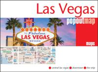
Stadsplattegrond Popout Map Las Vegas | Compass Maps
Handig ( borstzak- ) formaat stadsplattegrond met voldoende detail, zodat je ook de kleinere straatjes erop aantreft. Van veel wereldsteden inmidddels leverbaar en dat is mooi, want juist in dit soort steden wil je je handen liever vrij houden en niet teveel hoeven stoeien met het uitvouwen van een grote plattegrond, en/of teveel als "toerist" opvallen. Door het unieke vouwsysteem blijft alles zeer compact en biedt het kaartje een razendvlugge manier van orientatie. Wel is dit product alleen geschikt voor het ( grote ) centrum van de stad.Verder geven de kaartjes uit deze reeks ook de meeste highlights van de stad aan en ( indien van toepassing ) een overzichtskaartje van de metro. Las Vegas PopOut Map: pop-up city street map of Las Vegas city centre - folded pocket size travel map Contents include maps of: * Central Las Vegas * Greater Las Vegas * Downtown * The Strip * Las Vegas vicinity The ultimate pocket map of Las Vegas! Explore Las Vegas with the help of this genuinely pocket-si…
7,95
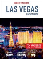
Reisgids Las Vegas | Insight Guides
De pocket guide serie van Insight Guides is een zeer compacte reisgids die makkelijk in een jas- of broekzak past. Veel informatie over bezienswaardigheden, maar ook praktische zaken als vervoer, accommodaties etc.  Insight Pocket Guide Las Vegas is a concise, full-colour travel guide that combines lively text with vivid photography to highlight the very best that this spectacular city has to offer. The Where to Go chapter details all the key sights, including The Fremont Street Experience, the City Center and the Big Shot and the mega resorts on The Strip. There are also excursions to the Hoover Dam and Grand Canyon National Park. Handy maps on the cover help you get around Las Vegas with ease. To inspire you, the book offers a rundown of the Top 10 Attractions in the city, followed by an itinerary for a Perfect Day in Las Vegas. The What to Do chapter gives you the lowdown on the most popular games, the best entertainment shows, and the city's nightlife, sports and other activities. …
10,50
Reisgids Pocket Las Vegas | Lonely Planet
Klein compact stadgidsje voor Las Vegas met alle essentiele informatie voor een paar dagen. Eten & drinken, Accomodaties en bezienswaardigheden. Met stadsplattegrond.   Lonely Planet Pocket Las Vegas is your passport to the most relevant, up-to-date advice on what to see and skip, and what hidden discoveries await you.   Join the classy crew at Bellagio, the landmark Strip resort, hike the trails of mile-high Grand Canyon, drink in the views at the Stratosphere while the sun drops below the horizon; all with your trusted travel companion. Get to the heart of the best of Las Vegas and begin your journey now!   Inside Lonely Planet Pocket Las Vegas: Full-colour maps and images throughout Highlights and itineraries help you tailor your trip to your personal needs and interests Insider tips to save time and money and get around like a local, avoiding crowds and trouble spots Essential info at your fingertips - hours of operation, phone numbers, websites, transit tips, prices Hon…
12,95
Stadsplattegrond Las Vegas | Universal maps
This Las Vegas, Nevada Street Map is full-colour and includes maps featuring Downtown Las Vegas, The Strip Detail Map, Boulder City, Henderson, and North Las Vegas. Provides comprehensive indexing, colour-coded travel routes, rail roads, airports, city/county/state boundaries, zip code numbers/boundaries, government facilities, fire/police stations, hospitals, shopping centres, schools/colleges/universities, post offices, libraries, parks, golf courses, cemeteries, and points of interest.
7,25
Stadsplattegrond - Wegenkaart - landkaart Quebec City & Gaspe Peninsula | ITMB
Een degelijke kaart aan twee kanten bedrukt. Aan de ene zijde een plattegrond van Quebec stad, schaal 1:10.000. En aan de andere zijde een wegenkaart, schaal 1:750.000, van Gaspe schiereiland met aanduidingen van o.a. nationale parken, vliegveld, benzinepomp, dirt-roads. ITMB is pleased to be introducing yet another brand new title to our line. Quebec City is one of the oldest urban areas in North America, having been continuously occupied since 1608 (unfortunately, the first attempt at settlement, in 1606, failed through poor planning, and all the settlers perished). QC is also the only completely walled city in North America and the city streets within the walls have barely changed in 400 years. The city is also linguistically unique in being almost completely French Canadian in language (Montreal is much more Anglophiled). The city was the capital of French Canada until General Wolfe and the British army arrived in 1759. The British were able to climb the cliffs protecting the city …
13,95
Stadsplattegrond - Wegenkaart - landkaart Dubrovnik & Croatian Coast Cruise | ITMB
Goede plattegrond van Dubrovnik, schaal 1:3.000. Met aan de achterzijde een wegenkaart, schaal 1:325.000, met als extra informatie routes van veerboten en cruiseschepen ingetekend.   The ancient port city of Dubrovnik, on the southern Croatian coastline, has evolved into a major tourist destination. The old walled city, normally entered through the famous Pile Gate, was so crowded with tourists when we arrived, that it took some time to get to the main street of Stradun. The city has completely recovered from the Montenegrin bombing during the breakup of Yugoslavia, with a few shellholes remaining just to show to tourists. The highlights of a visit are the Rector’s Palace, the Tvrdava fortress, and the cathedral. The map covers the urban area outside of the old town as well, as this is where most of the hotels and restaurants are located. The other side of the map shows the extensive coastline of Croatia in two parts – from the Italian border to Trogir, and from Split to the border wit…
13,95
Stadsplattegrond - Wegenkaart - landkaart Quito & Ecuador Central | ITMB
Een degelijke wegenkaart van Ecuador met aanduidingen van o.a. nationale parken, vliegveld, benzinepomp, dirt-roads en kleine plattegrond van hoofdstad. Als overzichtskaart goed te gebruiken. Finally, ITMB releases its long-awaited re-worked map of the wonderful South America city of Quito. The city is squeezed in between mountain ranges and, the entire city stretches from north (on the right-hand side of the map) to the south. The "bottom" of the map is, actually the eastern portion. A regional inset map clarifies the situation. The street network is clearly shown, along with the rapid line bus way and the city's Metro. The Old Town is perhaps the most interesting portion of the city for visitors and is on the left-hand portion of the map. The newer downtown is centered on La Carolina Park on the right-hand side of the map. This is where most of the shopping malls and hotels are located. The old airport is shown in part on the far right, but the new international airport is located fa…
13,95
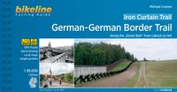
Fietsgids Bikeline Iron Curtain Trail 3 - German-German Border Trail | Esterbauer
Praktische fietsgids met detailkaarten, ingetekende route, informatie over overnachten en fietsenmakers, zwaarte en hoogteprofiel. In spiraalbinding, Engelstalig   The Iron Curtain ran for about 7,000 km from the Barents Sea in the north straight through Europe to the Black Sea and divided the continent in East and West. Until the Velvet Revolution in Eastern Europe it was a physical and ideological border between two blocks which conceived each other as enemies. Not only were many neighbouring states divided, but Germany itself was divided into east and west. Today there are hardly any reminders that the wall ever existed.   The border in Germany was 1,400 km long. The former death strip was composed of 3.000 km of fences, car-trenches for 730 km, 830 observation towers, the brightly lit roads, walls and bunkers – most of it is gone. Remaining are the vehicle roads with their perforated paving stones and several observation towers. And in a few years the sparse vegetation will be supp…
17,95

Klanten-reviews van Stadsplattegrond Las Vegas | ITMB

Er zijn nog geen beoordelingen voor dit productBen jij de eerste die een review plaatst?

Meer over Stadsplattegrond Las Vegas | ITMB

Productomschrijving

Stadsplattegrond met register. The "Strip’" not only refers to a burlesque dance but to the pedestrian haven in Las Vegas that entrances and titillates millions of visitors every day. The world’s largest travel destination is Las Vegas, not London or Paris. That’s right, SIN CITY and proud of it, Vegas is one of the modern marvels of total entertainment anywhere in the world – and now ITMB has mapped it as it’s never been seen before. Take the Strip, that stretch of Las Vegas Boulevard from the Mandalay Bay to the venerable Lady Luck, and map it – showing each resort, event centre (oops, center), monorail, and hotel. Add in surrounding attractions and shopping areas, and you have the central portion of this great city covered. The other side goes from the western beltway to Nelles air force base and from the city limits south to McCarron Airport, fully indexed. Printed on plastic paper for durability;
Webshop.nl maakt gebruik van cookies. Ga je verder op onze website, ga dan akkoord met het plaatsen van cookies en de verwerking van deze data door ons en vermelde partners.