webshop.nl
Categorieën
  Sluiten

Meer Borch

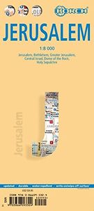
Stadsplattegrond Jerusalem - Jeruzalem | Borch

Borch Jerusalem is een duidelijke, geplastificeerde plattegrond van het centrum met informatie over openbaar vervoer en bezienswaardigheden. Inclusief straatnamenregister.   Jerusalem 1:8 000, Bethlehem 1:11 000, Greater Jerusalem 1:30 000, Central Israel 1:400 000, Dome of the Rock, Holy Sepulchre, The Middle East administrative & Time Zones   Our...
10,25

Webshops met dit product

Webshop
Bezorging
Prijs

Anderen bekeken ook

Stadsplattegrond Jerusalem - Jeruzalem | Borch
Borch Jerusalem is een duidelijke, geplastificeerde plattegrond van het centrum met informatie over openbaar vervoer en bezienswaardigheden. Inclusief straatnamenregister.   Jerusalem 1:8 000, Bethlehem 1:11 000, Greater Jerusalem 1:30 000, Central Israel 1:400 000, Dome of the Rock, Holy Sepulchre, The Middle East administrative & Time Zones   Our soft-laminated folded map of Jerusalem shows: Jerusalem 1:8 000, Bethlehem 1:11 000, Greater Jerusalem 1:30 000, Central Israel 1:400 000, Dome of the Rock, Holy Sepulchre, The Middle East administrative & time zones and Top 30 Sights. Borch maps are easy to fold, durable and water-repellent with a wipeable surface. Borch Maps show hotels, museums, monuments, markets, public transport, top sights and points of interest, useful statistics, conversion charts for temperatures, weights and measurements, climate charts showing temperatures, sunshine hours, precipitation and humidity, overview maps, time zones, and much more...   One of the most f…
10,25
Stadsplattegrond Dublin | Borch
Borch Dublin is een duidelijke, geplastificeerde plattegrond van het centrum met informatie over openbaar vervoer en bezienswaardigheden. Inclusief straatnamenregister. Our soft-laminated folded map of Dublin shows: Central Dublin 1:12 000, Phoenix Park 1:25 000, Temple Bar & Grafton Street 1:10 000, Dublin & Environs 1:125 000, East Coast 1:700 000, Public Transport Dublin, Ireland administrative & time zones, Top 30 Sights. Borch Maps are easy to fold, durable and water-repellent with a wipeable surface. Borch Maps show hotels, museums, moanuments, markets, public transport, top sights and points of interest, useful statistics, conversion charts for temperatures, weights and measurements, climate charts showing temperatures, sunshine hours, precipitation and humidity, overview maps, time zones, and much more...   The bustling Irish capital has much to offer the visitor, especially with regard to literary history. Once home to Oscar Wilde, James Joyce, W.B. Yeats, G.B. Shaw, Samuel Be…
10,25
Stadsplattegrond Wenen | Borch
Borch Wenen is een duidelijke, geplastificeerde plattegrond van het centrum met informatie over openbaar vervoer en bezienswaardigheden. Inclusief straatnamenregister.   Our soft-laminated folded map of Vienna shows: Vienna Centre 1:11 000, UNO-City 1:11 000, Schönbrunn 1:11 000, Hofburg 1: 7 000, Vienna & Region 1:100 000, Public Transport Vienna, Austria administrative and Top 30 sights. Borch Maps are easy to fold, durable and water-repellent with a wipeable surface. Borch Maps show hotels, museums, monuments, markets, public transport, top sights and points of interest, useful statistics, conversion charts for temperatures, weights and measurements, climate charts showing temperatures, sunshine hours, precipitation and humidity, overview maps, time zones, and much more...   Vienna, situated in the east of Austria, is not only its largest city but also its capital in cultural, economic and political terms. Vienna boasts a high standard of living and was designated a UNESCO World Her…
10,25
Stadsplattegrond Frankfurt am Main | Borch
Borch Frankfurt is een duidelijke, geplastificeerde plattegrond van het centrum met informatie over openbaar vervoer en bezienswaardigheden. Inclusief straatnamenregister.   Our soft-laminated folded map of Frankfurt shows: Frankfurt a. M. 1:12 000, Frankfurt Centre 1:8 250, Greater Frankfurt 1:110 000, public transport Frankfurt, Germany administrative, Top 30 Sights. Borch Maps are easy to fold, durable and water-repellent with a wipeable surface. Borch Maps show hotels, museums, monuments, markets, public transport, top sights and points of interest, useful statistics, conversion charts for temperatures, weights and measurements, climate charts showing temperatures, sunshine hours, precipitation and humidity, overview maps, time zones, and much more...   The modern city of Frankfurt am Main - also known as "Bankfurt", "Mainhattan" or "The Big Äppel" - is Germany's fifth largest city and the country's financial and business center. It is home to the European Central Bank, the German …
10,25
Stadsplattegrond Stockholm | Borch
Borch Stockholm is een duidelijke, geplastificeerde plattegrond van het centrum met informatie over openbaar vervoer en bezienswaardigheden. Inclusief straatnamenregister.   Our soft-laminated folded map of Stockholm shows: Stockholm 1:15 000, Gamla Stan 1:7 500, Greater Stockholm 1:100 000, Public Transport Stockholm, Sweden administrative & time zones, Top 30 Sights. Borch Maps show hotels, museums, monuments, markets, public transport, top sights and points of interest, useful statistics, conversion charts for temperatures, weights and measurements, climate charts showing temperatures, sunshine hours, precipitation and humidity, overview maps, time zones, and much more...   Stockholm is Sweden's capital, largest and most populous city, with a population of just under one million in the city and just over two million in its major metropolitan area. Founded around the 13th century, Stockholm was always and remains the cultural, political and economic center of Sweden and is today a ci…
11,50
Stadsplattegrond Istanbul | Borch
Borch Istanbul is een duidelijke, geplastificeerde plattegrond van het centrum met informatie over openbaar vervoer en bezienswaardigheden. Inclusief straatnamenregister.   Our soft-laminated folded map of Istanbul shows: Istanbul 1:11 000, Topkapi Palace 1:4 000, Grand Bazaar 1:3 000, Üsküdar 1:13 000, Greater Istanbul 1:150 000, Northwestern Turkey 1:2 000 000, Public Transport Istanbul, Turkey administrative & time zones, Top 30 sights. Borch Maps are easy to fold, durable and water-repellent with a wipeable surface. Borch Maps show hotels, museums, monuments, markets, public transport, top sights and points of interest, useful statistics, conversion charts for temperatures, weights and measurements, climate charts showing temperatures, sunshine hours, precipitation and humidity, overview maps, time zones, and much more...   Istanbul (formerly known as Byzantium and Constantinople) is Europe's most populous city (circa 13 million inhabitants) and is located on the Bosphorus Strait. …
10,25

Klanten-reviews van Stadsplattegrond Jerusalem - Jeruzalem | Borch

Er zijn nog geen beoordelingen voor dit productBen jij de eerste die een review plaatst?

Meer over Stadsplattegrond Jerusalem - Jeruzalem | Borch

Productomschrijving

Borch Jerusalem is een duidelijke, geplastificeerde plattegrond van het centrum met informatie over openbaar vervoer en bezienswaardigheden. Inclusief straatnamenregister.   Jerusalem 1:8 000, Bethlehem 1:11 000, Greater Jerusalem 1:30 000, Central Israel 1:400 000, Dome of the Rock, Holy Sepulchre, The Middle East administrative & Time Zones   Our soft-laminated folded map of Jerusalem shows: Jerusalem 1:8 000, Bethlehem 1:11 000, Greater Jerusalem 1:30 000, Central Israel 1:400 000, Dome of the Rock, Holy Sepulchre, The Middle East administrative & time zones and Top 30 Sights. Borch maps are easy to fold, durable and water-repellent with a wipeable surface. Borch Maps show hotels, museums, monuments, markets, public transport, top sights and points of interest, useful statistics, conversion charts for temperatures, weights and measurements, climate charts showing temperatures, sunshine hours, precipitation and humidity, overview maps, time zones, and much more...   One of the most fascinating and historic cities in the world, Jerusalem is the capital and largest city of Israel and dates back to 4,000 BC. It is a major center for all three monotheistic religions (Judaism, Christianity and Islam) and boasts an Old City (listed as a UNESCO World Heritage Site) teeming with religious monuments, e.g. Temple Mount, Western Wall, Church of the Holy Sepulchre, Dome of the Rock, al-Aqsa Mosque, among many others. Located 60 kms east of Tel Aviv, Jerusalem is located between the Mediterranean and the Dead Sea, which is only 35kms away, 420 meters below sea level and renowned for its therapeutic Dead Sea Salt. Beyond its omnipresent religious significance, Jerusalem is also known for its arts and culture scene. The Jerusalem Symphony Orchestra, the Palestinian National Theatre, the International Convention Center and Jerusalem Film Festival, as well as many other events and institutions, broaden the palette of fascinating sights and activities.

Productspecificaties

Artikelnummer(s)
Brand
Borch
Webshop.nl maakt gebruik van cookies. Ga je verder op onze website, ga dan akkoord met het plaatsen van cookies en de verwerking van deze data door ons en vermelde partners.