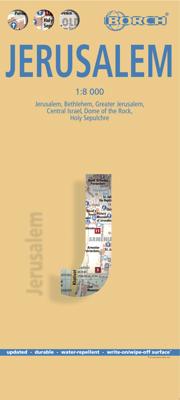
Stadsplattegrond Jerusalem - Jeruzalem | Borch

0
Borch Jerusalem is een duidelijke, geplastificeerde plattegrond van het centrum met informatie over openbaar vervoer en bezienswaardigheden. Inclusief straatnamenregister.   Jerusalem 1:8 000, Bethlehem 1:11 000, Greater Jerusalem 1:30 000, Central Israel 1:400 000, Dome of the Rock, Holy Sepulchre, The Middle East administrative & Time Zones   Ou...

Verkopers met dit product

Webshop
Bezorging
Prijs
DeZwerver.nl logo
DeZwerver.nl
2,95
9,95

Anderen bekeken ook

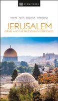
Reisgids Eyewitness Travel Jerusalem, Israel and the Palestinian Territories | Dorling Kindersley
Prachtig geillustreerde reisgids met o.a. 3D tekeningen, fraaie kaarten en geweldige foto’s. Daarnaast uitgebreide achtergrondbeschrijvingen. Echt om in de stemming te komen! De engelstalige versie van de Capitool Reisgids. Infused with a fascinating mix of cultural influences, sacred sites and ancient ruins, you'll be itching to book a trip to Jerusalem! This updated travel guide brings Jerusalem, Israel and the Palestinian territories to life, transporting you to a landscape of dramatic desert outcrops and Mediterranean beaches that have enchanted visitors since the dawn of civilization. Discover serene sacred sights and bustling Bauhaus boulevards. This updated eyewitness travel guide includes: - Our pick of Jerusalem, Israel and the Palestinian Territories' must-sees, top experiences, and hidden gems - The best spots to eat, drink, shop and stay - Detailed maps and walks make navigating the region easy - Easy-to-follow itineraries - Expert advice: get ready, get around and stay …
22,50
Stadsplattegrond Wenen | Borch
Borch Wenen is een duidelijke, geplastificeerde plattegrond van het centrum met informatie over openbaar vervoer en bezienswaardigheden. Inclusief straatnamenregister.   Our soft-laminated folded map of Vienna shows: Vienna Centre 1:11 000, UNO-City 1:11 000, Schönbrunn 1:11 000, Hofburg 1: 7 000, Vienna & Region 1:100 000, Public Transport Vienna, Austria administrative and Top 30 sights. Borch Maps are easy to fold, durable and water-repellent with a wipeable surface. Borch Maps show hotels, museums, monuments, markets, public transport, top sights and points of interest, useful statistics, conversion charts for temperatures, weights and measurements, climate charts showing temperatures, sunshine hours, precipitation and humidity, overview maps, time zones, and much more...   Vienna, situated in the east of Austria, is not only its largest city but also its capital in cultural, economic and political terms. Vienna boasts a high standard of living and was designated a UNESCO World He…
9,95
Reisgids Israël & the Palestinean Territories - Palestina | Lonely Planet
De perfecte reisgids voor zowel de georganiseerde als de zelfstandige reiziger. Naast een algemene inleiding van het land / streek vol met praktische informatie over hoe je er het beste kunt reizen: slapen, eten, vervoer, excursies ... alles kun je er in vinden. Engelstalig. Lonely Planet At the intersection of Asia, Europe and Africa – both geographically and culturally – Israel and the Palestinian Territories have been a meeting place of cultures, empires and religions since history began. Lonely Planet will get you to the heart of Israel & the Palestinian Territories, with amazing travel experiences and the best planning advice.   Lonely Planet’s Israel & the Palestinian Territories is your passport to the most relevant, up-to-date advice on what to see and skip, and what hidden discoveries await you. Walk amongst the ruins of ancient Jericho; take an early morning walk up to the Temple Mount for a breathtaking view of the Dome of the Rock; float in the briny waters of the Dead …
23,95
Wandelgids Israel National Trail | Eshkol
The Israel national trail is one of the most exciting hikes in the world, expanding over 1000 kilometers from the north to the south of Israel. You can hike its' entire length, or just selected sections of your choice. It is the ultimate Israeli hiking experience, and you can do it easily with the guide that simply has all you need. This full and comprehensive guide includes 55 topographical maps (1:50,000) and 7 road maps (1:250,000). This is the only guide with all the maps in English. The guide offers a full description of the hike on the Israel national trail in both northbound and southbound directions and the hiking profile - distance and height above or below sea level. The maps along with a day-by-day trail descriptions and tips make this guide your one-stop shop and all you need to hike the Israel National Trail. The guide is suitable for experienced hikers as well as families and individuals looking to explore Israel in a whole new and exciting way. We have provided in the g…
69,95
Stadsplattegrond City map New York | Lonely Planet
De stadsplattegronden van Lonely Planet zijn uitgevoerd op scheur- en watervast papier, zijn lichtgewicht en kennen een handig formaat. Het centrum van de stad is in heldere kleuren in beeld gebracht met straatnamen, bezienswaardigheden en symbolen voor openbaar vervoer. Op de achterzijde staat informatie over de toeristische hoogtepunten en in de meeste gevallen een schematische plattegrond van het openbaar vervoer. Met een register. Durable and waterproof, with a handy slipcase and an easy-fold format, Lonely Planet's New York City Map is your conveniently sized passport to traveling with ease. Get more from your map and your trip with images and information about top city attractions, walking tour routes, transport maps, itinerary suggestions, an extensive street and site index, and practical travel tips and directory. With this easy-to-use, full-color navigation tool in your back pocket, you can truly get to the heart of New York, so begin your journey now! Durable and waterproof…
9,95
Stadsplattegrond Glasgow Illustrated Map | Collins
Explore new places with dependable maps from Collins. As the largest city in Scotland, Glasgow is a vibrant and bustling hub, enjoyed by thousands of visitors each year. This updated map displays delightful water-colour mapping, and includes individual illustrations of all the main sights and landmarks in the city.   Covers the centre of Glasgow from the Botanic Gardens in the north and the Riverside Museum to the west to the 12th century Cathedral and the gritty Barras Market to the east. Further mapping stretches southwest to Pollok Park and the newly refurbished Burrell Collection. The map features: Historical and contemporary anecdotesPopular areas at larger scale, hundreds of shops, restaurants, cafes and barsComprehensive travel information and indexShop-by-shop street maps of Buchanan Street and the Merchant CityRailway stations, taxi ranks and car parksBus routes shown for tour companies and airport linksBeautiful illustrations of Glasgow's top sights The perfect companion or …
9,95
Stadsplattegrond Discovering Edinburgh Illustrated Map | Collins
Explore new places with dependable maps from Collins. This brand new edition retains the delightful water-colour mapping, with individual paintings of all the main sights and landmarks.   This brand new edition retains the delightful water-colour mapping, with individual paintings of all the main sights and landmarks.   Popular areas at larger scale, hundreds of shops, restaurants, cafés and bars, comprehensive travel information and index.   This map includes:   • Large-scale plans of the Castle, Royal Mile, Botanic Gardens, Leith and Newington   • Shop-by-shop street maps of Princes Street, George Street, Victoria Street and the Grassmarket   • Railway stations, bus routes, taxi ranks and car parks   • Historical and contemporary anecdotes   • Suggestions for day trips out of the city   • Comprehensive index   Area of coverage:   Covers the centre of Edinburgh from Inverleith Park in the north to The Meadows in the south, and from the Scottish National Gallery of Modern Art in the w…
12,50
Reisgids Israel | Bradt Travel Guides
Voor vele landen net zo goed, zo niet beter dan de Planet. Beduidend soberder uitgevoerd, maar ook met veel informatie voor backpackers en met veel kaartmateriaal. Een aanrader! This new third edition of Bradt's Israel has been fully updated to reflect all the most recent changes and includes a comprehensive and detailed history section, plus improved maps and structural revisions to aid navigation. Israel is a land where three world religions - Judaism, Christianity and Islam - meet in stunning landscapes, where ancient architecture stands next to modern, where the fertile north spills into the arid southern desert and where the secular live alongside the devout. From its ancient history and the sacred Jewish, Christian and Muslim sites of Jerusalem, to modern Tel Aviv with its trendy districts, countless museums and bustling markets, Israel has a lot more to offer than meets the eye. In Bradt's Israel you'll find tips on the top hotels and restaurants, details of local wines, fascin…
22,50
Wegenkaart - landkaart - Stadsplattegrond Fleximap Seoul | Insight Guides
Geplastificeerde stadskaart van Seoul, de hoofdstad van Zuid Korea. Goede overzichtelijke kaart met een grof overzicht van de hele stad en een gedetailleerde kaart van het centrumdeel. Fleximap Seoul is a laminated, tear-resistant map which includes 4 maps of Seoul and the surrounding area, each with individual indexes. The main map shows central Seoul at a scale of 1:14 000 on which places of interest are prominently highlighted. A map of the Seoul area is included on the reverse at a scale of 1: 110 000 together with overview maps of South Korea and Korea & Japan. The public transport network is shown on the back cover.   In addition to the mapping, Fleximap Seoul also gives a list - with des...criptions and some photographs - of 23 recommended sights, divided by theme and linked to the mapping by numbered markers. There is also a handy information section with concise details on getting around, tourist offices, money, tipping, opening times, public holidays, telecommunications, eme…
9,95
Wegenkaart - landkaart - Stadsplattegrond Fleximap Kuala Lumpur | Insight Guides
Geplastificeerde kaart van Kuala Lumpur, met register. Voor de 'gewone' toerist een handige kaart, geen groot formaat, overzichtelijk met alle belangrijke plaatsen goed weergegeven.   Flexi Map Kuala Lumpur is a laminated, tear-resistant map which has 3 separate maps, each one accompanied by its own index.    It includes a list - with descriptions and some photographs - of 30 recommended sights, divided by theme and linked to the mapping by numbered markers. There is also a handy information section with concise details on getting around, tourist offices, money, tipping, opening times, public holidays, telecommunications, emergency telephone numbers and climate.   On one side is a street plan of the city, shown at a scale of 1:12 500 (1cm = 0.125km), the accompanying index is categorised for ease of use. One way streets, car parks and pedestrian zones are clearly shown and many prominent public buildings, hotels and other places of interest are highlighted and listed in the exten…
9,95

Klanten-reviews van Stadsplattegrond Jerusalem - Jeruzalem | Borch

Er zijn nog geen beoordelingen voor dit productBen jij de eerste die een review plaatst?

Meer over Stadsplattegrond Jerusalem - Jeruzalem | Borch

Productomschrijving

Borch Jerusalem is een duidelijke, geplastificeerde plattegrond van het centrum met informatie over openbaar vervoer en bezienswaardigheden. Inclusief straatnamenregister.   Jerusalem 1:8 000, Bethlehem 1:11 000, Greater Jerusalem 1:30 000, Central Israel 1:400 000, Dome of the Rock, Holy Sepulchre, The Middle East administrative & Time Zones   Our soft-laminated folded map of Jerusalem shows: Jerusalem 1:8 000, Bethlehem 1:11 000, Greater Jerusalem 1:30 000, Central Israel 1:400 000, Dome of the Rock, Holy Sepulchre, The Middle East administrative & time zones and Top 30 Sights. Borch maps are easy to fold, durable and water-repellent with a wipeable surface. Borch Maps show hotels, museums, monuments, markets, public transport, top sights and points of interest, useful statistics, conversion charts for temperatures, weights and measurements, climate charts showing temperatures, sunshine hours, precipitation and humidity, overview maps, time zones, and much more...   One of the most fascinating and historic cities in the world, Jerusalem is the capital and largest city of Israel and dates back to 4,000 BC. It is a major center for all three monotheistic religions (Judaism, Christianity and Islam) and boasts an Old City (listed as a UNESCO World Heritage Site) teeming with religious monuments, e.g. Temple Mount, Western Wall, Church of the Holy Sepulchre, Dome of the Rock, al-Aqsa Mosque, among many others. Located 60 kms east of Tel Aviv, Jerusalem is located between the Mediterranean and the Dead Sea, which is only 35kms away, 420 meters below sea level and renowned for its therapeutic Dead Sea Salt. Beyond its omnipresent religious significance, Jerusalem is also known for its arts and culture scene. The Jerusalem Symphony Orchestra, the Palestinian National Theatre, the International Convention Center and Jerusalem Film Festival, as well as many other events and institutions, broaden the palette of fascinating sights and activities.  

Verken gerelateerde categorieën

Webshop.nl maakt gebruik van cookies. Ga je verder op onze website, ga dan akkoord met het plaatsen van cookies en de verwerking van deze data door ons en vermelde partners.